 Portuguese
  English
  Spanish
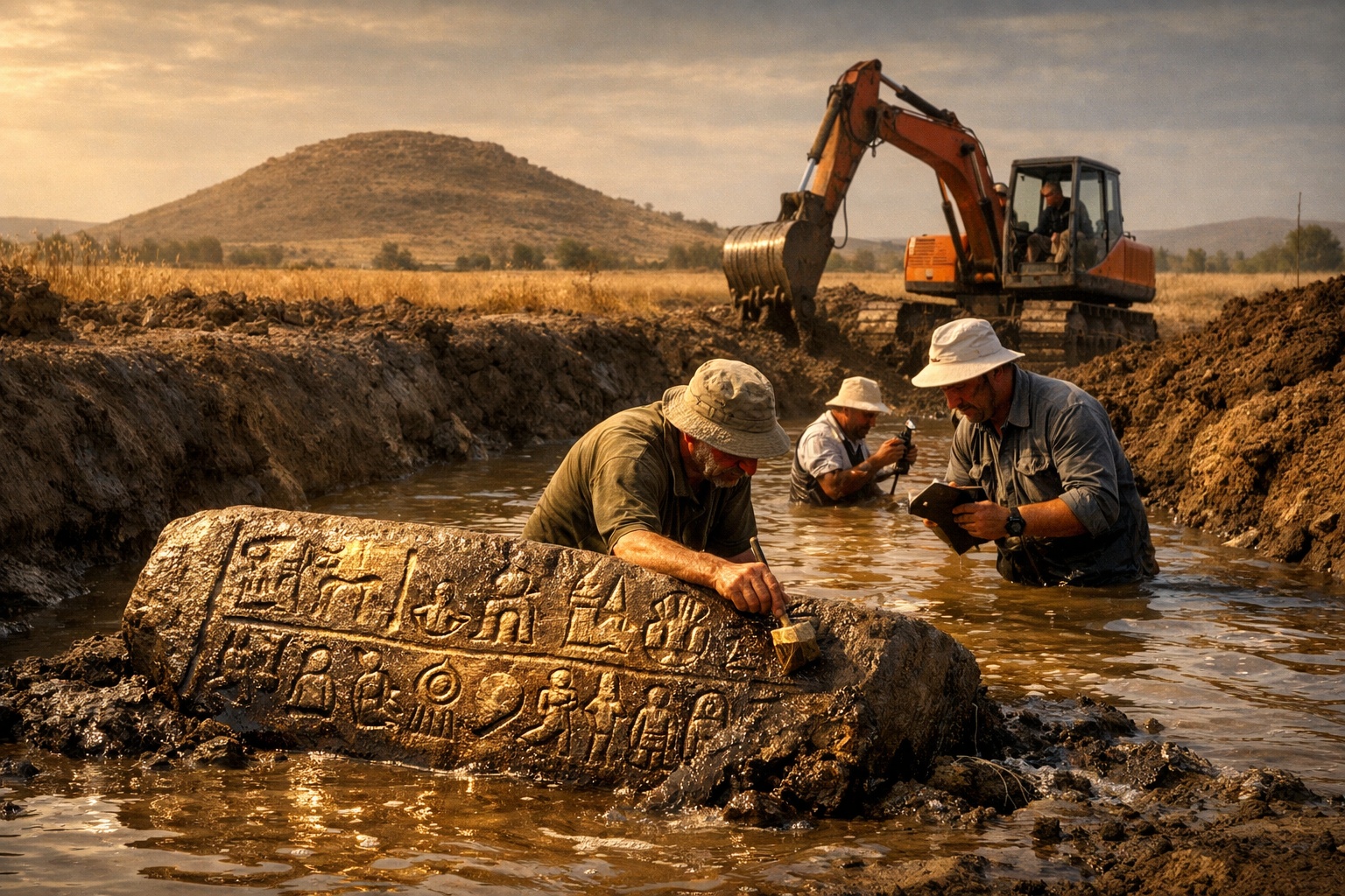

Luwian Inscription Stone Discovered In An Irrigation Canal In 2018 Led Archaeologists To Identify A Massive 125-Hectare Archaeological Site In The Konya Plain, Possibly The Lost Capital Of The Hittite Empire.
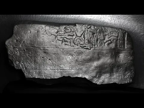
Discovery In An Irrigation Canal In Turkey Revealed An Ancient Stele That Changed Anatolian Archaeology: In The Winter of 2018, A Turkish Farmer Was Carrying Out A Routine Task On His Farmland Near The Village of Türkmen-Karahöyük, Located In The Vast Konya Plain, In South-Central Turkey. The Task Was Routine: Dredging Sediment Accumulated In An Irrigation Canal That Supplied The Fields. During The Work With Heavy Machinery, The Excavator Blade Struck Something Solid. It Was Not A Common Rock. When The Sediment Was Removed, A Large Stone Covered With Ancient Carvings Appeared That Might Reveal Tarhuntassa.
The Following Year, During The 2019 Archaeological Excavation Season, The Farmer Casually Mentioned The Find To An International Team of Researchers Working In The Region. The Group Was Led By Professor James Osborne From The University of Chicago, Responsible For Archaeological Studies In The Konya Plain. Upon Hearing The Description, Osborne Decided To Immediately Check It Out.
“We Rushed Right Over, And We Could See The Stone Still Emerging From The Water. So We Jumped Right Into The Canal — We Went In Up To Our Waists To Examine It,” The Archaeologist Later Reported.
ARTICLE CONTINUES BELOWSee also
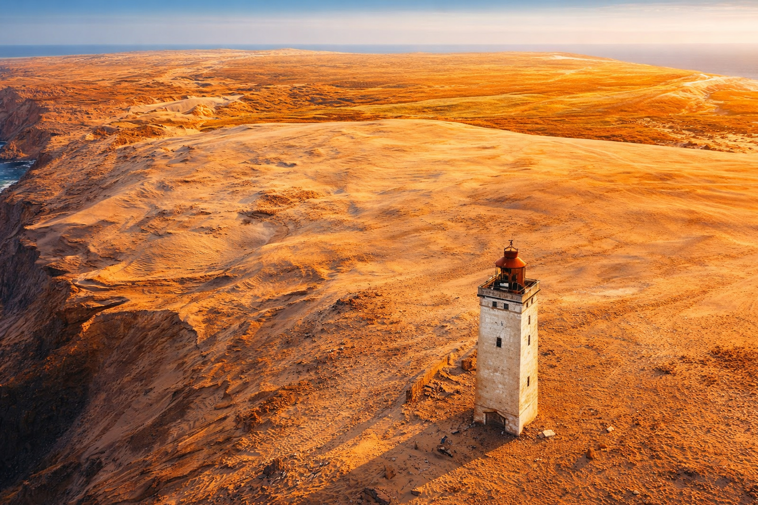
Attracting around 250,000 people a year, a lighthouse 200 meters from the sea, on a 60-meter high cliff, on the North Sea coast in Denmark, becomes one of the most impressive examples of how nature can threaten historical buildings.
The narrowest house in the world is only 63 centimeters wide, but inside it can accommodate a bathroom, kitchen, bedroom, office, and even two staircases.

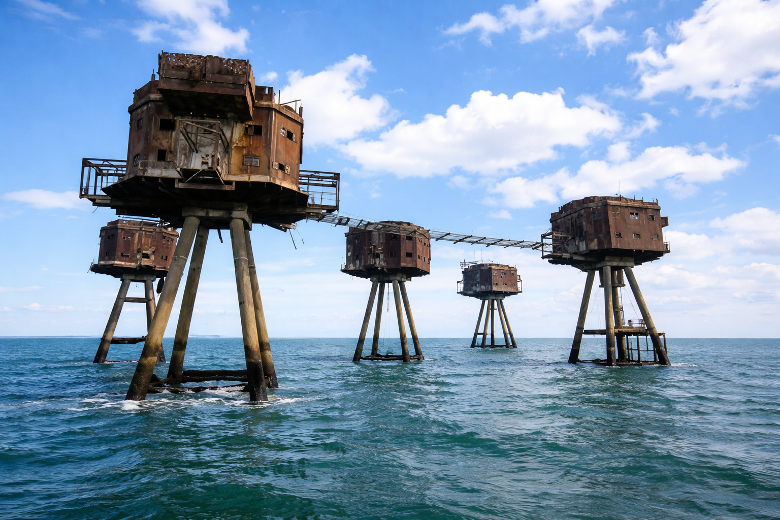
In the middle of the sea, these enormous concrete and steel structures, built by the British Navy to protect strategic maritime routes, look like they came straight out of a Star Wars movie.
For years, no one could cross a neighborhood in Tokyo because of the tracks, but an impressive solution changed mobility and completely transformed the local routine.

The Object Found Was An Ancient Stele — And Its Inscription Would Reveal Something Unexpected. The Discovery Of A Single Stone In An Agricultural Canal Ultimately Led Archaeologists To Identify One Of The Largest Ancient Cities Ever Found In Anatolia.

Stele With Luwian Inscription Revealed The Name Of An Unknown King And The Revelation Of Tarhuntassa
The Stone Found In The Canal Was A Monumental Stele, A Type Of Stone Block Used In Antiquity To Record Royal Declarations, Military Achievements Or Important Political Events. The Inscriptions Carved On The Surface Were Written In Luwian Hieroglyphic, An Ancient Language Of The Indo-European Branch Used In Anatolia During The Bronze And Iron Ages.
This Language Disappeared Over Two Thousand Years Ago.
James Osborne Was Not A Specialist In This Language, But Luck Was On His Side. In The Same Department At The University of Chicago Worked Two Of The World’s Leading Experts In Hittite And Luwian Languages: Petra Goedegebuure And Theo Van Den Hout, Responsible For The Editing Of The Renowned Chicago Hittite Dictionary.
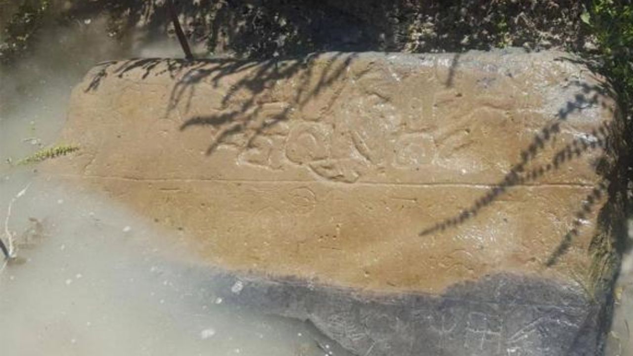
When The Inscription Was Translated, It Revealed Something Surprising. The Text Mentioned A Ruler Named Hartapu, Who Called Himself A “Great King”, A Title Reserved For Sovereigns Of Great Power In The Ancient World.
The Inscription Described The Military Achievements Of The King, Including The Defeat Of The Kingdom Of Muska, Later Known By The Greeks As Phrygia, A Land Associated With The Legendary King Midas. According To Osborne, The Discovery Brought Unexpected Information About The History Of The Region.
“In An Instant, We Had New And Profound Information About The Bronze Age Middle East. We Had No Idea This Kingdom Existed.”
The Stele Was Removed From The Canal With The Help Of A Tractor Owned By The Farmer, Transported To A Regional Museum, And Later Cleaned, Documented, And Photographed.
Türkmen-Karahöyük: The Artificial Hill That Hid A Massive City
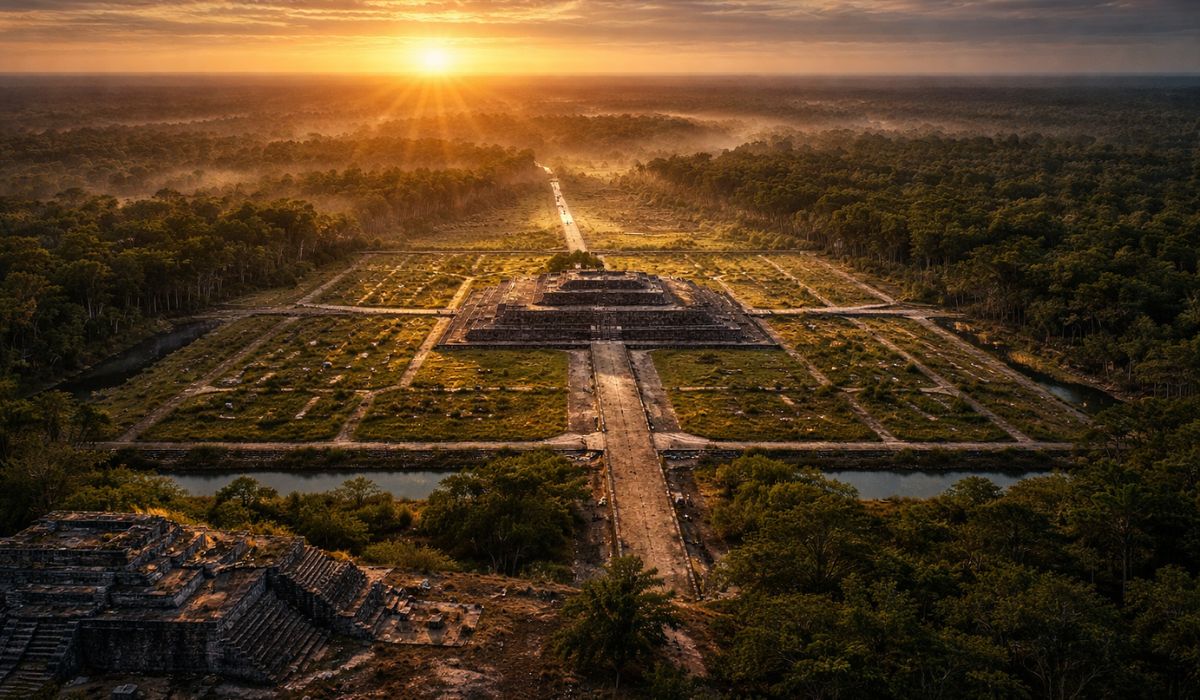
The Site Where The Stele Was Found Made The Discovery Even More Impressive. The Stone Was At The Edge Of An Artificial Hill Known As Türkmen-Karahöyük, A Large Archaeological Mound Formed By Accumulated Layers Of Human Occupation Over Thousands Of Years. This Type Of Formation Is Known In Archaeology As A Tell.
Türkmen-Karahöyük Stands About 35 Meters Tall And Stands Out In The Konya Plain As The Largest Archaeological Mound In The Region Related To The Bronze And Iron Ages. Despite Its Size, The Archaeological Site Had Never Been Systematically Excavated.
It Was Only Identified In 2017 By The Konya Regional Survey Project (KRASP), Led By Michele Massa Of The British Institute At Ankara, And Christoph Bachhuber Of The University Of Oxford. Until Then, The Site Did Not Appear In In-Depth Archaeological Studies. When The Team Began A Detailed Surface Survey — Using Drones, Aerial Photography, And Systematic Collection Of Ceramic Fragments — They Noticed Something Surprising.
The Site Was Not Just Large. It Was Gigantic.
125-Hectare Ancient City Reveals One Of The Largest Urban Centers In Anatolia
The Analysis Of The Ceramic Fragments Found On The Surface Showed That The Site Was Continuously Occupied Since The Late Chalcolithic, Around 4,500 B.C. This Means Over Six Thousand Years Of Human Occupation At The Same Geographical Point. During The Late Bronze Age, Between Approximately 1650 And 1200 B.C., The Settlement Grew Rapidly.
The Urban Area Quadrupled, Reaching At Least 125 Hectares. For Comparison, The Old City of Jerusalem Is About 90 Hectares. Türkmen-Karahöyük Was Significantly Larger. According To Michele Massa, Co-Director Of The Research, The Materials Found Indicate That The Site Was An Important Political And Economic Center.
The Surface Of The Site Contains A Large Amount Of Fine Ceramics Associated With Ruling Elites, As Well As Evidence Of Violent Destruction, Such As Layers Of Burned Bricks And Arrowheads Found Among Ashes. These Signs Suggest That The City Suffered At Least One Major Military Attack Throughout Its History.
Among The Artifacts Found Are:
- Administrative Seals About 4,000 Years Old
- Remains Of Monkeys Sent As Diplomatic Gifts By Egyptian Pharaohs About 3,700 Years Ago
- Grains Of Wheat And Barley About 3,000 Years Old
- A Writing Stylus Made From Animal Bone About 2,000 Years Old
These Artifacts Indicate Intense Administrative And Commercial Activity.
The Possible Link To Tarhuntassa, Lost Capital Of The Hittite Empire
The Importance Of Türkmen-Karahöyük Becomes Even Greater When Considering A Central Episode In The History Of The Ancient World. Around 1274 B.C., The Famous Battle Of Kadesh Took Place, Fought Between Two Great Empires Of The Time: The Egypt Of Ramses II And The Hittite Empire Ruled By Muvatali II.
This Confrontation Is Considered The Largest Chariot Clash In Ancient History, Involving Thousands Of Military Vehicles. The Battle Also Resulted In The First Documented Peace Treaty In History, The Text Of Which Is Now Displayed At The United Nations Headquarters In New York. Prior To Marching Into This Battle, Muvatali II Made A Strategic Decision: He Transferred The Capital Of The Hittite Empire From Hattusha In Northern Anatolia To A New Southern City Called Tarhuntassa.
The Move Brought The Political Center Closer To The Syrian Border While Also Moving The Capital Away From Threats Coming From The North. After The Death Of Muvatali II, The Capital Returned To Hattusha. Tarhuntassa Became A Vassal Kingdom Ruled By Kurunta, The Son Of The Former King. For Decades, Archaeologists Have Tried To Locate The Exact Position Of This City. It Remained Lost.
Archaeological Evidence Suggests That Türkmen-Karahöyük May Be Tarhuntassa
The Definitive Identification Has Yet To Be Confirmed, But The Evidence Strongly Points To The Possibility That Türkmen-Karahöyük Is The Ancient Tarhuntassa. The Site Is Located In The Same Region Described In Hittite Treaties As A Border Area Between Different Administrative Territories.
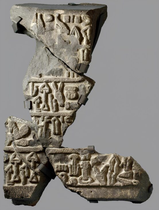
Furthermore, The Urban Expansion Of The Site Coincides Chronologically With The Period During Which Tarhuntassa Would Have Functioned As An Imperial Capital. Another Important Factor Is The Inscription Of King Hartapu, Found Just 13 Kilometers From The Site, In The Sacred Kızıldağ Mountains. Hartapu Also Used The Title “Great King”, Which Suggests A Direct Connection To The Royal Tradition Of Tarhuntassa.
With 125 Hectares, Türkmen-Karahöyük Was Likely The Largest Urban Center In Central Anatolia Before The Foundation Of The Modern City Of Konya. According To Osborne, The Archaeological Potential Of The Site Is Immense.
“Within This Mound Are Palaces, Monuments, And Houses. The Stele Was A Wonderful Discovery — But It Is Just The Beginning.”
Discovery Was Made Almost Without Excavations Thanks To Modern Archaeological Technology
One Of The Most Impressive Aspects Of This Discovery Is That It Occurred Practically Without Traditional Excavations. The Archaeologists Used A Range Of Modern Non-Invasive Investigation Techniques, Including:
- Systematic Surface Survey
- High-Resolution Aerial Photography With Drones
- Satellite Image Analysis
- Magnetometry
- Soil Electrical Resistivity
These Tools Allow Mapping Buried Structures Without Removing Soil. With These Technologies, Researchers Managed To Map A City Of 125 Hectares Without Digging A Single Shovel Of Earth. According To Archaeologist Gonca Dardeniz Arıkan From The University Of Istanbul, The Artifacts Found Reveal Highly Organized Administrative Systems.
“We Are Observing Economic Systems From 3,500 Years Ago. Merchants Used Seals And Accounting Tokens In A Way Very Similar To Modern Business Practices.”
Next Step May Confirm The Identity Of The Lost Capital Of The Hittites
Complete Excavations At Türkmen-Karahöyük Are Still Ongoing. One Of The Most Important Stages Of The Research Involves Collecting Clay Samples From The Site To Compare With Tablets And Seals Found In Hattusha, The Ancient Hittite Capital.
These Artifacts Are Known To Have Been Produced In Tarhuntassa. If The Geological Signatures Of The Clays Match, The Identification Of Türkmen-Karahöyük As Tarhuntassa Will No Longer Be A Hypothesis And Will Become A Consolidated Archaeological Fact. If This Happens, The Story Of The Discovery Will Have An Unlikely Protagonist.
A Farmer Who Was Dredging An Irrigation Canal In The Winter Of 2018 May Be Remembered As The One Responsible For Revealing One Of The Largest Lost Cities Of Ancient Anatolia.


Fascinating, but what poor English!