 Portuguese
  English
  Spanish
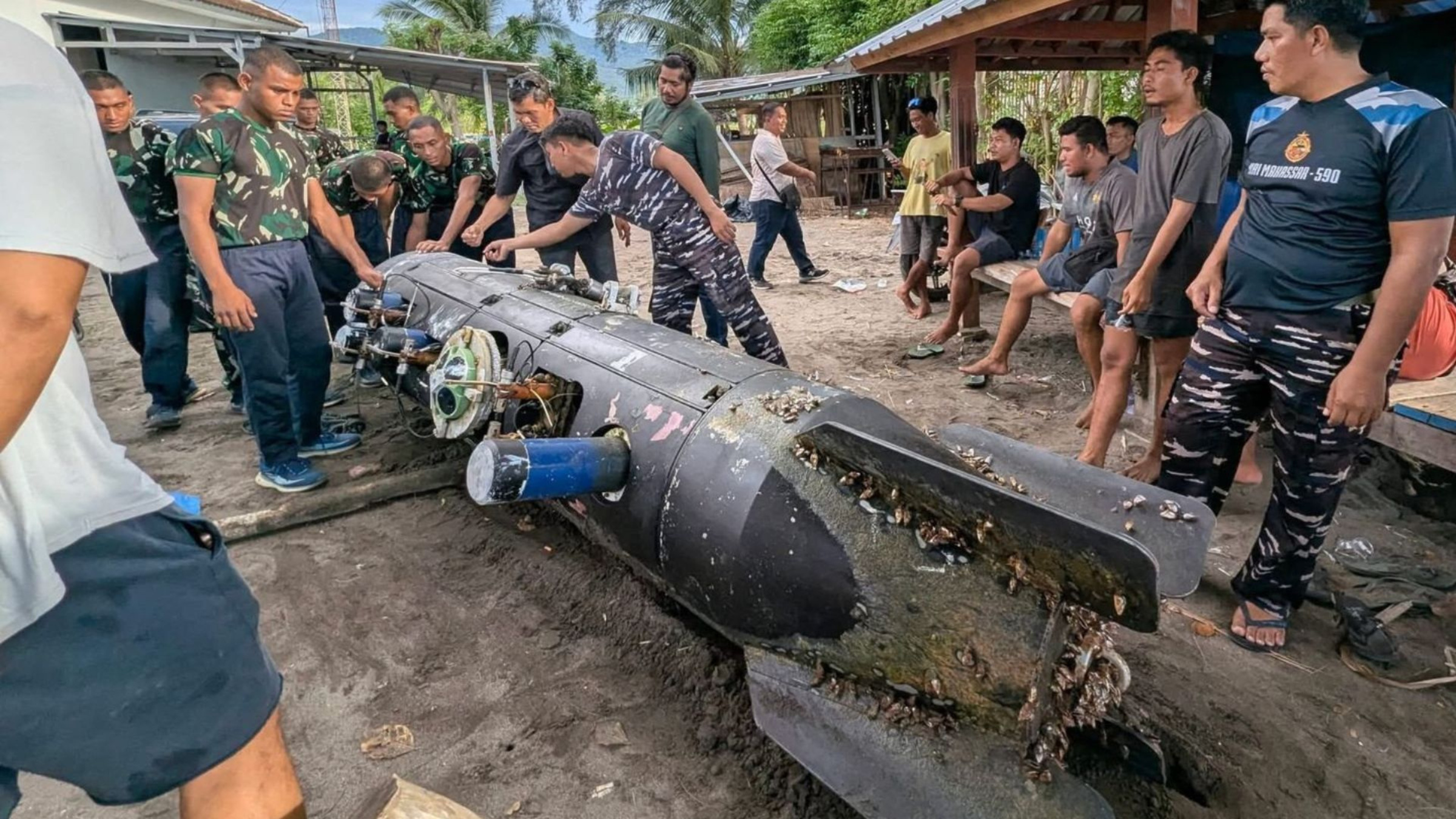
The 3.7-meter-long device was recovered by authorities on a crucial maritime route in Indonesia, triggering a deep investigation into possible foreign espionage activities and regional security threats.
The Indonesian Navy has initiated a detailed investigation following the discovery of a torpedo-shaped underwater drone in the strategic waters of Gili Trawangan, North Lombok.
The equipment, identified with markings from CSIC (China Shipbuilding Industry Corporation), was found floating by a local fisherman on April 6, 2026. The recovery of the underwater drone raised immediate alarms about possible foreign intelligence activities and monitoring of the seabed in crucial Indonesian maritime corridors.
Technical features and maritime monitoring
The cylindrical device features a sophisticated hydrodynamic design, measuring approximately 3.7 meters in length with a diameter of 70 centimeters. Equipped with rear control fins and integrated sections with sensors, the underwater drone has features similar to long-duration underwater gliders, such as the Chinese model “Sea Wing.”
-
Brazil accelerates the development of a Brazilian rocket to launch small satellites and achieve space autonomy.

-
With hypersonic missiles priced like a Tesla, China is betting on a simple and devastating strategy to pressure the U.S.: mass production, saturating defenses, and turning cost into a weapon of military superiority.

-
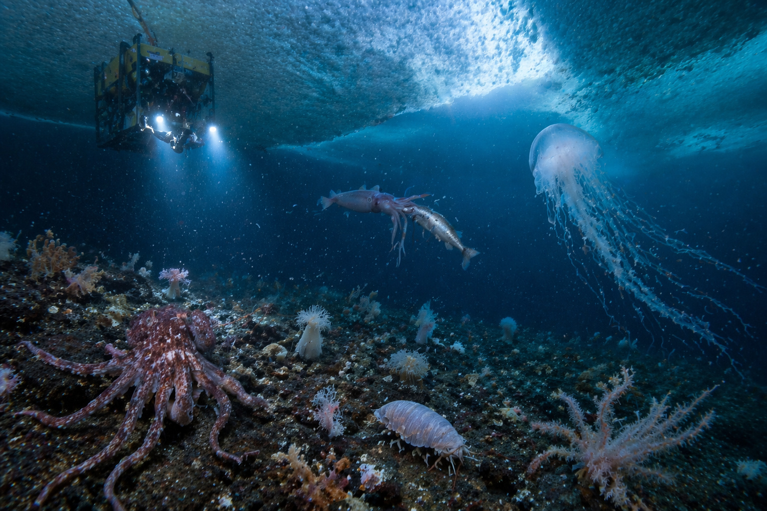
An ancient and active ecosystem is revealed beneath a giant iceberg in Antarctica after a scientific expedition with a submarine robot at a depth of 1,300 meters, and the discovery surprises international researchers.
-
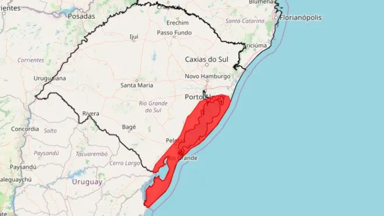
Red alert from Inmet for April 8, 2026 places 26 cities in the path of an extratropical cyclone with winds exceeding 100 km/h in southern Brazil and risks of destruction, power outages, and structural collapse.
This type of technology uses changes in buoyancy to move, allowing persistent mapping and acoustic data collection missions without the need for continuous propulsion.
Experts point out that the recovered underwater drone has the capability to collect fundamental oceanographic variables, including salinity levels, temperature gradients, and underwater topography. This data is considered extremely valuable for military operations, as it directly affects sonar performance and submarine concealment capabilities. The presence of the equipment in the ALKI II maritime route suggests a deliberate attempt to characterize the underwater environment in a zone of intense strategic competition.
Security procedures and military analysis
After being located by the fisherman near the North Gili Trawangan Strait, the object was transferred under custody to the naval base in Mataram.
The Bomb Squad of the West Nusa Tenggara Police conducted an initial inspection that ruled out the presence of explosive materials or radioactive substances in the underwater drone. Currently, the naval military police is conducting in-depth examinations to identify the exact origin, operational purpose, and data stored in the device’s memory system.
Authorities have established a security perimeter around the object to ensure that the investigation follows official defense protocols. Rear Admiral Tunggul confirmed that the focus of the analyses is on the possibility that the underwater drone was used for covert surveillance.
The integrated design of the system, which includes antennas and optical lenses, reinforces the thesis that the device was designed for reconnaissance missions and persistent monitoring in deep waters.
Strategic implications in the Indonesian region
This incident marks another chapter in the discovery of unmanned underwater vehicles (UUVs) linked to China in Indonesian territory in recent years. The location of the underwater drone on a strategic route between the South China Sea and the Indian Ocean raises questions about maritime sovereignty and regional security. Defense analysts suggest that such deployments may serve to map safe navigation routes for long-range submarines in future operations.
The “dual-use” configuration of these devices allows them to be presented as scientific research instruments, although they have obvious potential for naval intelligence. The Indonesian Navy remains on alert to determine whether the underwater drone was operating autonomously or was part of a broader sensor network.
The outcome of the technical expertise will be crucial in determining the diplomatic and military response to the growing presence of foreign autonomous systems in its territorial waters.
Click here to access the study.


Seja o primeiro a reagir!