 Portuguese
  English
  Spanish
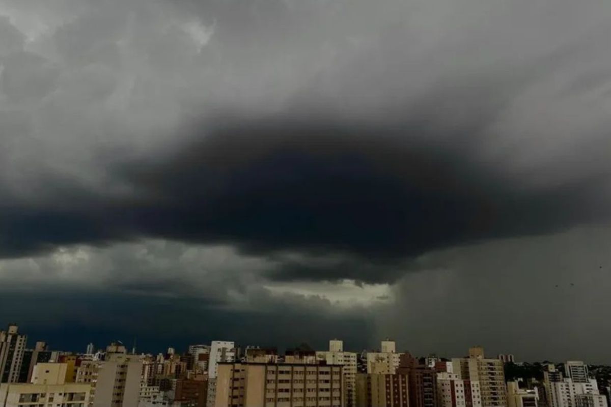


In Brazil, the ZCAS activity fueled by an atmospheric river concentrates extreme rain from South to North, with accumulations that can exceed 100 mm per day and reach 300 mm in a few days, increasing the risk of flooding, landslides, and overflow in vulnerable areas until next Wednesday.
In Brazil, the new episode of the ZCAS has once again organized a persistent band of instability and placed four regions on alert until Wednesday (11), with forecasts of up to 300 mm accumulated and gusts that can reach 100 km/h in critical areas.
The pattern is reinforced by an atmospheric river that continuously injects moisture, increasing the potential for rain in sequence, soil saturation and rapid river and slope responses, especially where urban drainage and land occupation are already under pressure.
Where Rain Should Be Heaviest Until Wednesday
The areas with the highest potential for extreme accumulations are concentrated in the Southeast, especially in Rio de Janeiro, São Paulo, and Minas Gerais.
-
The first nuclear submarine in Latin America is being built in Brazil, but the Navy warns that without an additional one billion reais, the project may halt, and the delivery forecast, which was 2029, has already been pushed to 2037 due to a lack of funds.

-
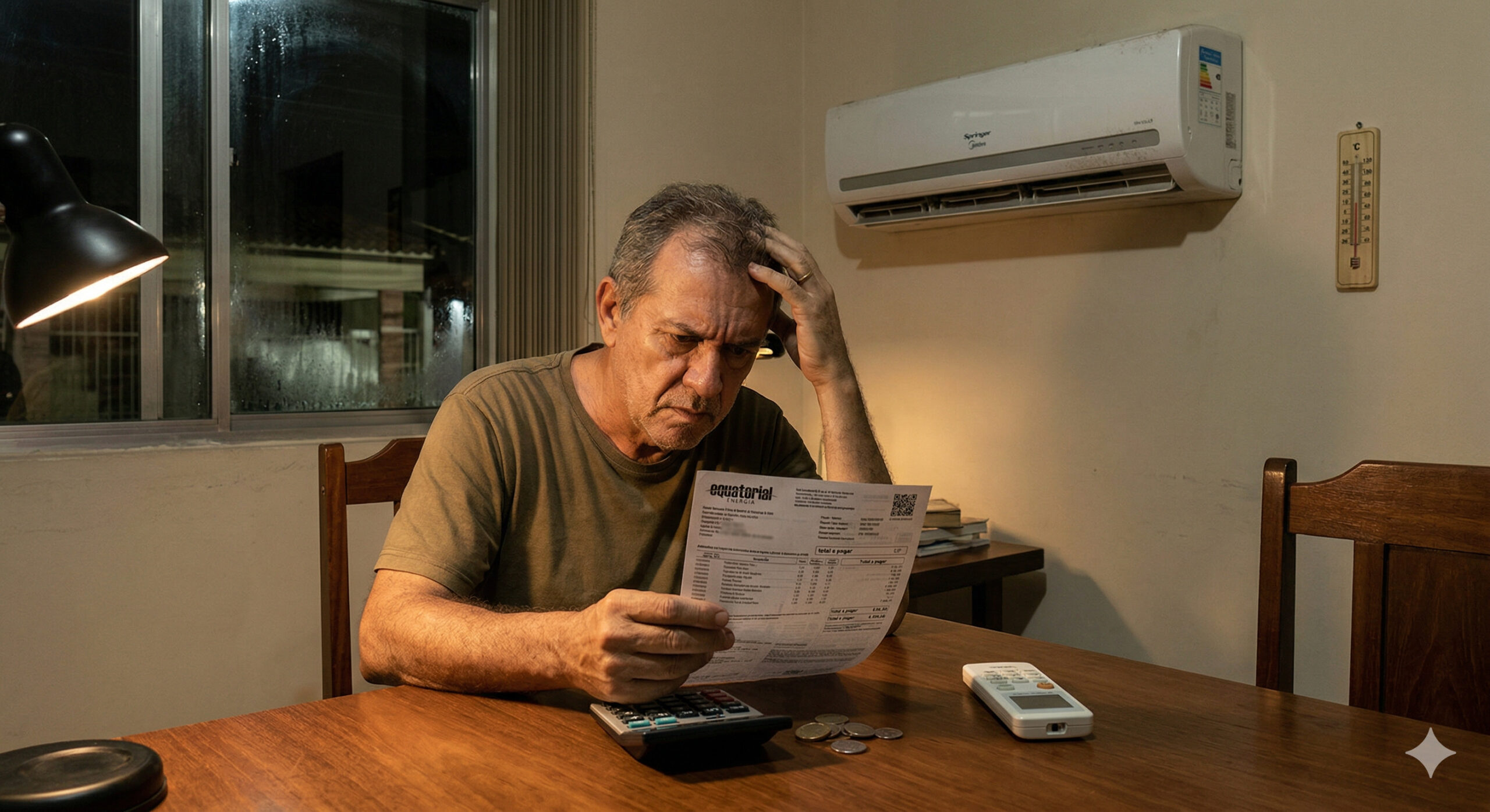
The most expensive appliance in your home is not in the kitchen or the bathroom, it runs 24 hours a day to cool a few items and can cost more per month than the value of everything it stores, while a single replacement eliminates the consumption equivalent to a shower running for 30 minutes daily.

-
Beneath 25 km of ice, a moon of Jupiter hides an ocean with more water than all the seas on Earth and may have the necessary conditions to support life, according to studies supported by NASA.

-
The appliance that should cool your home may be driving up your electricity bill when installed with the wrong power, forcing the device to work harder and consume much more than necessary.

In the fluminense territory, the risk increases from South Fluminense to the Center and the Baixada, including the Metropolitan Region of the capital. In São Paulo, the alert includes the Paraíba Valley, Campinas, and Ribeirão Preto. In Minas, the focus is on Alto Paranaíba, West, and South. It is in this corridor that volumes may exceed 100 mm per day.
In the Midwest and North, the area of operation also draws attention in Goiás, Mato Grosso, Amazonas, and Pará, with accumulations around 200 mm over the period. Meanwhile, Rondônia, Tocantins, Maranhão, Piauí, and western Bahia may record heavy rain with a more moderate trend, reaching up to 100 mm. Overall, Brazil faces a broad event, with different behaviors depending on relief, urbanization, and local drainage capacity.
Why the ZCAS Gained So Much Strength in This Episode
The ZCAS has resumed its activity with support from an atmospheric river, a combination that favors the continuous transport of moisture and the maintenance of heavy clouds for several days. When this mechanism remains stable, rain stops being sporadic and becomes recurring, accumulating volume in sequence. The critical factor is not just the intensity of one hour, but the persistence over days.
This chain of events helps explain why the risk of impact increases even in areas that already experience seasonal precipitation. Saturated soil reduces absorption capacity, rivers react more quickly to new pulses of rain, and slopes become more sensitive. In Brazil, this type of scenario often simultaneously pressures urban mobility, drainage networks, and emergency services, especially in densely populated regions.
Red Alert, Strong Winds, and Pressure on Infrastructure

Inmet issued a red alert of great danger for Rio de Janeiro, Minas Gerais, and São Paulo, with emphasis on areas such as South and Southwest Minas, Zona da Mata, South Fluminense, Vale do Paraíba Paulista, Northwest Fluminense, Baixadas, Central Fluminense, Metropolitan Region of Rio, and North Fluminense. The technical reading indicates a high risk for flooding and river overflow.
In addition to the rain, the forecast indicates winds of up to 100 km/h for part of the period, an element that increases the potential for indirect damage. Combined, strong winds and heavy rainfall can affect energy, transportation, and emergency response operations.
For Brazil, the immediate challenge is to synchronize meteorological monitoring, local response, and clear communication to reduce unnecessary exposure.
What Changes in the Routine of Those in Risk Areas
For residents, workers, and merchants in susceptible zones, daily planning begins to depend on the timing of the rain and the state of the roads. In such episodes, long journeys during peak instability hours increase operational risk.
The most efficient decision is usually to anticipate movements and avoid crossings at flooding points, even when the water seems shallow.
In case of a storm, practical guidance is to avoid crossing areas with strong currents, not to seek shelter under trees or small structures, and to watch for any changes on slopes. It is also worthwhile to follow official alerts and rapid weather changes throughout the day. In Brazil, persistent rain events require less improvisation and more protocol: continuous attention, alternative routes, and preventive action before worsening.
The current episode combines rain of up to 300 mm in a few days, gusts of up to 100 km/h, and risk distributed across different areas of the territory, with emphasis on Southeast, Midwest, and North. The difference between inconvenience and disaster often lies in the timeliness of decisions, the reading of local risks, and the capacity for response in each city.
In your region of Brazil, what weighs more in such events: rapid flooding, river overflow, or landslide risk? And, looking at the real routine of your city, which preventive measure actually works when extreme rain begins: phone alerts, early road blocks, or immediate route changes?


Aqui no Nordeste Pernambuco,está muito seco, aqui na minha região é sertão deu uma chuva passageira, Sábado já tinha muitos meses que não chovia.
Como será no sul do Brasil em Santa Catarina?
Alerta no celular é o mais eficiente, na minha opinião.