 Portuguese
  English
  Spanish
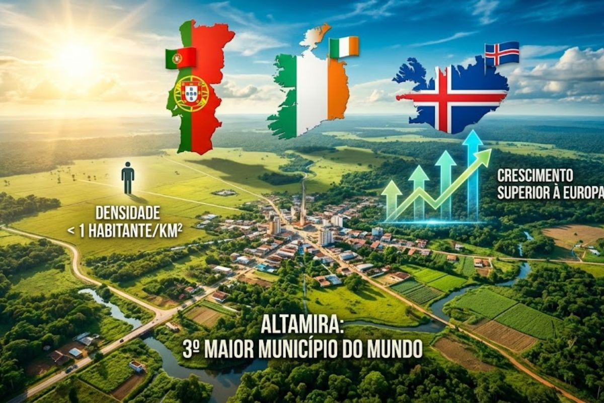
Altamira, in Southwestern Pará, Covers 159,533 Square Kilometers, Has a Density of Less Than One Inhabitant Per Square Kilometer, Amazonian Relief, More Cattle Than People, and Districts Over a Thousand Kilometers from the Headquarters, Creating Heavy Challenges for Public Services, Logistics, Urban Development, and Sustainable Future Amidst the Forest.
Altamira is not just a name lost on the map of Pará. Altamira has become a symbol of territorial excess and low human occupancy, a municipality larger than Portugal, Ireland, Iceland, and Greece, yet unable to fill its own city. Instead of crowded buildings, there is too much space and too few people.
At the same time, Altamira appears in statistics as the third largest municipality in the world by area, larger than 104 independent countries, but with about 138,749 inhabitants spread across a vast territory, expensive to maintain, and difficult to integrate. Between the Xingu, small streams, long roads, and isolated farms, the municipality lives the paradox of being enormous on the map and sparse in real life.
Giant Altamira, Small Population

Altamira is located in southwestern Pará and occupies almost 13 percent of the entire state territory. In practice, it is 159,533 square kilometers for just over 138,000 inhabitants, a direct result of dispersed occupation, with few urban centers and a lot of forest, pasture, and remote communities.
-
The narrowest house in the world is only 63 centimeters wide, but inside it can accommodate a bathroom, kitchen, bedroom, office, and even two staircases.
-
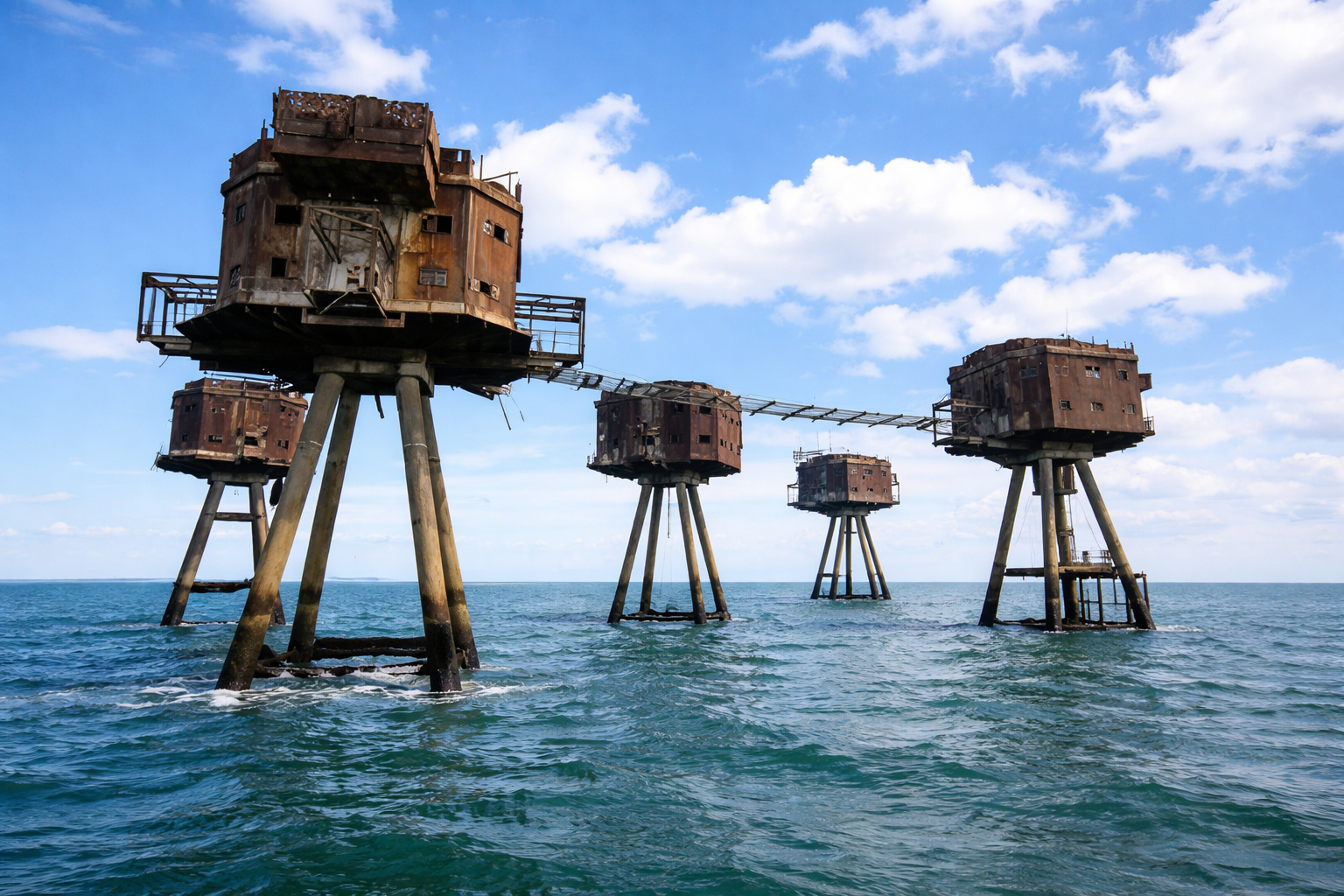
In the middle of the sea, these enormous concrete and steel structures, built by the British Navy to protect strategic maritime routes, look like they came straight out of a Star Wars movie.
-
For years, no one could cross a neighborhood in Tokyo because of the tracks, but an impressive solution changed mobility and completely transformed the local routine.

-
With 15 floors, an unusual building in Curitiba uses concrete, pilasters, and exposed roofs to create the effect of stacked houses.


The population density of Altamira is less than one inhabitant per square kilometer, a rare figure even by Amazonian standards.
While metropolises compete for space, Altamira experiences the opposite scenario: plenty of ground, but large gaps between the points where people actually live.
Altamira Larger Than Entire Countries
To understand the scale, it is worth comparing Altamira with the rest of the world. Altamira has an area larger than Portugal, Ireland, and Iceland, and it also surpasses Greece and more than a hundred independent nations. All this concentrated in a single Brazilian municipality, tucked into the map of Pará.
Founded in 1911, Altamira grew along the banks of the Xingu River, surrounded by small streams and forest, territorially connecting to 13 neighboring municipalities.
This vast size has become a strategic advantage in some areas but also presents a monumental logistical problem, because any public policy needs to cover distances that in many countries would require a different level of planning and budget.
Altamira on the Banks of the Xingu, with More Than 60 Neighborhoods
The urban center of Altamira formed around the Xingu River, surrounded by small streams and impressive biodiversity.
Altamira houses more than 60 neighborhoods within its urban area, with commerce, services, schools, and infrastructure that serve those living closer to the center.
But the municipality does not end when the pavement does. Besides the main city, Altamira manages a sprawling territorial network, with riverside communities, rural areas, and forest regions located many hours from the urban center.
The same Altamira that appears compact when viewed from the city is, in fact, a giant difficult to stitch together completely.
Altamira Districts More Than a Thousand Kilometers from the Headquarters
Altamira also has two official districts that are extremely distant from the headquarters: Castelo de Sonhos and Cachoeira da Serra, each located more than a thousand kilometers from the main urban center.
In practice, they function almost like their own cities, but remain under the administrative umbrella of Altamira.
For those living in these districts, “going to Altamira” means embarking on a long, expensive, and tiring journey, which distances the population from the headquarters and complicates direct access to public services, political decisions, and administrative structures. One municipality, many different worlds within it.
Altamira With More Cattle Than People
Over the decades, the occupation of Altamira’s territory has been marked by extensive cattle ranching. In many rural areas, the cattle population exceeds that of people, with large farms, open pastures, and few houses scattered across the landscape.
This model helps explain why Altamira continues to have such a low density, even after growing in economic importance.
The economy revolves around productive activities that do not require large human concentrations, keeping the municipality vast, productive, but still empty compared to its size.
Governing Altamira: Size of a Country, Budget of a City
All this combination transforms the management of Altamira into a daily challenge. The enormous population dispersion and internal distances create problems such as:
- difficulties in providing health, education, and public services to remote communities
- long travels between communities and the headquarters, both by road and by river
- logistical limitations for the government, which needs to cover a territory the size of a continent
- uneven growth, with the urban area concentrating infrastructure while many remote regions remain in partial isolation
Altamira, viewed from above, appears to be a colossus. But, seen up close, it reveals a municipality still trying to transform size into quality of life, stitching together a giant territory with few resources and many demands.
If you could choose, would you prefer to live in a compact and crowded city or in a place like Altamira, huge, empty, and spread across the Amazon?


Seja o primeiro a reagir!