 Portuguese
  English
  Spanish
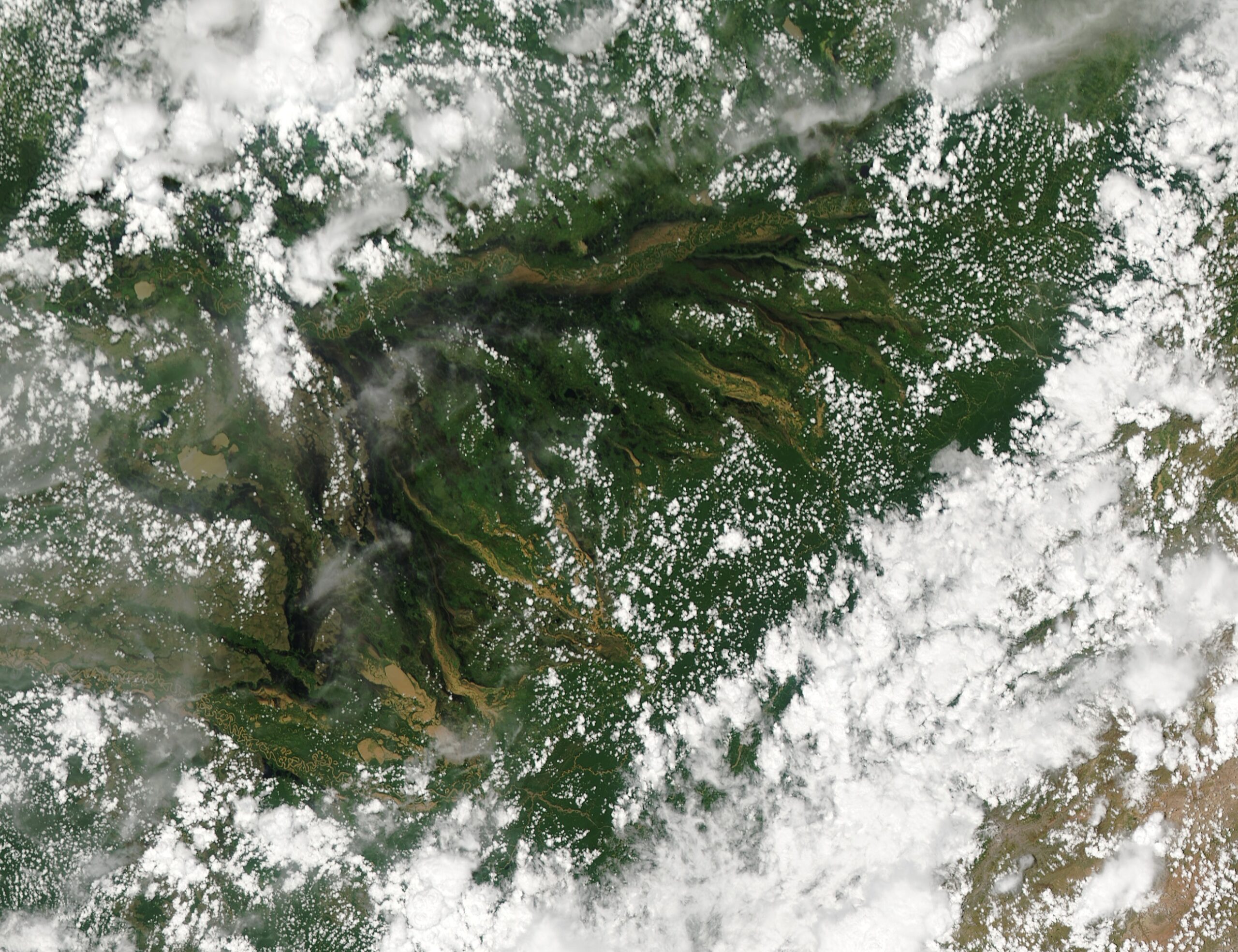
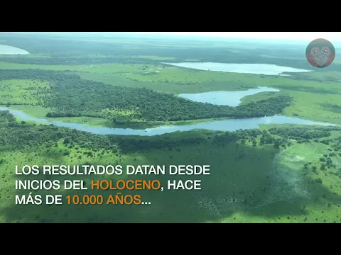
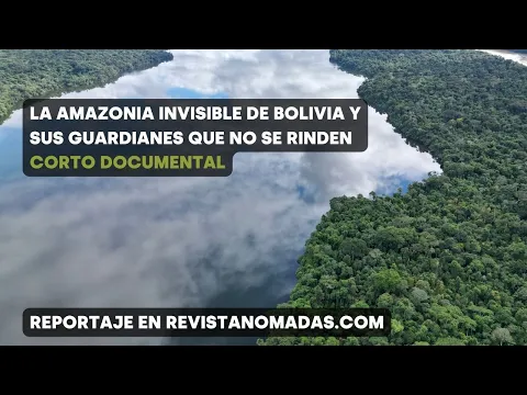
The Llanos de Moxos in Bolivia form a floodplain of 6.9 million hectares that transforms every year with Amazonian waters into a giant system of rivers and lakes.
In 2024, the Llanos de Moxos returned to the center of environmental analyses, with data consolidated by organizations such as WWF and satellite images released by NASA Earth Observatory about the floods in the region reinforcing the scale of this floodable system in the north of Bolivia. In the area officially recognized by the Ramsar Convention, the wetland complex exceeds 6.9 million hectares, equivalent to about 69 thousand square kilometers, and ranks among the largest seasonally floodable environments on the planet.
This system integrates the southwest of the Amazon basin: the Beni, Mamoré, and Iténez rivers cut through the plain and converge to form the Madeira River, one of the major tributaries of the Amazon. Its dynamics are governed by the annual flood pulse, a hydrological phenomenon typical of the large Amazonian floodplains, where water advances and retreats seasonally, reorganizing habitats, channels, and wetlands over several months.
The result is one of the most dynamic natural systems in South America, where rivers, lagoons, floodable fields, and channels expand and retract on a large scale in short time intervals. In scientific descriptions of the region, the Llanos de Moxos appear as a floodplain marked by extremely strong seasonal variation, capable of radically reshaping the landscape between the dry and flood seasons.
-
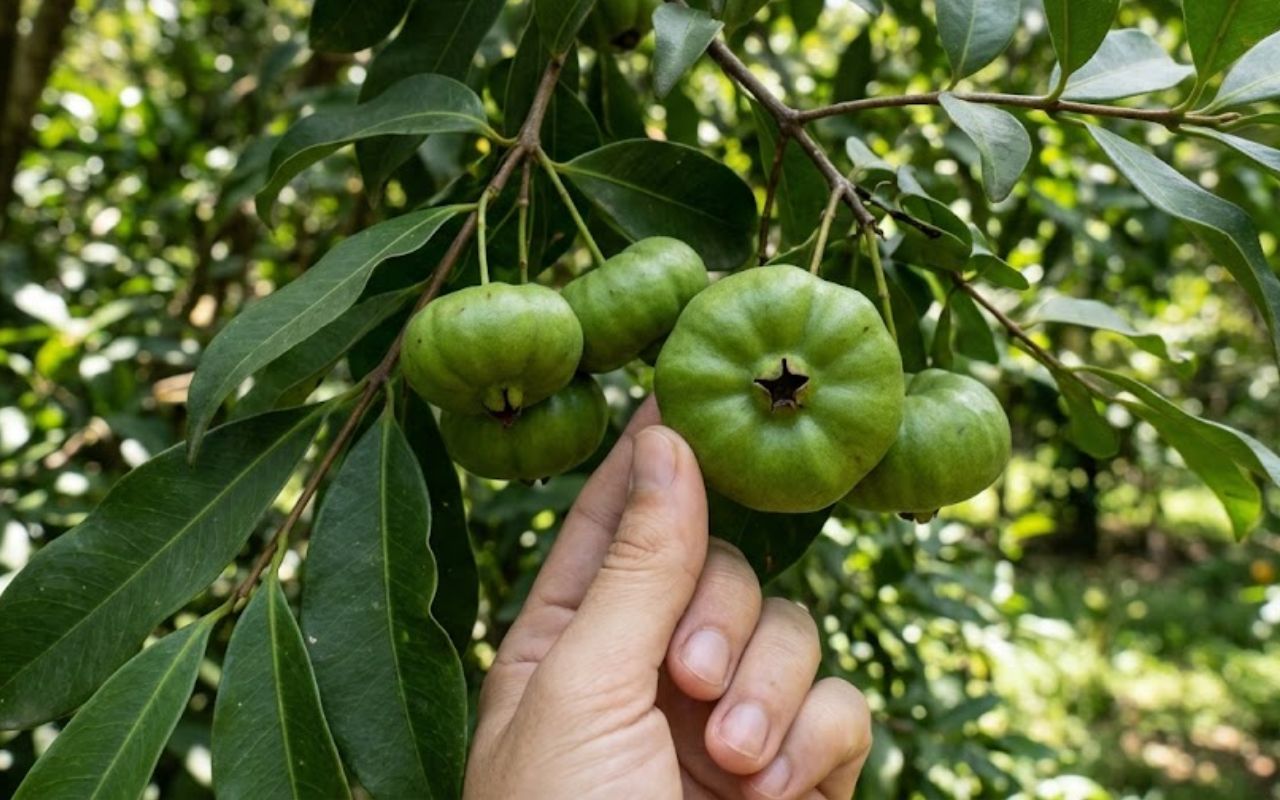
Little-known fruit from the Atlantic Forest draws attention for combining an acidic flavor, high vitamin C content, and antioxidants that help combat free radicals. It can be used in juices, jams, ice creams, liqueurs, sauces, meats, and savory dishes; meet the cambuci (Campomanesia phaea).
-
Nazi submarine U-864, sunk during World War II with 65 tons of mercury, is back in the spotlight and exposes a growing environmental risk on the seabed of Norway as the government faces an urgent technical decision.

-
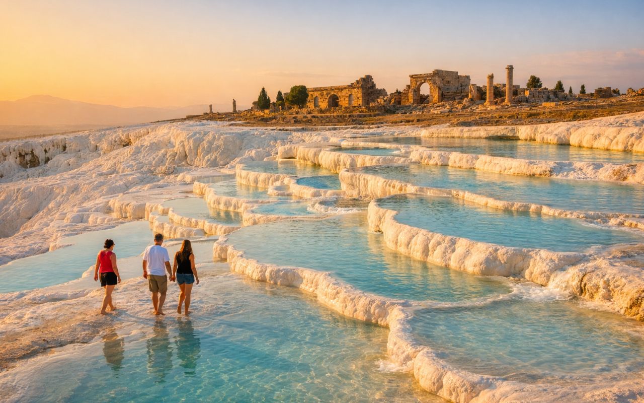
It seems like something out of a movie: “Cotton Castle” in Turkey, formed by minerals over the centuries, features thermal pools, ancient history, and one of the most surreal landscapes in the world / discover Pamukkale.
-
Psychology states that the rarest mental strength today is not resilience or determination, but rather the ability to cope with uncertainty without immediately seeking distractions, explanations, or the opinion of someone else.

Amazon flood pulse raises water level by up to 5 meters and redefines the entire landscape
The functioning of the Llanos de Moxos is directly linked to the rainfall regime of the Amazon. During the rainy season, large volumes of water from Amazonian rivers and regional tributaries begin to spread across the plain.
This process causes a rise in water levels that can reach up to 5 meters in certain areas. As the terrain is extremely flat, small variations in altitude are sufficient to spread water over vast expanses.
Flooding does not occur uniformly. Some areas remain submerged for longer, while others quickly alternate between dry and flooded conditions.
This hydrological pulse is the main driver of the system, responsible for transforming an apparently static savanna into a highly dynamic environment. Over months, the advance and retreat of the waters completely reshape the territory.
A labyrinth of rivers, lagoons, and seasonal channels forms every year on a continental scale
During the flood period, the landscape of the Llanos de Moxos transforms into a complex mosaic of water and land. Rivers overflow, channels expand, and lagoons connect, creating a continuous network of water bodies.
This system can extend for thousands of kilometers, forming a true hydrological labyrinth. In satellite images, the region appears as a mix of dark and light areas, indicating the presence of water and vegetation.
The scale of this phenomenon is so large that it can be observed from space, highlighting the continental dimension of the flooding.
During the dry season, much of this water evaporates or returns to the main rivers, revealing extensive areas of dry land once again.
The extremely flat terrain of the Llanos de Moxos explains the rapid expansion of water
One of the factors that make this system possible is the terrain of the region. The Llanos de Moxos have very small altitude variations, often less than a few meters over large distances.
This characteristic allows water to spread easily, without encountering significant natural barriers. Additionally, the low slope reduces flow velocity, favoring the formation of extensive and long-lasting flooded areas.

This combination of flat terrain and large volumes of water creates ideal conditions for the formation of one of the largest floodplains on the planet. Without this specific topography, the system would not have the same scale or behavior.
Ancient artificial structures reveal human adaptation to the flood system
The region of the Llanos de Moxos also holds evidence of ancient human occupation highly adapted to flooding conditions.
Archaeological research has identified the presence of elevated structures, artificial channels, and drainage systems built by pre-Columbian populations.
These structures indicate that the inhabitants of the region developed techniques to cope with the flood pulse, creating habitable areas and agricultural systems adapted to the seasonally flooded environment.
This demonstrates that the system is not just a natural phenomenon, but also a historically occupied and modified environment by complex human societies. These discoveries expand the understanding of the interaction between humans and extreme environments in the Amazon.
Llanos de Moxos influence the hydrological dynamics of the Amazon and regional environmental balance
In addition to their local importance, the Llanos de Moxos play a relevant role in the hydrological dynamics of the Amazon basin.
The plain functions as a large temporary reservoir, storing water during the rainy season and gradually releasing it over time.
This process helps regulate river flow, reducing flood peaks and maintaining water availability during drier periods.
This regulatory role makes the system fundamental to the regional hydrological balance. Additionally, the interaction between water, soil, and vegetation contributes to broader ecological and climatic processes.
Satellite monitoring reveals seasonal changes and expansion of the flooded area
The use of remote sensing technologies has been essential to understand the behavior of the Llanos de Moxos.
Satellite images allow tracking the expansion and retraction of flooded areas throughout the year, identifying flow patterns and interannual variations.
This data is fundamental for climate studies, environmental planning, and water resource management.
The continuous observation of the system highlights its dynamic nature and the importance of constant monitoring. Without these tools, it would be difficult to fully understand the scale and complexity of the phenomenon.
Why the Llanos de Moxos are considered one of the most extreme natural systems on the planet
The combination of scale, hydrological dynamics, and seasonal variability places the Llanos de Moxos among the most impressive natural systems on Earth.
Few environments exhibit such broad and recurring transformation over a relatively short time interval.

The alternation between dry land and large flooded areas completely redefines the landscape, influencing ecosystems, climate, and human occupation.
This extreme behavior makes the Llanos de Moxos a unique example of how water can shape territory on a continental scale. The region continues to be a subject of study for scientists interested in hydrology, ecology, and environmental changes.
This type of giant floodable system may exist in other regions of the world
The case of the Llanos de Moxos raises important questions about the existence of similar systems in other parts of the planet. Although there are other floodplains, few reach the scale and complexity observed in Bolivia.
This suggests that specific conditions of climate, terrain, and hydrology are necessary for the formation of such systems.
In light of this, a relevant reflection arises: how many other natural systems of continental scale may be operating silently, transforming entire landscapes without great global visibility?


Seja o primeiro a reagir!