






 Portuguese
  Spanish


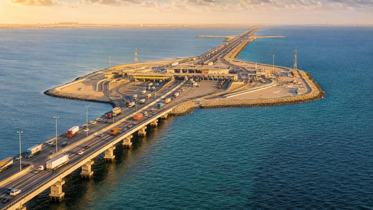

Inaugurated on November 26, 1986, the King Fahd Causeway crosses the Persian Gulf between Al Khobar and Bahrain via a hybrid route of bridges and embankments, with artificial islands, central border control, four lanes, and structures designed to withstand saltwater, currents, heat, and marine corrosion.
The King Fahd Causeway transformed approximately 25 kilometers of the Persian Gulf into a permanent road link between Al Khobar in Saudi Arabia and the Bahrain archipelago. Officially inaugurated on November 26, 1986, the crossing allows the movement of cars, buses, trucks, passengers, and goods between the two countries.
The information was published by Market Monitor on July 19, 2026. The project combines five sets of bridges, seven embankments, artificial islands, four traffic lanes, border facilities, and 536 concrete pillars, instead of using a single continuous bridge over the entire route.
Crossing replaced a sea and air-dependent connection

Before the opening of the road route, the maritime separation imposed greater dependence on vessels and flights for travel between the two kingdoms. The new infrastructure created a continuous land passage over an area previously crossed mainly by sea or air means.
-
Instead of crossing the sea only by boat or plane, engineers built the King Fahd Causeway with 25 kilometers, five bridges, seven embankments, artificial islands, central customs, and 536 concrete pillars to connect Saudi Arabia and Bahrain by permanent road since 1986.

-
Brazil’s most anticipated highway advances with 8 lanes, 24 viaducts, and promises to double the speed between SP and RJ; the R$ 1.5 billion project surpasses 70% completion and enters a new phase with controlled detonations.

-
The largest bridge in São Paulo reaches the decisive “kiss” stage, uniting both sides of the 2.4 km structure over the Tietê River and moving towards the final stretch after an investment of R$ 389 million in SP-333.
-
Switzerland repurposes a military tower from the 1980s and completes a R$ 960 million project at an altitude of 3,000 meters: engineering by Herzog & de Meuron ‘suspended’ a platform 55 meters above a glacier, with materials transported to the summit by cable car and helicopter.
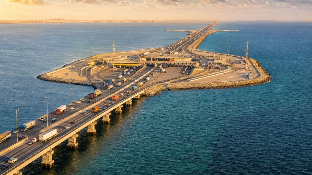


The change reduced the operational distance between cities, airports, companies, and markets. Passengers and cargo began to traverse the gulf without needing to board ships or rely exclusively on air connections.
King Fahd Causeway is not a single structure
Despite the name, the crossing does not consist of a continuous bridge spanning 25 kilometers. The project alternates between elevated segments, road embankments, and artificial areas constructed over sections of varying depths.
This composition allowed the engineering to adapt to the conditions found along the route. Shallow areas received embankments, while channels and deeper points were overcome by bridges supported by pillars.
Five bridge sets keep channels open
The elevated sections were installed where it was necessary to preserve water circulation or maintain passages for certain vessels. In total, the connection comprises five sets of bridges distributed along the route.
These structures transfer the deck loads to pillars and foundations positioned under the seabed. The openings prevent the entire crossing from functioning as a continuous barrier between different parts of the gulf.
Seven embankments created land where there was once water

In the shallower sections, the road advances over seven embankments constructed with materials such as rocks and sand. The sides received protection to withstand the action of waves, currents, and erosion.
The solution allowed for a reduction in the number of pillars, decks, and deep foundations. Instead of supporting the entire highway above the water, engineers created permanent strips of land in selected parts of the route.
Hybrid choice reduced technical limitations
Building the entire connection on pillars would considerably increase the volume of concrete, foundations, and structural pieces. On the other hand, filling the 25 kilometers exclusively with embankments could more intensely interfere with water circulation.
The project sought to balance these two limitations. Bridges were employed where openings were necessary, while embankments provided road support in points where the shallower depth favored this method.
Artificial islands interrupt the long crossing
Areas created in the middle of the gulf function as intermediary points between the two countries. They host operational facilities, road returns, services, and spaces necessary for traffic control.
The islands also allow for the concentration of structures that would be difficult to install directly on narrow bridge segments. The result is a maritime highway formed not only by concrete and asphalt but by artificial lands incorporated into the operation.
Central island became an international border

The main intermediary area is known as Passport Island. It was planned to host immigration, customs, and administration procedures associated with the passage of people and goods.
The space is divided between the Saudi and Bahraini sides, connected by the road itself. The central customs transforms an artificial island into an international terminal installed in the middle of the Persian Gulf.
Control in the center avoids concentration at the ends
The installation of border services in the central area distributes the procedures along the crossing. This prevents all checks from needing to occur exclusively at the entry points of Al Khobar or Bahrain.
Travelers and transporters arrive at the island, go through the required controls, and continue along the highway. The structure combines road infrastructure, international inspection, and logistical organization in a single operational point.
Structure uses 536 concrete pillars

The five bridge sets are supported by 536 pillars positioned in a marine environment. These elements receive the loads from the decks, vehicles, and external forces and transfer them to the foundations.
The source also reports the use of approximately 350,000 cubic meters of concrete in the construction. The scale of the materials reveals that the King Fahd Causeway functions as a coastal infrastructure system, not just as an elevated road.
Foundations needed to reach the seabed
Each support depends on foundations capable of withstanding the permanent weight of the structure, traffic, and environmental stresses. The behavior of the soil under the water influences the depth and type of solution required.
Ground movements or erosion around the bases can alter the stability of the pillars. Therefore, safety depends as much on the visible components as on the elements installed below the gulf’s bottom.
Saltwater imposes a permanent risk of corrosion

Salinity represents one of the main challenges for reinforced concrete structures installed over the sea. When aggressive agents reach the metal reinforcements, they can initiate corrosion processes capable of causing expansion, cracks, and loss of performance.
The heat and tidal variations increase the complexity of the environment. Durability requires suitable concrete, protection of reinforcements, crack control, and continuous monitoring of exposed parts.
Rocks protect the edges of the embankments
The embankments are subject to the impact of waves and the movement of currents. Without protection, the water could progressively remove particles from the sides and compromise the highway’s support.
Stone coverings were used to reduce this wear. The rocks dissipate part of the wave energy and help preserve the shape of the artificial areas built over the shallow sections.
Joints absorb expansion and movements
High temperatures cause concrete, steel, and pavement to expand, while cooling causes contraction. In an extensive crossing, small accumulated variations can lead to considerable displacements.
Structural joints allow certain segments to move without transferring excessive forces to other parts. Controlled flexibility protects decks and supports from stresses that could arise if the entire structure were rigidly continuous.
Precast pieces accelerated assembly
Pre-produced segments were used in the bridge decks. Controlled manufacturing allows components to be prepared before the corresponding stage is fully cleared on site.
Afterwards, the pieces are transported, positioned, and connected over the pillars. The method reduces part of the work done directly over water and favors greater dimensional repetition along the elevated sections.
Four lanes support the flow between countries
The route was structured with four lanes to allow road travel between Saudi Arabia and Bahrain. The traffic includes private vehicles, buses, and trucks transporting people and goods.
This circulation requires pavement, signage, lighting, border control, and permanent maintenance. The infrastructure needs to function as an international highway and, simultaneously, as a maritime structure exposed to severe environmental conditions.
Operation continues decades after inauguration
The official opening took place on November 26, 1986, after construction began at the start of that decade. Since then, the crossing remains a land connection between the two kingdoms.
Its permanence depends on inspections and repairs aimed at corrosion, wear, joints, pavements, pillars, and embankments. A structure of this size does not end when it is inaugurated: it requires technical operation throughout its useful life.
Maintenance needs to reach parts above and below water


The decks and pavements can be evaluated directly, but pillars, foundations, and areas near the seabed require specific procedures. The inspection needs to identify changes before they compromise larger components.
Currents can also remove sediments around foundations, a phenomenon capable of reducing the support offered by the ground. Monitoring the behavior of the submerged soil is as important as checking for cracks and corrosion in the visible parts.
King Fahd Bridge brought two markets closer
The crossing made it possible to transport goods via a continuous road between the countries. Companies began to rely on a land alternative to move products and access commercial centers, airports, and services.
The impact is not just on travel time. A permanent connection reorganizes logistical routes, increases transportation predictability, and strengthens economic relations between territories separated by the sea.
The work shows how coastal engineering modifies geography
The King Fahd Bridge did not eliminate the Persian Gulf, but created a functional strip capable of crossing it. Bridges, embankments, and artificial islands were combined to produce a new physical connection between two countries.
The work demonstrates that large maritime crossings may require different solutions along the same route. In your opinion, do projects of this magnitude justify the permanent transformation of the coastal environment when they expand transportation and economic integration? Leave your comment.


