






 Portuguese
  Spanish


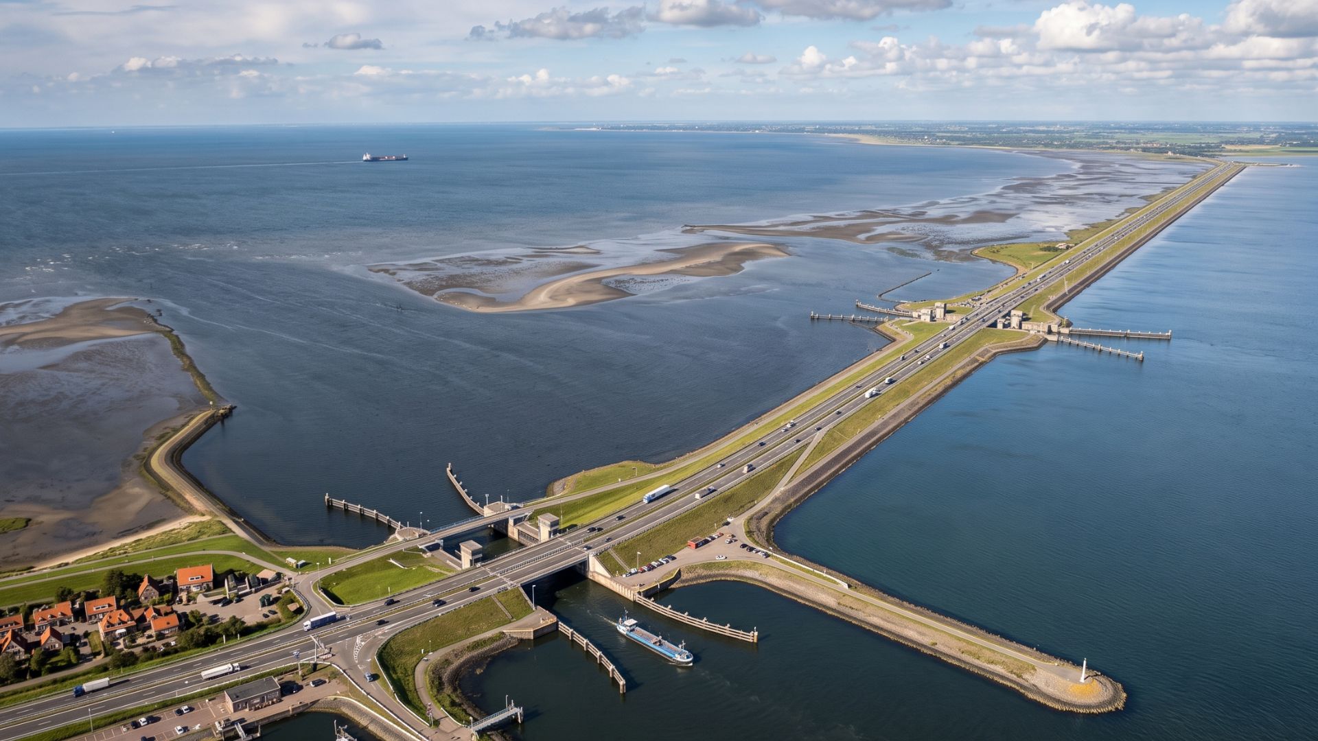

Afsluitdijk closed the former Zuiderzee with a 32 km dyke, millions of m³ of sand and glacial clay, creating Lake IJsselmeer.
The Afsluitdijk, in the Netherlands, is one of the most impressive hydraulic works of the 20th century and a symbol of the Dutch struggle against the sea’s advance. Built between 1927 and 1932, the structure closed the former Zuiderzee, a salty inlet connected to the North Sea, and definitively separated the region from the current Wadden Sea. According to the Rijkswaterstaat, the national agency for infrastructure and water management in the Netherlands, the dyke is 32 km long and connects Den Oever in North Holland to Zurich in Friesland. The scale of the work is also evident in the materials: the DBNL records about 27 million m³ of sand and 15 million m³ of keileem, a glacial clay mixed with sand, gravel, and stones.
Afsluitdijk closed the former Zuiderzee and changed the map of the Netherlands
The Afsluitdijk was not built just to create a road link between two regions. The work was conceived as a defense structure against floods, designed to close the former Zuiderzee and reduce the exposure of cities, towns, and agricultural areas to storms coming from the North Sea.
Before construction, the Zuiderzee was a salty maritime inlet, subject to frequent flooding. According to the Rijkswaterstaat, the current IJsselmeer was called Zuiderzee before the Afsluitdijk, when the region still had saltwater fishing and communities vulnerable to recurring floods.
-
With 2,000 tons of steel and self-supporting shelves, Havan is building a R$ 250 million expansion in SC at the largest distribution center in Latin America, a complex the size of 28 football fields that sorts 20,000 boxes per hour.

-
Few people know, but the tallest statue of the Virgin Mary in the world is 98.15 meters tall, is located in the Philippines, and functions as a habitable tower facing the sea.
-
Reaching 12.7 trillion reais and growing 2.3% in 2025, Brazil’s GDP confirmed the fifth consecutive year of expansion, driven by the extractive industry and services that supported household consumption.

-
Norway towed to the North Sea a platform weighing 656,000 tons made with 245,000 m³ of concrete and 100,000 tons of steel, creating the heaviest movable object ever constructed by humans.



With the closure, seawater stopped advancing freely into the interior of the territory. The former salty mass was separated from the Wadden Sea and began to slowly transform into the IJsselmeer, a freshwater lake that became a central piece of Dutch water management.
32 km dyke became a road over the sea between North Holland and Friesland
The structure is 32 km long and functions as a direct link between North Holland and Friesland. According to Rijkswaterstaat, the Afsluitdijk separates the Wadden Sea from the IJsselmeer and also serves road traffic, waterway traffic, and recreational activities.
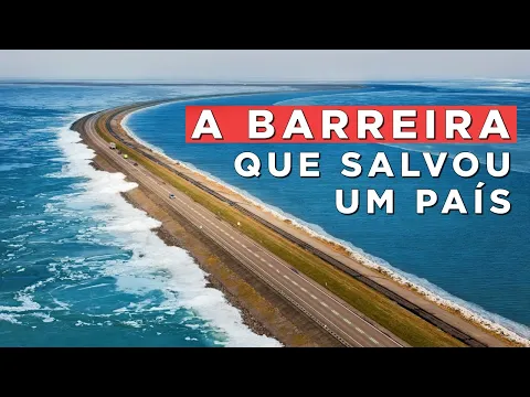

In practice, the project became a road on top of a sea wall. It shortened routes, created a strategic connection, and transformed a coastal defense structure into nationally important transport infrastructure.
This combination explains why the Afsluitdijk remains relevant almost a century later. It is not just a historic dike, but a project that combines flood protection, mobility, water control, and symbolic value for Dutch engineering.
27 million m³ of sand and 15 million m³ of glacial clay supported the wall
The strength of the project lies in the materials used. The DBNL, the digital library of literature and technical history of the Netherlands, records that, in the closure of the Afsluitdijk, about 27 million m³ of sand and 15 million m³ of keileem were used.
The keileem is a glacial clay mixed with silt, sand, gravel, and larger stones. According to Rijkswaterstaat, this material was used in dike works for its strength and low permeability, essential characteristics for structures exposed to the permanent pressure of water.
This technical choice was decisive. The Afsluitdijk was not just a mass of sand thrown into the sea, but a structure planned with selected materials to form a more stable, heavy, and infiltration-resistant core.
Construction began in 1927 and closed the last gap on May 28, 1932
The main construction of the Afsluitdijk began in 1927, advancing from the shores and support points created along the route. According to Rijkswaterstaat, areas like Breezand and Kornwerderzand were important for the progress of the project.
The decisive moment occurred on May 28, 1932, when the last gap was closed. From this point, the former Zuiderzee was separated from the Wadden Sea, and the process of transforming saltwater into freshwater began.
The Rijkswaterstaat records that the closure of the last span, known as De Vlieter, marked the transformation of the Zuiderzee into the IJsselmeer. The project changed the geography of the region and reorganized part of the Netherlands’ water protection strategy.
About 5,000 workers participated in one of Europe’s largest hydraulic projects
According to the Rijkswaterstaat, about 5,000 workers were involved in the construction of the Afsluitdijk. For a project carried out between the late 1920s and early 1930s, this number reveals the human, logistical, and technical scale of the project.
The work took place in a maritime environment, with currents, mud, material transportation, and the progressive closure of an area exposed to the force of the water. It was a heavy engineering project carried out before the era of computers, advanced digital models, and modern monitoring systems.
The construction required ships, dredgers, barges, and continuous work to deposit sand, glacial clay, and reinforcement materials. The complexity lay in advancing over the water without allowing the currents to destroy what had already been built.
Closure of the Zuiderzee created the IJsselmeer and paved the way for new polders
The closure of the former Zuiderzee had a direct impact on the formation of the IJsselmeer. According to the Rijkswaterstaat, since 1932 the Afsluitdijk has closed off the IJsselmeer, the former Zuiderzee, separating it from the Wadden Sea.

This transformation also allowed progress in land reclamation projects. The Rijkswaterstaat states that with the construction of Wieringermeer, Noordoostpolder, Eastern Flevoland, and Southern Flevoland, 165,000 hectares of new territory emerged.
This data enhances the significance of the project. The Afsluitdijk not only served to contain water but also to reorganize part of the Dutch territory, creating space for housing, agriculture, infrastructure, and nature.
Gates in Den Oever and Kornwerderzand control the water between lake and sea
The Afsluitdijk is not just a continuous wall. According to Rijkswaterstaat, the sluice complexes of Den Oever and Kornwerderzand drain excess water from the IJsselmeer to the Wadden Sea.
This function is essential because the IJsselmeer receives water from rivers and needs to maintain controlled levels. When conditions allow, water is released to the Wadden Sea through the drainage structures.
With the advancement of climate change and rising sea levels, this system needed to be modernized. Rijkswaterstaat reports that new sluices, pumps, and reinforcements are part of the Afsluitdijk’s renovation.
Modernization reinforced the Afsluitdijk against extreme storms and climate change
The Afsluitdijk has spent decades protecting part of the Netherlands, but the structure has entered a new phase of reinforcement. According to Rijkswaterstaat, the dike is under pressure from the effects of climate change and needed urgent renovation.
The goal of the modernization is to prepare the structure for waves capable of hitting it during an extreme storm. The agency reports that the side facing the Wadden Sea received new cladding to withstand waves in an extreme event expected once every 10,000 years.
The update shows that the Afsluitdijk is not a structure stuck in the past. It continues to be adapted to protect the country in a scenario of higher seas, harsher climate, and growing demand for water security.
Blocks of 6.5 tons and a factory of 70,000 pieces marked the new phase of the project
The modernization brought new materials on an industrial scale. According to Rijkswaterstaat, the Levvel-blocs, each weighing 6,500 kg, were installed at the bottom of the slope to break the force of the waves on the side facing the Wadden Sea.
The renovation required its own production chain. The agency reported that a semi-automated factory was built to produce about 70,000 Levvel-blocs used in the reinforcement of the barrier.
According to Rijkswaterstaat, the design of the new elements allowed for saving about 60% of concrete compared to a traditional solution. The project combined gigantic scale, material efficiency, and the need to preserve the historical identity of the structure.
Barrier separates the Wadden Sea from the IJsselmeer and created an ecological challenge
The Rijkswaterstaat highlights that the Afsluitdijk separates two areas of great natural value: the Wadden Sea and the IJsselmeer. Therefore, the modernization also considers waterfowl, ecology, and species circulation.
The agency reports that the construction has become an obstacle for fish migrating between saltwater and freshwater. To address this issue, fish passage and migration initiatives have been planned.
This point adds complexity to the agenda. The same barrier that protected cities and reorganized the territory also interrupted natural flows, requiring new environmental solutions decades later.
The wall that closed the sea became one of the greatest marks of Dutch engineering
The Afsluitdijk embodies one of the strongest ideas of Dutch engineering: not just resisting water, but redesigning the territory from it. By closing the Zuiderzee, the construction created the IJsselmeer and changed the country’s relationship with the sea.

It spans 32 km in length, 27 million m³ of sand, 15 million m³ of glacial clay, about 5,000 workers, and a geographical transformation that separated saltwater from freshwater.
Almost a century later, the structure continues to be reinforced with concrete blocks, new sluices, and pumps.
The construction that closed an old entrance to the North Sea still needs to evolve to continue protecting the Netherlands.


