 Portuguese
  English
  Spanish
After the 2018 Agreement, The Caspian Sea Gained a Unique Legal Status, While Its Hybrid Crust, Sunken Cities, Mud Volcanoes and Oil Reserves Continue to Challenge Classifications
The Caspian Sea has become a rare case on the planet: even though it has been called a sea for centuries, it is not officially a sea or a lake in a definitive way. In 2018, a treaty among the five countries bordering the Caspian Sea established a unique regime for the region, leaving the legal discussion open and fueling an impasse that also bothers scientists.
The confusion is not just political. The Caspian Sea has characteristics that seem to “mix” categories: the bottom has hybrid crust, the water maintains salinity even when isolated from the ocean, human history speaks of sunken cities, and underground, there are signs of mineral resources and an unusual concentration of mud volcanoes.
Caspian Sea Gained a Unique Legal Status in 2018
On August 12, 2018, during a summit among the countries bordering the Caspian Sea, a treaty was signed that avoided a simple answer to the age-old question “sea or lake?”.
-
What if the Sun disappeared suddenly? Simulation shows Earth in darkness within minutes, extreme cold, and rapid collapse of life on the planet.

-
A 2,400-year-old iron foundry has been discovered in Senegal with 100 tons of slag, 35 furnace bases, and signs of nearly eight centuries of continuous metallurgical activity.

-
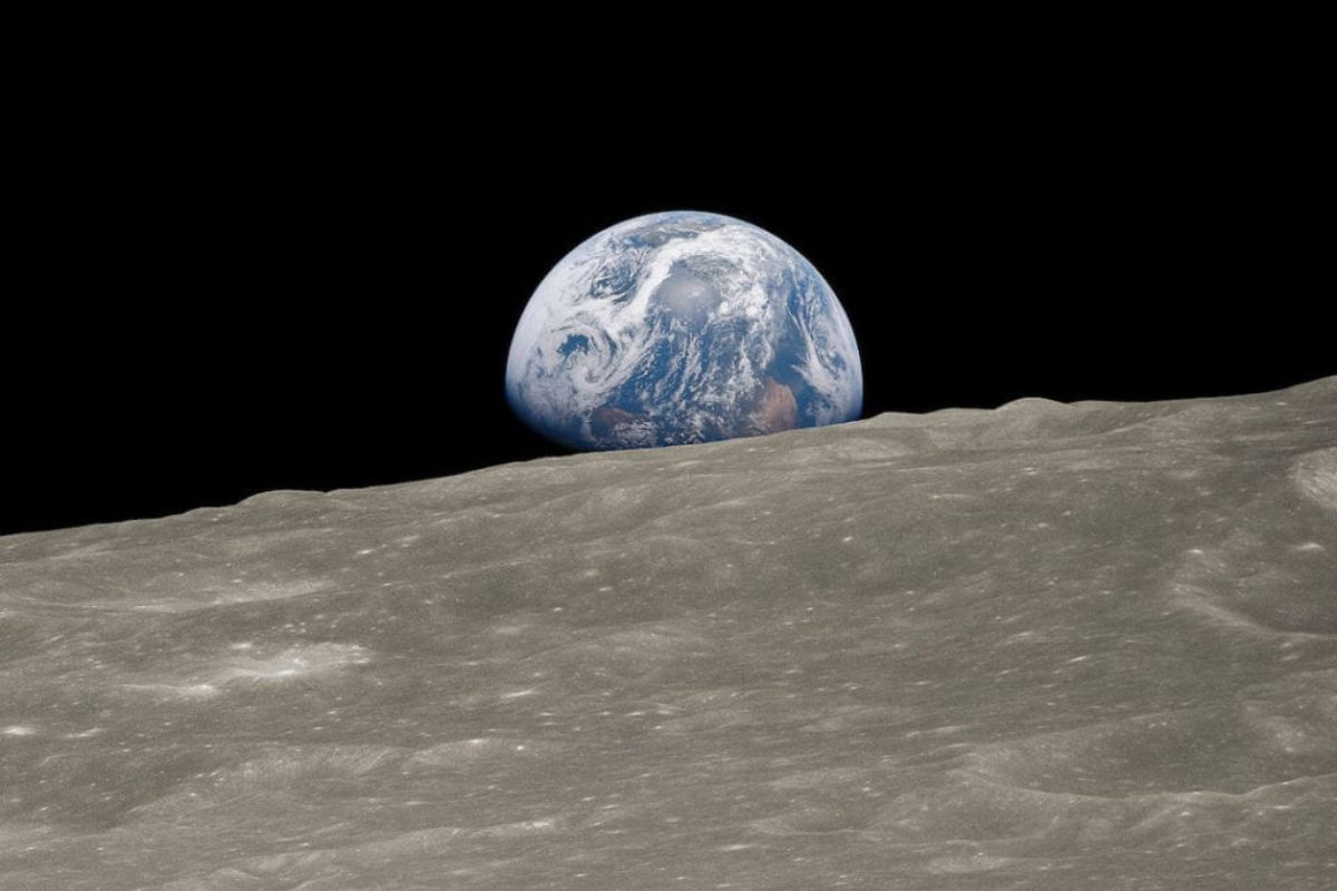
Four humans are flying towards the Moon inside the Orion capsule launched by the SLS rocket, and on April 6, Artemis II will disappear behind the far side of the Moon without communication with Earth for nearly an hour.
-
Worlds covered by water, atmospheres filled with hydrogen, and the possibility of life beyond Earth: ocean planets are rewriting the map of cosmic search and forcing scientists to rethink where to look.


The document named the region as a closed water body with its own exclusive regime, something that does not fit perfectly into traditional classifications of international law.
In practice, the dispute over labels remains alive. For some geographers, the logic of not having a direct connection to open ocean pushes the definition towards “lake”.
For sailors, however, the Caspian Sea remains a sea because it is a vast body of water, with navigation and behavior that escape the stereotype of a common lake.
Hybrid Crust at the Bottom of the Caspian Sea Confuses Geology
One of the most intriguing points of the Caspian Sea lies at the bottom. In general, the earth’s crust is divided into continental crust, which is thicker, and oceanic crust, which is thinner. However, at the Caspian Sea, the bottom does not fit well into either of the two. It presents a hybrid profile, with striking changes between north, center, and south.
In the north of the Caspian Sea, part of the base behaves like a submerged extension of the eastern European shelf, with shallow depth, reaching about 15 meters even in deeper spots.
As one moves towards the center, the depth increases, the bottom descends to hundreds of meters, and begins to exhibit typical traits of oceanic crust, with an average depth of 208 meters.
In the south, the structure comes even closer to oceanic crust and reaches about 1,025 meters. This contrast causes the very relief to “pull” the Caspian Sea towards different definitions depending on the observed section.
Largest Lake on The Planet, But With Sea-Like Scale and Salinity
Despite the discussions, it is often described as the largest lake in the world, covering about 371,000 km². In scale, it is close to seas like the Baltic and the Black, which reinforces the perception of “sea” in the imagination of those navigating the region.
Another striking point is the salinity. The Caspian Sea maintains an average salinity of around 1.2 to 1.3%, even while receiving a large volume of freshwater from rivers, particularly the Volga.
The presence of salt and marine organisms reinforces the oceanic origin but raises a central question: how does it continue to exhibit “marine” behavior even when isolated from the ocean for so long?
Carabogazgou Bay and The Strange Fluctuations in Water Level
The variations in the level of the Caspian Sea are cited as abnormal because they occur over relatively short periods. A decisive element in this story is Carabogazgou Bay, a huge, shallow coastal lagoon on the eastern shore. Water from the Caspian Sea enters through a narrow channel and, in practice, does not return because evaporation is intense.
When the channel was closed with a concrete dam to try to “save” the level of the Caspian Sea, the bay practically dried up, exposing a saline bottom and causing environmental and social effects, such as salty sandstorms and the collapse of activities related to local mineral extraction.
Years later, with the removal of the barrier, water began to flow again, and the bay started to recover its level, although the full recovery of the ecosystem is still described as slow. The episode reinforces how the Caspian Sea reacts in ways that do not always follow simple predictions.
Endemic Fauna of The Caspian Sea Is Unique And Vulnerable

Beyond geology, the Caspian Sea holds a rare biological heritage. A large portion of the fish species and various invertebrates and mollusks are endemic, meaning they do not exist anywhere else on the planet.
Among the most well-known symbols are the sturgeon, associated with caviar, and the Caspian seal, which intrigues biologists for being in a closed continental water body.
The text highlights that sturgeon is an ancient group and that species associated with caviar had a significant impact on the global market in the 20th century. This economic value increases human interest in the Caspian Sea, but also amplifies environmental pressures and concerns, as losing such unique fauna would have irreversible impacts.
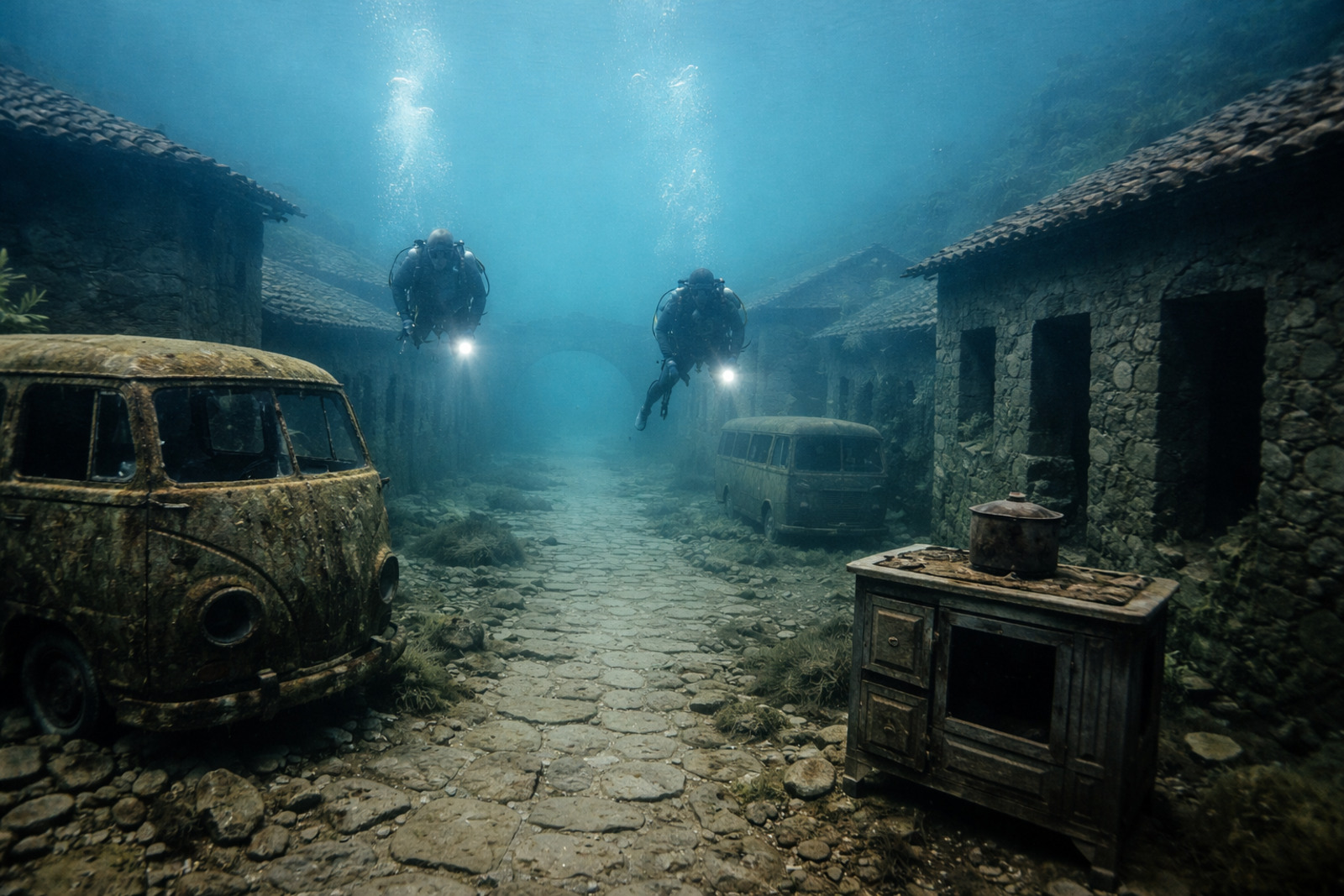
Sunken Cities And Ruins: The “Atlantis” Of The Caspian Sea

The human history of the Caspian Sea also fuels mysteries. There are ancient and modern reports about sunken cities and structures that appear and disappear as the water level changes.
One historically based case is the fortress of Sabail, near the coast of Baku, which is believed to have been built between 1232 and 1235 and ended up submerged after an earthquake in 1306. In low water periods, parts have been known to resurface, and underwater research has found hundreds of engraved plates.
Another “Atlantis” associated with the Caspian Sea appears as an archaeological and legendary search: the city of Itil, linked to the Khazar Kaganate, cited in historical records but still not definitively located. In this scenario, the Caspian Sea blends geography, archaeology, and historical narrative into a single enigma.
Mud Volcanoes And Oil: What The Bottom Of The Caspian Sea Hides
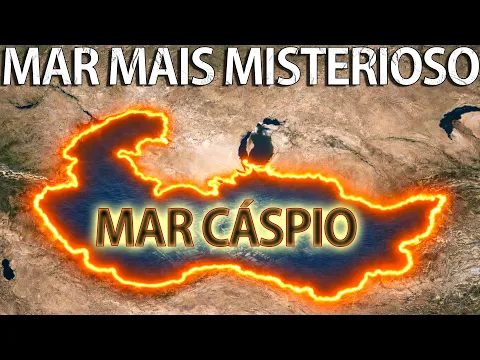
At the bottom of the Caspian Sea, besides wreckage and shipwrecks accumulated over centuries, there is geological and energy dimension.
The text mentions estimates that speak of up to 50 billion barrels of oil and 8.3 trillion m³ of natural gas in the region. Even representing a fraction of global reserves, these resources have strategic weight for diversifying supply.
And there is an even more unique phenomenon: the concentration of mud volcanoes. In the territorial waters of Azerbaijan alone, more than 140 underwater mud volcanoes have already been confirmed. In eruptions, columns of water, gas, and mud can rise very high, and some activities even form temporary islands.
One cited example is Kumani Bank island, which emerged in February 2023 and disappeared by the end of 2024 due to erosion. Few places show so clearly how the bottom of the Caspian Sea remains active and unpredictable.
Do you think the Caspian Sea should be treated as a sea, a lake, or does it make sense to have a third category for it?


-

Uma pessoa reagiu a isso.