 Portuguese
  English
  Spanish
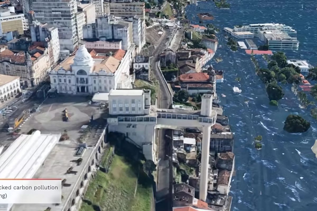


Detailed Study Reveals The Impact Of Sea Level Rise On The Metropolis Of Salvador, Highlighting Vulnerable Coastal Areas, Flood Risks And Erosion, The Geological Context Of The Region And Future Projections, As Well As Current Adaptation Measures.
Salvador, a historical gem of Brazil, faces an uncertain future. Sea level rise, driven by climate change, threatens important areas of this Brazilian metropolis.
While the city is not expected to disappear entirely, rising waters could cause severe flooding and significant damage in low-lying coastal regions by the end of the century.
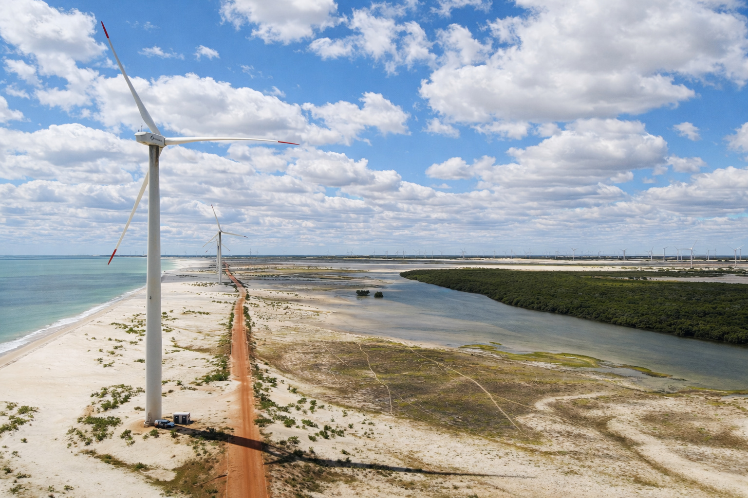
Sea Level Rise And Northeast Brazil
Climate change introduces various impacts to this Brazilian metropolis, including rising temperatures and altered precipitation patterns. Sea level also feels the effects of these changes, with the rate of rise potentially varying regionally. This increase can have strong impacts on the coastal ecosystems of the Northeast, such as loss of agricultural land and increased flooding. IPCC reports are crucial for understanding projections regarding sea level rise. Coastal erosion on beaches in Recife illustrates the effects of this phenomenon.
-
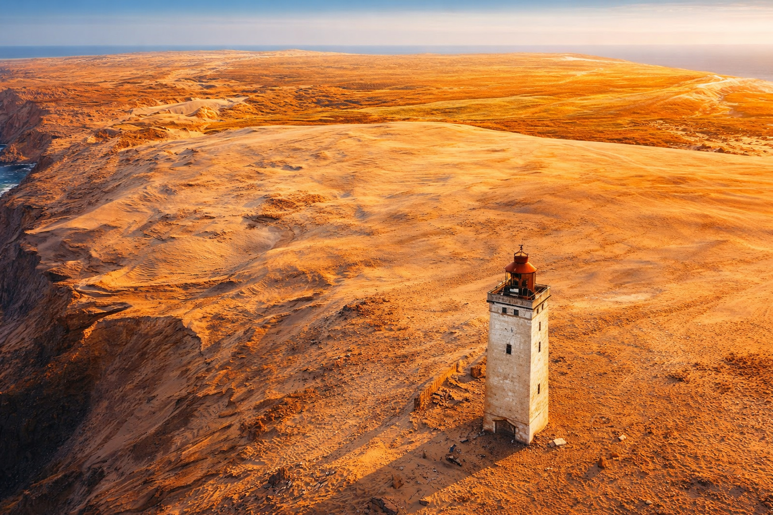
Attracting around 250,000 people a year, a lighthouse 200 meters from the sea, on a 60-meter high cliff, on the North Sea coast in Denmark, becomes one of the most impressive examples of how nature can threaten historical buildings.
-
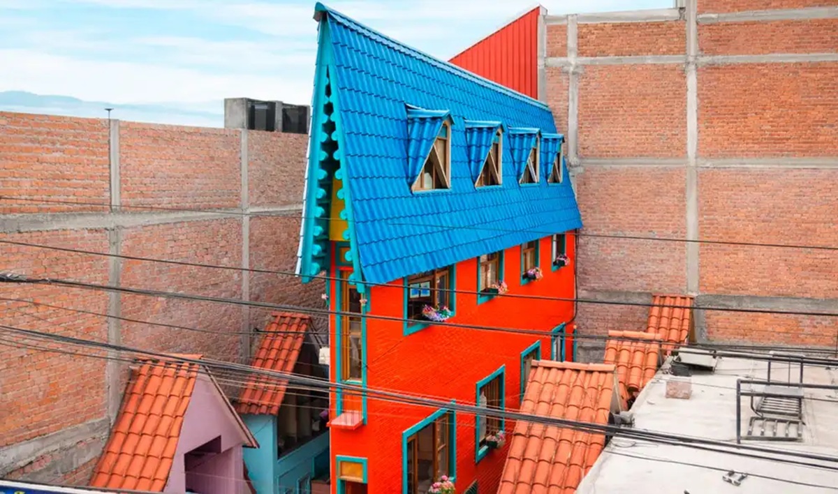
The narrowest house in the world is only 63 centimeters wide, but inside it can accommodate a bathroom, kitchen, bedroom, office, and even two staircases.
-
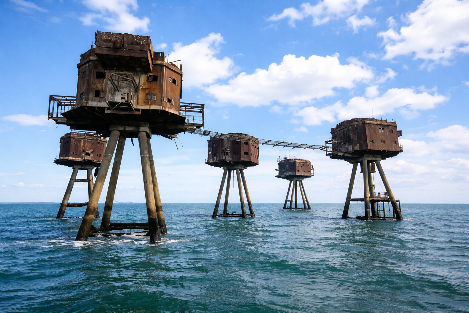
In the middle of the sea, these enormous concrete and steel structures, built by the British Navy to protect strategic maritime routes, look like they came straight out of a Star Wars movie.
-
For years, no one could cross a neighborhood in Tokyo because of the tracks, but an impressive solution changed mobility and completely transformed the local routine.

The impacts of climate change in the Northeast are interconnected, with sea level rise potentially exacerbating other issues such as water scarcity, affecting food security. The vulnerability of the northeastern coast is significant due to the socioeconomic conditions of many communities, which may limit their capacity to adapt to the impacts of sea level rise.
Salvador: A Vulnerable Brazilian Metropolis
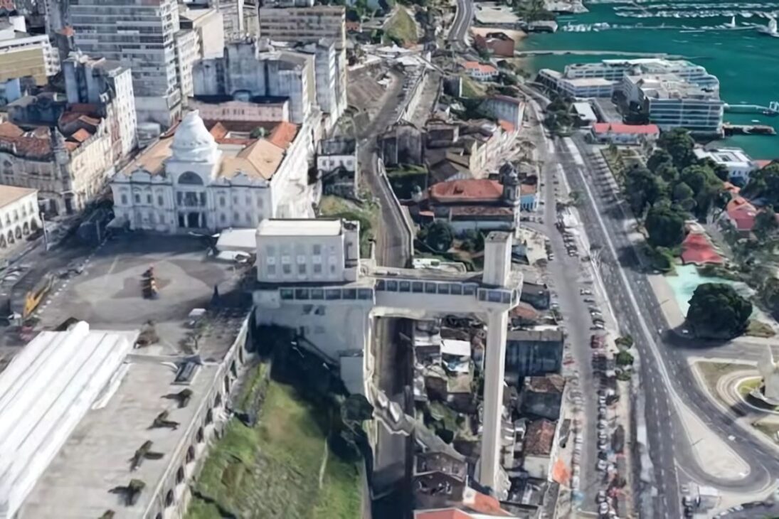

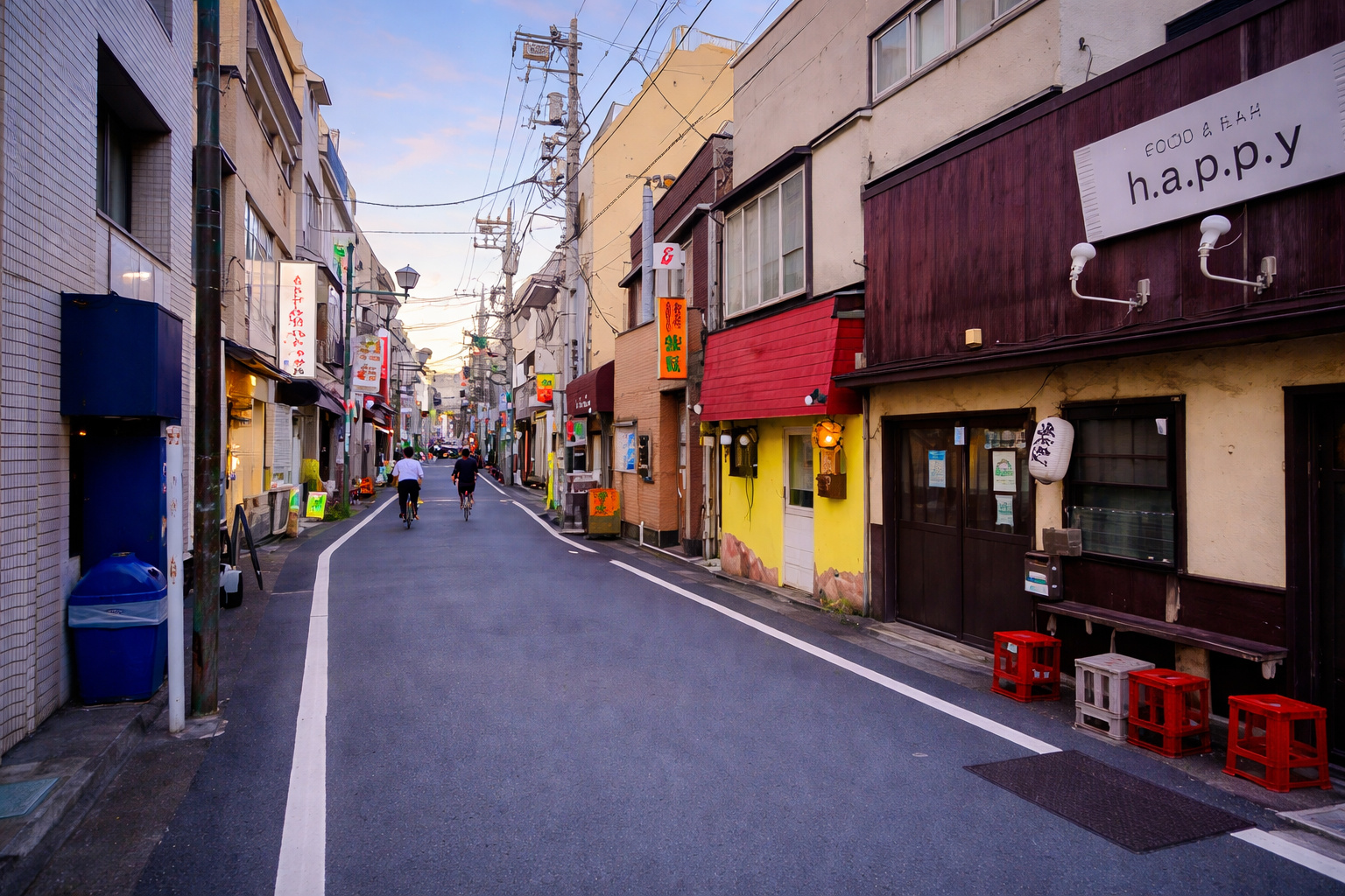
Salvador is located on the coast of Bahia and has low-lying areas that are heavily urbanized near the sea. Some specific areas of Salvador are highly vulnerable to sea level rise, including Cidade Baixa, Porto da Barra, Mercado Modelo, Ilha dos Frades, and part of the railway system. The projected rise in sea level may impact these areas in various ways, including permanent and increased flooding during high tides and storms, as well as damage to infrastructure and historic sites.
Millions of people in Brazilian coastal cities, including Salvador, may be affected. The concentration of historical, cultural, and economic assets in low-lying coastal areas makes this Brazilian metropolis particularly susceptible to significant losses. The irregular topography of Salvador complicates the assessment and management of the impacts of sea level rise, as different areas will have different degrees of vulnerability.
Coastal Erosion In Salvador: An Ongoing Problem
Coastal erosion occurs throughout the coast of Salvador. Natural factors such as waves and currents contribute to this, but human factors also worsen erosion, like urban development and the construction of coastal structures. The alteration of natural defenses, such as mangroves and dunes, also contributes to erosion. Coastal erosion causes several problems in Salvador, including loss of beaches and damage to infrastructure.
The recovery from the damages caused by coastal erosion has high costs. Studies focus on erosion events linked to storm surges in Salvador. The CoastSnap project monitors coastal erosion in the city. Coastal erosion in Salvador is not only natural; human activities significantly influence it, and better coastal management and urban planning can help mitigate its effects. The interaction between sea level rise and coastal erosion can worsen the situation, leading to a faster shoreline retreat and more severe impacts on the waterfront of this Brazilian metropolis.
The Geology Of The Soteropolitan Coast And The Risks
The coast of Salvador has diverse geology, including different types of rocks and sediments. The coast features cliffs, beaches, dunes, and bays. The geology influences the susceptibility of the coast to erosion and flooding. Rocky cliffs may be more resistant to erosion than sandy beaches, but low-lying coastal plains are more vulnerable to flooding. Specific geological formations like the Alto de Salvador are important.
The Salvador Fault also influences the topography of the Brazilian metropolis. The Baía de Todos os Santos has its own geological context. The diverse geological characteristics along the coast of Salvador mean that the impacts of sea level rise and erosion will not be uniform throughout the city, requiring local assessments and customized adaptation strategies. Understanding the history of the coast of Salvador helps to foresee future changes, as this history has been shaped by geological processes and variations in sea level over thousands of years.
The Future Of Salvador: Projections And Adaptation
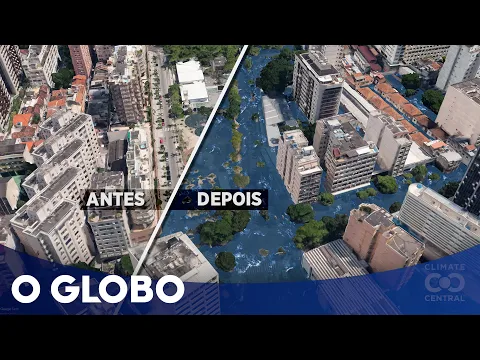
Historical data on sea level in Salvador has been available since 1947. The tidal station at Porto de Salvador has provided data since 2002. Future projections for sea level rise in Salvador indicate a significant risk. Different scenarios depend on greenhouse gas emission levels. Specific projections suggest a rise of 55 cm to 80 cm by 2100, which will have implications for flooding in Salvador. The exposure “Salvador 2100” visually shows possible flooding. Climate Central uses data from the IPCC to make these projections. In scenarios of more severe climate change, sea level rise may be even greater.
The Brazilian metropolis is planning and implementing measures to adapt to sea level rise. The Climate Change Mitigation and Adaptation Plan (PMAMC) establishes important actions for coastal zones. The CoastSnap project monitors coastal changes. Other measures include physical barriers and urban plan revisions. A working group has been created in Salvador to monitor sea level rise and define strategies. Adherence to the CoastSnap project demonstrates a commitment to coastal monitoring. The effectiveness of these measures will depend on their implementation, long-term commitment, and integration with other policies.


Bom dia.As Autoridades deveriam está atentos a esse tipo de destruiçao e impedir.para não gastar bilhôes e não resolver o problema.
Bom dia.As autoridades deveriam está atentos a esse tipo de destruiçao. Não fiscalizão, deixa destruir o habitate natural e a consequência é gastar bihões e não solucionar o problema.
Hummm! Essa conversa existe a mais de 40 anos, Salvador continua tudo como antes no quartel de Abrantes.
Evidente q em alguns momentos, acontecem avanços momentâneos na costa soteropolitana, mas, recua e a natureza se molda como antes.
É quem nem as geleiras que se deslocamento e desmoronam, quantas bobagens, só mostram onde o gelo desaba, mas não mostra o restante dos 90% intacto, a natureza se restabelece.