






 Portuguese


With approximately 150 kilometers between Baguio and Bontoc, Halsema Highway cuts through the Central Cordillera, facing monsoon rains, rockfalls, and intense fog, while providing access to famous local tourist destinations
The Halsema Highway, the main link between Baguio and the mountainous areas of Northern Philippines, stretches approximately 150 kilometers and reaches an elevation of 2,255 meters in Atok. The combination of steep slopes, monsoon rains, fog, rockfalls, and unprotected stretches makes travel especially treacherous from June to November.

Halsema Highway Faces Landslides, Fog, and Curves Among Mountains
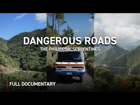
Known as one of the most dangerous roads in the Philippines, Halsema Highway traverses the Central Cordillera and serves as a vital corridor for intercity buses and trucks loaded with vegetables produced in the mountainous areas.
The risks increase primarily during the typhoon season, from June to November. During this period, heavy rains make the road slippery, create mud, and increase the occurrence of landslides and rockfalls.
-
16 km Road in Pakistan Rises Along Cliffs, Lacks Guardrails, and Barely Fits a Jeep

-
Japan Constructed 53.85 km Tunnel to Link Two Major Islands, with 23.3 km Under the Sea, 100 Meters of Rock Over the Structure, and Trains Reaching 240 Meters Below Sea Level
-
Ingenious Cooling: How 4,500 Liters of Water and Architecture Kept an Australian Home Cool at 24.9 ºC During Extreme Heat

-
Brazilian Couple Turns Meeting in Ceará into 84 Years of Marriage, Enters Guinness and Builds Family with 13 Children, 55 Grandchildren, and 54 Great-Grandchildren


In several places, vehicles pass close to abysses and encounter sections without guardrails. The fog can also reduce visibility to just a few meters, further complicating driving on the tight curves.
Between December and May, during the dry season, the conditions change. The asphalt tends to remain dry, and visibility improves, although there is still a moderate risk mainly related to fog in the early hours of the day.

Highest Point Reaches 2,255 Meters in Atok
One of the figures that illustrate the scale of Halsema Highway is its maximum altitude. The road reaches 2,255 meters in Atok, Benguet, identified in the material as the highest roadway section in the country.
The altitude contributes to unusual temperatures in a tropical country. During the early mornings, frost can occur on the region’s crops, a phenomenon that attracts visitors’ attention.
The road also passes through mountains covered with pine trees, deep valleys, and terraced agricultural areas. One of the well-known sections is the so-called “Philippine Pali,” where the mountain was cut to allow the road to pass through.
Lookout points along the route allow for views of cabbage and carrot farms spread across the slopes.
Highway Also Provides Access to Tourist Destinations
Despite harsh natural conditions, most of the highway has been paved, facilitating access to remote communities and increasing tourist traffic in the chilly northern regions of the Philippines.
The road serves as an entryway to destinations such as the Banaue Rice Terraces and the caves of Sagada. The journey itself has also become part of the tourist experience, traversing mountainous and agricultural areas.
Truck traffic can slow down travel. Even relatively short trips can take hours when heavy vehicle convoys are on the road.
Government May Block Traffic During Higher Risk Periods
During the rainy season, the Philippine government monitors conditions on the Halsema Highway and may proactively block traffic. Measures to mitigate landslide risks along the main agricultural route in the region are also planned.
Recommendations include avoiding nighttime travel due to poor lighting and heavy fog, and, when possible, relying on local drivers familiar with the curves and road conditions.
This article was prepared based on information provided about the Halsema Highway, including references to the Department of Public Works and Highways (DPWH), Department of Tourism, and the Autentic Documentary channel, with data, numbers, and guidance preserved as per the consulted material.


