 Portuguese
  English
  Spanish


Billion-Dollar Project in São Paulo Plans 700-Meter Bridge in the South Zone, Integration with Train and Bus Corridors, Bike Path, and New Road System, Promising to Shorten Commutes and Benefit Over 1 Million Residents.
The City of São Paulo is developing the project for the future Graúna-Gaivotas Bridge, a crossing of 700 meters over the Braço do Cocaia, in the Billings reservoir, in the South Zone.
With an estimated investment of R$ 450 million, the project aims to shorten commutes to 14 minutes and serve over 1 million residents.
The endeavor is in the study and technical contract stage, with no inauguration date set.
-
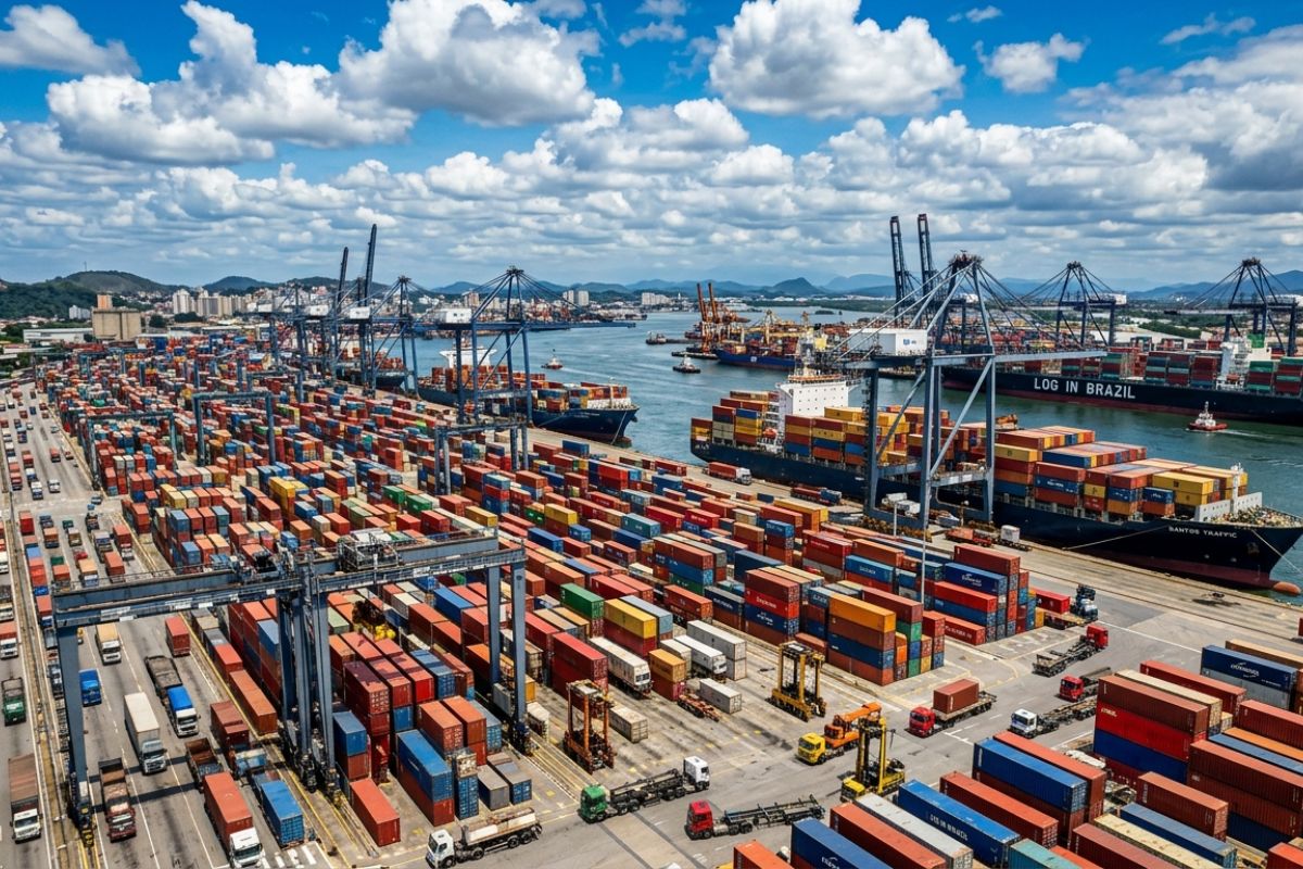
Ports like Santos and Paranaguá are operating at their limits and may block containers as early as 2030, warns a study by Macroinfra; bottlenecks increase costs and delays and push cargo to Rio, Salvador, Pecém, and Suape across Brazil.

-
Lula reveals in an interview that he asked President Xi Jinping three times to invest in a major project in Brazil, the Salvador-Itaparica bridge, which is set to begin in June with the participation of a Chinese consortium and is expected to be extraordinary, according to the president.

-
Neighboring city of Belo Horizonte has properties starting at R$ 139,000 with 90 m² and a price per square meter much lower than the capital, even concentrating automotive, petrochemical, and logistics hubs.
-
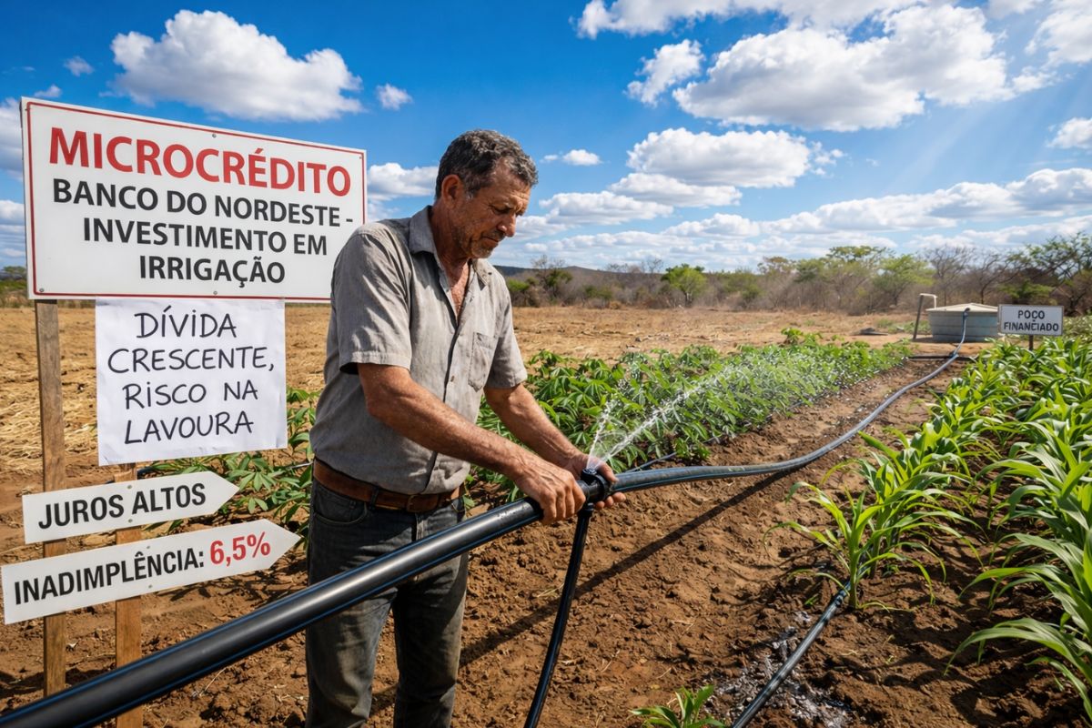
Drought in northern Bahia forces family farmers to invest in expensive irrigation and seek microcredit from Banco do Nordeste; with high interest rates and a default rate of 6.5%, the debt becomes a threat to the crops.

According to a report published by the Gazeta de São Paulo newspaper this Monday (15), part of the initial fronts has already been activated to prepare the road network that will support the crossing.
In June of this year, the City Council approved the restructuring of the road infrastructure in Grajaú and Cidade Dutra, a necessary measure to make the project viable.
The bridge will connect areas currently separated by the Billings reservoir and aims to facilitate access to the expanded city center.
The proposal serves densely populated neighborhoods at the edge of the reservoir and the far south.
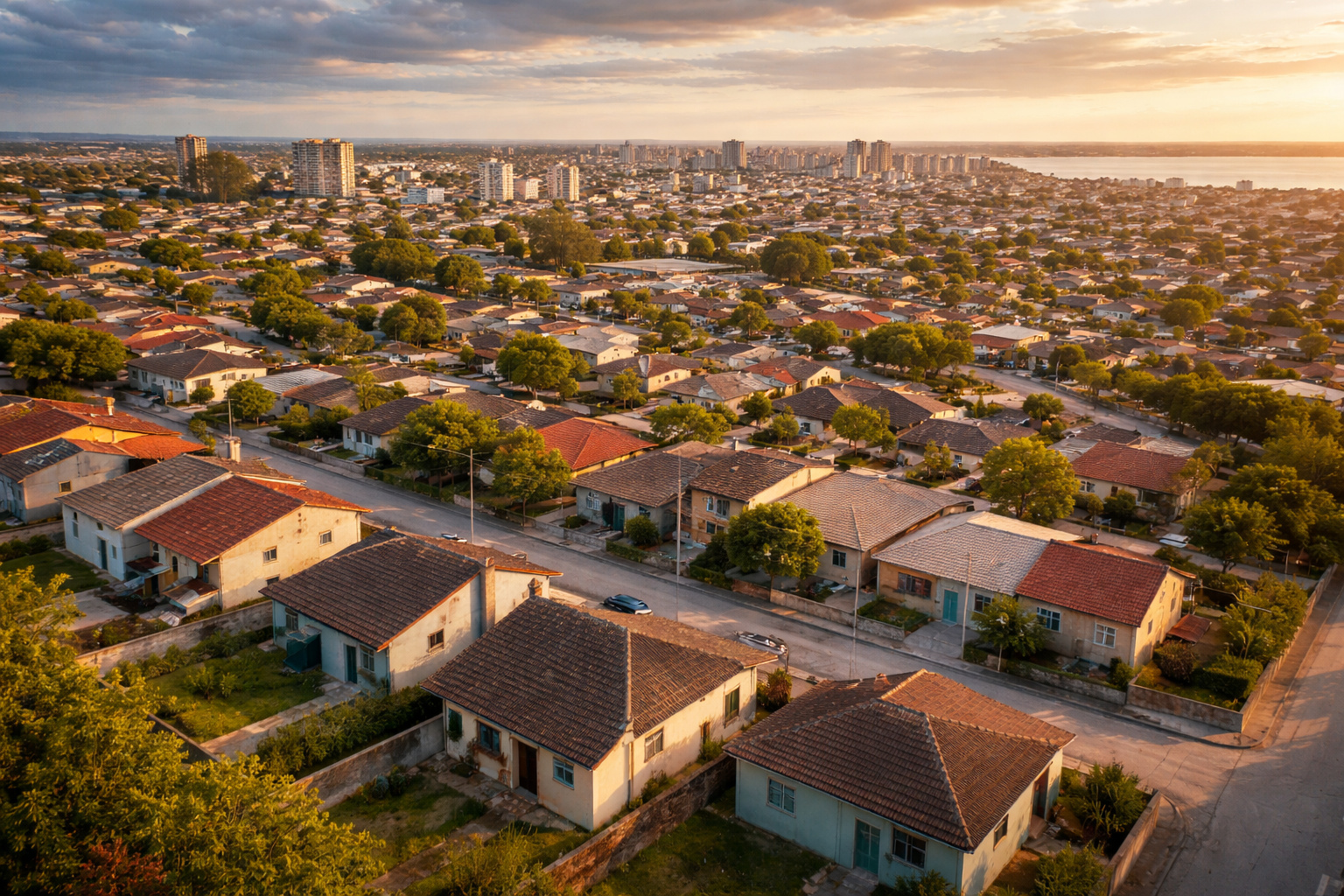
Residents of Jardim das Gaivotas, Chácara das Gaivotas, Parque Cocaia, Jardim Toca, and Cantinho do Céu are among the primary beneficiaries, with a promise of more direct routes to employment, service, and higher-capacity public transport corridors.
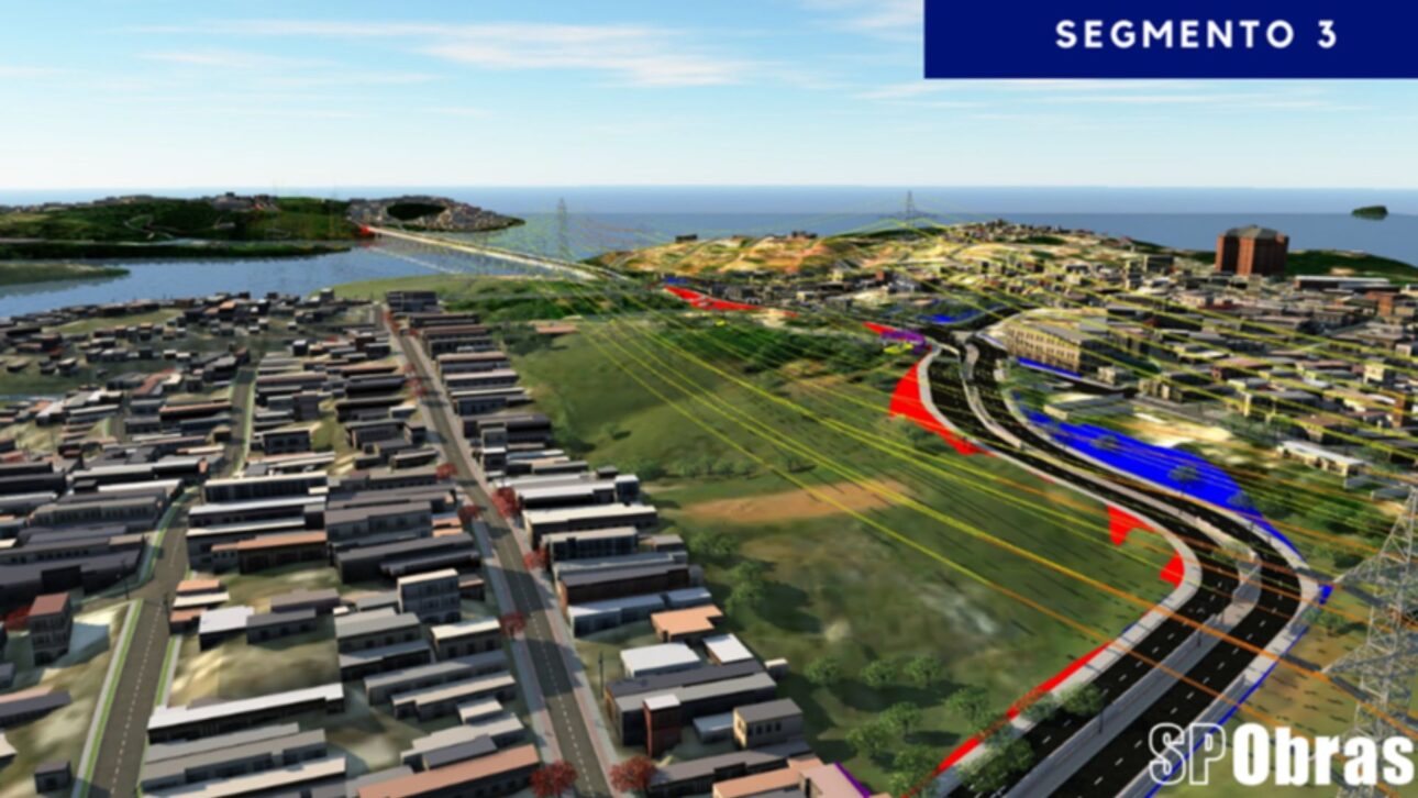
Route of the Graúna-Gaivotas Bridge
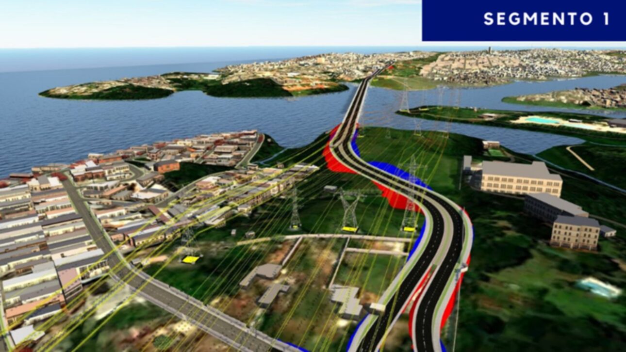
The plan has been sectioned to organize its execution in segments.
The first segment will be about 1,700 meters long, starting at Avenida Lourenço Cabreira, near Avenida Manuel Alves Soares, and advancing to the end of Praça Ramires Ferreira.
In this segment, the goal is to redistribute local traffic and prepare access to the future crossing.
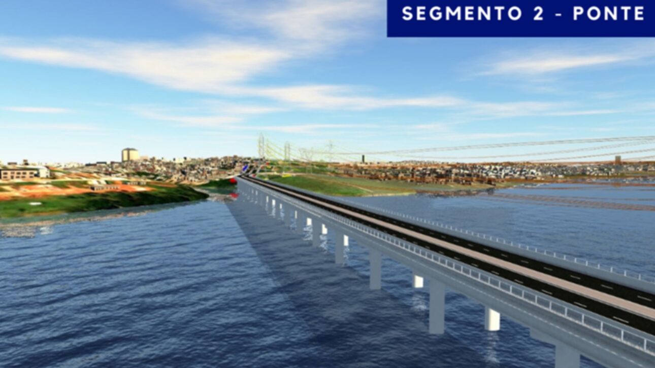
According to the Gazeta de São Paulo newspaper’s investigation, the second part of the route crosses the high tension line and begins the 700-meter bridge over the Braço do Cocaia.
This segment ends at the junction of Estrada Canal da Cocaia and Rua Cláudio Astaria, a point expected to receive road safety interventions and new connections to the bus system.
The third segment completes the axis with approximately 2,500 meters.
The link runs along Estrada Canal de Cocaia, continues through Rua Rubens de Oliveira and Rua Pedro Escobar until it reaches Avenida Dona Belmira Marin, in the Gaivotas neighborhood.
This stage closes the circulation loop and integrates the crossing with the surrounding arterial roads.
Integration with Public Transport and Bike Path
In addition to the bridge, the project includes a bike path along the route.
The city claims that the solution should improve public transport performance in the neighborhoods of Grajaú, Parelheiros, and Marsilac, creating faster routes for bus lines and providing a safe alternative for cycling commutes.
The Gazeta de São Paulo newspaper also pointed out that there will be connections with exclusive corridors and lanes on the Teotônio Vilela, Atlântica, Olívia Guedes Penteado, Interlagos, Nossa Senhora de Sabará, and Dona Belmira Marin avenues.
The system will also connect to the Grajaú Urban Terminal and to the Line 9-Emerald of CPTM, expanding integration options for those who rely on different modes of transport daily.
The government’s expectation is to better distribute light vehicle and bus traffic, reduce irregular crossings in riverside areas, and shorten travel time between neighborhoods separated by the reservoir.
Meanwhile, the bike path should connect currently discontinuous sections of the local bike path network, designed parallel to the lanes and access points at strategic intersections.
Impact on Surrounding Neighborhoods
Currently, the population of the far south faces long routes to go around the Billings and reach higher-capacity avenues.
With the new connection, segments that require detours through saturated roads can be made directly, with fewer transfers to the train.
The municipal administration maintains that, combined, these changes should reduce internal travel time and improve the reliability of feeder lines.
In neighborhood commerce, the expectation is to facilitate supply and circulation between local service hubs.
Schools, health units, and public facilities in Grajaú and nearby areas are also likely to become more accessible, especially during peak hours when current bottlenecks intensify.
Next Steps for the Project
The set of interventions is under the coordination of the Municipal Secretariat of Infrastructure and Works (Siurb).
According to the city, the contracted studies define the route, bridge dimensioning, and road adjustments in the three segments, as well as the bike path design.
The next stages involve consolidating executive projects, licensing, and continuing construction in the field. So far, there is no delivery schedule announced.
In an interview with the Gazeta de São Paulo newspaper, the municipal management emphasized that the project includes both the bridge and improvements to the public transport network, aiming to reduce travel time and increase integration between modes.
The report also sought Siurb for updates on the schedule and more technical details.
If the secretariat provides new information, this content will be updated to reflect the most recent stage of the project and any changes in scope.
With the planned connection to shorten routes and add integrations with buses and trains, residents in the southern part of the capital see the possibility of transforming their commuting routines; in your opinion, what priority should come first: accelerating the construction of the bridge or anticipating the public transport improvements that will come with it?


Com a ponte, quantos km a comunidade vai economizar? Quanto tempo usa sem a ponte?
Está impossível let a notícia, tantos são os anúncios que surgem. Desisti. Bloqueio seu site.