 Portuguese
  English
  Spanish
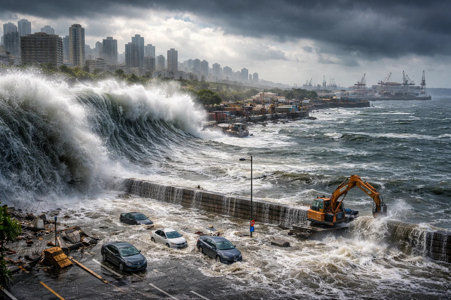


A Review of 385 Studies from 2009 to 2025 Found a Mass-Repeated Error in Measuring Sea Level and Height, with the Average Difference Ranging from 24 to 27 cm, Including Regions Where It Exceeds 1 Meter
The calculation that many people used to “measure” the height of the sea may be wrong. And it wasn’t an isolated slip. Researchers reviewed 385 peer-reviewed studies published between 2009 and 2025 and arrived at a disturbing number: about 99% estimated ocean height incorrectly.
The result is straightforward for those who live or work near the coast. If the sea height is underestimated, the flooding risk is also underestimated. And this impacts costly projects, from retaining walls to ports and industrial areas.
The Problem Appeared Where No One Wanted to Look, in the Comparison Between Land Height and Sea Height That Decides Whether a Place Floods or Not
To assess coastal risk, the logic is simple. You compare land height with sea height.
-
What if the Sun disappeared suddenly? Simulation shows Earth in darkness within minutes, extreme cold, and rapid collapse of life on the planet.

-
A 2,400-year-old iron foundry has been discovered in Senegal with 100 tons of slag, 35 furnace bases, and signs of nearly eight centuries of continuous metallurgical activity.

-
Four humans are flying towards the Moon inside the Orion capsule launched by the SLS rocket, and on April 6, Artemis II will disappear behind the far side of the Moon without communication with Earth for nearly an hour.
-
Worlds covered by water, atmospheres filled with hydrogen, and the possibility of life beyond Earth: ocean planets are rewriting the map of cosmic search and forcing scientists to rethink where to look.


The ideal approach is to use actual measurements. Land height measured by satellites and surveys. Sea level measured by tide gauges, ocean buoys, satellites, and other instruments.
However, the review found a pattern. Instead of using measured sea level, most studies relied on a reference called the geoid.
The Geoid Shortcut Became Fashionable, but It Is Not the Real Sea, and This Undermines Storm, Tsunami, and Swell Predictions
The geoid can be imagined as a “digital shape” of the ocean based on Earth’s gravity and rotation. It is a useful reference in some areas.
The problem is treating this as if it were the sea level that meets the coast.
The authors of the review themselves explain two significant points. In regions with few gravity data, the geoid can be off by meters. Moreover, it does not account for what actually changes the sea, such as currents, wind, tides, and water temperature.
The review also identified another type of flaw. In about 9 percent of the studies, even when data were available, there was incorrect alignment between sea and land measurements. Less than 1 percent achieved correct alignment.
When Researchers Switched from “Design” to Real Measurements, the Average Difference Was 24 to 27 cm, and in Parts of Asia, It Exceeded 1 Meter
To measure the extent of the damage, the authors used a global set of sea level based largely on satellite measurements of ocean surface.
Then came the game-changing number for engineering and planning. The average underestimation of sea level was between 24 and 27 centimeters.
In some areas, the difference was much greater due to a lack of data. In parts of Southeast Asia and the Indo-Pacific, sea level appears more than 1 meter higher than many studies indicated.
There were also locations where the height was overestimated, according to the researchers. They cite regions in the northern Mediterranean, Antarctica, and some islands in the Atlantic and Pacific.
The Impact Directly Affects Construction and Money, Because a Few Centimeters of Error Becomes a Design Error When Water Hits with Force
On a map, 25 centimeters may seem insignificant. At the shoreline, it can be the difference between “holding up” and “being overtopped” in an extreme event.
This is where the news assumes an industrial face. Those who design and operate near the coast depend on these numbers.
Ports, shipyards, support bases, storage areas, access roads, submarine outfalls, dikes, and protective walls are not designed on intuition. They are based on height, safety margins, and future scenarios.
When the basis of the calculation is underestimated, the project may also be undersized. And fixing it later is often expensive, slow, and politically challenging.
An expert quoted in the news, coastal geologist Patrick Barnard, highlighted a common risk: using results from very broad studies in local plans without additional verification.
The Alert Became Heavier Because 45 Studies Cited by the IPCC Were Included in This Package, and the Estimate of Exposed People May Have Been Too Optimistic
The review points out that the error appeared even in studies used as references by the IPCC in its Sixth Assessment Report. The cited number is 45 works.
The message is that the human cost could be higher than many had been calculating.
The authors cite an estimate: a rise of 1 meter in sea level, something that could occur in about a century, would submerge areas where up to 132 million people live. They describe this as a rise of up to 68 percent compared to what was previously suggested.
A climate scientist quoted, Anders Levermann, stated that sea level rise is slow but becomes dangerous when ignored. He also asserts that these new estimates indicate we are further along in time than previously thought.
In the end, Seeger and Minderhoud state that they produced publicly available coastal sea level data by integrating more recent measurements to assist research and planning moving forward.
What stands out is the scale of the error. It is not a laboratory discussion. It is a technically repeated detail that can alter construction decisions, costs, and risks in coastal cities and industrial hubs.
And for you, does this change the way you trust completed studies when planning a project near the sea, or does it still seem like a problem far from daily life?


La cosa parece bien clara; como, a pesar de las predicciones catastrofistas, el nivel del mar no parece que haya subido nada en los últimos cien años, los predicadores del apocalipsis climático tienen que inventarse una explicación. Las mediciones estaban mal hechas, dicen ahora. Cualquier cosa menos admitir que no tienen ni idea de cómo se comporta el clima.
Não tenho conhecimento técnico, mas fico aqui pensando na quantidade de coisas que se joga/lança no mar em todo mundo qual impacto final. Containers que caem, navios que afundam, navios e barcos em atividade, submarinos, lixo, aterros sem estudo de impacto, lixo, etc…
Fundamental padronizar o método de medição, determinação das cotas máximas para longevidade das estruturas. Excelente artigo.