






 Portuguese


Beneath the cerrado of Mato Grosso, a network of flooded galleries continues to reveal passages, great depths, and still-unknown paths as researchers seek to understand how water circulates through this subterranean system.
The entrance is located in the cerrado of Mato Grosso, but what exists below the surface is still not fully mapped.
In Nobres, researchers are following flooded galleries that have taken them beyond 130 meters deep and through nearly 2 kilometers of subterranean paths, while new passages continue to be identified during expeditions.
The exploration takes place in the Gruta da Lagoa Azul State Park, primarily in the area of Pai João Dolina, a natural formation that leads to an extensive flooded network.
-
Brazil Unveils $1.06 Billion AI Supercomputer with 7,200 Petaflops, Aiming for Global Top 10 and Plans to Transform Rio Grande do Norte and Rio de Janeiro into AI Hubs by 2027

-
This New Technology Transforms 72,000 Contaminated Laboratory Disposable Bottles into Recyclable Plastic
-
Island in the Philippines Draws 12,000 Interested Individuals with Promise of AI Governance, Yet Lacks Formal Sovereignty
-
Gadget Made from Straws, Sponge, and Pipe Cleaners Created by 18-Year-Old Student to Help Woman with Cerebral Palsy Rediscover Her Love for Painting, Now Sells in Over 25 Countries and Gains Apple Recognition


The area is about 120 kilometers from Cuiabá and has been studied through successive campaigns that combine speleology, geology, hydrology, and technical diving.
In the fourth stage reported in 2026, the team spent ten days in the region.
The divers managed to spend between five and seven hours underwater in a single operation, a period that includes not only the exploration of the passages but also the long procedures necessary to safely return after spending time at great depths.
Their goal is not just to discover how far the cave extends.
Each new gallery helps create a kind of map of the hidden waters beneath this part of Mato Grosso and may provide clues about where the water comes from, how it circulates, and how different cavities in the region may relate to each other.

Nearly 2 Kilometers of Galleries Have Already Been Mapped in Nobres
In four expeditions, researchers have already surpassed 130 meters in depth and traversed approximately 2 kilometers of flooded galleries, according to information released in June 2026 by the portal Primeira Página.
The known extent has increased as new routes have been opened and measured by the divers.
This does not mean that the cave only spans 2 kilometers.
The number represents what has been achieved and recorded in the exploration lines, while sections remain unmapped.
During the most recent campaign, the team identified two large channels that connect at approximately 115 meters deep.
From this junction, the divers found access to an even larger gallery, which continues to be a focus of research.
It is precisely at this point that the scale of the system begins to become clearer.
Even after years of work and dives that last much of the day, there are still unanswered pathways and stretches where the beams of their flashlights reach spaces not yet mapped in previous explorations.
Guiding Cables and Sensors Help Map the Underwater Cave
Exploring a completely flooded cave is different from diving in open water.
Once a researcher enters a gallery, there is no option to simply ascend vertically to the surface if it becomes necessary to interrupt the dive.
Therefore, guiding cables are part of the system used to record and navigate the pathway.

Sensors associated with the mapping work collect information that allows for the reconstruction of the route taken within the rock.
With this data, the team produces maps that help determine where the next dive should proceed.
The goal is to transform an environment that, during the exploration, appears only within the limited reach of flashlights into a representation capable of showing depth, direction, and connections between different passages.
Researcher Sergio Rhein Schirato, affiliated with the University of São Paulo and involved in exploring the caves in the region, is among the authors of a scientific paper about the cavities of Pai João and João Terêncio.
The study brought together underwater maps and geological information to begin understanding how the karst aquifer of Nobres functions.
Groundwater Can Flow at Great Depths
Geology helps explain why these caves are important.
The region has karst terrains formed in rocks that can be slowly dissolved by water over long periods, creating voids, channels, and underground caves.
Some previous research identified characteristics associated with systems called vauclusian, in which groundwater flows through deep conduits and returns to the surface under pressure.
This dynamic can cause a spring to conceal a much larger path beneath what is visible on the surface.
The scientific study on Pai João and João Terêncio revealed differences between the two cavities.
João Terêncio exhibits the characteristics of a spring with upward flow, while Pai João operates differently, with water occupying a dolina connected to deep conduits.
An important question remains open: Do these caves belong to the same hydrological system or represent independent networks?
The scientific surveys published thus far have not been able to definitively resolve this issue.
“To do this, we conducted an assessment of the trees and vegetation to identify which ones were most suitable for setting up this structure,” explained 1st Sergeant Édson de Oliveira Sá about the support work carried out to facilitate the movement of equipment.
A hyperbaric chamber also formed part of the safety infrastructure for previous expeditions.
The scientific work published later reports that the adopted procedures allowed operations to be conducted without incidents and that emergency equipment was not needed.

Why Dives Can Last Up to Seven Hours
Spending five, six, or seven hours underwater does not mean remaining all that time advancing through unknown tunnels.
In very deep dives, a significant portion of the time may be consumed by a controlled return to the surface.
The deeper and longer the exposure, the more careful this process needs to be.
Decompression may require prolonged stops, which is why exploring a few hundred additional meters of an underground passage can turn into an operation lasting many hours.
This also limits how much ground can be investigated in each attempt.
The diver must consider the outbound journey, the return, the planned reserves for the operation, and the time required to leave the deeper depths.
The environment adds other challenges.
There are narrow sections, areas with sediments that can reduce visibility, and much larger passages, where the true dimension is revealed as beams of light traverse the walls.
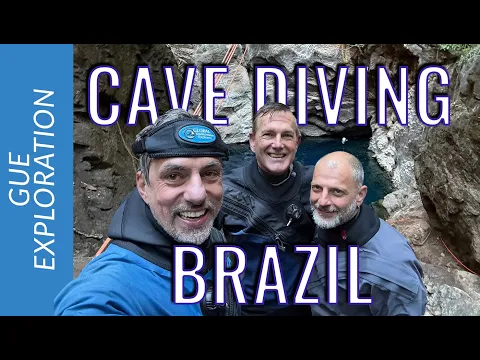

Rick Stanton Joins the Exploration in Mato Grosso
The 2026 team brought together Brazilian researchers and some of the most well-known names in cave diving internationally.
Among them was Rick Stanton, a Brit who was part of the rescue operation for the youth soccer team and their coach trapped in Tham Luang cave in Thailand in 2018.
After familiarizing himself with the system in Mato Grosso, Stanton assessed that the region still holds potential for years of exploration.
The statement aligns with what the expeditions themselves have been demonstrating: even after various campaigns, new pathways continue to emerge.
Jarrod Jablonski, director of Global Underwater Explorers, an international organization involved in the project, also participated.


