 Portuguese
  English
  Spanish
Black Sea MAP Project Mapped 2,000 km² of the Black Sea Floor, Discovered 65 Shipwrecks Between 40 and 2,200 Meters, and Revealed Intact Vessels Preserved by Oxygen-Free Waters
Between 2015 and 2017, the Black Sea Maritime Archaeology Project, internationally known as the Black Sea MAP, conducted one of the most ambitious maritime archaeology surveys ever carried out in deep waters. The project mapped approximately 2,000 square kilometers of the Black Sea floor within Bulgaria’s Exclusive Economic Zone and revealed 65 wreck sites ranging from the Early Bronze Age, around 3,300 B.C., to the 19th century. What would already be extraordinary in any sea gained even greater dimension in the Black Sea due to a rare natural condition: below a certain depth, the water does not have enough oxygen to support most life that typically destroys wood, ropes, oars, and other organic materials.
The international team captured over 250,000 high-definition photographs, recorded hundreds of hours of ultra HD video, and compiled a massive volume of bathymetric, acoustic, seismic, photogrammetric, and laser data. The result was not only the location of shipwrecks. The project opened a new window into the history of navigation, trade, and shipbuilding in one of the world’s most significant regions connecting Europe and Asia.
The survey was conceived by Hans K. Rausing, who established the Expedition and Education Foundation to enable the initiative. Funding came from the Julia and Hans Rausing Trust, reflecting the foundation’s interest in expanding knowledge about the origins of human civilization and the deep history of communities established around the Black Sea. Scientific leadership was taken by experts from the University of Southampton, who coordinated a rare-scale expedition even by contemporary ocean archaeology standards.
-
Attracting around 250,000 people a year, a lighthouse 200 meters from the sea, on a 60-meter high cliff, on the North Sea coast in Denmark, becomes one of the most impressive examples of how nature can threaten historical buildings.

-
The narrowest house in the world is only 63 centimeters wide, but inside it can accommodate a bathroom, kitchen, bedroom, office, and even two staircases.

-
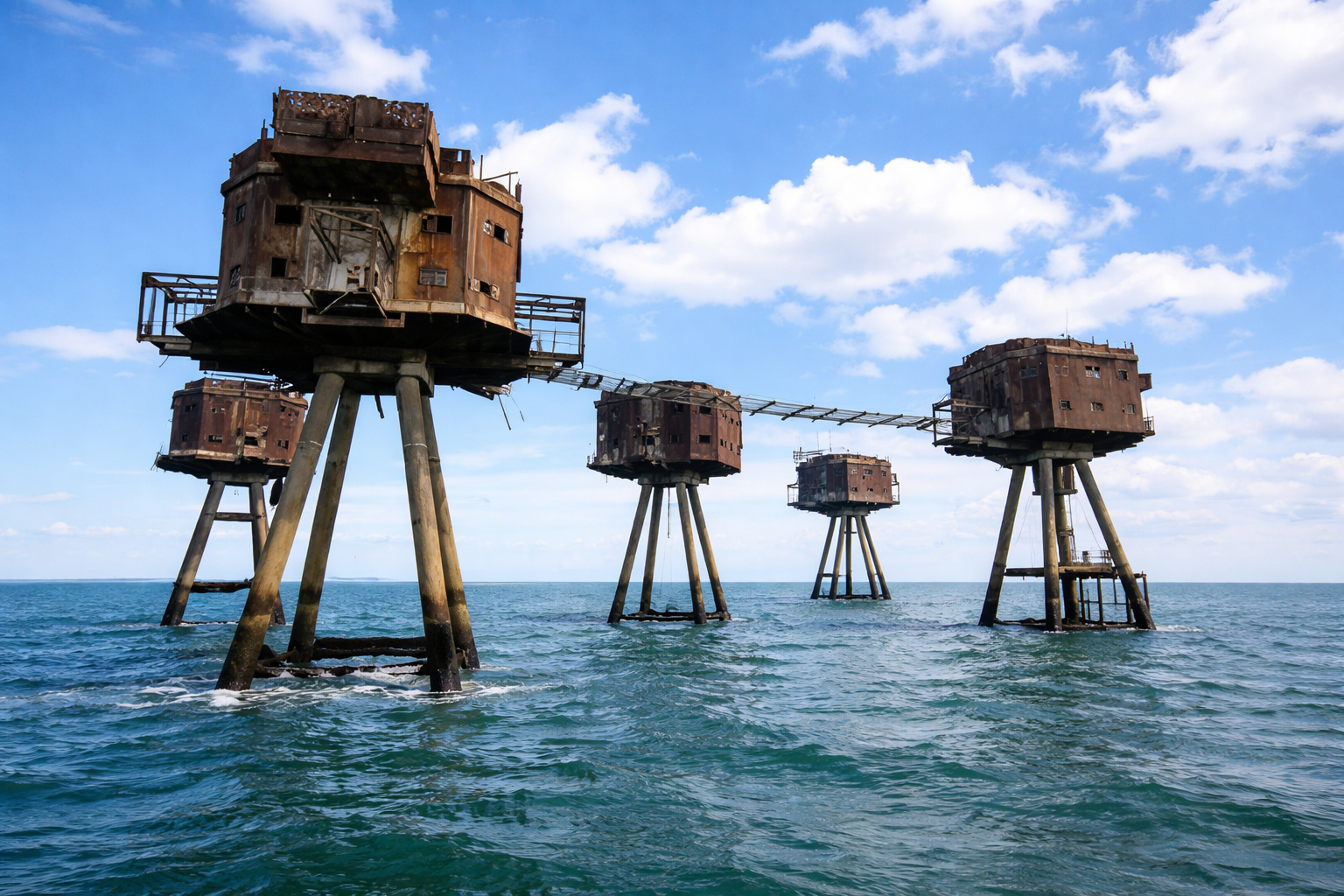
In the middle of the sea, these enormous concrete and steel structures, built by the British Navy to protect strategic maritime routes, look like they came straight out of a Star Wars movie.
-
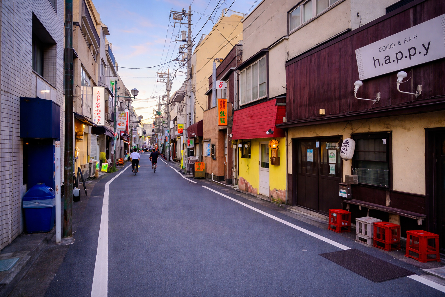
For years, no one could cross a neighborhood in Tokyo because of the tracks, but an impressive solution changed mobility and completely transformed the local routine.

Anoxic Conditions of the Black Sea Preserve Wood, Masts, and Oars for Thousands of Years
The main differentiator of the Black Sea lies in its chemical structure. Only about 13% of the total volume of the sea is oxygenated, while the rest is anoxic, that is, practically without dissolved oxygen.
Below approximately 150 meters, a deep layer forms where the biological and chemical processes that normally accelerate organic decomposition are drastically reduced or simply cease to occur.
This prevents the action of organisms such as shipworms, gribbles, and other wood borers that, in normal marine environments, destroy sunken vessels within a few decades or, at most, in a few centuries.
In the deep Black Sea, the scenario is different. The absence of oxygen has turned the deep waters into a true underwater museum of human history.
Wood, fastenings, tool marks, rudders, masts, rowing benches, cargo, and decorative elements can remain preserved for extraordinarily long periods. Instead of finding only fragments of hulls or scattered cargo deposits, archaeologists found entire vessels, many of them resting in recognizable original form.
What in shallow waters would be quickly destroyed by currents, tides, biological predators, and mechanical impact, in the deep Black Sea can survive for over two thousand years. This combination of extreme depth, low physical disturbance, and anoxia makes the site one of the most valuable underwater archaeological environments in the world.
Black Sea Between Europe and Asia Preserves 2,500 Years of Trade, War, and Ancient Navigation
For millennia, the Black Sea has been a geographical and historical crossroads. Its position between Europe and Asia, combined with connections to the Mediterranean and important river systems, made it a hub for human circulation since antiquity.
Through its waters passed Hittites, Thracians, Greeks, Persians, Scythians, Romans, Byzantines, Huns, Slavic peoples, Goths, Vikings, medieval Italian merchants, Ottomans, and many other groups that used the sea both for trade and for war and cultural expansion.
This succession of civilizations made the Black Sea a continuous stage of maritime activity. For centuries, however, technology did not allow for proper investigation of its great depths.
As early as 1976, engineer and marine archaeologist Willard Bascom had written about the possibility that the anoxic waters of the Black Sea preserved an exceptional wealth of ancient shipwrecks. The Black Sea MAP was the project that finally proved this hypothesis on a monumental scale.
The 65 shipwrecks discovered comprise a virtually uninterrupted sequence of 2,500 years of nautical tradition, spanning Greek, Roman, Byzantine, Ottoman, and modern periods. They do not represent merely isolated maritime accidents. Together, they form a physical archive of the evolution of navigation, shipbuilding, trade routes, and crew life over the centuries.
Technology with ROVs, Sonar, and 3D Photogrammetry Allowed Recording Shipwrecks at Extreme Depths
To achieve this level of documentation, the project used technology typically associated with the offshore industry, adapted for archaeological purposes.
During the field seasons of 2016 and 2017, Black Sea MAP chartered vessels from the Swedish companies MMT and Reach Subsea, specialized in deep marine research. From the R/V Havila Subsea ship, the team operated robotic systems and sensors capable of working in extremely challenging conditions.
Two remotely operated vehicles, the famous ROVs, were fundamental to the discovery and documentation of the sites. Both carried Cathx imaging systems developed for the specific task of producing high-precision archaeological documentation.
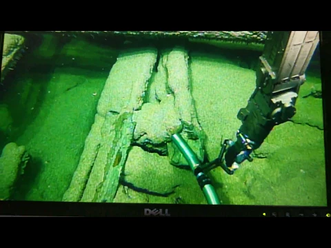
In addition to cameras, the vehicles were equipped with high-power lights, laser scanners, acoustic systems, and georeferencing instruments. The use of tethered vehicles allowed archaeologists and operators to monitor everything in real-time, making instantaneous decisions on routes, filming focus, sample collection, and positioning around the wrecks.
The team also employed side-scan sonar, seismic data, bathymetric measurements, and optical scanning to build as complete a picture as possible of each location.
The goal was not only to locate targets on the seabed but to produce records with a level of detail sufficient for advanced archaeological analysis. In many cases, the 3D models created from the images allowed the entire site to be visualized with a wealth of information superior to that obtained in various traditional excavations.
Surveyor Interceptor Revolutionized Archaeology in Deep Waters by Operating at 1,800 Meters and 6 Knots
Among the most impressive equipment used in the project, one stood out: the ROV Surveyor Interceptor, developed by MMT and Reach Subsea. The vehicle was described as revolutionary because it operated at three times the speed of conventional ROVs, carrying a complete suite of geophysical instrumentation, high-definition cameras, intense lighting, and laser scanners.
During the Black Sea MAP, the Surveyor Interceptor set relevant records for this type of operation. The vehicle operated at depths of up to 1,800 meters, maintained sustained speed exceeding 6 knots, and covered approximately 1,250 kilometers throughout the project. In deep underwater research, this represents a rare combination of range, speed, and data quality.

The second system was based on a work-class Schilling ROV, equipped with an Ivanoff Cathx wide-angle camera and high-lumen lights. Its primary function was to capture images intended for photogrammetry of the sites.
At depths exceeding 2,000 meters, the cameras had to withstand crushing pressures, while the lighting had to be strong enough to allow for short exposure times, minimizing motion blur and preserving sharpness.
Underwater Photogrammetry and 250,000 Images Created Detailed 3D Models of the Shipwrecks
The volume of visual material produced by the project was extraordinary. There were over 250,000 high-definition photographs and hundreds of hours of ultra HD video. This volume was not only used for disclosure or raw documentation. It fed sophisticated photogrammetry processes, a technique that builds three-dimensional models from thousands of overlapping images.
In practice, the software identifies visible points in two or more adjacent photographs and calculates their position in space, generating a 3D model with millions of points. In underwater archaeology, this allows for the production of extremely faithful digital replicas of the ship, cargo, and surrounding sediment, without the need for physical removal of the material.
The Cathx Ocean SOLID systems were also used for optical distortion correction, orthorectification, and image mosaic generation. These mosaics offer a broad and detailed view of each site’s layout, functioning as high-precision visual maps. Instead of an archaeologist having to imagine the original layout of a ship from isolated fragments, the 3D model allows for the study of the entire ensemble, almost as if the vessel were still in operation.
This combined use of ROVs, lasers, sonar, high-resolution photography, and photogrammetry transformed the bottom of the Black Sea into a cutting-edge maritime archaeology laboratory.
Greek Ship from Around 400 B.C. Was Found Intact at 2 Kilometers Depth
The discovery that attracted the most worldwide attention was that of a Greek merchant ship dating from the 4th century B.C., located over 2 kilometers deep.
The hull, about 23 meters long, appeared extraordinarily preserved, with rare elements such as mast, rowing benches, and overall structure intact. Until then, vessels of this type were known primarily from representations in ancient Greek ceramics, such as the famous Sirens Vase in the British Museum.

The state of preservation was so impressive that the discovery was described as capable of changing modern understanding of shipbuilding and navigation in the ancient world. Since the internal cargo, typically used to date shipwrecks, was not fully accessible, an ROV collected a small sample for carbon dating.
The result confirmed what the vessel’s design had already suggested: it was a ship from the classical Greek period.
Professor Jon Adams from the University of Southampton stated that an intact shipwreck of this age was unprecedented. Seeing a classical Greek ship in such complete condition is, for maritime history, akin to finding a monument from Antiquity preserved in almost impossible conditions.
13th and 14th Century Venetian Ship and Byzantine Vessels Broaden the Maritime History of the Black Sea
In addition to the Greek ship, the project found a Venetian vessel from the 13th or 14th century considered the most complete example ever discovered of this type. Roman, Byzantine, Ottoman ships, and later commercial vessels were also documented, many of which sank in bad weather along known routes.
Some of these wrecks exhibit details that would hardly survive in any other marine environment. An Ottoman ship, for example, preserved intricate wood carvings, revealing a level of decorative finishing almost nonexistent in shallow wrecks.

In another case, framing elements resting over 1,100 meters showed fastenings and tool marks still visible, providing direct data on construction techniques, naval carpentry, and vessel maintenance.
According to Dr. Kalin Dimitrov, director of the Underwater Archaeology Center in Sozopol, each season of Black Sea MAP filled gaps in the mosaic of ancient navigation. The vessels represent Greek colonization, Roman and Byzantine periods, as well as Ottoman times, helping to reconstruct trade routes, circulation patterns, and ways of life spanning from prehistory to the modern era.
Bulgaria Protects Underwater Heritage and Was the Second Country to Ratify the UNESCO Convention
The relevance of Black Sea MAP is not limited to discovery. The project also reinforced the importance of legal protection for underwater cultural heritage. The coordinates of each identified site and the complete research data were submitted to Bulgarian authorities and the Underwater Archaeology Center in Sozopol, ensuring that the locations remain protected for future generations of researchers.
Bulgaria plays an important role in this context because it was the second country to ratify the UNESCO Convention on the Protection of Underwater Cultural Heritage. This gives the country a more robust institutional framework than many other coastal states, with integration between archaeology, marine management, and heritage legislation.
This legal dimension is crucial because, in many cases, the first step to preservation is registration. Not every shipwreck needs to be excavated immediately. In such delicate and difficult-to-access environments, documenting with high precision already represents a powerful form of preservation. In some selected sites, however, the project applied photogrammetry to monitor the impact of controlled excavations, especially when sediment layers obscured important diagnostic elements, such as steering mounts, rudder blades, personal belongings of the crew, and cargo remains.
ROVs and AUVs Take Archaeology to 6,000 Meters and Put 98% of the Ocean Floor Within Reach of Researchers
The Black Sea MAP also became a symbol of a larger shift in maritime archaeology. Remotely Operated Vehicles, the ROVs, and Autonomous Underwater Vehicles, the AUVs, now allow researchers to study the seabed at depths of up to 6,000 meters. This means that approximately 98% of the world’s ocean floor is, at least theoretically, within reach of archaeological investigation.

In recent years, projects in the Mediterranean and the Black Sea have demonstrated the scientific value of deep-water archaeology and helped form a new generation of specialists trained in both archaeological methods and underwater technology.
The accumulated experience makes it clear that this type of work needs to be collaborative. Engineers, system operators, deep-water archaeologists, and experts in specific historical periods need to work together so that each measurement, each image, and each digital model has real analytical utility.
Technical precision alone is not enough. As the project specialists themselves emphasize, each image and each piece of data collected must answer specific archaeological questions. That is what transforms technology into historical knowledge.
The Deep Bottom of the Black Sea is an Underwater Museum That Can Rewrite the History of Shipbuilding
At the end of the project, the Black Sea MAP not only revealed 65 shipwrecks. It established the Black Sea as one of the most important archaeological environments on the planet. The combination of depth, anoxia, low biological disturbance, and long history of navigation created the equivalent of a underwater museum of human history.
The identified wrecks represent a continuous pattern of trade, war, communication, and cultural circulation dating back to prehistory. They show that the Black Sea has been a crucial maritime crossroads for thousands of years and that its deep bottom preserved this memory to a degree that no written archive could offer.
The Black Sea MAP established the Black Sea as one of the most important underwater museums in the world and showed that deep-water maritime archaeology is just beginning to reveal its true potential. Alongside Greek ships preserved as if they had just sunk, Venetian, Byzantine, and Ottoman vessels help reconstruct the evolution of shipbuilding, navigation, and trade networks that connected entire continents.
More than just a collection of impressive findings, the project proved that modern robotic technology can unlock secrets held in extreme environments for thousands of years. And, in the case of the Black Sea, these secrets continue to rest silently beneath an oxygen-free layer of water, waiting for the next archaeologists to descend with cameras, lasers, and 3D models to tell new parts of human history.


Seja o primeiro a reagir!