






 Portuguese
  Spanish


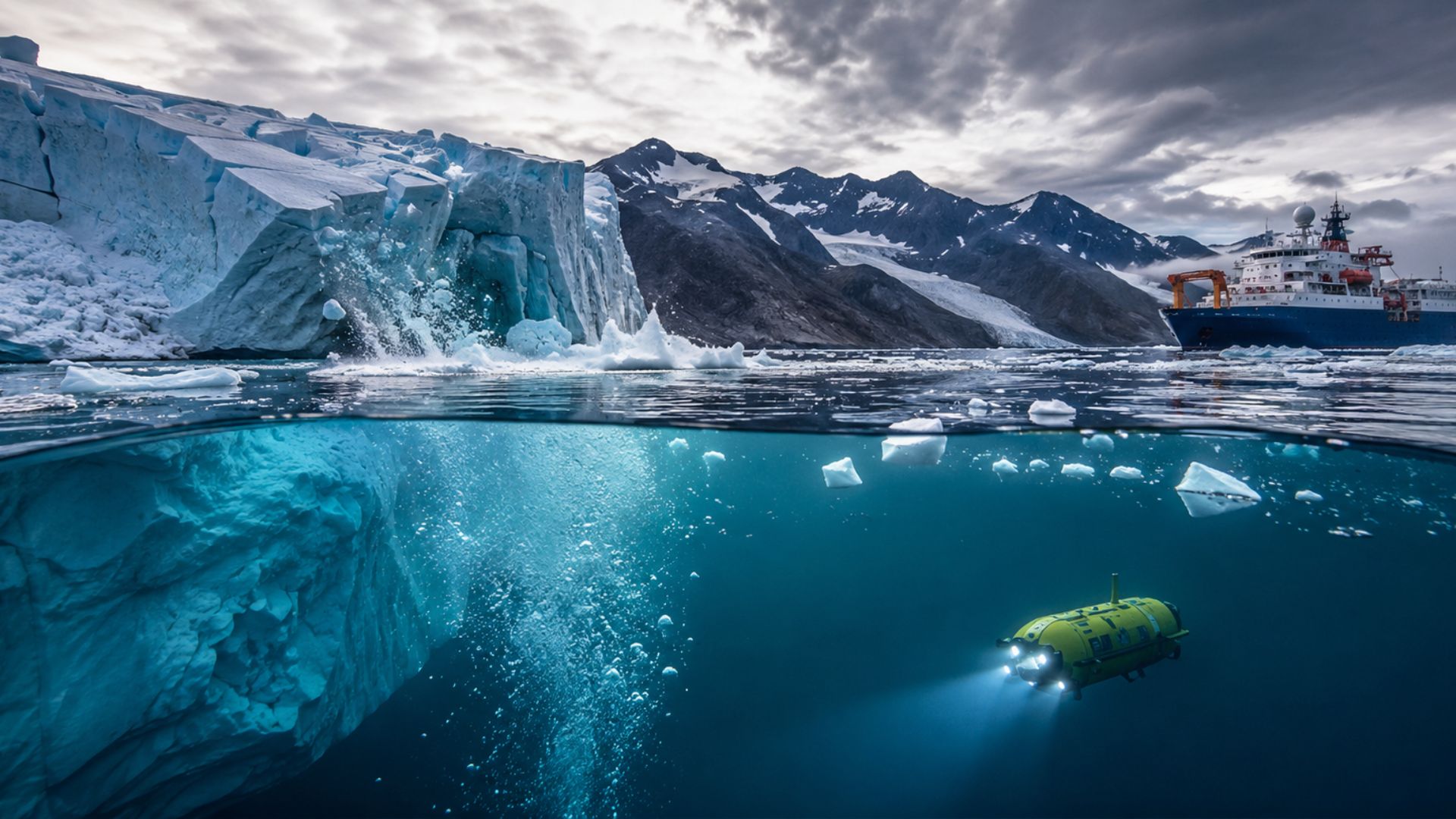

International expedition mobilizes scientists, polar ship, and autonomous equipment to observe little-explored regions of Greenland, where the advance of ice melt can interfere with Atlantic currents, alter climate patterns, and increase risks related to rising sea levels.
An international team of about 80 scientists and crew members began an expedition to Greenland on July 16, 2026, to investigate how accelerated ice melt can affect Atlantic currents, the European climate, and sea levels.
Scheduled to last five to six weeks, the mission takes place aboard the British polar ship RRS Sir David Attenborough, equipped to collect information in dangerous and still little-observed regions where glaciers meet ocean waters directly.
Part of the GIANT project, an acronym for Greenland Ice Sheet to Atlantic Tipping Points, the work is part of a scientific initiative valued at 20 million pounds, created to analyze possible critical changes in the Atlantic climate system.
-
Goodbye home delivery by Correios: residents now have to pick up packages at Correios agencies, face a delivery time up to 7 days longer, and still risk having the package returned if they don’t collect it within the specified period.

-
Goodbye traditional air conditioning: Xiaomi emerges with technology that cools even at 65 ºC, heats up to -35 ºC, saves up to 30% with AI, automatically detects 122 faults, and delivers 13,800 W of power.
-
Microwave with days numbered: new Panasonic technology eliminates the turntable, heats food without setting time, analyzes 64 points of the food every 0.1 second, and promises much more even heating.
-
JBL’s super speaker arrives in Brazil with a 15-hour battery, 200 W RMS, 2 woofers, 2 tweeters, Bluetooth 6.0, lossless audio via USB-C, and a feature that promises powerful sound without distortion.


Freshwater from ice melt can modify the Atlantic
Among the researchers’ main concerns is the increase in freshwater discharged into the ocean by melting glaciers, a process capable of modifying the maritime circulation that transports heat and helps regulate some of the climatic conditions observed in Europe.
Due to its low salt concentration and different temperatures from ocean waters, this flow from ice melt will be monitored to identify possible changes in the movement, temperature, and distribution of water masses along the Atlantic.
Although they do not claim that a severe change will occur, scientists consider monitoring essential, as a possible slowdown of currents could favor regional climate changes, extreme weather events, and additional sea level rise.
Before departure, the United Kingdom and other areas of Western Europe faced a period of high temperatures, a context that increased interest in scientific models capable of anticipating climate transformations and guiding adaptation strategies in affected regions.
Responsible for the project, marine geophysicist Kelly Hogan from the British Antarctic Survey told Reuters that recent heat episodes have shown how societies struggle to adapt even to climate changes considered relatively small.
More than recording the visible retreat of the ice, the team aims to understand the mechanisms that operate below the surface, where ocean water comes into contact with glaciers and can accelerate both melting and the detachment of large blocks.
Glacier retreat accelerated in two decades
Released by the University of Copenhagen in November 2023, the study associated with the acceleration alert used historical records, satellite images, and aerial photographs preserved in the National Archives of Denmark to track changes over more than a century.
By analyzing more than a thousand glaciers representative of different regions of Greenland, researchers reconstructed approximately 130 years of transformations, which allowed them to compare the recent retreat with the behavior observed throughout the 20th and 21st centuries.
During the 1980s and 1990s, the evaluated glaciers retreated, on average, about five meters per year, while the loss recorded in the last two decades reached approximately 25 meters annually, according to the results presented by the research.
This difference represents a fivefold acceleration in the average retreat of the formations analyzed, but it does not mean that the entire Greenland ice sheet is melting uniformly or exhibiting exactly the same behavior in all areas.
Based on about 200,000 aerial photographs, the survey indicated that the advance of the retreat reached different climatic zones of the island, including northern areas that previously seemed to respond more slowly to rising temperatures.
Even housing more than 20,000 glaciers with varying sizes, altitudes, and shapes, Greenland showed signs of acceleration in the main regions examined, which reinforces the need for more detailed observations of the ongoing changes.
Submersible will reach hard-to-access areas
To investigate points inaccessible to conventional vessels, the expedition carries the Boaty McBoatface, an autonomous submersible developed to dive up to 1,500 meters deep under the compact mixture of ice located in front of Greenland’s glaciers.
During the dives, the equipment will map the geometry of the layer formed by sea ice, snow, and fragments of icebergs, as well as assess how this structure interferes with the movement of glaciers and the interaction between the ocean and the ice.
Drones, sensors, and other autonomous instruments will also be used, capable of expanding data collection without exposing researchers to regions prone to sudden block detachment and rapid changes in sea conditions.
Operations engineer at the National Oceanography Centre, Sam Smith told Reuters that the submersible will be able to gather a significant amount of unprecedented data about an area where ice concentration hinders detailed, frequent, and continuous measurements.
With observations conducted in the air, on the surface, and at great depths, the team aims to understand how temperature, salinity, currents, fjord shapes, and ice concentration influence the behavior of glaciers over time.
Data can improve climate forecasts
After collection, the information will feed a new generation of climate models and contribute to the development of an early warning system, designed to recognize signs of rapid changes or instability before the impacts reach larger proportions.
Although the fieldwork will end after a few weeks, the analysis will continue at the involved research centers, where the new measurements will be compared with previous records to improve forecasts about the Atlantic and the future evolution of Greenland’s ice.
As the retreat progresses and new technologies reach previously inaccessible points, to what extent will the data gathered in Greenland be able to transform forecasts about the climate, ocean currents, and sea levels in the coming decades?


