 Portuguese
  English
  Spanish
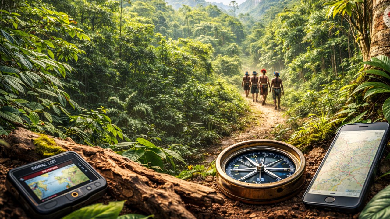


Brazilian Indians Use Seven Ancestral Navigation Techniques in the Amazon Rainforest, Achieve 98% Accuracy, and Show That Traditional Knowledge Prevails in the Jungle.
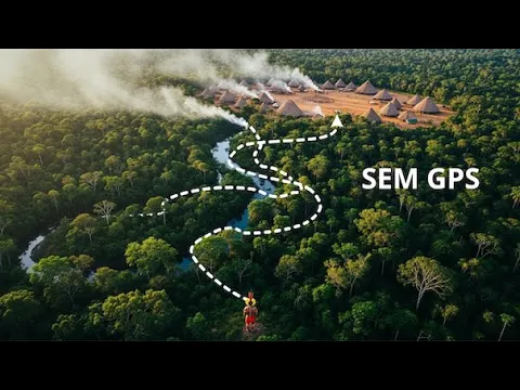
The Amazon rainforest is perhaps the worst place on the planet to navigate: everything looks the same, the sky is barely visible, and the ground erases any trace in a few hours. Even so, Brazilian Indians cross hundreds of kilometers of dense forest and arrive exactly where they want, without GPS, without compass, without map, with an accuracy rate of around 98 percent, higher than that of many commercial devices in dense forest environments.
Over thousands of years, indigenous peoples like Caiapó, Tikuna, Yanomami, and Munduruku have developed a complete navigation system based solely on reading light, wind, plants, animals, water, and spatial memory.
It is a true mental GPS, so sophisticated that neuroscientists study the brains of these navigators to understand how it processes so much spatial information at the same time.
-
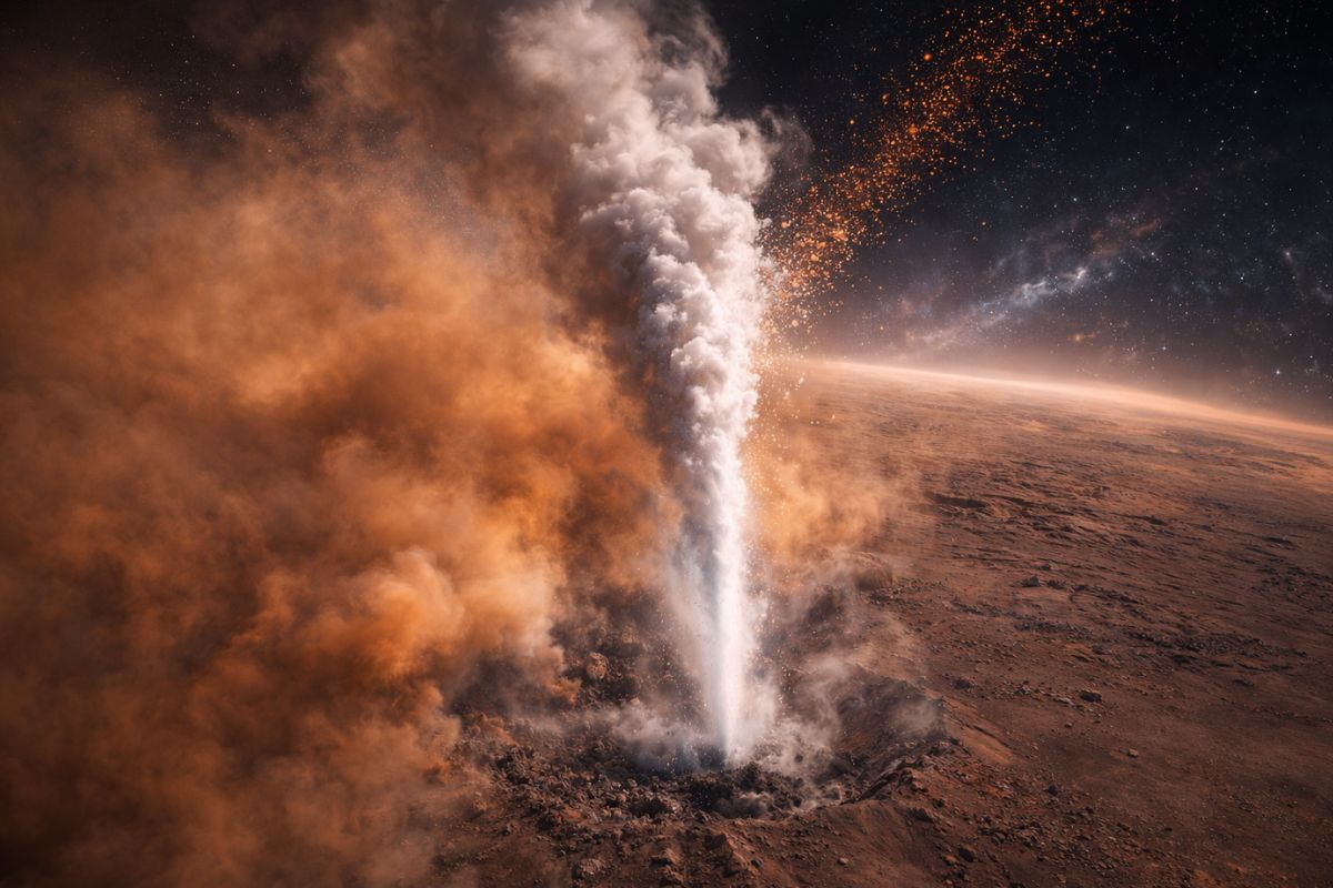
Scientists caught a water vapor explosion on Mars exactly when it shouldn’t have happened: an unexpected dust storm launched the water to an altitude of 80 kilometers and accelerated the escape of hydrogen into space by 2.5 times.
-
The Brazilian Navy launched the NPa Mangaratiba (P-73) on April 27: a 54.2 m Macaé-class patrol vessel, with 43 crew members, 6 days of autonomy, and a range of 4,000 km to monitor the entire Blue Amazon.

-
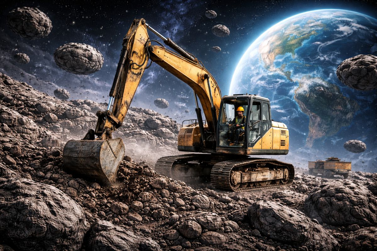
Chinese scientists have identified 122 viable asteroids for large-scale asteroid mining and outlined the Tiangong Kaiwu plan to explore space water ice and metals throughout the Solar System by 2100.
-
Does compulsive lying exist? What does science know about mythomania and why does it go beyond ‘lying too much’?


Why the Amazon Is a Maze Where Even GPS Gets Lost
Navigating in the Amazon rainforest is not like following a trail in an urban park. Inside, you can see only 10 or 15 meters ahead at most.
In all directions, it looks like the same infinite green wall. There are no visible mountains in the distance, no towers, no open horizon to serve as a reference.
The treetops block about 90 percent of sunlight, making it difficult to use the sun as a guide. At night, stars are hardly visible. Extreme humidity corrodes compasses and electronic devices, and the ground covered with vegetation erases footprints quickly.
In practice, a person without specific techniques has minimal chances of finding their way back if they get lost inside. Brazilian Indians move with almost total confidence.
Technique 1: Reading the Sun Through the Canopy
Even with light filtered by the canopy, Brazilian Indians can use the sun as a reliable compass. They combine four main signals:
- The predominant direction of light rays, even when diffused.
- The temperature difference between sides of the tree that receive more or less sun.
- The pattern of weak shadows projected on the ground.
- The light’s hue throughout the day, more yellow in the morning, white at noon, and orange in the late afternoon.
Using these signals simultaneously, they can estimate the position of the sun with a margin of error of about 10 degrees, enough to maintain a quite accurate east-west and north-south orientation even without seeing the sky directly.
Technique 2: The Biological Clock of Birds and Insects
In the forest, sound is also a clock. Brazilian Indians memorize schedules and behavior patterns of dozens of species.
They know, for example, that certain birds sing at dawn, that cicadas make louder sounds between late morning and early afternoon, and that crickets start their night song at very specific times.
The result is an auditory clock: just listening to the forest for a few minutes can help them know approximately what time it is. And time means direction.
If the indigenous person knows where the sun rises, where it sets, and what time they are listening, they can mentally reconstruct the position of east, west, north, and south. Some animals also indicate proximity to water, altitude, or type of terrain, adding more layers of information to navigation.
Technique 3: Microclimates and Invisible Winds as a Compass
The Amazon rainforest may seem uniform, but it is a mosaic of microclimates. Brazilian Indians notice minimal differences in humidity, temperature, and air circulation that go unnoticed by most people.
They can feel when the air becomes more humid, indicating proximity to rivers or streams. They notice variations of only 1 or 2 degrees between sunlit slopes and shaded areas.
They use almost imperceptible wind currents as a constant reference for direction, as the prevailing wind in the region tends to come from a specific side.
It is no coincidence: many indigenous navigators deliberately stop, go silent, close their eyes, and simply feel the wind on their face. In a few seconds, they can tell which direction they are going.
Technique 4: Spatial Memory and Natural Landmarks
Perhaps the most impressive aspect of the mental GPS of Brazilian Indians is their spatial memory. They are trained from childhood to memorize natural landmarks that any other person would overlook: a tree with an unusually broken branch, a stone with moss on a specific side, a vine curled in a different shape.
This training starts early, around 4 or 5 years old, when parents and elders ask children to observe and remember these details. By the age of 10, they are already able to recall hundreds of landmarks. By 20, thousands. By 40, tens of thousands.
Neuroscientists who studied these navigators found more neurons and greater gray matter in the hippocampus, the area of the brain linked to spatial memory. It is not something genetic or mystical. It is a direct result of intense and daily practice.
The mental map formed is not only visual: it includes sounds of streams, smells of plants, textures of soil, creating a three-dimensional and multisensory model of the forest.
Technique 5: Reading Plant Growth
Plants also point the way. Brazilian Indians have learned to see growth patterns that reveal direction, height, type of soil, and proximity to water. Some of the main signals include:
- Mosses and lichens that accumulate more on one side of a trunk because they receive less direct sunlight.
- More vigorous branches on the side receiving more light.
- Species that only grow in certain types of soil, such as clay or sand.
- Subtle color variations in leaves of wetter or drier plants.
- Vegetation density, which changes according to altitude.
By observing dozens of trees and plants around, indigenous peoples draw a sort of botanical compass rose, confirming direction and better understanding the terrain they are in.
Technique 6: Sounds of Water as a Permanent Guide
Rivers, streams, creeks, and waterfalls have different sounds. Brazilian Indians can accurately distinguish the frequencies, intensity, and rhythm of each of them and use this as a navigation reference.
A large river produces a deep, constant sound that can be heard from kilometers away. A medium creek creates sharper and more variable noises. Waterfalls have an unmistakable sound signature. Even a creek changes its sound between dry and wet seasons.
Moreover, these navigators can locate the exact direction of the sound source by slowly turning their heads until the sound seems equal in both ears. This triangulation, done just by hearing, results in margins of error of a few degrees, comparable to professional acoustic systems.
Technique 7: The Invisible Trail
Brazilian Indians do not depend on obvious trails. They create and read invisible paths. They leave subtle, almost imperceptible signs: a branch broken in a specific way, a leaf tied differently, a small arrangement of stones. To anyone else, it all seems natural. To them, it is a comprehensible signaling system.
In the same way, they can follow the tracks of people and animals days later, reading micro-changes: turned leaves, slightly compacted soil, fresh sap on a broken branch, a spider web that has not yet been reconstructed. They do not look for a single sign; they combine dozens of them to reconstruct the entire path.
When Science Pitted Brazilian Indians Against GPS and Elite Troops
To test this mental GPS, researchers from the University of São Paulo conducted an experiment with three groups: Caiapó Indians, professional guides using GPS, and special forces soldiers with military training. All were blindfolded, disoriented, and left at a random point in the forest. The mission was to return to base, located about 15 kilometers in a straight line.
The results were surprising:
- The Caiapó Indians arrived first, in about 6 hours, following nearly straight paths with a very low average deviation from the ideal route.
- The guides with GPS took longer, with significantly larger deviations, because the signal failed under the dense canopy.
- Some soldiers got completely lost and needed to be rescued.
In another study, researchers asked participants to point out north in various locations in the forest, comparing indigenous peoples, urban people using a compass, and navigation algorithms on mobile phones.
The indigenous peoples rarely made mistakes, while compasses and mobile phones failed more frequently, affected by interferences and loss of calibration.
Neuroimaging exams also showed greater gray matter in the hippocampus and increased activity in regions linked to spatial orientation in the brains of experienced indigenous navigators, reinforcing the idea that these skills can be developed through training; they are not a “magical power” exclusive to them.
How to Apply These Techniques in Your Daily Life, Even Far From the Forest
The ancestral knowledge of Brazilian Indians is not only useful for surviving in the Amazon. It can be adapted to urban life, weekend trails, and even as a mental development exercise.
In the city, it is possible to practice navigating without GPS in unfamiliar neighborhoods, using the sun between buildings to get a sense of east and west, memorizing corners, facades, and landmark points.
On trails, observing the way back frequently helps to record how the return will be while also noting important trees, stones, and forks.
In any environment, training multisensory attention is key: listening to constant sounds, feeling the wind, noticing smells, perceiving small temperature differences.
In emergencies, a rule taught by indigenous peoples is simple and powerful: stop, observe, think. Do not start walking aimlessly. Look for water clues and, if necessary, follow water courses, which tend to lead to communities.
From a personal development perspective, making a conscious effort to return from a new place without looking at a map strengthens spatial memory.
Neuroscientists confirm that the brain maintains plasticity throughout life, so anyone can improve their navigation skills with consistent training.
What Indigenous Mental GPS Teaches About Traditional Knowledge
The story of this mental GPS of Brazilian Indians debunks a common idea: that technology completely replaces traditional knowledge. In fact, studies show the opposite.
Indigenous techniques work precisely in scenarios where GPS, compasses, and apps fail the most, such as under very dense forests, with overcast skies and few artificial reference points.
These ancestral knowledges are not just folkloric curiosities. They are complex systems of observation, memory, and reasoning refined over thousands of years.
By recognizing them, we not only value Brazilian indigenous peoples but also recover human skills that we are losing in the screen age.
In the end, what science is beginning to recognize is simple: traditional knowledge and modern technology are not enemies; they are complementary. And the Amazon rainforest continues to be the best living laboratory to prove this.
And you, do you think you could navigate without GPS in a completely unfamiliar place relying only on your senses?


IMPRESSIONANTE.
O GPS mental funciona desde a infância mesmo sem ascendência indígena. Por exemplo durante toda a minha vida 68 anos no campo nas estradas ou paisagens urbanas uso a técnica memória fotográfica. Com treino não falha nunca. Excelente matéria.