 Portuguese
  English
  Spanish
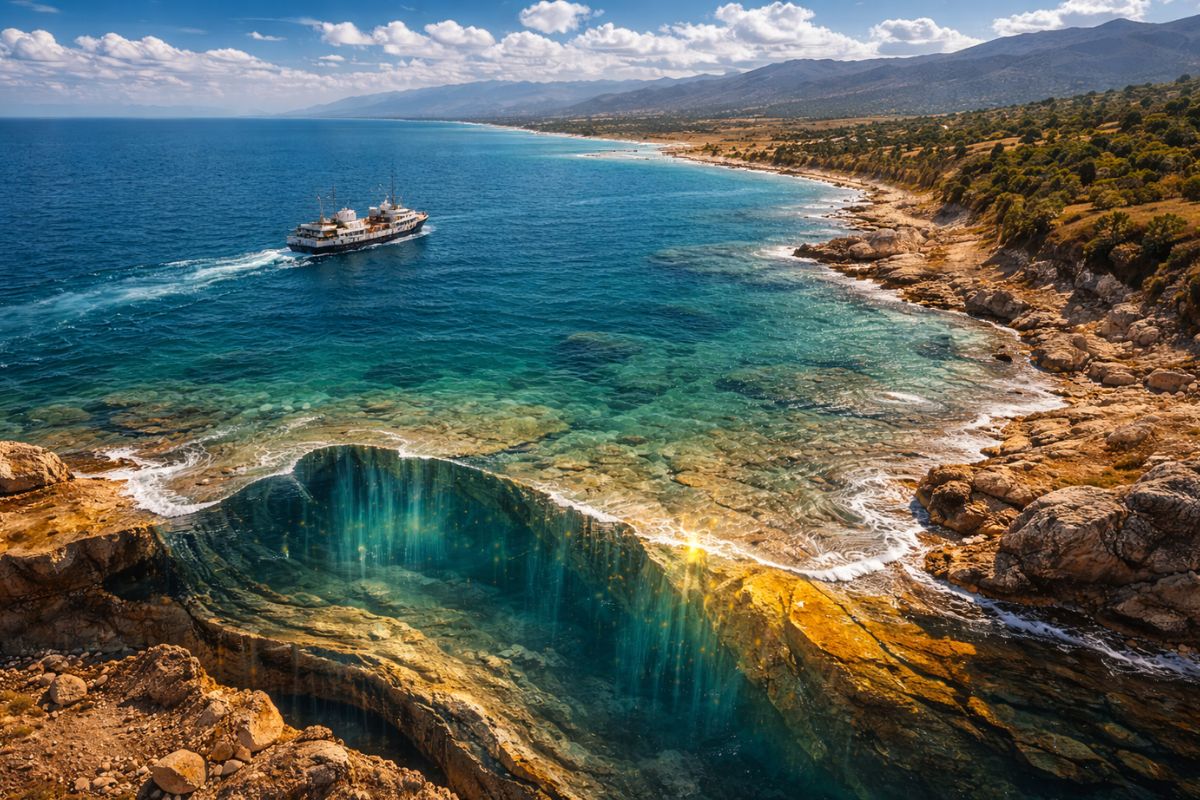
After the 2018 agreement, the Caspian Sea gained a unique legal status, while its hybrid crust, submerged cities, mud volcanoes, and oil reserves continue to challenge classifications
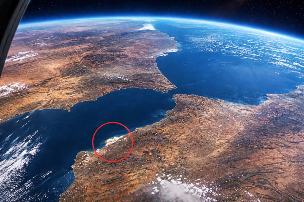
The Caspian Sea has become a rare case on the planet: even though it has been called a sea for centuries, it is not officially classified as either a sea or a lake definitively. In 2018, a treaty among the five countries bordering the Caspian Sea consolidated a unique regime for the region, leaving the legal discussion open and fueling a deadlock that also troubles scientists.
The confusion is not just political. The Caspian Sea combines characteristics that seem to “mix” categories: the bottom has hybrid crust, the water maintains salinity even when isolated from the ocean, human history speaks of submerged cities, and underground, there are signs of mineral resources and an unusual concentration of mud volcanoes.
Caspian Sea gained a unique legal status in 2018
On August 12, 2018, during a summit among the countries bordering the Caspian Sea, a treaty was signed that avoided providing a simple answer to the old question “sea or lake?”.
-
Why did the sky turn blood red in the west of Australia and it wasn’t sunset? Discover what is behind the change that took over the horizon for miles.

-
The most feared warplane of the United States is over 70 years old, carries 32 tons of explosives, flies 14,000 kilometers nonstop, and has just been sent to the United Kingdom amid escalating tensions with Iran.

-
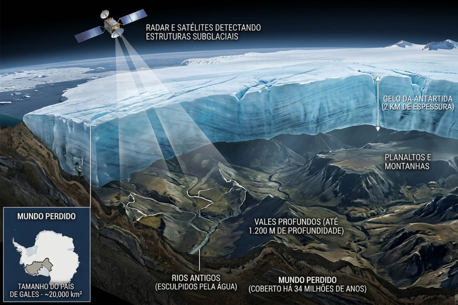
Satellites and radars revealed, beneath 2 kilometers of ice in Antarctica, a lost world the size of Wales, with rivers, valleys 1,200 meters deep, and plateaus sculpted by water, frozen for 34 million years, when the continent had temperate forests and was part of a supercontinent that included South America.
-
A 2 kg exoskeleton with an 800-watt motor and artificial intelligence that predicts movements in 2 milliseconds reduces the load on the legs by up to 30 kg, increases strength by 40%, and allowed an 84-year-old woman to climb mountains without falling behind.


The document designated the region as a closed body of water with its own exclusive regime, something that does not fit perfectly into traditional classifications of international law.
In practice, the dispute over labels remained alive. For some geographers, the logic of not having a direct connection to open ocean pushes the definition towards “lake”.
For sailors, however, the Caspian Sea remains a sea, because it is a vast body of water, with navigation and behavior that defy the stereotype of a common lake.
Hybrid crust at the bottom of the Caspian Sea muddles geology
One of the most intriguing points of the Caspian Sea lies at the bottom. Generally, the Earth’s crust is divided into continental crust, which is thicker, and oceanic crust, which is thinner. However, in the Caspian Sea, the bottom does not fit well into either category. It presents a hybrid profile, with marked changes between the north, center, and south.
In the northern part of the Caspian Sea, part of the base behaves like a submerged extension of the eastern European platform, with shallow depth, reaching about 15 meters even in deeper points.
As it moves towards the center, the depth increases, the bottom descends to hundreds of meters, and begins to exhibit typical traits of oceanic crust, with an average depth of 208 meters.
In the south, the structure comes even closer to oceanic crust and reaches about 1,025 meters. This contrast makes the very relief “pull” the Caspian Sea towards different definitions depending on the observed section.
Largest lake on the planet, but with the appearance of a sea in scale and salinity
Even with discussions, it is often described as the largest lake in the world, covering about 371,000 km². In scale, it is close to seas like the Baltic and the Black Sea, which reinforces the perception of “sea” in the imagination of those navigating the region.
Another notable point is the salinity. The Caspian Sea maintains an average salinity of around 1.2 to 1.3%, even receiving a large volume of freshwater from rivers, notably the Volga.
The presence of salt and marine organisms reinforces its oceanic origin, but raises a central question: how does it remain “marine” in part of its behavior even when isolated from the ocean for so long?
Carabogazgou Bay and the strange oscillations of water level
The variations in the level of the Caspian Sea are cited as abnormal because they occur over relatively short periods. A decisive element in this story is Carabogazgou Bay, a huge and shallow coastal lagoon on the eastern shore. Water from the Caspian Sea enters through a narrow channel and, in practice, does not return, because evaporation is intense.
When the channel was closed with a concrete dam to try to “save” the level of the Caspian Sea, the bay practically dried up, exposing a saline bottom and causing environmental and social effects, such as salty sandstorms and the collapse of activities related to local mineral extraction.
Years later, with the removal of the barrier, water began to flow again, and the bay started to recover its level, although the total recovery of the ecosystem is still described as slow. The episode reinforces how the Caspian Sea reacts in ways that do not always follow simple predictions.
Endemic fauna of the Caspian Sea is unique and vulnerable

In addition to geology, the Caspian Sea holds a rare biological heritage. A large portion of fish species and various invertebrates and mollusks are endemic, meaning they do not exist anywhere else on the planet.
Among the most well-known symbols are the sturgeon, associated with caviar, and the Caspian seal, which intrigues biologists for being in a closed continental body of water.
The text highlights that sturgeon is an ancient group and that species associated with caviar had a significant impact on the global market in the 20th century. This economic value increases human interest in the Caspian Sea, but also amplifies environmental pressures and concerns, as losing such a unique fauna would have irreversible impacts.
Submerged cities and ruins: the “Atlantis” of the Caspian Sea

The human history of the Caspian Sea also fuels mysteries. There are ancient and modern reports of submerged cities and structures that appear and disappear as the water level changes.
One case with historical basis is the fortress of Sabaíl, near the coast of Baku, which is said to have been built between 1232 and 1235 and ended up submerged after an earthquake in 1306. During periods of low water level, parts have reappeared, and underwater research has found hundreds of engraved plates.
Another “Atlantis” associated with the Caspian Sea appears as an archaeological and legendary quest: the city of Itil, linked to the Khazar Khanate, mentioned in historical records but still not definitively located. In this scenario, the Caspian Sea mixes geography, archaeology, and historical narrative into a single enigma.
Mud volcanoes and oil: what the bottom of the Caspian Sea hides
At the bottom of the Caspian Sea, in addition to wrecks and shipwrecks accumulated over centuries, there is the geological and energy dimension.
The text mentions estimates of up to 50 billion barrels of oil and 8.3 trillion m³ of natural gas in the region. Even representing a fraction of global reserves, these resources have strategic weight for diversifying supply.
And there is an even more singular phenomenon: the concentration of mud volcanoes. In the territorial waters of Azerbaijan alone, more than 140 underwater mud volcanoes have been confirmed. During eruptions, columns of water, gas, and mud can rise very high, and some activities even form temporary islands.
An example cited is Kumani Bank island, which emerged in February 2023 and disappeared by the end of 2024 due to erosion. Few places show so clearly how the bottom of the Caspian Sea remains active and unpredictable.
Do you think the Caspian Sea should be treated as a sea, as a lake, or does it make sense to have a third category for it?


Seja o primeiro a reagir!