 Portuguese
  English
  Spanish
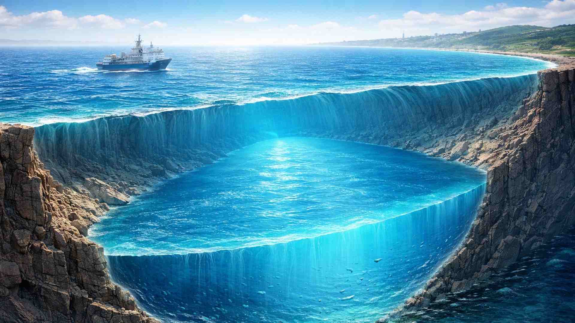


Identified Under the Seafloor off the East Coast of the United States, the Freshwater Reservoir, Possibly Formed About 20,000 Years Ago During the Last Ice Age, Has an Estimated Volume Capable of Supplying a City the Size of New York for Up to 800 Years
A massive freshwater reservoir hidden beneath the seafloor off the east coast of the United States may be around 20,000 years old and large enough to supply a city the size of New York for up to 800 years, according to preliminary analyses from a recent scientific expedition.
Researchers indicate that the freshwater reservoir formed during the last ice age when extensive glaciers covered the region, remaining frozen under extreme conditions and later trapped beneath layers of marine sediments for thousands of years.
Discovery of a Large Submarine System Along the East Coast
The freshwater reservoir is located beneath the seafloor and appears to extend from the coast of New Jersey up to northern Maine.
-
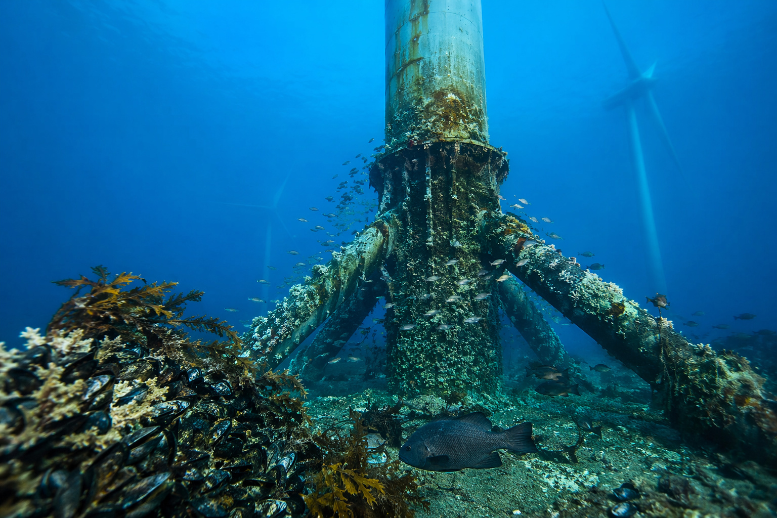
It seemed like just a clean energy project in the ocean, but over time, offshore turbines began to provoke something unexpected: lifeless areas started to fill with species and form new ecosystems.
-
China conducts the world’s first flight of a hydrogen-powered turboprop aircraft, covering 36 km in 16 minutes.

-
China does not want to depend on oil and is advancing in ‘water’-powered airplanes amid the energy crisis affecting the whole world.

-
NASA releases Google Maps resource to track the Artemis II Mission in real time and turns the app into a practical tool to visualize the spacecraft’s position and data directly on your phone.

Initial analyses suggest that the freshwater has been preserved since the last glacial period, which occurred about 20,000 years ago.
The investigation gained new momentum last summer when researchers conducted an expedition to delve into old reports of freshwater presence beneath the ocean along the east coast. These records date back to the late 1960s and early 1970s.
“It was quite a project and the realization of a lifelong dream,” said Brandon Dugan, co-scientific head of the expedition and professor of geophysics at the Colorado School of Mines, in an interview with Live Science.
Expedition 501 and Direct Collection of Water Beneath the Seafloor
The scientific mission, named Expedition 501, lasted three months and extracted approximately 50,000 liters of water from the marine subsurface at three distinct points near Nantucket and Martha’s Vineyard.
The researchers drilled down to 400 meters below the seafloor, reaching a thick layer of freshwater-saturated sediments. This layer lies beneath saline sediments and an impermeable seal made up of clay and silt.
According to Dugan, the data collected so far indicate that the freshwater reservoir may extend deeper into the subsurface than initial historical reports suggested, which implies that its total volume could be even larger than previously estimated.
Evidence of Glacial Origin from Chemical and Isotopic Analyses
Hypotheses concerning the formation of the freshwater reservoir are being tested through preliminary radiocarbon analyses, noble gases, and isotopes.
This data suggests that most of the freshwater originated from glaciers during the last ice age, a period that spanned from 2.6 million to 11,700 years ago.
Dugan explained that researchers largely ruled out direct influence from the topography of New England, as there are no major mountain ranges near the coast capable of channeling significant volumes of rainwater to the seafloor.
Still, he emphasized that there may be a mixed component in the system, with contributions from rainwater combined with glacial meltwater, forming a hybrid reservoir trapped beneath the marine sediments.
Historical Hypotheses and the Role of the United States Geological Survey
The presence of freshwater beneath the ocean was first documented about 60 years ago by the United States Geological Survey during evaluations of mineral and energy resources conducted in offshore areas between Florida and Maine.
According to Dugan, researchers from the USGS found the discovery peculiar, as they identified freshwater in sediments located beneath the ocean.
In the 1980s, some hypotheses were raised, but the topic eventually fell silent for a long period.
In 2003, Dugan and Mark Person, a hydrology professor at the New Mexico Institute of Mining and Technology, rediscovered these records and systematized three main hypotheses to explain the presence of the submarine freshwater reservoir.
Possible Mechanisms for the Formation of Freshwater Beneath the Ocean
The first hypothesis considers prolonged periods of sea level significantly lower, allowing rainwater to infiltrate the exposed soil.
With the subsequent rise in sea level over hundreds of thousands of years, this water would become trapped beneath the sediments.
A second possibility involves elevated mountain ranges near the ocean capable of directing rainwater directly into deep submarine areas. However, this hypothesis has lost traction in the specific context of the northeast coast.
The third explanation, related to the expansion of polar ice caps, suggests that the advance of ice lowered sea level and generated large volumes of meltwater.
The friction of glaciers with the bedrock produced heat, accumulating water at the base of the ice caps and forcing it into the subsurface under intense weight.
Geological Structure and Barrier Against Saltwater Intrusion
Drillings conducted 30 to 50 kilometers off the coast of Massachusetts revealed a clear separation between the layers of freshwater and saltwater. An impermeable barrier of clay and silt currently prevents mixing between the two.
“We have a barrier on top of the freshwater that prevents the saltwater from intruding from above,” Dugan said. According to him, this barrier is sufficient to maintain separation today but would not have been able to withstand the pressure exerted by a glacier during the ice age.
The researcher highlighted that the process that deposited the freshwater in the subsurface had enough energy to overcome any existing sedimentary barrier at the time, allowing the flooding of deeper layers with low salinity water.
Salinity Gradient and Quality of Collected Water
Salinity measurements indicated that salt content decreases as it approaches the coast, remaining significantly below the typical salinity of the ocean in the areas studied during the expedition.
At the drilling point closest to Nantucket and Martha’s Vineyard, the recorded salinity was 1 part per 1,000, the maximum safe limit considered for drinking water. In more distant areas, values varied between 4 and 5 parts per 1,000.
At the furthest site from the coast, researchers found levels of 17 to 18 parts per 1,000, roughly half the average salinity of ocean water, reinforcing the presence of a diluted and distinct reservoir.
Upcoming Analyses and Expectation for Definitive Results
With the completion of the drillings, scientists began more detailed studies on the freshwater reservoir, including the presence of microbes, rare earth elements, and characteristics of the porous space of the sediments, essential data for more accurately estimating the total size of the system.
The ages of the sediments are also being analyzed, which will allow for a more precise determination of when the freshwater reservoir was formed. According to Dugan, more conclusive results regarding the origin and timeline of the system are expected in about a month.
“The important thing is that we collected all the necessary samples to answer our main questions,” said the researcher, adding that after the equipment is removed, the wells close on their own.
Future Applications and Importance of Scientific Mapping
Dugan emphasized that the goal of the study is not to promote the immediate use of the freshwater reservoir but to provide a detailed understanding of the system to inform future decisions if the resource is deemed necessary.
According to him, the existence of reliable data allows potential managers or researchers to have a solid starting point, avoiding poorly informed decisions or the need to restart investigations from scratch.
The study of this vast submarine freshwater reservoir represents a significant advancement in understanding the hidden water resources beneath the oceans and highlights the complexity of geological processes that shaped the east coast over tens of thousands of years.
This article was compiled based on information published by Live Science, drawing from interviews and data presented by researchers from the Expedition 501, including statements from geophysicist Brandon Dugan of the Colorado School of Mines and historical records from the United States Geological Survey (USGS).


Texto muito mal escrito, com muitas redundâncias e informações repetidas. Fugiu da escola.
Poisé se esses cientistas ler mais a palavra de Deus, veriam que tudo que descobriram está registrado em genesis nos primeiros capítulos.
Ainda se classificam cientistas.
Siempre metiendo la boca donde no los llaman. Adoradores de mentiras!
Sensacional observação. Estou escrevendo exatamente um livro sob a existência do dilúvio aos olhos da própria ciência que, por si, tenta negar a existencia do Criador.
Pelo menos trump não pode usar justificativa de falta de água para invadir o Brasil.
O problema é Trump construir uma arca para se salvar e todos do “”conselho da paz??””: por ele criado. kkkk
E bem **** fora lula invade oq tu sabe sobre o cara sabe nada