 Portuguese
  English
  Spanish
A cyclone with atypical characteristics is forming in the South Atlantic and is expected to have an inverted trajectory from East to West, from the sea to the continent with gusts of 70 to 90 km/h in open sea and a Cyclonic Vortex at High Levels that will cause instability, risk of hail and waterspouts in southern Brazil between Tuesday and Friday.
An atypical cyclone is currently forming in the South Atlantic and is expected to attract attention in satellite images in the coming hours. According to an analysis by MetSul Meteorology, the cyclone has two atypical aspects that make it rare on the Brazilian coast: its trajectory will be from East to West from the sea to the continent, when the normal is the opposite and its initial stage shows subtropical or tropical characteristics, with a warm center completely dissociated from a cold front.
The cyclone is expected to cause wind gusts between 70 km/h and 90 km/h in open sea during this Tuesday (31), but projections indicate that the system will lose organization and begin to dissipate as it approaches the southern coast of Brazil between Tuesday and Wednesday (April 1). Even so, a second phenomenon associated with the cyclone, a Cyclonic Vortex at High Levels (VCAN), will advance from the Atlantic to the continent and cause instability with a risk of hail, waterspouts, and heavy rain in the South, Southeast, and Midwest until Friday.
What makes this cyclone different from everything normally seen on the Brazilian coast
Cyclones on the Brazilian coast are recurring phenomena, with at least one acting in the South Atlantic almost every week.
-
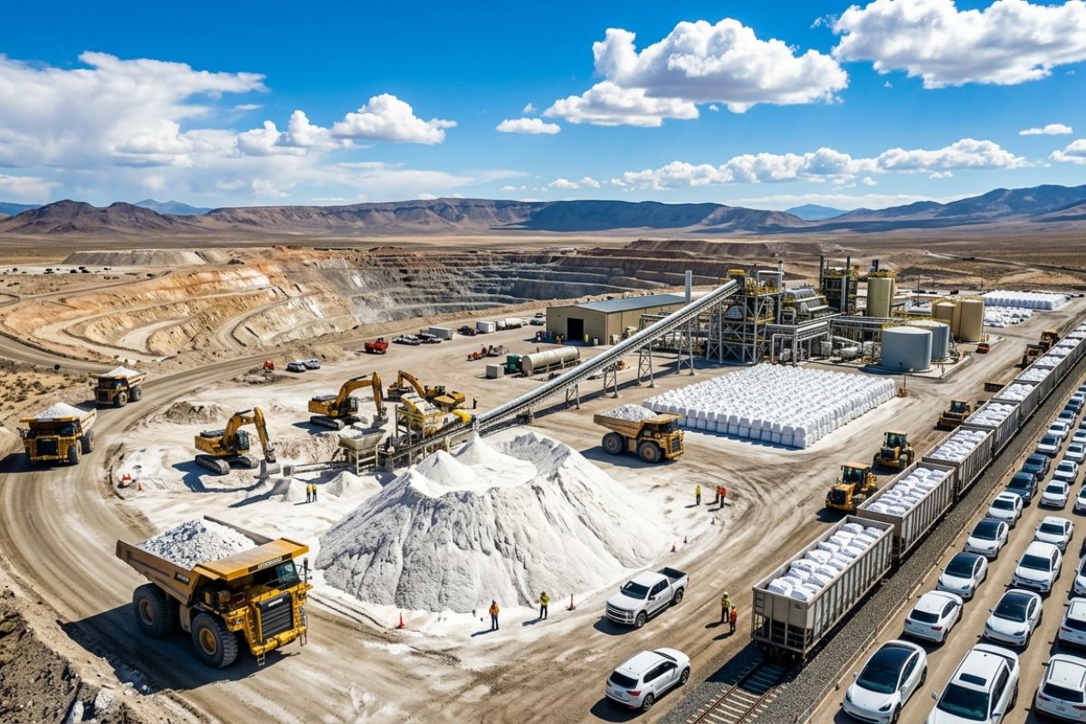
The “white gold” of Thacker Pass: the McDermitt caldera could be worth $1.5 trillion and hold nearly half of the world’s lithium; 40,000 tons/year could provide batteries for 800,000 electric cars already in the U.S.
-
The first nuclear submarine in Latin America is being built in Brazil, but the Navy warns that without an additional one billion reais, the project may halt, and the delivery forecast, which was 2029, has already been pushed to 2037 due to a lack of funds.

-
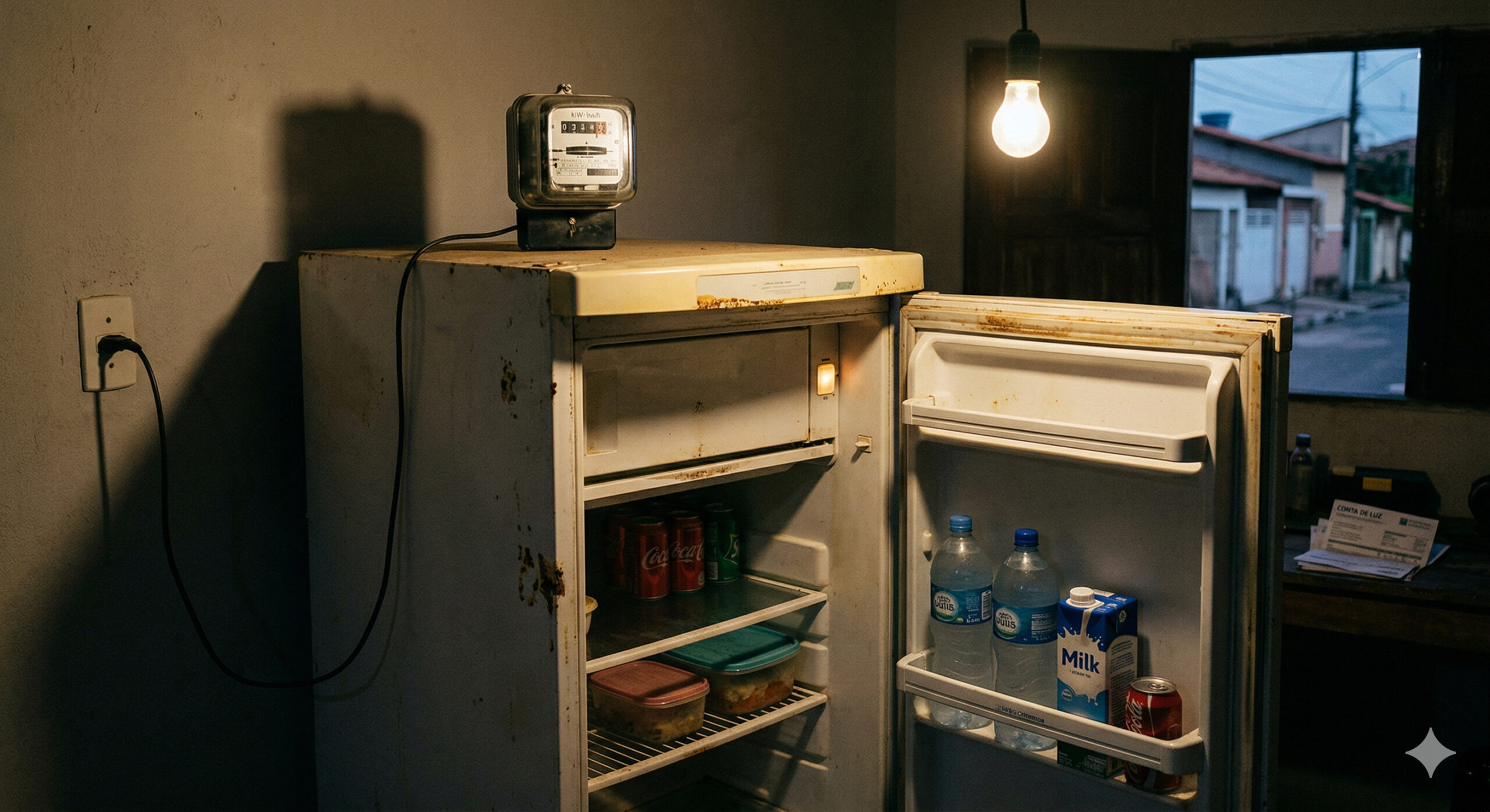
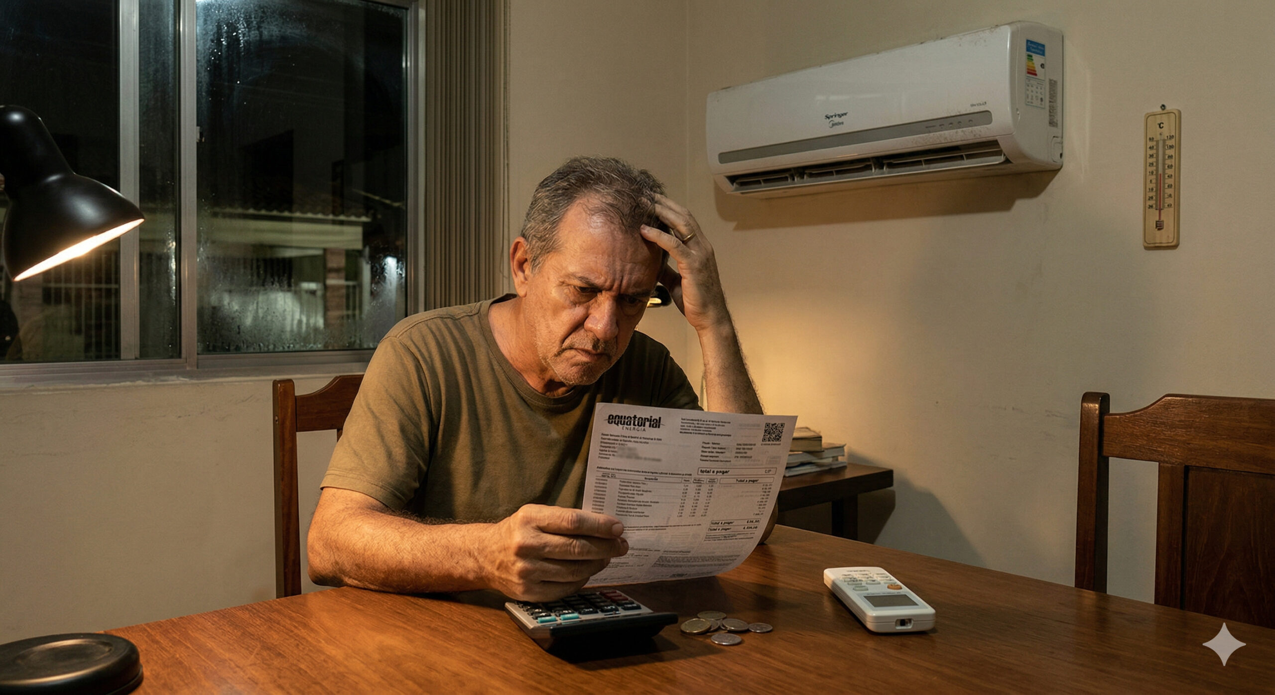
The most expensive appliance in your home is not in the kitchen or the bathroom, it runs 24 hours a day to cool a few items and can cost more per month than the value of everything it stores, while a single replacement eliminates the consumption equivalent to a shower running for 30 minutes daily.
-
Beneath 25 km of ice, a moon of Jupiter hides an ocean with more water than all the seas on Earth and may have the necessary conditions to support life, according to studies supported by NASA.


The vast majority are extratropical, forming at the surface associated with cold fronts and following a predictable trajectory: from West to East, moving away from the continent towards the ocean. This cyclone does the opposite: it originates in the ocean and moves towards the coast, which is extremely unusual and has immediately drawn the attention of the meteorological community.
The second atypical aspect of the cyclone is its thermal structure. While common extratropical cyclones have a cold core, this system shows indications of a warm core at the surface, which classifies it as subtropical or tropical in its initial stage.
The phase diagram of the European model indicates that the cyclone is expected to transition from a warm center (subtropical) to a cold center (extratropical) just as it begins to dissipate.
It is a rare sequence that has generated debate among meteorologists about the classification of the system; the Brazilian Navy, responsible for naming atypical cyclones in the South Atlantic, is monitoring the case.
Gusts of up to 90 km/h at sea and what to expect from the cyclone on land
The low-pressure center that gives rise to the cyclone has been acting since the night of this Monday (30) over the Atlantic, around the coordinates 27°S and 40°W, and is beginning to deepen.
Numerical models indicate that the cyclone is expected to cause gusts of 70 km/h to 90 km/h during this Tuesday in open sea, speeds that already constitute strong to intense winds.
The good news is that, according to the models from the European Meteorological Center (ECMWF), the cyclone is expected to lose strength, become disorganized, and dissipate before reaching the coast, which means that projections do not indicate strong winds on land directly caused by this system.
The short duration is another unusual aspect: while a recent cyclone remained almost stationary for five days in the same region of the South Atlantic, this rare behavior is expected to have a short life and dissipate in less than two days.
The VCAN that follows the cyclone: hail, waterspouts, and storms in southern Brazil
Although the surface cyclone is expected to dissipate before reaching the coast, at altitude another phenomenon is advancing from the ocean to the continent: a Cyclonic Vortex at High Levels (VCAN), an area of low pressure with cooler air at altitude that will influence the weather in southern Brazil between Tuesday (31) and Friday (April 3).
The VCAN is expected to enter the territory through the Santa Catarina coast and mainly affect Santa Catarina, before returning to the ocean and gradually losing strength.
Despite the name, the VCAN is not an extratropical cyclone; it only acts at high levels of the atmosphere, does not originate at the surface, and can even coexist with stable weather in some areas.
Even so, the system will cause instability in several states with irregular rain, sometimes heavy, and isolated storms. The rain is expected to affect areas in the South, Southeast, and Midwest.
The most concerning risk is isolated hail, especially in Santa Catarina, Paraná, and São Paulo. The contrast between cold air at altitude (brought by the VCAN) and warm, humid air at the surface is what intensifies the storms and creates conditions for hail, waterspouts on the coast, and funnel cloud formation. It is the type of atmospheric combination that requires heightened attention in the coming days.
Atypical cyclones in the South Atlantic: an increasingly observed phenomenon
Cyclones with subtropical or tropical characteristics on the Brazilian coast are rare, but not unprecedented. The last named atypical cyclone was the subtropical storm Biguá, in December 2024, which reached winds of up to 95 km/h and caused damage along the coast of Rio Grande do Sul.
Before it, in March 2026, another cyclone with unusual behavior remained almost stationary for five days in the same region of the South Atlantic, generating intense debate about its classification.
The meteorological community observes that these out-of-pattern systems are increasingly attracting attention.
The rule is that cyclones on the Brazilian coast are extratropical; those that exhibit subtropical or tropical characteristics are exceptions and occur much less frequently, but when they do arise, they spark scientific curiosity and require careful monitoring.
In the current case, the cyclone may not pose a direct risk to land, but the accompanying VCAN is what will really impact the weather in the coming days.
What to expect in the coming hours and days
In summary: an atypical cyclone with an inverted trajectory and subtropical characteristics is forming in the Atlantic this Tuesday, with gusts of up to 90 km/h in open sea, but is expected to dissipate before reaching the coast.
The direct impact on land comes from the VCAN advancing from the ocean to southern Brazil between Tuesday and Friday, bringing irregular rain, isolated storms, a risk of hail in Santa Catarina, Paraná, and São Paulo, and the possibility of waterspouts along the coast.
Satellite images are expected to show a spiral of clouds typical of a cyclone over the Atlantic, an impressive visual record that is worth following. But beyond the images, the alert is real: those in southern Brazil in the coming days should stay alert to weather conditions and follow the guidance of Civil Defense.
Are you in the South or Southeast region? Have you noticed a change in the weather? And what do you think of a cyclone that moves “backwards,” from the sea to the land? Share in the comments how the weather is in your city and if you’ve noticed signs of instability.

Seja o primeiro a reagir!