 Portuguese
  English
  Spanish
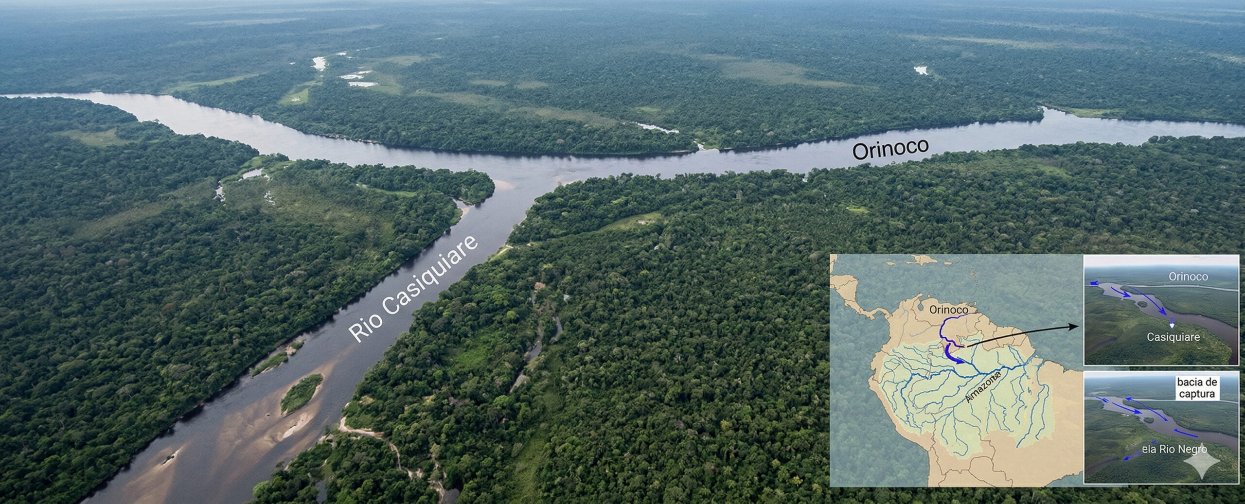
Casiquiare River connects Orinoco to Amazonas, challenges hydrology, and may capture one of the largest basins on the planet, according to scientific studies.
According to researchers from Water Resources Research, from the American Geophysical Union, who published a comprehensive review in February 2025 on unusual drainages in the Americas, the Casiquiare River violates multiple watershed delineation rules so systematically that modern hydrology manuals cannot classify it without creating specific exceptions.
This is neither an artificial channel nor a temporary anomaly. The Casiquiare is a permanent, navigable river, approximately 356 kilometers long, that diverts between 20% and 30% of the flow from the upper Orinoco and delivers it to the Negro River, the main tributary of the Amazon. This flow creates a natural connection between the two largest river systems in South America, forming a hydrological corridor that was already used by indigenous peoples long before the arrival of Europeans.
The existence of this phenomenon challenges fundamental concepts of physical geography, as it establishes a continuous link between basins that, in theory, should be completely separate.
-
At a depth of 2,900 km, Tuzo and Jason form two colossal structures buried beneath Africa and the Pacific that have challenged science for decades, and a new study suggests that these gigantic structures may have originated from material exchanges between the core and the mantle in the early days of Earth.

-
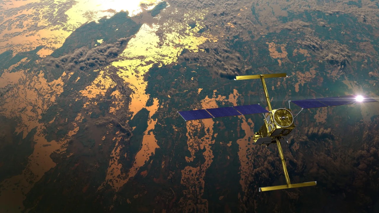
NASA and France use a high-precision radar satellite to monitor 127,000 river segments and discover incredible data about the global fluctuations in water volume.
-
Amazon is moving forward with the discontinuation of old Kindles, directly impacting users; discover an effective alternative that allows you to maintain access to digital books and avoid immediate replacement of the device.

-
The global space economy has surpassed $613 billion and is expected to reach up to $1.8 trillion by 2035, but 78% is already dominated by the private sector, and the explosive growth comes from satellites that operate daily on Earth while rockets take off only occasionally.

Casiquiare phenomenon challenges watersheds and basic concepts of hydrographic basins
Traditional hydrology is based on a central principle: water flows to lower altitude regions, and watersheds separate basins in a stable and permanent manner.
However, the Casiquiare River breaks this logic in the Venezuelan state of Amazonas, where the extremely flat terrain creates a unique situation.

The altitude at the bifurcation with the Orinoco is about 123 meters above sea level, while the mouth at the Negro River is approximately 91 meters. This represents a total difference of only 32 meters over 356 kilometers, resulting in an average slope of about 0.009%, practically imperceptible on topographic maps.
Under these conditions, during seasonal floods, part of the Orinoco’s waters overflow and find a natural path southward, permanently feeding the Amazon system. The result is not an episodic event, but a continuous transfer of water between two continental basins.
Dimensions of the Casiquiare River reveal an active and expanding river system
The channel exhibits significant variations along its course. Its width can range from approximately 46 meters at its narrowest sections to over 500 meters near the mouth. The current speed varies from about 0.3 meters per second at the bifurcation to 3.6 meters per second in more dynamic stretches during flood periods.
These data demonstrate that the Casiquiare is not a slow or marginal channel, but an active river system, with transport capacity and dynamics comparable to medium-sized rivers.
Furthermore, the river gains volume along its course due to the contribution of tributaries from the southern bank, reinforcing its importance within the Amazon system.
European cartographers created fictitious mountains to deny the existence of the Casiquiare
Despite being known to indigenous peoples for centuries, the Casiquiare faced strong resistance in the European scientific community.
Initial reports, such as those by the Jesuit Cristóbal de Acuña in 1639 and Father Manuel Román in 1744, were met with skepticism. The idea of a river connecting two large basins was considered incompatible with the hydrology principles of the time.

The French geographer Philippe Buache classified the phenomenon as a “geographical monstrosity,” a term used to describe something considered impossible within the prevailing scientific knowledge.
To resolve the contradiction, European cartographers even drew chains of nonexistent mountains in the southern region of Venezuela, creating a fictitious barrier that would explain the supposed impossibility of the connection.
Alexander von Humboldt’s expedition confirmed the connection between Orinoco and Amazonas in 1800
The definitive scientific proof occurred in 1800 when Alexander von Humboldt and botanist Aimé Bonpland conducted a detailed expedition in the region.
Equipped with advanced scientific instruments for the time, they traveled the Orinoco to its bifurcation, navigated the 356 kilometers of the Casiquiare, and reached the Negro River.

Humboldt recorded precise measurements, documented the fauna and flora, and produced maps that confirmed the existence of the connection. His works published in 1812 solidified the scientific understanding of the phenomenon.
Even so, conceptual resistance persisted for decades, highlighting how much the Casiquiare challenges traditional models.
River capture process indicates that the Casiquiare may grow and alter continental basins
The phenomenon responsible for the formation of the Casiquiare is known as river capture, a process in which a drainage system expands its area by capturing flows from another neighboring system.
Hydrological studies indicate that the channel is expanding and that the amount of water diverted from the Orinoco may be increasing over time.
Research published in the journal Water in 2019 points to evidence that the system already shows sedimentary alterations in the main channel of the Orinoco, caused by the loss of part of its flow.
This process could lead, on a geological scale, to the complete incorporation of the upper Orinoco into the Amazon basin.
Scientific studies indicate that the upper Orinoco may be captured by the Amazon system
A study published in 2018 in Geophysical Research Letters describes the Casiquiare as an intermediate state of river bifurcation, suggesting that the system is in transition.
The analysis indicates that, with the advance of erosion and hydrological dynamics, the channel may evolve to completely capture the upper course of the Orinoco.
If this occurs, a significant portion of the drainage currently associated with the Orinoco would permanently integrate into the Amazon basin, altering the regional hydrological balance.
Natural waterway connects Caribbean and Amazon without the need for land transport
The Casiquiare creates a continuous navigable connection between two systems that flow into different regions of the Atlantic Ocean.
It is possible, for example, to start from the Amazon region, navigate through the Negro River, enter the Casiquiare, reach the Orinoco, and arrive at the Caribbean without the need for land transport.
This route has historically been used by indigenous peoples and European explorers, and it was analyzed during World War II as a possible logistical corridor.
Casiquiare ecosystem remains preserved and reveals chemical transition of waters
The Casiquiare region remains largely preserved, with continuous tropical forest cover and low human interference.
Along its course, the composition of the water undergoes significant changes. Initially clear and with neutral pH, the water progressively becomes darker due to the presence of humic acids from southern bank tributaries.
This process gives the river characteristics similar to those of the Negro River, known for its dark coloration visible in satellite images.
Now we want to know: do you believe that the Casiquiare can completely transform the map of the basins of South America?
The Casiquiare River is not just a geographical curiosity, but an active phenomenon that can redraw one of the largest hydrographic structures on the planet.
Considering the scientific evidence and the ongoing river capture dynamics, in your view, can this process really lead to the total incorporation of the upper Orinoco into the Amazon basin?


Seja o primeiro a reagir!