





MapBiomas finds that 31,300 hectares of native Caatinga vegetation were replaced by solar and wind power plants between 2015 and 2025. The biome accounts for 79% of the land converted nationwide, fueling debate over energy expansion and conservation.
The expansion of solar and wind power in Brazil’s hinterland has left a mark visible in satellite images: 31,300 hectares of native Caatinga vegetation were replaced by facilities using these two energy sources between 2015 and 2025. That figure represents 79% of all natural cover converted for solar power plants and wind farms in Brazil during the period, according to a MapBiomas survey released on November 18, 2026.
The area occupied by the facilities also surged. The land used by these projects in the biome grew from approximately 4,200 hectares in 2016 to 52,400 hectares in 2025, a 12.6-fold increase. The expansion of energy sources that help reduce dependence on fossil fuels has put conservation of the semiarid region’s vegetation at the center of energy planning.
Nearly eight of every 10 hectares of vegetation replaced by renewables were in the Caatinga
The data are part of Collection 11 of annual land-cover and land-use maps, produced by MapBiomas with information covering 1985 to 2025. For the first time, the project included a beta class for wind farms, making it possible to track the expansion of those facilities alongside photovoltaic power plants.
-
Nearly 2.1 million Indian households have received at least one zero electricity bill after installing rooftop solar, as subsidy program targets 10 million homes

-
Ceará’s R$71.7 billion green hydrogen projects remain in limbo as India advances with a $3.6 billion ammonia factory slated for 2029

-
After eight years of growth, global solar installations may fall in 2026 as China reports nearly 55% fewer new installations in the first nine months
-
R$395 million in power from small generators went uncounted in electricity accounts; Aneel changes 2027 rule without affecting Brazilians’ solar energy credits




The survey found that 39,600 hectares of native vegetation were converted to solar and wind facilities in Brazil between 2015 and 2025. Of that total, 31,300 hectares were in the Caatinga. The remainder was in other biomes affected by the same land-use change.
There is another important figure: solar power plants and wind farms together occupied 52,400 hectares in the biome in 2025. Not all of that land was covered by natural vegetation before the projects were installed. In 2015, about 60% of the sites that now host these facilities were still covered by native vegetation, while agricultural activities occupied 36%.
Solar installations surpassed wind farms in land area
The shift changed the landscape of renewable power generation in northeastern Brazil. In 2024, photovoltaic facilities in the Caatinga covered 24,600 hectares, surpassing wind farms, which occupied 23,400 hectares that year. By 2025, solar power accounted for 53% of the total area occupied by the two types of facilities in the biome.
The region contains a large share of the land used nationwide for these energy sources: 63% of the area occupied by photovoltaic power plants and 85% of the area occupied by wind farms identified in Brazil are in the Caatinga, the mapping shows. Intense sunlight, strong winds and available land help explain why so many projects have been built in this part of the country.
Within the Caatinga, Minas Gerais accounts for 25% of the area covered by photovoltaic power plants, followed by Bahia at 18%. Rio Grande do Norte and Ceará each account for 16%, while Pernambuco represents 11%. Among wind farms, Rio Grande do Norte leads with 37%, ahead of Bahia at 28% and Piauí at 14%.
In parts of Piauí and Bahia, nearly nine-tenths of the land was covered by natural vegetation
The share of native cover present before the projects were installed varies by state. MapBiomas found cases where 88% of the land now occupied by photovoltaic power plants in Piauí was covered by native vegetation in 2015. The same share was found on land now occupied by wind farms in Bahia.
These percentages highlight the importance of choosing where to build. Two power plants with the same electrical capacity can have different environmental consequences if one occupies land that has already been altered while the other requires clearing vegetation that had remained intact. Internal roads, turbine foundations, equipment yards and connection lines are also part of the land footprint.
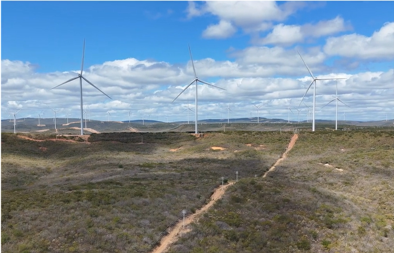
In the Paraíba municipality of Junco do Seridó, a photograph released by MapBiomas itself shows wind turbines spread across a landscape of low-lying vegetation typical of Brazil’s semiarid region. The image helps illustrate the difference between installing equipment in a natural landscape and choosing land that has already been altered by human activity.
Expansion still covers a small share of the biome, but its concentration worries researchers
Comparing the projects with the entire Caatinga helps put their footprint in perspective. Solar and wind projects occupied approximately 0.06% of the biome in 2025, according to MapBiomas. Agriculture and livestock, by far the region’s main human activity, covered 30.1 million hectares, accounting for 97% of areas used by people.
Pastures alone covered 25.1 million hectares, equivalent to 29.1% of the Caatinga’s territory. Over four decades, that area grew by 69%. Renewable energy growth therefore accounts for a much smaller land footprint than agriculture and livestock, although it represents a large share of the vegetation converted for solar and wind power generation in the country.
Washington Rocha, the MapBiomas coordinator for the Caatinga, supports continued expansion of renewable power generation, but says it should be planned to protect areas of greater ecological value. Choosing regions already altered by land use is one way to reduce the need to clear natural vegetation.
Brazil’s only biome found exclusively within the country lost millions of hectares in four decades
The Caatinga covers 86.3 million hectares across nine states. Native vegetation covered 74.1% of the territory in 1985. By 2025, 54.1 million hectares remained, equivalent to 62.7% of the biome’s area. The cumulative net loss over the period reached 9.8 million hectares.
The survey shows that since 2020, the area cleared has exceeded the area of natural vegetation restored every year. The largest net loss occurred in 2023, when the difference between vegetation cleared and vegetation restored reached 513,000 hectares. Areas undergoing regeneration also require attention, since the return of trees and shrubs does not ensure an immediate recovery of the previous ecological structure.
Of the 1,209 municipalities in the biome, 916 have lost more than 5% of their native vegetation since 1985. In 280 municipalities, the decline exceeded 30%. The transformation reflects different economic activities and decades of land use, not just the installation of power generators.
How to expand renewable electricity without repeating vegetation loss
The research adds a concrete criterion to the debate over new projects: assess each site’s land-use history before deciding where to install panels, turbines and access infrastructure. Satellite maps can identify areas already used for agriculture and ranching, previously cleared land, and regions where native vegetation remains.
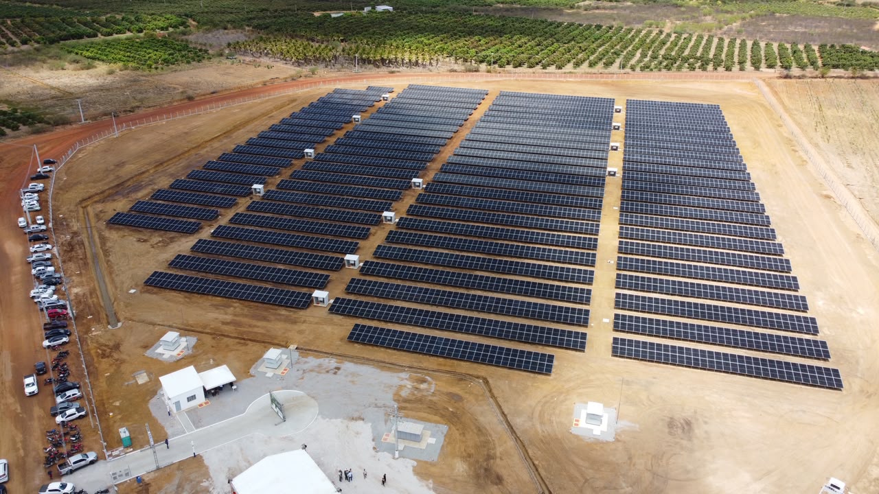
The solar project installed in the Maniçoba irrigation district in Juazeiro, Bahia, is an example of the technology’s growing presence in the region. Announced by Codevasf in October, the system has 5,400 modules and batteries to power water pumps. The assessment does not identify this particular installation as having caused vegetation loss; its photograph shows the physical scale a field of panels can reach.
The new data put a choice before governments, investors and communities: continue expanding a renewable electricity mix while also considering each project’s land-use costs before construction begins. The mapping provides a basis for comparing sites and demanding preservation measures at future facilities.
Should new solar and wind farms prioritize already-cleared land, even when building on other sites would cost less? Readers can share their views in the comments and pass the story along to others following the expansion of clean energy in Brazil.


