 Portuguese
  English
  Spanish
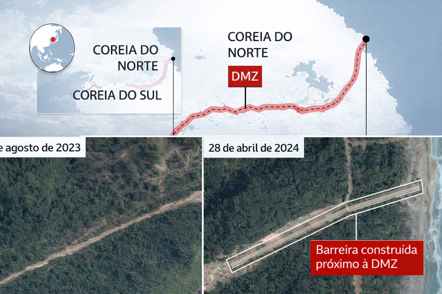
The Border Between The Koreas Has Over 250 Km Of Fences, Moats And Fortified Zones, Forming The Largest Continuous System Of Territorial Isolation In The World.
The border that separates South Korea from North Korea is not just a political line drawn on a map. It is one of the largest continuous territorial engineering projects ever kept in operation, where physical infrastructure, permanent surveillance, and absolute spatial control combine to create an almost insurmountable barrier. Along more than 250 kilometers in length, the territory has been shaped to prevent any unauthorized crossings, transforming the region into an unmatched physical system of isolation in the world.
A Border That Has Turned Into A Permanent Engineering Work
The so-called Korean Demilitarized Zone (DMZ) officially emerged in 1953, at the end of the Korean War, but what exists today goes far beyond a simple military agreement.
Over the decades, the area has been progressively reinforced with continuous metal fences, walls, anti-tank moats, minefields, and exclusion zones, creating a multilayered physical barrier.
-
SUS surpasses Brazil and inspires a revolution in health: agreement with Mexico could bring universal, free, and more accessible care to millions of people outside the country.

-
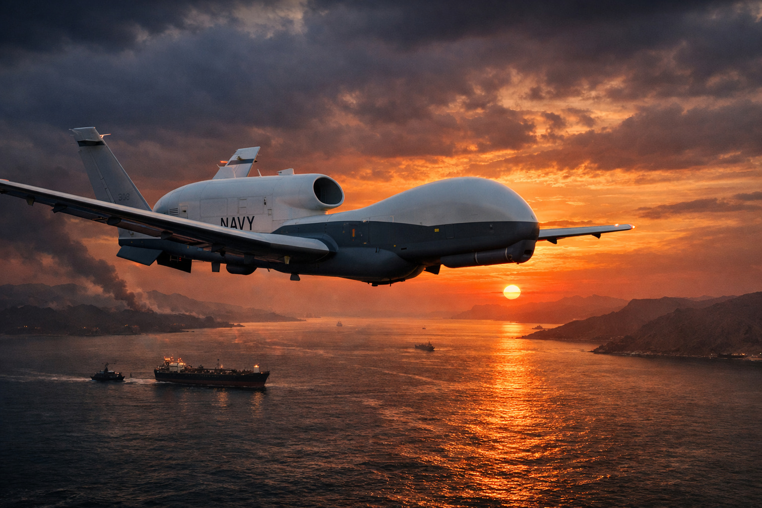
US drone worth $1 billion disappears after issuing emergency alert in the Strait of Hormuz, raising global tension.
-
SUS surpasses Brazil and inspires a revolution in health: agreement with Mexico could bring universal, free, and more accessible care to millions of people outside the country.

-
With a total blockade of software, data, and connected systems, the U.S. has completely closed its doors to Chinese cars and transformed vehicles into geopolitical weapons, creating a new technological battlefield that could reshape the global automotive industry.


On the South Korean side, the fences extend almost along the entire line of terrestrial contact, following mountainous terrains, valleys, and flat areas. In many sections, there is not just one fence, but two or three parallel lines, separated by patrol corridors and technical zones with restricted access.
Impressive Physical Dimensions
The DMZ is approximately 250 km long, crossing the entire Korean peninsula from west to east. Its official width is about 4 kilometers, forming an entire territorial strip dedicated to isolation. Within this corridor, large areas have been kept without permanent human occupation for over 70 years.

The South Korean fences reach several meters in height, are reinforced with barbed wire, sensors, and lighting systems, and follow a continuous trajectory that requires constant maintenance.
In more sensitive areas, the infrastructure includes concrete walls, additional metal barriers, and dug moats to prevent the passage of armored vehicles.
Moats, Obstacles, And Molded Terrain
In addition to the fences, the engineering of the border includes anti-tank moats, dug along various strategic points. These moats are not improvised trenches: many have sufficient width and depth to completely block the advance of heavy vehicles, functioning as permanent obstacles in the terrain.
The terrain itself has been incorporated into the defensive system. Steep slopes, marshy areas, and dense forest zones are kept under controlled conditions, making any attempt to cross undetected difficult.
Surveillance Integrated With Infrastructure
The border does not rely solely on physical obstacles. The entire structure has been designed to operate in an integrated manner with observation posts, patrol roads, night lighting, and electronic detection systems. The result is a border where civil engineering, military logistics, and territorial control function as a single organism.
The internal roads allow for rapid movement of patrol vehicles along the fence, while technical zones provide access only to authorized teams for maintenance and inspection.
A Territorial Paradox: Human Isolation, Environmental Preservation
Interestingly, the same infrastructure that prevents continuous human presence has created an unexpected effect. The DMZ has become one of the most ecologically preserved areas in Asia, precisely because it has remained virtually untouched for decades.
Forests, rivers, and natural habitats have developed within this isolated strip, transforming a hostile border into an involuntary ecological corridor.
Nevertheless, this preservation does not diminish the scale of the project. The DMZ remains, above all, a physical system of territorial separation, maintained with constant resources and long-term technical planning.
A Work Without A Completion Date
Unlike bridges, dams, or tunnels, the fortified border between the Koreas does not have a defined “end.” It is a permanent operation that requires inspections, reinforcements, replacement of structures, and continuous technological adaptation.
For over seven decades, the line of separation has ceased to be just a political limit and has solidified as one of the largest continuous human interventions on the territory, where each kilometer was designed to prevent movement, control space, and maintain absolute separation between two countries.
In today’s world, few infrastructures represent the idea of engineering applied to territorial control as well as this border. It is not just a fence. It is a complete physical system, extended over hundreds of kilometers, shaping the space, the terrain, and the very dynamics of the Korean peninsula.

-

Uma pessoa reagiu a isso.