 Portuguese
  English
  Spanish
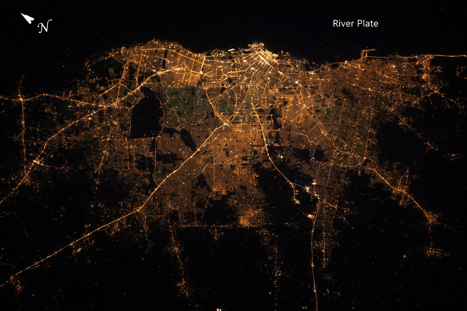
View from space, Buenos Aires reveals a striking contrast between light and darkness, highlighting urban expansion, energy consumption, and the clear territorial division between densely populated areas and nearby rural regions.
In images released by NASA, captured by astronauts aboard the International Space Station, the city of Buenos Aires appears at night as a gigantic luminous spot surrounded by vast areas of darkness. Taken at about 400 kilometers altitude, these images clearly show a phenomenon that intrigues scientists and impresses observers: the boundary between the urban and rural environment can be visually identified in a single orbital frame.
According to records from NASA’s Earth Observatory program, Buenos Aires stands out precisely for this extreme contrast, becoming one of the most didactic examples of how urbanization alters the appearance of the planet when viewed from space.
Images from the ISS show city as a bright nucleus surrounded by dark void
The photographs reveal an intensely illuminated urban core that spreads continuously, forming a bright mass that is easily identifiable. Around it, the scenery changes abruptly: agricultural areas and less urbanized regions appear almost completely dark.
-
NASA spent over 118 million reais to build a single bathroom that works in zero gravity, and it has just gone to space on the first crewed mission to the Moon in more than 50 years.

-
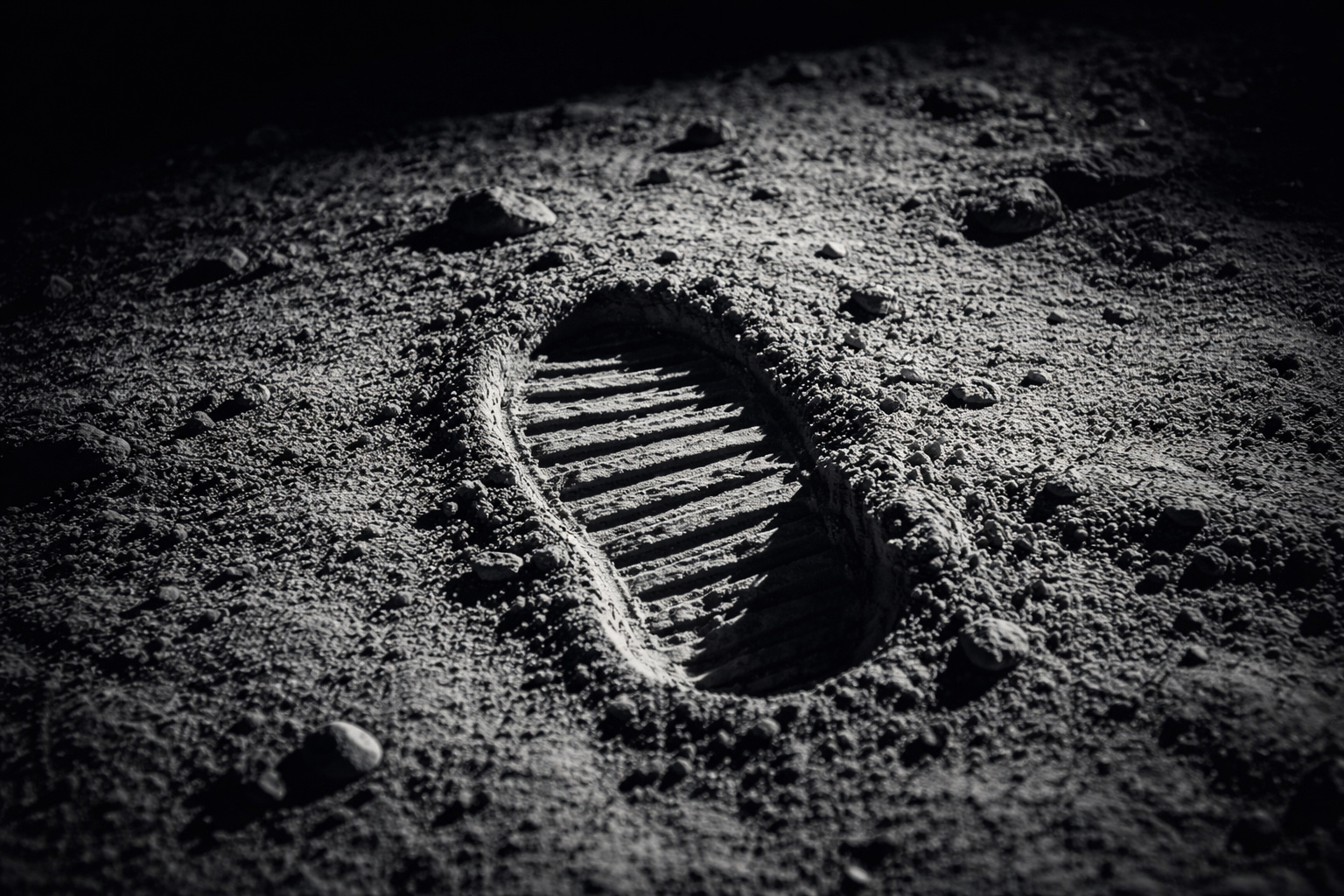
Man never set foot on the Moon? 5 scientific proofs confirm that humanity has been there and definitively dismantle conspiracy theories.
-
The Brazilian Army will adopt humanoid robots to test the concept of future combat, says a website, surprising everyone, but later revealing that it was all just an allusion to April Fool’s Day.

-
There is a city in China right next to Hong Kong where people speak Portuguese, the streets have names in Portuguese, and the architecture looks like it came straight out of a historic city in Brazil.


This transition is not gradual but rather abrupt, creating a clear visual line between two completely different worlds: the urban and the rural. The difference occurs because cities concentrate continuous artificial lighting from streetlights, buildings, vehicles, and infrastructure, while rural areas have sparse or nonexistent lighting.
Luminous contrast transforms Buenos Aires into a reference for urban studies
The pattern observed in Buenos Aires is not just a visual spectacle. It also has scientific applications. Nighttime brightness data are used by researchers to analyze:
- Urban expansion
- Population distribution
- Energy consumption
- Economic development
The intensity of light emitted by a city is directly related to the level of human activity, which transforms nighttime images into strategic tools for global monitoring. In the case of Buenos Aires, the contrast with the rural surroundings further facilitates this type of analysis, making the city a classic example in remote sensing studies.
Difference between city and countryside can be seen from orbit without advanced instruments
Astronaut reports indicate that, under ideal conditions, this difference in brightness can be perceived with the naked eye. Cities appear as intense bright spots, while rural areas remain practically invisible at night.
This contrast creates a kind of “natural map” of human occupation, allowing for quick identification of where there is population concentration and where natural or agricultural areas predominate.
Urban lighting reflects historical patterns of growth and planning
The way Buenos Aires appears in the images is also linked to its historical development. As one of the largest metropolises in South America, the city has a dense and continuous urban structure, with a high concentration of infrastructure.

This pattern results in a homogeneous light emission, which clearly differentiates itself from the surrounding areas, where occupancy is more dispersed. Furthermore, urban expansion over the decades has enlarged this luminous spot, making it even more visible from space.
Orbital sensors confirm patterns observed by astronauts
In addition to images manually captured by astronauts, sensors like VIIRS record the Earth’s luminosity with high precision. These systems confirm what is already visible to the naked eye: large cities function as intense sources of light on a predominantly dark planet at night.
In the case of Buenos Aires, the data show a continuous light concentration, contrasting with neighboring low-emission regions. This difference is so significant that it can be detected on a continental scale, highlighting the city as one of the main urban centers in the region.
Nighttime observation of Earth reveals direct impact of human activity
The images of Buenos Aires are part of a global phenomenon: the transformation of Earth into a mosaic of lights at night. Highly urbanized regions, such as Western Europe, the East Coast of the United States, and parts of Asia, exhibit high levels of luminosity.

On the other hand, less developed areas or those with low population density remain dark. This contrast directly reveals the distribution of human activity on the planet, something that cannot be observed with the same clarity during the day.
Buenos Aires becomes a visual example of the boundary between urbanization and nature
The clarity with which this division appears in the images makes Buenos Aires an emblematic case. In a single photograph, it is possible to identify where the city ends and where the countryside begins, something that normally requires detailed maps and complex geographical analysis.
This characteristic makes the city a reference not only visually but also scientifically, being used in studies on urbanization, land planning, and land use.
Bright city and dark countryside show how urbanization redefines the planet seen from space
The view of Buenos Aires from the ISS highlights one of the most striking aspects of human presence on Earth: the ability to transform natural darkness into luminous networks visible from space. With an intense light spot surrounded by kilometers of darkness, the city clearly and directly reveals the division between urban and rural areas.
This contrast not only impresses visually but also provides one of the clearest representations of urban expansion and human impact on the planet when observed from orbit.


Seja o primeiro a reagir!