 Portuguese
  English
  Spanish
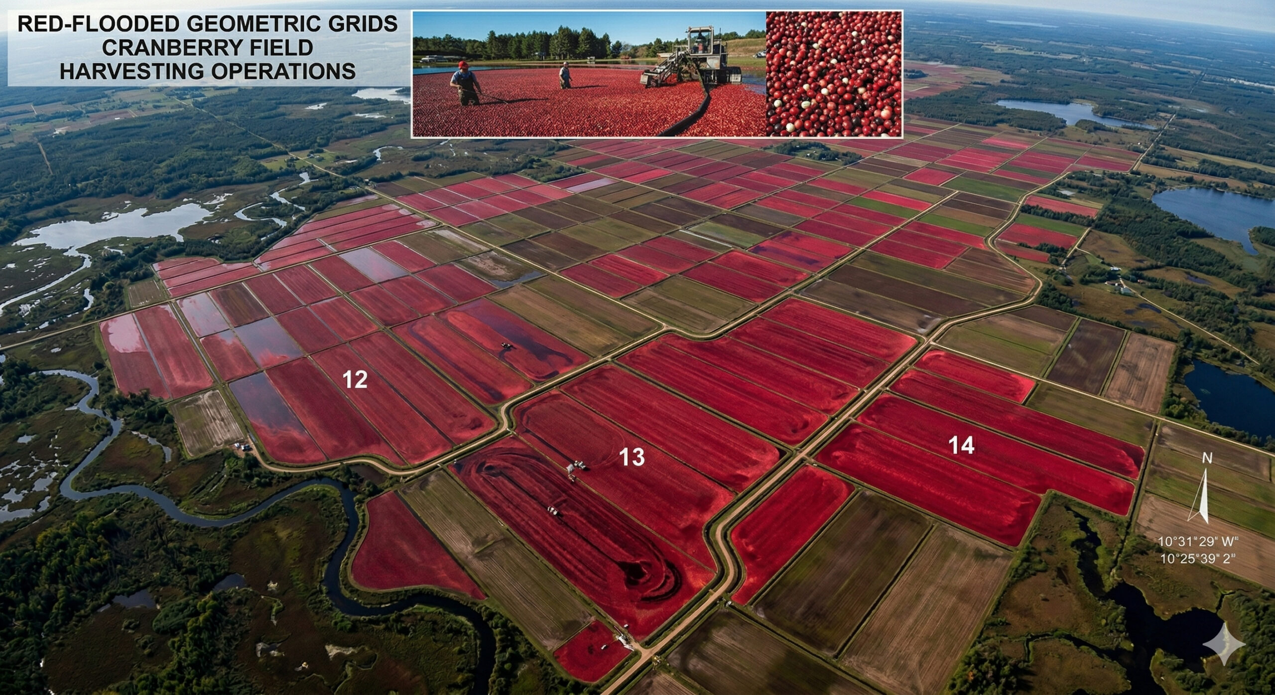
Cranberry fields in Wisconsin turn red at harvest and form visible geometric patterns from space in one of the most curious agricultural landscapes in the USA.
Fields of cranberries visible from space: In records released by the NASA Earth Observatory, the central region of the state of Wisconsin, in the United States, appears as one of the planet’s most unusual agricultural landscapes when viewed from satellite. During the harvest season, large productive areas are deliberately flooded, causing the cranberry fruits to float on the water’s surface and create a striking visual effect: entire fields take on a deep red color that stands out even in orbital images. What makes this phenomenon even more impressive is the spatial organization of these fields.
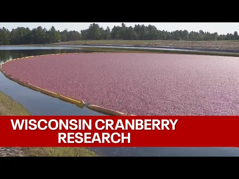
The cultivation areas appear structured in well-defined geometric blocks, with parallel rows and agricultural compartments that form a visual mesh contrasting with the natural environment around. According to an official publication from NASA Earth Observatory, the satellite image recorded on October 13, 2025 shows geometric networks of cranberry beds next to small lakes near the town of Warrens, known as the “cranberry capital of Wisconsin.”
This scenario is not permanent but occurs at specific times of the year, which reinforces its visual impact. According to the same NASA publication, when the fruits ripen, producers flood the fields with up to 30 centimeters of water and use machines to loosen the fruits from the plants; since cranberries have internal air pockets, they rise to the surface, causing entire areas to turn red for a short period. The temporary transformation of the landscape is a direct result of this harvesting method, making the region one of the most curious examples of how agricultural practices can generate visible patterns on an orbital scale.
-
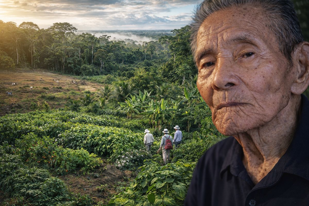
At 96 years old, the last survivor of a colony of Japanese immigrants who arrived in the Amazon in 1929 saw his community create an agricultural method that transforms destroyed pastures into forests that produce food year-round and attract researchers from around the world.
-
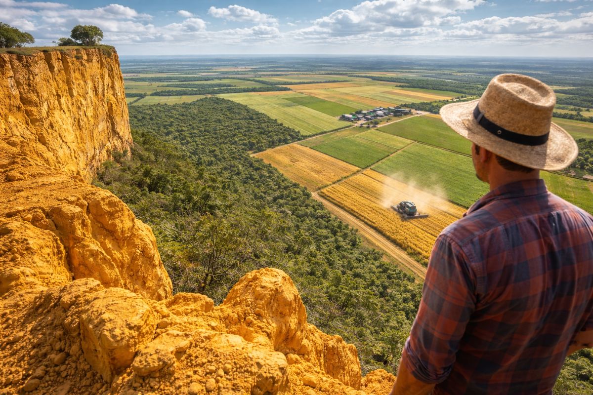
This rare yellow clay at the top of a plateau in northern Pará is transforming one of the poorest regions of Brazil into a new agricultural frontier, with producers already harvesting three crops a year from the same soil.
-
Brazil has avoided deforestation of 50 million hectares in the last three decades thanks to increased productivity in the field, and now low-carbon agriculture wants to prove that the country is part of the climate solution and not the problem.

-
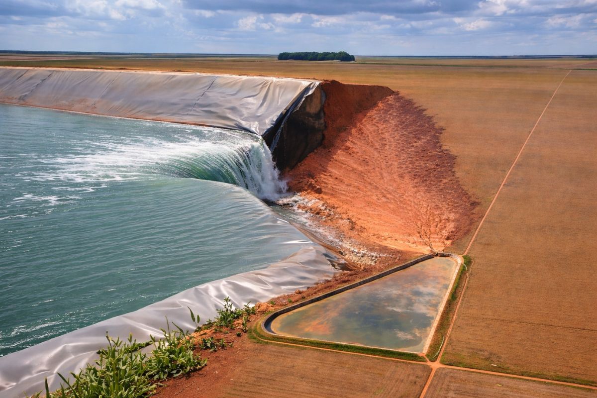
Irrigation pond breaks on a farm in southern Piauí, leaving the reservoir empty and a trail of damage; nearly 1 billion liters flood a soybean field, causing losses, with no injuries reported, and the causes still officially unknown.
Flood harvesting technique transforms fields into water mirrors covered with red fruits
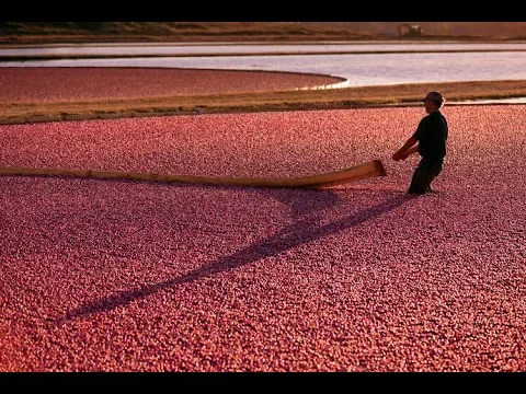
The red appearance of the fields is not caused by a natural change in vegetation but rather by a specific agricultural process. Cranberry production in Wisconsin primarily uses the method known as wet harvesting.
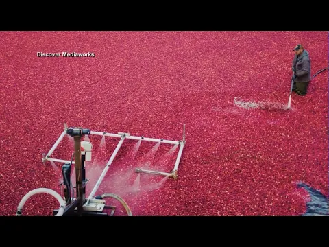
In this system, the fields are flooded with water during the harvest, creating a thin layer that covers the crops. Then, machines pass through the cultivated areas and agitate the plants, releasing the fruits. Since cranberries have air pockets in their structure, they immediately float, forming a dense layer on the water.
The result is a unique visual scenario: entire surfaces are covered with millions of red fruits, creating an intense contrast with the dikes and adjacent areas. This process not only facilitates collection but also generates the pattern that can be observed from space.
Organization of fields creates geometric patterns that stand out in orbital images
The structure of cranberry fields is not random. The areas are planned to allow water control, drainage, and access during harvest. This results in a clear division of the territory into rectangular or polygonal blocks, delineated by channels and dikes.
These boundaries form well-defined lines that organize the agricultural space, creating a visual network that becomes even more evident when the fields are flooded. The repetition of these shapes on a large scale produces a pattern reminiscent of a geometric mesh, contrasting with the natural environment around.

This type of organization is essential for the efficiency of cultivation but also generates an unexpected visual effect when viewed from space. The combination of geometry and color transforms the landscape into something that seems designed to be seen from above.
Wisconsin concentrates the largest cranberry production in the United States
The state of Wisconsin is responsible for a significant portion of cranberry production in the United States, being considered the main hub of this activity in the country. The environmental conditions of the region, including acidic soils and water availability, favor cultivation.
The concentration of productive areas in one region amplifies the visual impact observed from space, as multiple fields organized side by side create a continuous pattern. This grouping intensifies the effect of the red mosaic during harvest.
The economic importance of this production also contributes to the maintenance and expansion of these areas, ensuring that the observed pattern remains present over time.
Landsat images allow monitoring the seasonal transformation of the landscape
The use of satellites such as those in the Landsat series allows for observing the change in the landscape throughout the seasons. For much of the year, cranberry fields appear similar to other agricultural areas. However, during the harvest, an abrupt transformation occurs.
The change in color and texture is clearly visible in orbital images, allowing the exact moment when the fields are flooded and the fruits begin to float to be identified. This seasonal variation makes the region an interesting example of how agricultural practices can temporarily alter the appearance of the territory on a large scale.
Moreover, satellite monitoring allows for analyzing the extent of cultivated areas and tracking possible changes over the years.
Landscape combines intensive agriculture with hydraulic control of the territory
Cranberry production directly depends on water control. The fields are designed to allow both flooding and rapid drainage, which requires efficient hydraulic infrastructure.
Dikes, channels, and pumping systems are fundamental elements of this process, allowing producers to control the water level precisely. This infrastructure not only enables harvesting but also defines the spatial organization of the fields.

This type of control transforms the landscape into a highly managed system, where the interaction between water and land is constantly adjusted to meet production needs.
Pattern seen from space reveals how agriculture can create temporary artificial landscapes
The case of cranberry fields in Wisconsin shows how agricultural activities can generate visual patterns that only become evident when observed on a larger scale. The landscape, which at ground level may seem ordinary, transforms completely when viewed from space, revealing an organization that is not perceptible locally.
This phenomenon highlights agriculture’s ability to temporarily modify the territory, creating scenarios that would not exist naturally. The red coloration, combined with the geometry of the fields, results in a pattern that catches attention even in low-resolution images.
Comparison with other agricultural landscapes reinforces the uniqueness of the phenomenon
When compared to other agricultural systems, cranberry fields stand out due to the combination of visual factors. While many crops create geometric patterns, few exhibit such intense and concentrated color changes in a short period of time.
The uniform red coloration and the simultaneous flooding of large areas create an effect that is rarely observed in other agricultural regions, making the case of Wisconsin a singular example.
This uniqueness is one of the reasons why the region is frequently highlighted in satellite image analyses.
What seems a natural phenomenon is a direct result of a specific agricultural technique
When observing images of the fields during harvest, one might get the impression that it is an unusual natural phenomenon. However, the entire transformation is the result of a well-established agricultural method.
Controlled flooding and the floating of the fruits are planned processes, which are part of the productive routine. This combination of technique and visual result demonstrates how human practices can generate effects that seem natural when viewed from afar.
Have you ever imagined that a harvesting method could transform entire fields into landscapes visible from space?
The case of cranberry fields in Wisconsin shows how agricultural activities can transcend the local level and create visual patterns perceptible on a global scale. What starts as a production technique transforms into a phenomenon that attracts attention even in orbital images.
In light of this, an interesting question arises: how many other agricultural practices around the world are creating visible patterns from space without most people even realizing it? Share your thoughts in the comments.


Seja o primeiro a reagir!