 Portuguese
  English
  Spanish
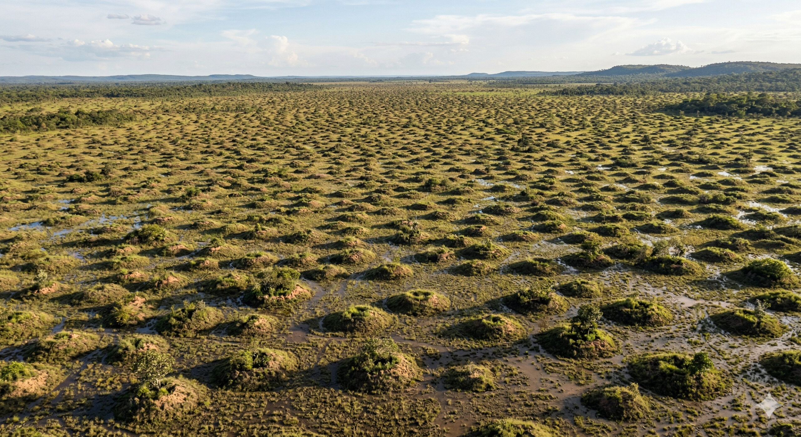
Murundus fields in the Cerrado form geometric patterns with mounds up to 20 meters, resulting from natural subterranean processes and soil hydric dynamics.
In studies consolidated by Embrapa and research published in scientific journals such as the Journal of Tropical Ecology and the Geomorphology journal, researchers have begun to describe more precisely the murundus fields as one of the most unique geomorphological landscapes of the Brazilian Cerrado. In these areas, small convex soil elevations repeat across the landscape and may be associated with subterranean and biogenic processes, especially the activity of termites over many generations, combined with local terrain conditions.
These formations mainly appear in areas with poor drainage and seasonal variations in moisture, where the murundus function as slightly higher and better-drained portions than the surrounding depressions. It is this relationship between saturated soil in the low areas and elevated terrain in the mounds that helps explain why murundus fields stand out even in aerial images, forming a repetitive pattern of rounded elevations across the landscape.
Located in different areas of Central Brazil, these fields are composed of murundus that can vary from 0.1 to 1.5 meters in height and from 0.2 to over 20 meters in diameter, according to descriptions from Embrapa itself for savanna formations with murundus. The safest formulation today is that these structures do not result from a single isolated mechanism, but from the interaction between soil, water, relief, and biological activity accumulated over extensive periods.
-
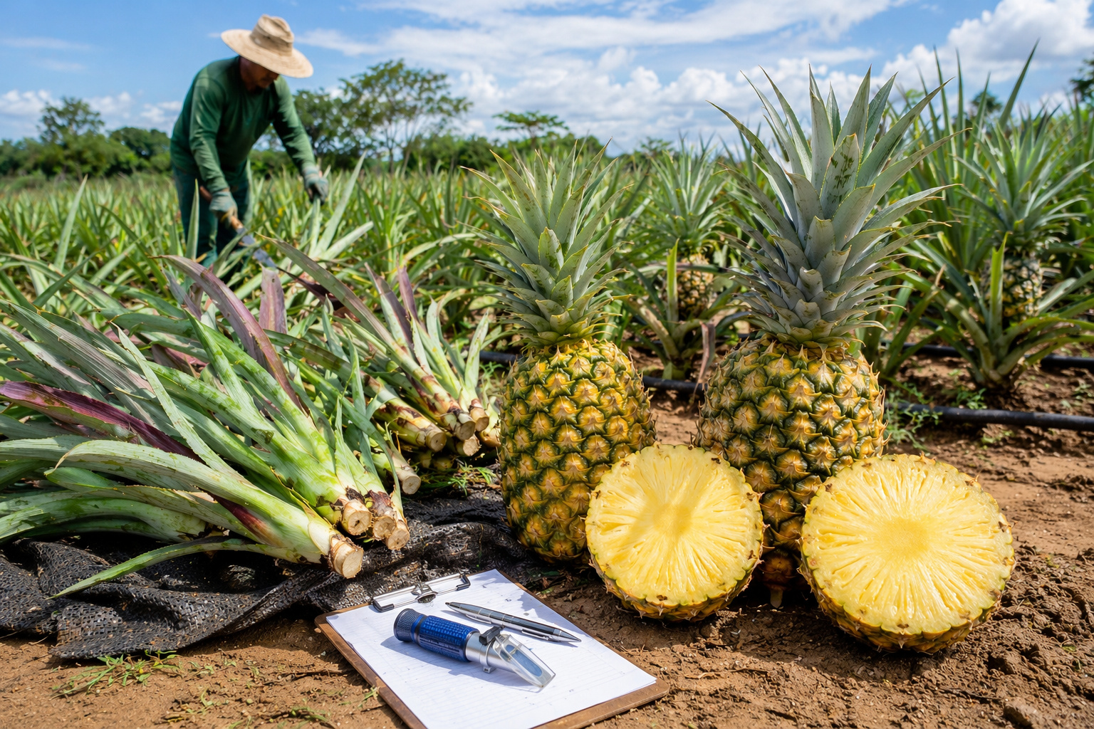
Spiny-free pineapple, sweeter and more resilient: Mato Grosso develops new cultivars that promise to reduce losses from fusariosis and increase productivity in the field.
-
Agro Machinery: discover the new technology aimed at impacting agriculture by professionalizing the buying and selling of agricultural machinery with precise data, more security, and fairer negotiations among producers.

-
Extreme heat is already invading crops, reducing productivity and putting pressure on livestock, fishing, and forests worldwide, and data from the FAO shows that the increase in temperatures has shifted from being a climate risk to a direct threat to global food production.

-
Spine-free pineapple, sweeter and more resilient: Mato Grosso develops new cultivars that promise to reduce losses from fusariosis and increase productivity in the field.

Murundus can exceed 20 meters in diameter and dominate large areas of the Cerrado
The murundus exhibit significant variations in size, reaching over 20 meters in diameter and heights close to 1.5 meters. In certain regions, these structures concentrate in large numbers, covering extensive areas.
The distribution of these mounds does not occur randomly. In many cases, a relatively regular spacing is observed, suggesting the presence of natural mechanisms of spatial organization.
The scale of the phenomenon is one of the most impressive aspects, with entire fields composed of hundreds or thousands of elevations distributed relatively uniformly, creating a striking visual pattern when viewed from above.
Waterlogged soil and hydric dynamics explain the formation of murundus fields
The murundus fields are directly associated with areas that have specific hydrological characteristics. The soil in these regions has low drainage and tends to accumulate water during rainy periods.
This environment favors the differentiation of relief. While lower areas remain flooded, the murundus stand out as relatively dry elevations, functioning as islands within a seasonally flooded system.

The constant presence of moisture influences soil structure and vegetation distribution, contributing to the maintenance of these elevations over time.
Subterranean processes of soil reorganization are identified as a key factor in the formation of murundus
One of the most accepted hypotheses to explain the formation of murundus involves subterranean processes that alter soil structure over time.
These processes are capable of redistributing particles, modifying soil compaction, and influencing water infiltration. Over decades or centuries, this dynamic can lead to the gradual accumulation of material, forming elevations that stand out from the original surface.
This mechanism occurs continuously and cumulatively, which explains the presence of structures with significant dimensions in environments where other erosive processes are limited.
Interaction between biological, hydrological, and geomorphological factors creates organized patterns
The formation of murundus cannot be attributed to a single isolated factor. The phenomenon results from the interaction between multiple natural processes acting simultaneously.
The dynamics involve changes in soil moisture, redistribution of materials, differential growth of vegetation, and processes of compaction and erosion. This combination creates a complex system capable of generating broad and organized spatial patterns.

These patterns are similar to those observed in other self-organized natural phenomena, where small local interactions result in large-scale structures.
Differentiated vegetation in murundus reinforces the visual pattern observed from above
Another important aspect of murundus fields is the difference in vegetation between the elevated areas and the surrounding areas.
As the murundus remain relatively drier, they support types of vegetation distinct from those found in flooded areas. This differentiation creates a visual contrast that accentuates the pattern of elevations in the landscape.
In aerial images, the murundus appear as points distributed over a more homogeneous background, reinforcing the perception of spatial organization.
Murundus fields connect to global phenomena of self-organization in nature
The murundus fields exhibit similarities to other natural phenomena that display organized patterns, such as circular formations in arid regions and geometric structures in extreme environments.
In all these cases, there is a common element: the self-organization of natural systems under limiting conditions. In the Cerrado, the predominant factor is the dynamics of water in the soil.
The comparison with international phenomena reinforces the idea that geometric patterns can arise naturally from repeated interactions over time.
The origin of murundus is still debated by science and involves multiple processes
Despite advances in research, there is still no absolute consensus on the exact origin of murundus. Some hypotheses attribute greater weight to geomorphological processes, while others highlight the role of subterranean processes in soil reorganization.
This divergence occurs because the phenomenon involves multiple factors acting simultaneously, making it difficult to identify a single predominant cause.

The murundus fields demonstrate that nature is capable of generating highly organized structures without any external planning. What appears to be an artificial pattern is, in fact, the result of natural processes that repeat over long periods.
Thousands of elevations distributed with relative regularity indicate that natural systems can achieve levels of organization comparable to designed structures.
Now we want to know: do these natural patterns indicate emergent organization or merely the result of accumulated physical processes?
The murundus fields of the Cerrado reveal a landscape shaped by slow yet highly efficient processes in the reorganization of soil and vegetation.
In your view, are these patterns merely a consequence of natural interactions, or do they indicate a deeper level of organization in environmental systems?


Seja o primeiro a reagir!