 Portuguese
  English
  Spanish
New Atmospheric System Advances Over The Country This Weekend, With Forecast Of Strong Wind, Heavy Rain, And Prolonged Instability In The South, Southeast, And Central West, While Other Weather Patterns Reinforce Regional Contrasts Throughout The Week.
An extratropical cyclone expected for the end of this week should cause a change in the weather in part of Brazil, with the possibility of gusts above 100 km/h and heavy rain capable of causing flooding.
Projections from meteorological services indicate that the system begins to organize on Friday (9) and gains strength on Saturday (10), mainly influencing areas in the South, Southeast, and Central West.
The trend, according to analyses released in recent days, is for instability to begin in the early hours of Friday.
-
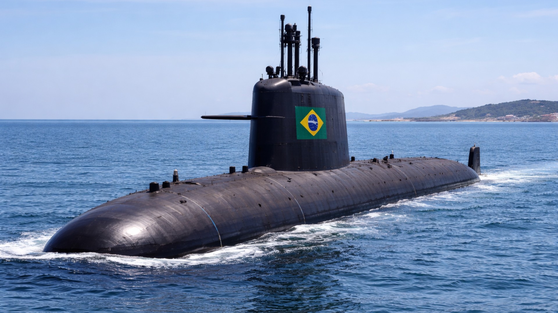
Brazil’s nuclear submarine with a speed 5 times greater than normal advances after nearly 50 years and R$ 40 billion spent.
-
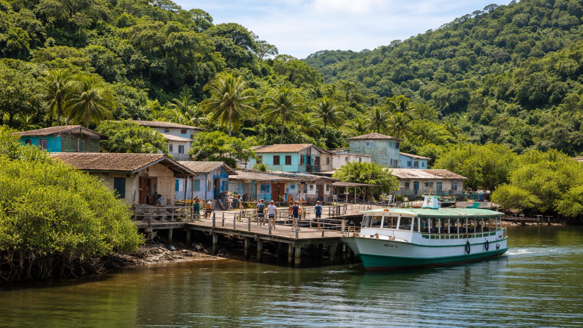
A Brazilian island charges R$ 0.50 to receive visitors and prohibits any new residents.
-
Why was the Great Wall of China built? The truth that many are unaware of!

-
At 73.8 meters tall, the world’s tallest teapot-shaped building has 15 floors, ensures stability, and impresses with an internal space of 28,000 cubic meters.

The highest risk of wind occurs between Saturday afternoon and Sunday (11), a period when storms may be accompanied by intense gusts, electrical discharges, and high volumes of rain in a short time.
Formation Of The Extratropical Cyclone And Impacts On The Weather
The formation of the cyclone is associated with the deepening of a low-pressure area and the advancement of a cold front, a typical scenario for the organization of storms in the South and across portions of the Southeast and Central West.
It is this combination that usually accelerates winds and concentrates rain, especially when there is a contrast of air masses and greater moisture availability.
In the midst of this process, the expectation is that the instability will disrupt the weather in different regions, with rapid alternation between periods of heavy rain and breaks, along with temperature variations throughout the day.
Forecast services also point out that as the cyclone moves toward the Atlantic Ocean, part of the affected areas is likely to improve earlier, while others remain under the influence of the unstable pattern.
States Most Affected By Heavy Rain And Strong Wind
The areas most susceptible to the effects of the system, according to the meteorological analysis cited in the original material, include Mato Grosso do Sul, Paraná, Rio Grande do Sul, Santa Catarina, and São Paulo.
For these states, the possibility is for significant rain and strong winds, with potential impacts in urban areas and also on highways, mainly due to flooding, flash floods, and falling branches and trees during the most intense gusts.
The estimate mentioned by meteorologist Matheus Manente, from Meteored, is for totals that can reach 100 mm in parts of the areas under the greatest instability.
The exception is São Paulo, where the projected volumes are closer to 50 mm, still enough to cause localized disruptions.
These numbers can vary within the state itself, as the rain tends to occur irregularly, with more intense cores in some municipalities.
In the South, Rio Grande do Sul is among the areas that could begin to see a decrease in rain by Sunday, as the cyclone moves away toward the Atlantic.
Nonetheless, severe weather conditions are not limited to a single day.
The critical window for gusts and strong rain showers extends from Saturday to Sunday, and residual effects may persist in other states, as indicated by the projections cited.
ZCAS, ZCIT, And VCAN Influence The Rain Pattern In The Country
In addition to the cyclone, the week has already been marked by atmospheric patterns that favor rain in some areas and reduce precipitation in others.
One of them is the South Atlantic Convergence Zone (ZCAS), which tends to organize a moisture corridor and cause persistent and heavy rain between portions of the Southeast and Central West, also influencing areas in the North.
In a forecast note for the week, the National Institute of Meteorology (Inmet) described the activity of these systems and pointed out conditions for high volumes in different parts of the country.
The agency also indicated that in the southwest of Paraná, the west of Santa Catarina, and the north of Rio Grande do Sul, there is potential for more severe episodes, with totals close to 100 mm in 24 hours and gusts that can reach 100 km/h.
In the extreme North, the Intertropical Convergence Zone (ZCIT) appears as one of the factors favoring rain in Amapá.
In the Northeast, the Upper-Level Cyclonic Vortex (VCAN) tends to hinder the formation of rain clouds in much of the eastern part of the region throughout the period.
This contrast helps to explain why the precipitation map shows marked differences between regions of the country over the same timeframe.
Most Critical Period Concentrates Highest Risk Of Disruptions
The combination of the consolidation of the cyclone, the presence of an associated cold front, and the available moisture creates a favorable environment for more organized storms, especially from Saturday to Sunday.
It is during this interval that the strongest gusts typically occur due to the intensified pressure gradient, and also the largest volumes of rain in short periods.
In practice, this means that the same state can present very distinct scenarios, with some cities registering quick and intense showers, while others experience continuous rain for longer.
Still, the general guidance from the cited meteorological services is to remain particularly attentive to the evolution between Saturday and Sunday, when the likelihood of disruptions due to wind and water tends to be higher.
With this scenario set for a short and more critical period, the main uncertainty becomes where the most intense cores will position themselves and for how long they remain over the same areas.
In such situations, the risk of flooding increases when heavy rain repeats in succession, especially in regions already soaked from previous episodes of instability.
How does your city usually react when the weather changes rapidly, with intense wind and concentrated rain, and what measures could reduce impacts before the arrival of a scenario like this?


-

-

-

-

-

-

302 pessoas reagiram a isso.