 Portuguese
  English
  Spanish
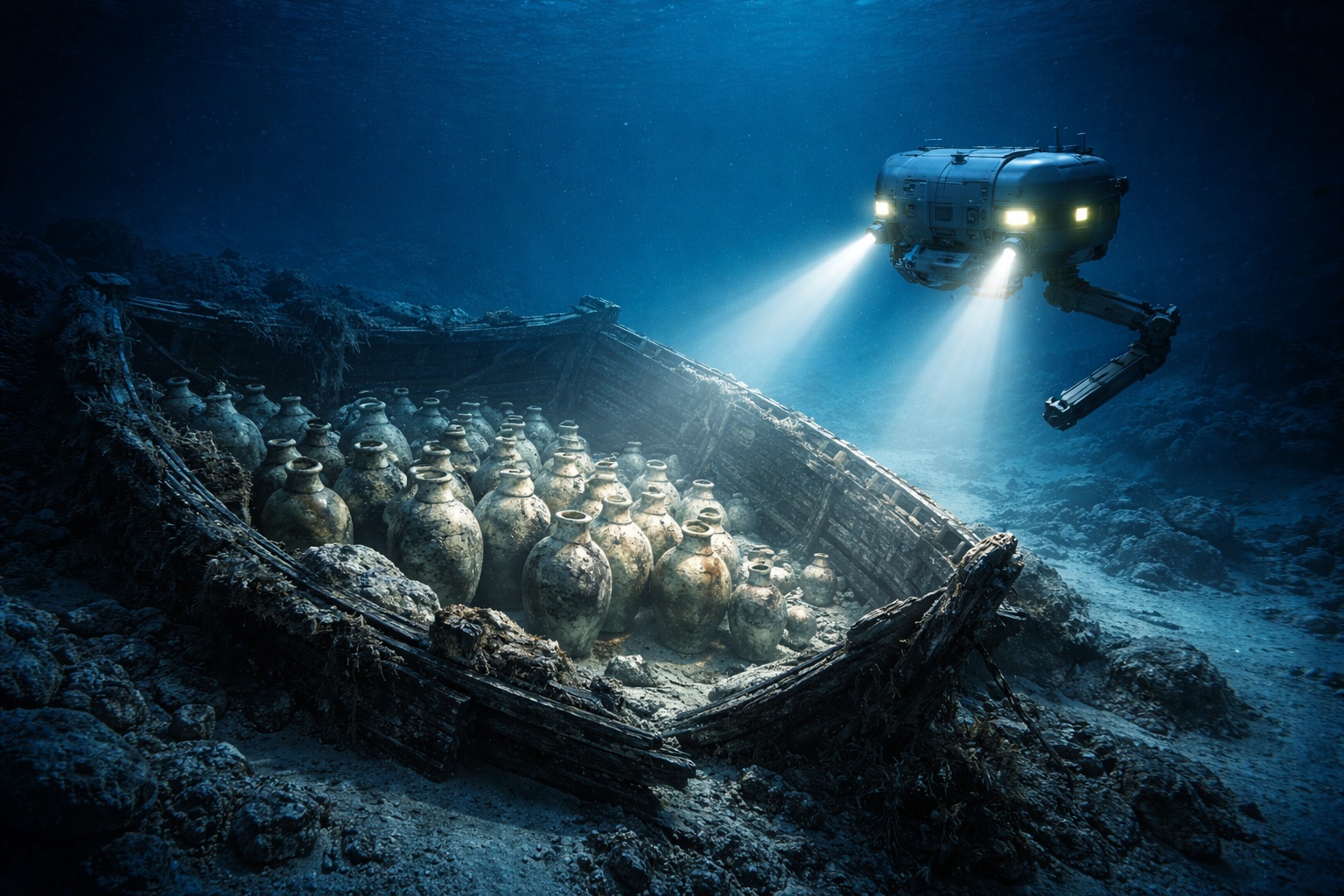


3,300-Year-Old Wreck Found 1.8 Km Deep in the Mediterranean Reveals the Oldest Ship Ever Discovered in Deep Water
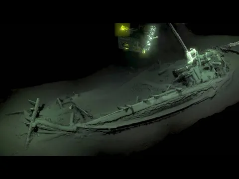
In May 2024, a submarine robot operated by the British natural gas company Energean was scanning the bottom of the Mediterranean off the northern coast of Israel when its sensors detected an anomaly in the marine sediment. The operation was part of a routine technical inspection procedure associated with the company’s natural gas extraction fields in the region. The technical team aboard the Energean Star ship decided to capture detailed images of the formation detected on the seabed. Upon examining the photographs taken by the underwater vehicle, the operators noticed something unusual: what initially appeared to be an irregular cluster of clay vessels partially buried in the sediment.
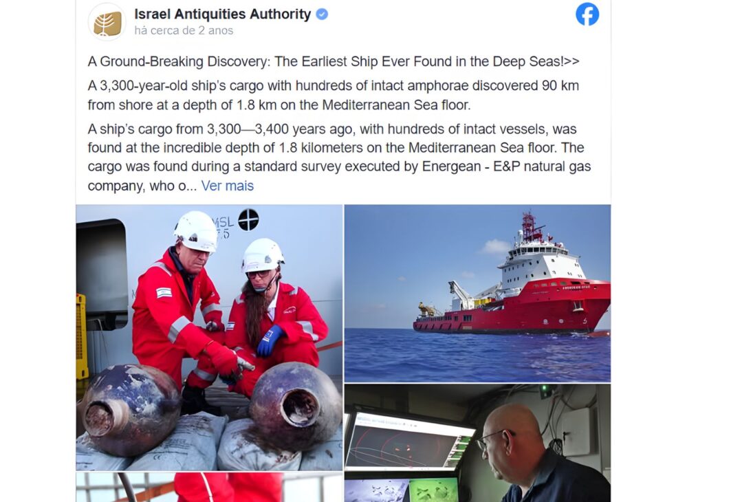
The images were immediately forwarded to specialists at the Israel Antiquities Authority (IAA), the agency responsible for overseeing archaeological discoveries in the country. The response arrived a few hours later and surprised even the most experienced archaeologists. What seemed to be just a collection of ancient jars turned out to be the oldest wreck ever found in deep water anywhere on the planet. Initial analyses indicated that the ship had sunk about 3,300 years ago, during the Bronze Age, and that its cargo had remained virtually untouched since then.
Archaeological Discovery in the Mediterranean Occurred During Natural Gas Field Inspection
Energean operates several natural gas extraction fields in Israeli territorial waters, including areas known as Karish and Katlan. During a routine inspection of the Katlan field, the company sent a ROV (Remotely Operated Vehicle) — a remotely operated underwater vehicle — to examine the seabed.
-
With a façade that resembles a giant zipper, the building in Milan creates a sense of strangeness, featuring lighting that transforms engineering and attracts the attention of residents and tourists.

-
The Brazilian city has 319 crooked buildings built on sandy soil without proper deep foundations, houses the largest beach garden in the world, with over 5 km, and is still considered the birthplace of surfing — meet Santos, in São Paulo.

-
New Zealand builds a shimmering building that vibrates, featuring a 62-seat cinema, moving sculptures, and an environment where sound, light, and energy are felt in the body.

-
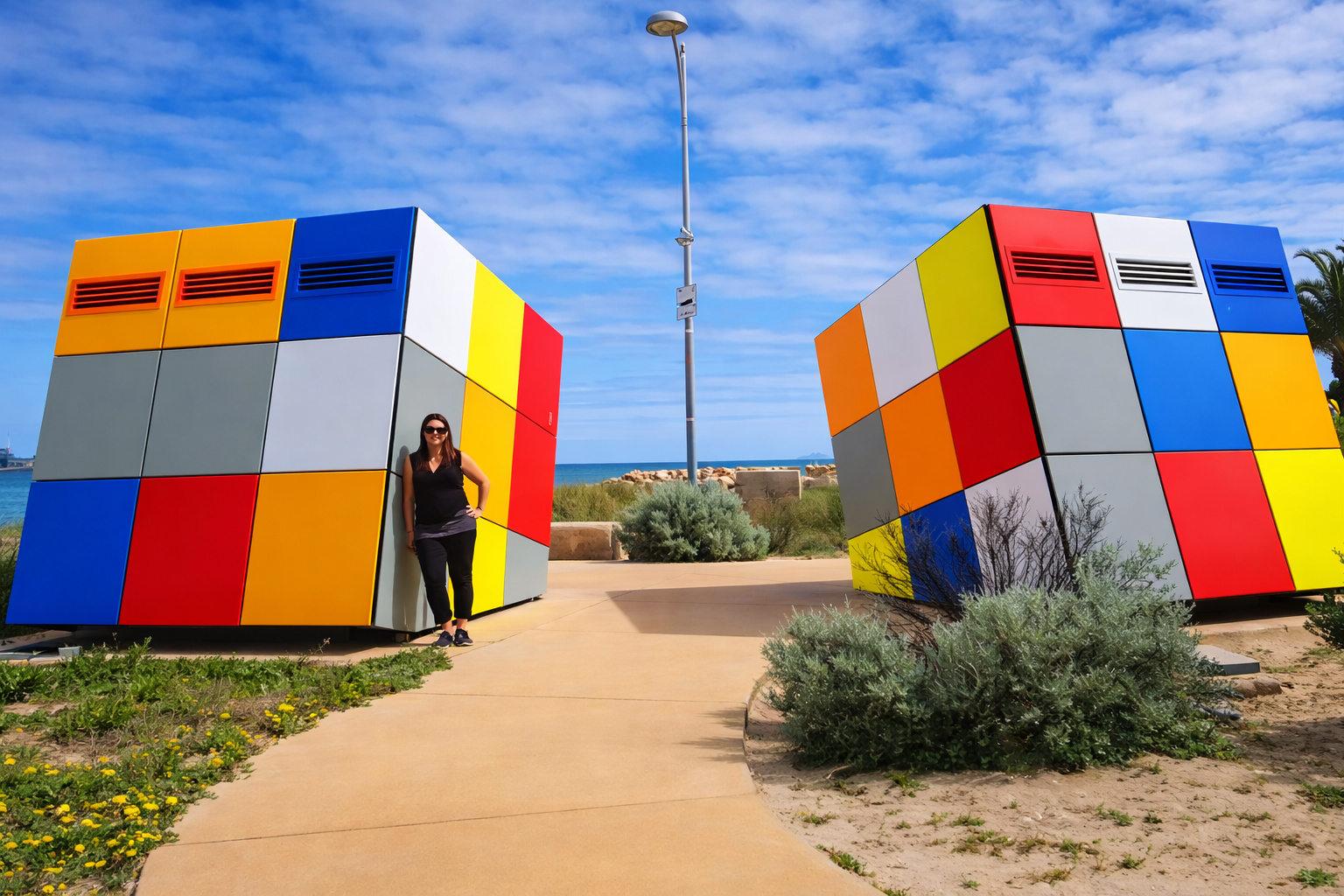
Two colored cubes of 2.5 m transform a public bathroom into a selfie spot in Western Australia, costing up to 75% less than traditional construction and helping to reduce vandalism in public spaces.

The equipment was operating at a depth of approximately 1.8 kilometers, in an area located about 90 kilometers from the Israeli coast. This depth places the site well beyond the reach of human divers and even conventional archaeological operations.
During the inspection, the robot captured images of a row of ceramic containers partially buried in the mud on the seabed. The appearance of the objects caught the operators’ attention, prompting them to send the material for archaeological analysis.
When the images reached Jacob Sharvit, director of the Maritime Archaeology Unit at the Israel Antiquities Authority, the recognition was immediate. The containers were Canaanite amphorae from the Bronze Age, dated approximately between the 13th and 14th centuries BC.
According to Sharvit, “this is one of the most significant discoveries ever made in the history of maritime archaeology”. In June 2024, the Israel Antiquities Authority made the discovery public, drawing the attention of the international scientific community.
Canaanite Wreck Challenges Traditional Theory of Ancient Navigation in the Mediterranean
The most surprising element of the discovery was not just the ship’s age, but the location where it was found. Until then, all known Bronze Age wrecks in the Mediterranean had been located relatively close to the coast. The most famous example is the Uluburun wreck, found in 1982 near the coast of Turkey.
The academic logic behind this concentration was simple: it was believed that ancient navigators rarely ventured far from the sight of land. Without compasses, modern navigation instruments, or accurate maps, coastal navigation was considered the safest way to travel.
The ship found by Energean completely challenges this theory. The wreck is located about 90 kilometers from the shore — a distance where no land is visible in any direction, just the maritime horizon.
According to Sharvit, this discovery profoundly changes the understanding of the capabilities of Bronze Age sailors.
“It is the first ancient ship found so far from the coast, in an area where there is no sightline to land.”
Astronomical Navigation May Explain How Canaanite Sailors Crossed the Open Mediterranean
If ancient sailors sailed so far from the coast, an inevitable question arises: how did they know where they were? The most accepted hypothesis among archaeologists involves the use of primitive astronomical navigation.
To maintain routes in open waters during the 13th century BC, Canaanite sailors likely used celestial references for guidance. During the day, the sun’s position in the sky could indicate direction and approximate latitude. At night, the stars and constellations would serve as natural guides to keep on course.
This type of navigation would be used centuries later by Greeks, Phoenicians, and other maritime peoples of the Mediterranean. The discovery suggests that Canaanite sailors had already mastered advanced astronomical navigation techniques much earlier than previously thought.
The historical context reinforces this possibility. The 13th century BC marked the height of economic interconnectedness in the eastern Mediterranean.
The Egyptian and Hittite empires dominated large territories in the region, while Canaanite peoples acted as commercial intermediaries between different civilizations. Products such as olive oil, wine, copper, tin, ivory, and aromatic resins circulated intensively between Egypt, Cyprus, Crete, Anatolia, and the Levant. Archaeologist Eric Cline from George Washington University describes this period as “the first era of globalization in the ancient Mediterranean”.
Hundreds of Preserved Amphorae Reveal the Original Cargo of the Bronze Age Ship
Although the ship’s hull has not yet been fully exposed above the sediment, surveys conducted with sensors indicate that wooden structures remain preserved beneath the layer of mud.
The environmental conditions at the bottom of the Mediterranean — high pressure, low current circulation, and absence of oxygen — created an ideal environment for archaeological preservation. On the surface of the sediment, the robots identified hundreds of Canaanite storage jars arranged in relatively intact layers.
These containers, known as amphorae, were widely used in antiquity to transport agricultural and commercial products such as wine, olive oil, and dried fruits. The arrangement of the jars suggests that the ship sank quickly, leaving no time for the cargo to disperse.
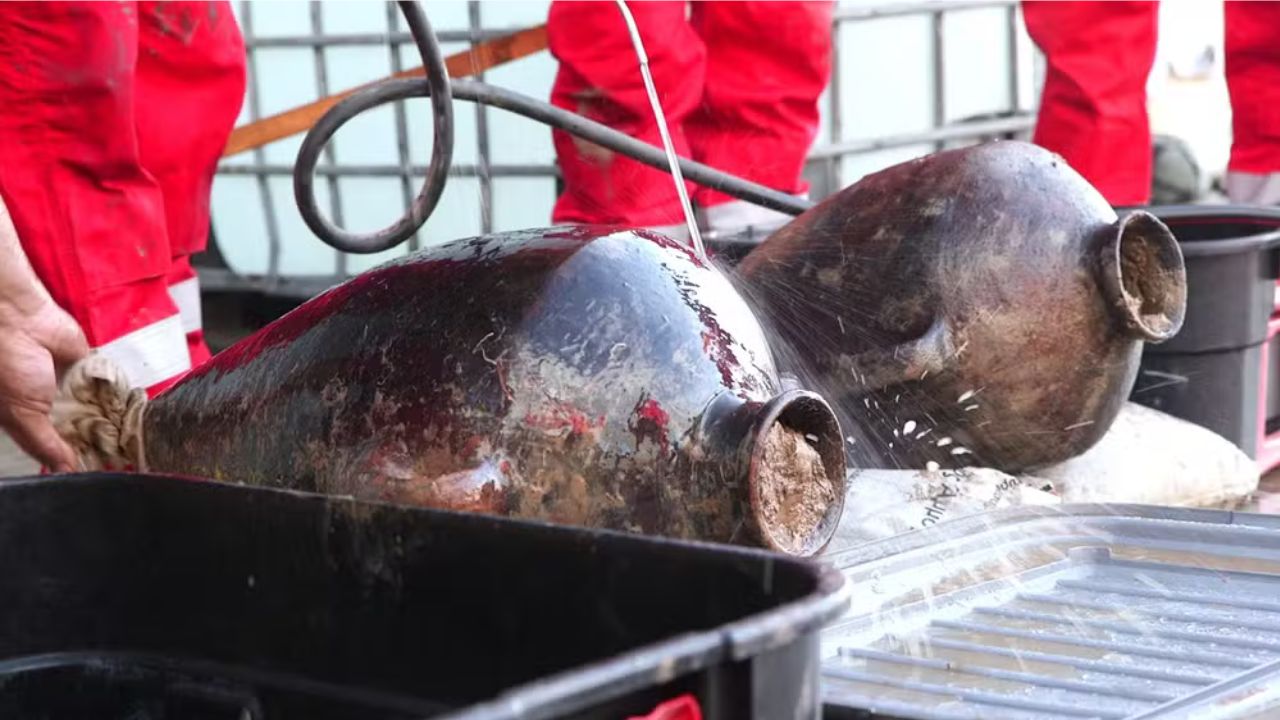
To confirm the extent of the wreck, two containers were carefully removed from the seabed after months of technical planning. Energean developed a special tool for the operation, capable of extracting artifacts from the mud without disturbing the rest of the archaeological site.
The two jars were taken from opposite ends of the identified area, allowing archaeologists to estimate the approximate size of the vessel. After a rise of about three hours to the surface, the containers emerged into the sunlight for the first time in over 3,200 years.
Mystery of What Caused the Wreck Still Intrigues Archaeologists
The intact arrangement of the cargo offers important clues about what might have happened in the final moments of the ship. According to Jacob Sharvit, “whatever happened seems to have occurred very rapidly”.
In situations of danger at sea, it was common for crews to jettison part of the cargo into the ocean to reduce the weight of the vessel and increase its buoyancy. However, there is no evidence that this occurred in this case. The amphorae remain organized as if the ship sank abruptly.
Two main hypotheses are considered by experts. The first involves a sudden storm that could quickly destroy a wooden vessel.
The second hypothesis involves pirate attacks, which were common in the Mediterranean during the Bronze Age. Egyptian and Hittite records mention groups known as “Sea Peoples”, responsible for attacks on maritime trade routes.
A surprise attack could explain the quick sinking and the absence of any attempt to save the cargo.
Wreck Rewrites the History of Ancient Navigation in the Mediterranean
To understand the significance of the discovery, archaeologists compare the new find to the famous Uluburun wreck. The Uluburun ship, regarded as one of the most important archaeological finds in the Mediterranean, was located at just 44 meters deep and less than 10 kilometers from the Turkish coast.
Between 1984 and 1994, archaeologists made over 22,000 dives to recover its cargo. Among the items found were:
- 10 tons of Cypriot copper
- 1 ton of tin
- 150 Canaanite amphorae
- elephant ivory
- African ebony wood
- an gold scarab associated with the Egyptian queen Nefertiti
The new wreck found off the coast of Israel belongs to the same Bronze Age trading tradition, but in a completely different context. The vessel was sailing in open waters, at a distance from the coast that requires advanced navigation techniques.
This demonstrates that Canaanite navigators of the 13th century BC were capable of undertaking deliberate voyages in deep water, using only sky observations and accumulated knowledge from generations of sailors.
Wreck Remains Preserved at the Bottom of the Mediterranean
Despite the scientific importance of the discovery, the Israel Antiquities Authority does not plan to immediately recover the remainder of the ship. The depth of 1.8 kilometers makes any archaeological excavation extremely complex and costly.
For now, the site remains preserved at the bottom of the Mediterranean. The oldest ship ever found in deep water continues where it sank 3,300 years ago — protected by darkness, ocean pressure, and the distance from shore that kept it hidden for more than three millennia.


Muito interessante e relevante para a arqueologia moderna.
Pode ter sido uma tempestade que tenha levado o barco para o mar aberto, para longe da costa !!!
….sabe-se lá o que ainda tem nas águas profundas desse vasto oceano !
….e ouro de galeões espanhóis e outros…dizem ainda ter um bocado espalhado !
…agora o ouro negro e metais já avisam “”pode causar catástrofes a exploração”” !