





A retired former forest ranger from the American Forest Service spent thirty years stacking stones by hand to repair dry streams in western Colorado. An eight-year study by Colorado State University measured the outcome and found a 40% increase in wet vegetation coverage.
The scene is not at all technological. A dozen people climb a dry ravine in western Colorado carrying stones in their arms, some in their twenties, others in their seventies, and deposit them one by one into the bed of a stream that does not flow. From three meters away, it looks like a pile of rubble. The service is coordinated by a 90-year-old former forest ranger, retired from the United States Forest Service since 1990, who examines each stone before approving its position. Between 2012 and 2020, he and his volunteers built nearly 900 of these structures in seven drainages of the Gunnison River basin.
The technical judgment at the time was straightforward: the piles were too small to produce an effect. The conclusion came in the opposite direction and is published in the scientific journal Restoration Ecology, in an article signed by Renée Rondeau and colleagues from the Natural Heritage Program at Colorado State University. Released in November 2023 and published in the journal in 2024, the survey followed eight years of measurements and recorded a 40% increase in wetland vegetation coverage in the treated areas, during the driest period the American Southwest has faced in about twelve centuries.
A four-degree dawn and the sound of stone hitting stone
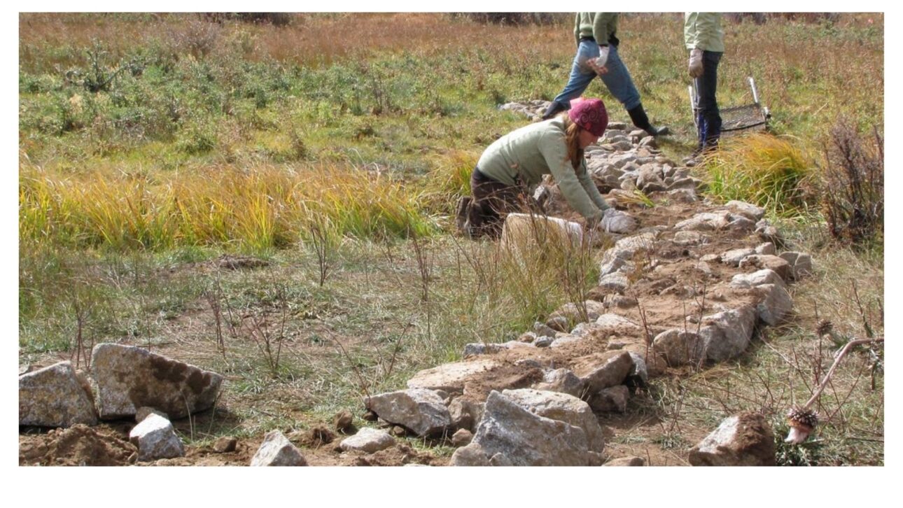
The work begins before the sun heats the ground. There is no engine, no excavator, and no concrete—just boots on gravel, gloves, and the dry sound of rock touching rock.
-
Medieval mansion undergoes a seven-year, £5 million restoration in Yorkshire, workers open a wall of a common room and find Tudor paintings from the 1550s hidden for centuries, as the complex restores hall, chapel, and historic quarters and begins to host guests for around £35 per person.

-
Men with metal detectors find two Roman lead ingots buried on a farm in Wales, pieces almost 2,000 years old marked with the name of Emperor Domitian and dated to 87 AD, revealing mineral exploitation that began shortly after the Roman conquest of West Wales.
-
Comet 10P/Tempel will make its closest approach to Earth on August 3, passing at about 61 million kilometers and could reach a magnitude of 7.4, becoming visible with binoculars under a dark sky before weakening again after being observed since its discovery in 1873.
-
At 50 years old, Silvio Santos’ daughter runs SBT, is part of a family with an estimated wealth of R$ 6.4 billion, and is trying to lead the network founded by her father into the era of streaming, 24-hour journalism, and multiplatform audience.




The group stops in front of a scar on the bed, a vertical step about sixty centimeters opened in the earth by the force of water. This is where the stones are laid, one at a time, in positions that seem random but are not. The arrangement follows a design intended for how the current will behave in the next flood.
The composition of the teams is as noteworthy as the method. Grandparents, teenagers from youth conservation programs, ranchers, and federal agency employees work side by side, moving material that fits in the arms of an average person.
The 90-year-old man no one expected to find in a ravine
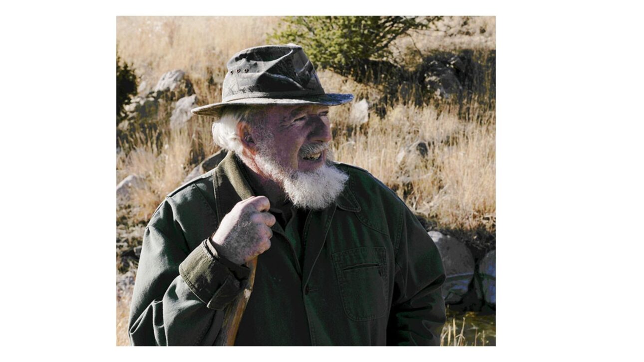
The trajectory behind this operation is one of the most unlikely in American conservation. Bill Zeedyk was born in 1935 in New Jersey, the son of teachers, and at 14 decided he wanted to work as a forest ranger.
His career followed exactly that path. He graduated from the University of New Hampshire in 1956 and, in 1962, became the first wildlife biologist assigned to the Daniel Boone National Forest. There were 34 years of Forest Service, during which he coordinated the national endangered species program in Washington and then supervised wildlife and fisheries throughout the southwest region, based in Albuquerque.
Retirement in 1990 was supposed to end the story. That’s when it really began: in 1994 he opened a consultancy to spread what he had observed in decades of fieldwork, and three decades later he continues climbing ravines with a staff, wide-brimmed hat, and white beard.
The wound was not lack of rain, it was plumbing
The diagnosis that guides the entire method stems from a simple and unintuitive distinction. The central problem of those meadows was never the amount of water falling from the sky, but the speed at which it disappeared.
No one can force an arid region to receive more rain. Preventing the land from expelling the water it has already received, however, is an intervention within reach. It was this shift in focus that separated the former forest ranger’s approach from what was practiced in the agencies.
This type of degradation is not exclusive to the American West. In Brazil, the advance of gullies and erosion grooves in pasture areas follows the same mechanics, with soil loss and lowering of the water table in lands that once retained moisture, a topic monitored by agricultural research institutions like Embrapa.
How a ditch swallows the water table of an entire meadow
The sequence of destruction often begins with something trivial. A wagon rut, the slope of a rural road, or a trail opened by cattle concentrates water that once spread across the surface into a single channel.
Concentrated, the current gains strength and begins to dig. Season after season, the channel deepens and turns into a gully, and that’s when the logic turns against the meadow. The deeper the cut, the lower it pulls the water table on both sides as the underground water flows laterally into the ditch and disappears.
The outcome is a self-feeding spiral. Wetland plants die, bare soil takes over, and the next storm finds fewer roots to hold the earth, digging the gully even deeper.
The most aggressive form of the wound has its own name
There is a specific point where this erosion becomes more violent. It’s called an erosive headcut: a vertical step in the stream bed, over which the water cascades.
The physics of what happens there explains why the damage progresses. The fall digs a small basin at the base of the step, the base gives way, the step collapses, and a new step forms just behind. The erosive headcut climbs the valley like a thread unraveling a stocking, and each year there is less meadow left behind it.
There is an involuntary marker that measures this process with uncomfortable clarity. A fence erected in 1937, with posts driven into the ground, now has those same posts hanging about a meter and a half above the bottom of a gully the difference corresponds to the soil that disappeared in a single human generation.
Less than 2% of the basin sustains almost all life
The disproportion between area and importance is what makes the problem severe. Wet meadows occupy less than 2% of the basin, and about 80% of the region’s wildlife depends on them.
The functioning of these areas resembles that of a sponge. They absorb snowmelt and storm runoff, retain this water in the soil and shallow layers, and release it slowly throughout late summer, when the rest of the landscape has already dried up.
It is this slow release that sustains the off-season color of the vegetation. In a silvery sea of sagebrush, the meadows appear as narrow strips of green, with grasses, rushes, wildflowers, and willows in the most waterlogged spots.
The bird that lost its nursery
The degradation of these sections hit a species that was already living on the edge. In November 2014, the United States Fish and Wildlife Service classified the Gunnison sage-grouse as federally threatened, with an estimated population of less than 4,000 individuals worldwide.
The connection between the bird and soil moisture lies in the feeding of the chicks. Broadleaf herbaceous plants and insects can make up to 78% of the chicks’ diet at the end of summer, and this type of food only exists where water is still retained.
The chain becomes evident when the two ends are joined. The basin was draining itself into its own ditches, and the bird was left without the moist areas where it raised its brood precisely during the most critical time of the year.
What the former forest ranger learned from the Zuni Pueblo
The origin of the method is not in an engineering manual. The Zuni Pueblo, in western New Mexico, had been cultivating arid land for over a thousand years by spreading runoff across fields with manual structures of stone and plant material.
Working alongside tribe members on a project in the Zuni Mountains, Zeedyk began to combine this repertoire with contemporary river science. What he gathered there sounded heretical to conventional engineering, accustomed to solving river issues with concrete and heavy machinery.
The underlying observation is that there was accumulated knowledge being ignored. Water and soil techniques tested for centuries remained outside the official repertoire, and it was from these that the basis of what is now called low-tech restoration emerged.
Two sayings that summarize the entire method
The first rule Zeedyk attributes to geomorphologist Dave Rosgen. “A river doesn’t want to be a lake” and the practical consequence of this is that high dams fail.
The explanation is mechanical. The waterfall carves an erosion basin at its base, which undermines and collapses the structure, or the flow bypasses the end and leaves it there, useless. Low and wide structures work with the current; high and narrow ones fight it and lose.
The second rule deals with expectation. “When it stops getting worse, it starts getting better” summarizes the idea that you don’t force a landscape to heal; you prevent it from deteriorating faster than it can grow. Zeedyk named the approach “let the water do the work,” the title of the book he co-authored with Van Clothier.
The three pieces of the toolbox
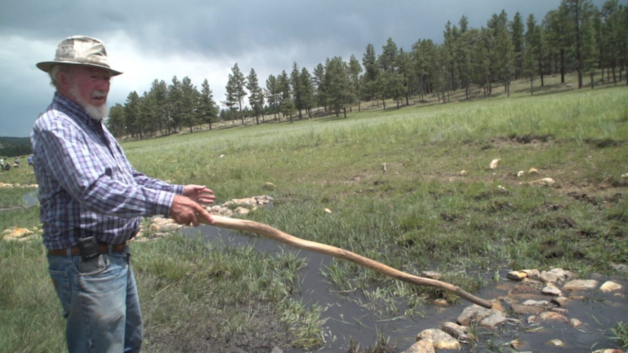
The first structure carries a name that is almost a technical joke. The one-stone dam is not a dam: it is a floor. It is a single layer of stones the size of soccer and basketballs, crossing the channel with several rows wide and only one stone high.
The effect is not to dam, but to slow down. The current loses enough speed to drop the sediment it carries, the silt settles on the stones and, season after season, the bed rebuilds around them, the ravine heals from the bottom up.
The other two pieces tackle different points. The Zuni bowl is assembled within an active erosive head and converts a concentrated waterfall into a stone staircase with successive drops and pools, dissipating the energy over many surfaces instead of just one. Meanwhile, the media luna, half-moon in Spanish, is a low crescent of rock that spreads the channeled flow back into a wide, slow sheet, which infiltrates instead of excavating.
The calculation that made ranchers pay attention
The argument that opened doors in the region was not ecological. Stream restoration with heavy equipment cost between 600 thousand and 1 million dollars per mile.
The manual alternative changed the order of magnitude. With hand tools and volunteers, the cost per mile was between 50 thousand and 100 thousand dollars, about ten times less, a value that fits the budget of local properties and programs.
The institutional arrangement formed around this. A climate vulnerability assessment for the basin was conducted in 2009; the following year a working group was formed bringing together the Bureau of Land Management, the Forest Service, the state parks and wildlife agency, ranchers, and youth conservation corps. The first site was installed in 2012, on private property of a local rancher.
Eight years stepping on the same points with a clipboard
The rarest part of this story is that someone took the trouble to measure. Renée Rondeau, from the Colorado Natural Heritage Program, designed the study with the rigor that a skeptical audience would demand.
The sampling was constructed to allow direct comparison. There were 135 sampling points within the treated drainages and 30 untouched points outside them, as a control, surveyed over eight years.
The climatic context of the period reinforces the test. Six of the nine monitored years were considered drought years, within the driest two-decade stretch the region has experienced since approximately the year 800.
What the numbers showed
The main result is in the vegetation cover. In the treated transects, the average wetland vegetation cover rose from 62% to 86%, which represents a 40% improvement when measured against the control points.
The project’s own goals were also achieved in most cases. Ten of the twelve monitored units reached the five-year target, including the four perennial meadows and six of the eight ephemeral units.
Some isolated indicators are especially significant. In one of the units, the Baltic rush jumped from 1% to 36% coverage; in two perennial units, the Canada thistle, an invasive plant, retreated by more than 80%; and native herbaceous and grass species, important for both birds and cattle, advanced in 67% of the units.
Where the method did not work
The study does not present the result as a uniform victory, and that is one of the reasons it carries weight. Only about half of the drainages showed a statistically significant difference compared to the controls.
Some limitations were at the starting point. Two ephemeral units were already among the wettest in the set and had practically no room for improvement, which reduces the chance of any intervention appearing in the numbers.
There are also factors that the design could not isolate. Grazing pressure could not be ruled out as a variable, and some structures had to be repositioned after intense storms.
The bird reappeared, and no one can prove why
Species counts fluctuate in cycles of highs and lows, and the year 2019 marked the lowest point since the current monitoring methodology began to be applied in 1996. In the following years, the numbers rose again in the basin.
The temptation to link one thing to another is great, and the state agency itself did not do so. A wildlife manager credited the recovery to an especially rainy July, and not to the stone structures.
Caution is justified and does not negate the coincidence. Birds move for many reasons and the direct cause is impossible to demonstrate, but water available in July is exactly what a healthy meadow should retain and exactly what the structures were designed to prevent from draining away.
From the satellite, the same conclusion
A second team approached the subject from a completely different path. A study led by Nicholas Silverman, published in 2019 also in Restoration Ecology, used vegetation indices obtained by satellite to evaluate low-tech restoration projects, including the Gunnison basin.
The conclusion pointed in the same direction as the fieldwork. The survey identified a net increase in vegetation productivity in the treated areas compared to similar control sections, in addition to examining vegetation sensitivity to precipitation as a measure of resilience.
The convergence between methods is what gives solidity to the set. One team counting plants on foot and another measuring greenery from orbit reached the same result, with independent databases from each other.
The technique came out of Gunnison
The current scale far exceeds the initial experiment. The Upper Gunnison River Water Conservancy District now records more than 2,670 such structures along 49 miles of watercourse.
The practice has also entered institutionalization. The federal natural resources conservation service incorporated the technique into its agricultural funding line in 2018, and in 2023 Colorado passed state legislation addressing restoration with small structures in ephemeral streams in the context of water rights management.
Other regions have adopted the repertoire with adaptations. In northern New Mexico, Comanche Creek has once again housed cutthroat trout; in the Navajo Nation, Pueblo Colorado Wash, once a deep ravine, raised the bed about three meters in twenty years. In some projects, stone structures are combined with beaver dam analogs, made of stakes and brushwood, and there are cases of reintroducing the animal itself in sections where it hadn’t appeared for a century.
The limits that remain standing

Not everything in the method is transferable, and those who work with it are usually the first to say so. Not every watercourse is a candidate, the structures require specialized design, and grazing management almost always needs to change along with the physical work.
There is also a legitimate question from those downstream. Downstream users want to know if the restoration alters the timing of water arrival, and the available answer suggests more water in the meadow at the end of summer and more base flow just below it.
The counterpart appears in the annual count. It is possible that there is a slight reduction in total water production throughout the year because the recovered vegetation consumes part of what was retained—an exchange that needs to be evaluated basin by basin.
Almost 900 hand-stacked stone structures between 2012 and 2020, seven drainages, eight years of measurement, and a 40% increase in wet vegetation during the most severe drought in about twelve centuries, for a tenth of the cost of heavy machinery. A 90-year-old former forest ranger, who has trained thousands of volunteers and helped design improvements in hundreds of miles of streams, sums it up by saying that the river has plenty of time and the rush is ours.
And you, do you think a manual and cheap technique like this would work in the erosion areas of Brazil? Or has the problem here already gone beyond the point where stacked stones can solve it? Share your thoughts in the comments and tag someone who understands land and water.


