 Portuguese
  English
  Spanish
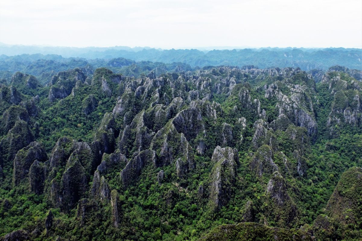
The caves of the Phong Nha-Ke Bang and Hin Nam No national parks are part of an exceptional karst landscape, with deep dolines, giant subterranean rivers, and rare and endemic species.
The caves of a cross-border complex between Vietnam and Laos hold a rare geological history: the limestone karst formations began to develop about 400 million years ago, in the Paleozoic era, making the area one of the oldest large-scale karst systems in Asia. The result is a landscape with dramatic cliffs, deep dolines, and an impressive underground network.
More than 220 kilometers of caves and subterranean rivers have been documented, many with global significance due to their size, beauty, and scientific value. In addition to the natural spectacle, the caves support highly specialized ecosystems, with rare, threatened, and endemic plants and animals, reinforcing the park’s role in conservation efforts.
Where the caves are located and why this park is considered unique

The set includes the Phong Nha-Ke Bang National Park and the Hin Nam No National Park, forming a cross-border property along the border between Vietnam and the Lao People’s Democratic Republic.
-
The Israeli Air Force trains pilots for modern warfare with the M-346 Lavi, simulating real combat, in-flight refueling missions, advanced virtual integration, and rigorous training to operate F-35I, F-15I, and F-16I in high-threat scenarios.

-
An employee of a paper factory disobeyed the Nazis’ order to destroy the party files, hid millions of records, and today these documents are revealing family secrets that Germany preferred to keep hidden for decades.

-
No more expensive plaster: a technique that adheres panels directly to masonry speeds up renovations, cuts costs, and gets everything ready for painting.

-
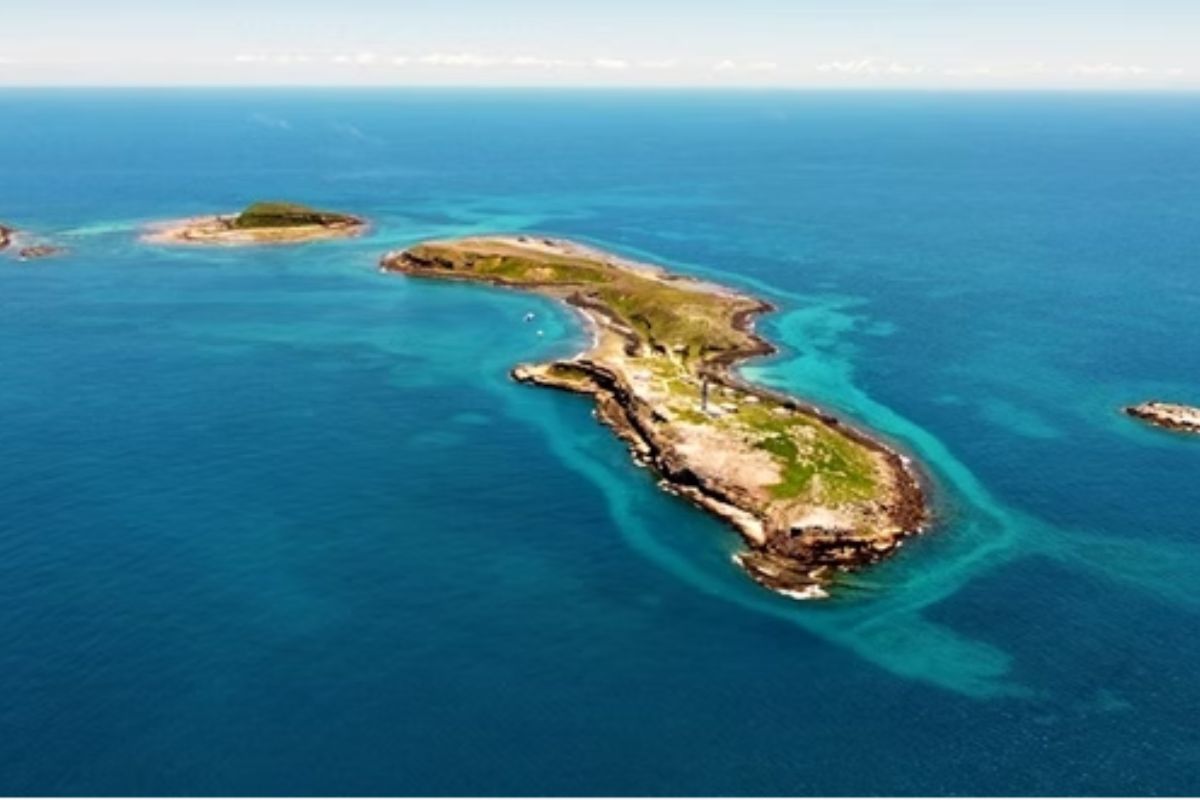
Abrolhos shows that preservation also brings returns: a study indicates R$ 1.9 billion generated, 100,000 jobs supported, and tourism, fishing, and conservation units transforming biodiversity into an economic engine in southern Bahia and northern Espírito Santo.
The combined area mentioned is 217,447 hectares, positioned at the confluence of the Anamite Range with the Central Indochina Limestone Belt.
The highlight is not only the number of caves but the integrity of the humid tropical karst terrain. It is one of the most well-preserved and impressive limestone landscapes in the world, with surface formations and underground structures that serve as a “record” of past geological processes.
How the caves formed over 400 million years
The karst formation evolved since the Paleozoic, with water dissolving limestone over eras, opening passages, subterranean rivers, and internal chambers. The topography became even more complex due to the intercalation of karst limestone with schists, sandstones, and granites, which helps explain the variety of forms in the relief.
Underground, the diversity of caves includes dry systems, terraced passages, dendritic networks, and active river caves. These structures record ancient changes in river courses, abandoned passages, and deposits of giant speleothems, evidence that adds scientific value to the set.
220 km of caves and subterranean rivers: the size of the hidden labyrinth

The survey documented more than 220 km of caves and subterranean rivers. The description highlights that many of these stretches have global importance due to their size and beauty, forming a “mosaic” of underground environments with rivers, natural pools, and stretches of great continuity.
Among the internationally relevant examples are the Son Doong and Xe Bang Fai caves. Son Doong is noted as the largest documented cave passage in the world in terms of diameter and continuity, while Xe Bang Fai is described as the largest active river cave passage and houses the largest natural pool of water formed by calcite deposits in a cave.
Rare biodiversity: species that depend on the caves and karst
The region supports ecosystems ranging from dry high-altitude karst forests to dense lowland wet forests, in addition to underground environments. This combination creates multiple ecological niches, favoring speciation processes and the emergence of highly specialized species.
The cited numbers reinforce this richness: in Phong Nha-Ke Bang National Park, more than 2,700 species of vascular plants and 800 species of vertebrates have been recorded, with 237 globally threatened species at the time of inscription and 400 endemic species from the central region of Laos or Vietnam.
In Hin Nam No National Park, more than 1,500 species of vascular plants and 536 species of vertebrates have also been recorded, including threatened and endemic species.
One cited example is the giant spider-hunting spider, described as the largest spider in terms of leg span in the world and endemic to Khammouane province in Laos.
Additionally, the area is home to 10 to 11 species of primates, with four endemic to the Anamite Range, including the largest remaining population of southern white-cheeked gibbons and the black langur.
Why this heritage requires strict rules for protection and management

The property follows the boundaries of national protected areas and adopts management zoning. In Phong Nha-Ke Bang, there are three mentioned zones: strictly protected, ecological restoration, and administrative and service. In Hin Nam No, there are two: controlled use and totally protected.
A buffer zone surrounds the entire area, with 295,889 hectares, encompassing the respective watersheds of the karst. This design is important because, in karst systems, what happens outside the entrances of the caves can directly affect the groundwater and the ecological stability of the set.
Threats to the caves: why tourism and exploration need limits
The conservation status varies within the property, and the text points out risks that could compromise long-term integrity.
Among the cited threats are illegal hunting, unsustainable exploitation of natural resources and forest products, invasive exotic species, infrastructure development, changes in land use, and tourism pressure, especially in the eastern part.
The central point is the ecological carrying capacity. The caves and their subterranean rivers are sensitive environments, and uncontrolled growth of activities can affect biodiversity, water, and the scientific value of the area itself.
How cooperation between Vietnam and Laos works to protect the caves
Cross-border management is described as being supported by memorandums of understanding for joint activities, such as enforcement operations and the development of an integrated action plan.
Each park also has its own management plans, with governance structures involving different levels of government and community participation, especially in Hin Nam No.
The logic is simple: a cave system does not “stop” at the map line, so protection needs to be coordinated to maintain the set as a block of intact ecosystems along the Anamite Range.
If you were to visit these caves, what would catch your attention more: the scale of 220 km of subterranean rivers or the chance to see rare species that only exist in this karst between Vietnam and Laos?


Seja o primeiro a reagir!