 Portuguese
  English
  Spanish
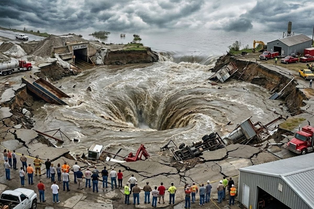
On November 20, 1980, an entire lake of fresh water just 3 feet deep turned into a crater when a Texaco drill punched through a salt mine. In just a few hours, 3.4 billion gallons drained, barges vanished, and the canal inverted its flow toward the Gulf
On the morning of November 20, 1980, an entire lake in Louisiana made headlines for a reason no one imagined seeing outside of a natural disaster. The crew of the Texaco platform noticed the drilling stuck beneath the surface and, after loud cracks, saw the structure tilt. In about an hour and a half, the 150-ton platform, estimated at US$ 5 million, disappeared at a point where the average depth was approximately 3 feet, as the water rushed to the “ground zero” as if someone had pulled the drain.
What followed was a sequence of hours that altered the local landscape: a whirlpool dragged boats, barges, and 11 towboats, along with chunks of land and trees, and accelerated drainage dried out an area estimated at around 5 km² in no time. Then, the hydrological dynamics went out of the ordinary, with inverted flows, saltwater intrusion, and pressure phenomena that only reinforced the scale of the geological collapse.
Salt Domes: The Subsurface That Explains the Impossible

The backdrop behind the entire lake involves a geological feature typical of the region: salt domes.
-
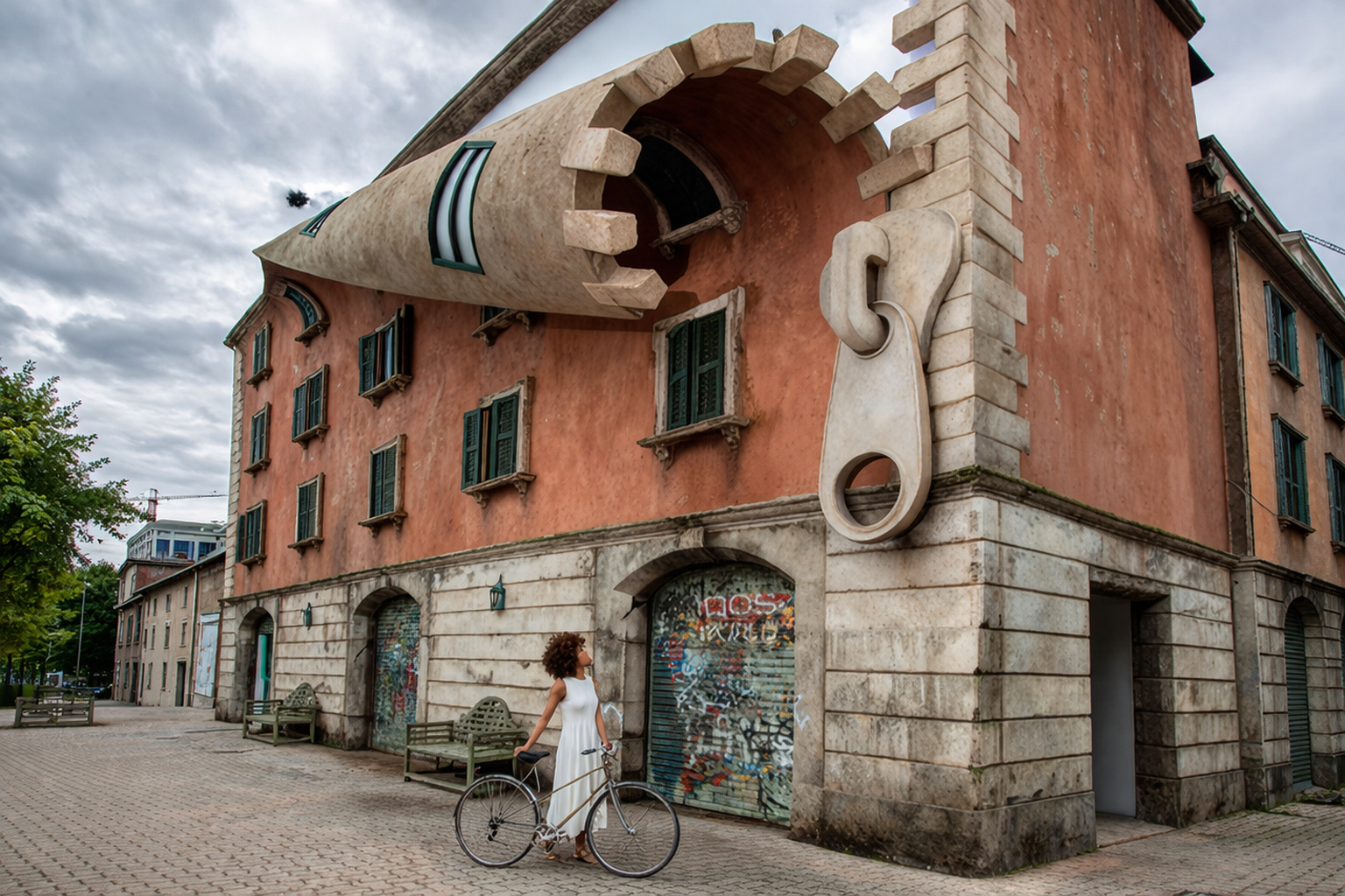
With a façade that resembles a giant zipper, the building in Milan creates a sense of strangeness, featuring lighting that transforms engineering and attracts the attention of residents and tourists.
-
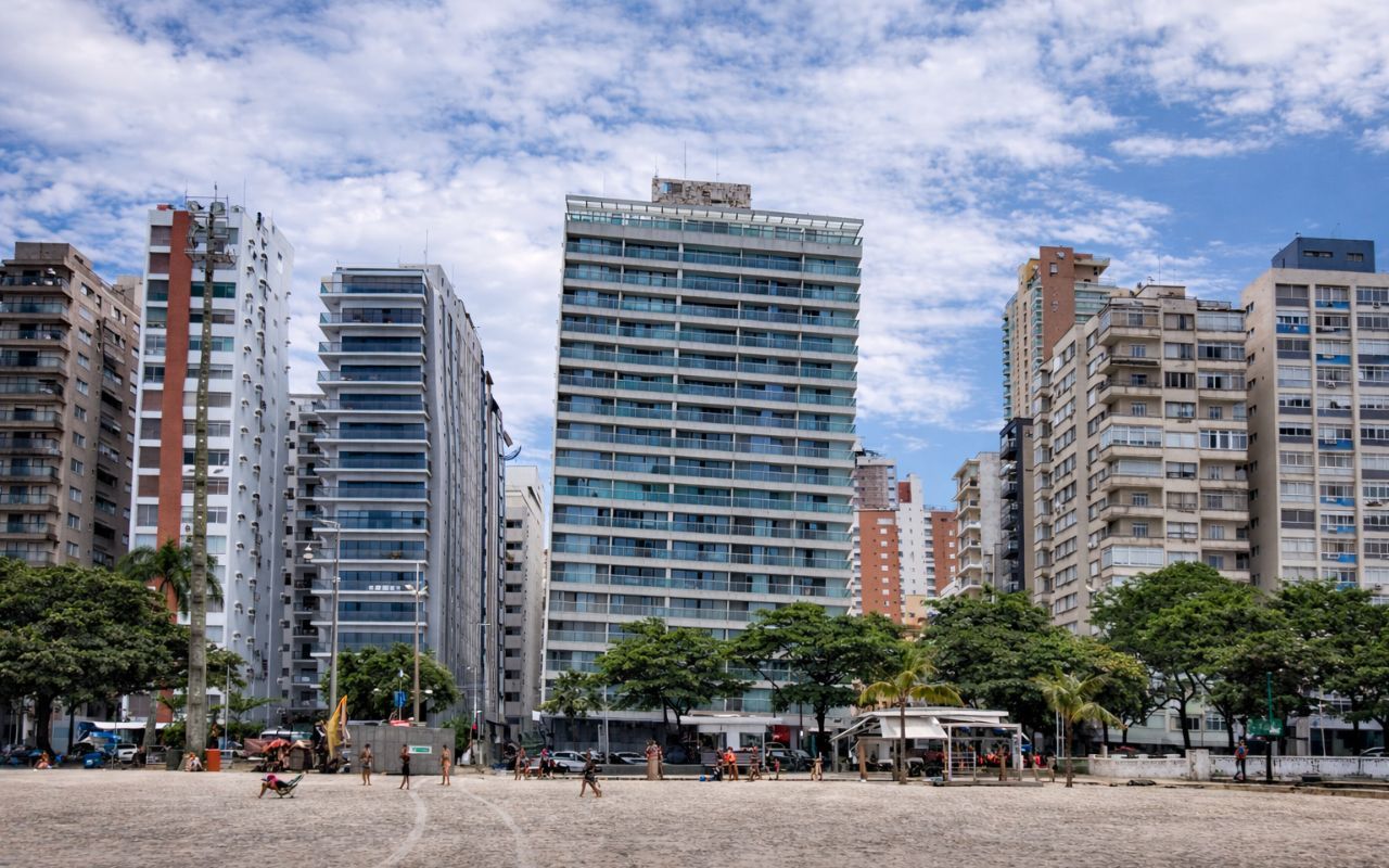
The Brazilian city has 319 crooked buildings built on sandy soil without proper deep foundations, houses the largest beach garden in the world, with over 5 km, and is still considered the birthplace of surfing — meet Santos, in São Paulo.
-
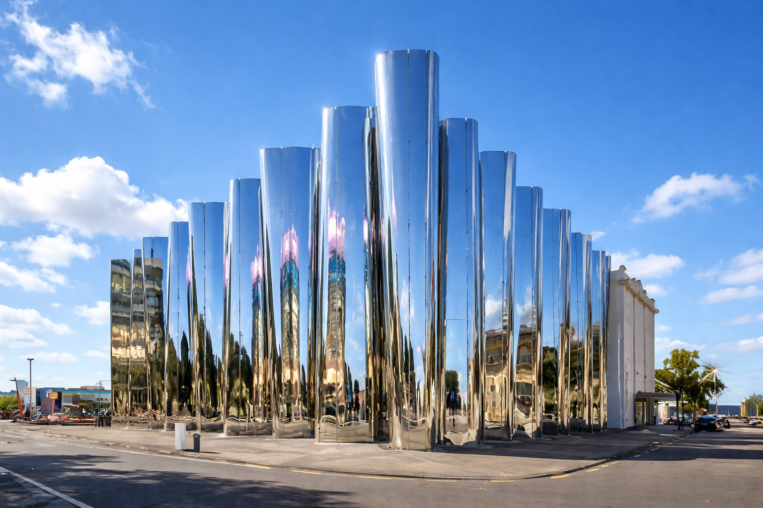
New Zealand builds a shimmering building that vibrates, featuring a 62-seat cinema, moving sculptures, and an environment where sound, light, and energy are felt in the body.
-
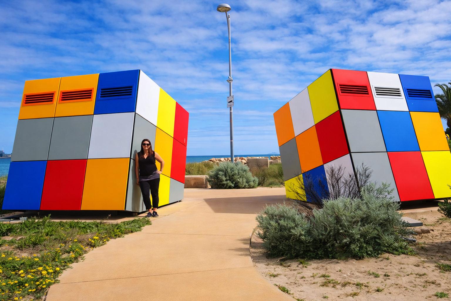
Two colored cubes of 2.5 m transform a public bathroom into a selfie spot in Western Australia, costing up to 75% less than traditional construction and helping to reduce vandalism in public spaces.

In Louisiana, there are at least 128 formations of this type mentioned in the account, created over millions of years, when ancient salty waters receded leaving layers of salt buried beneath rocks and sediments.
As salt is “lighter” and tends to rise compared to the heavier rocks above, it can break through geological layers and form massive domes, raising the terrain and creating hills.
It is in this context that references appear to the “five islands” of southern Louisiana, tied to salt domes that shape the landscape and have become markers for locals and travelers.
The First Hour: The Drill Jams, The Structure Tilts, and The Lake Begins to Get Away

The account describes a critical interval between the jammed drill and the moment the platform began to tilt.
As 12 men tried to free the drill, the situation worsened underwater, with no clear sign on the surface until the cracks and the tilt.
When the platform sank, the water from the entire lake began to flow toward the drilling point.
The comparison is direct: it looked like “a drain,” only on a scale capable of dragging vessels and altering the behavior of nearby channels.
The Artificial Whirlpool and the Domino Effect in the Surroundings
The suction was described as capable of swallowing not only the platform but also surrounding structures.
The whirlpool pulled 11 barges inside and then hit a tugboat in the canal that struggled against the current until the crew jumped to shore.
Hours later, the depression became a deep crater.
The account points out that more than 3.4 billion gallons of water would have drained, and a ruptured gas pipeline in the center of the crater caught fire, sending smoke and flames into the sky, to the extent that flight paths were redirected due to perceived risk of natural gas explosion.
The Tallest Waterfall in the State and the Intrusion of Saltwater
With the drainage and rearrangement of the system, a canal connecting the lake and the bay began to change direction, allowing saltwater to advance where there had previously been fresh water.
The account describes the emergence of the tallest waterfall in Louisiana, with height cited between 64 and 100 feet, for several days.
Besides that, the water and air under pressure burst through wells “like compressed air,” in geysers described as 400 tons, until the system began to stabilize.
The Invisible Underground Mine and The Error That Opened the Dolina
The central point: the entire lake had drained into a salt mine.
Salt exploration in the region had already been taking place, and the mentioned mine had multiple levels, reaching 1,500 feet deep, with wide tunnels and salt pillars supporting the ceiling.
The account attributes the trigger to the oil drilling that would have hit an inactive level of the mine.
The fresh water, upon entering, dissolved salt, widened the collapse, and accelerated the process until it became irreversible.
The delay between the stuck drill and the final tipping appears as part of the problem: while trying to understand the jam, the dissolution was advancing.
How the Lake Changed: From Shallow and Fresh to Deep and Brackish
The final result described is a new water body with an opposite profile to the original.
What was a sweet and shallow lake turned into a brackish lake with maximum depth cited of 200 feet, pointed out as the deepest in Louisiana in the account.
A visual detail summarizes the change: the chimney of a house on the edge of the former lake would remain visible above the water, solitary, as a physical mark of what was swallowed.
Oil Industry, Local Economy, and The Judicial Bill of the Collapse
The account contextualizes the economic strength of the oil and gas sector in Louisiana, citing that it generates about a quarter of the state’s revenue and supports tens of thousands of jobs.
It also explains why salt domes attract drilling: being impermeable, they can form traps and favorable structures for hydrocarbon accumulation.
In the legal consequences, compensations appear: a foundation linked to a plantation sued the companies after more than 64 acres of coastal properties were swallowed and received US$ 12 million.
Texaco was said to have been ordered to pay US$ 45 million to the salt company mentioned in the account, in disputes over miscalculations and underground maps.
Underground mining on Jefferson Island, in turn, was said to have ceased, leaving workers unemployed.
No Human Victims, But Rescues on the Brink
Despite the visual impact and the geological collapse, the account highlights that there were no human victims.
The 55 workers in the mine were said to have been saved, and the evacuation occurred with discipline, using the only available elevator.
There is also the information that three dogs died.
As for the barges, there is a relevant data point for the timeline: nine out of 11 would have emerged and floated again after the water pressure equalized.
What Continued After: Gas Storage and Fear of Repetition
Since 1994, the account mentions that AGL Resources began using a salt dome as storage and center for compressed natural gas, with expansion plans that generated local resistance.
The main fear cited is intrusion of saltwater into the local aquifer and safety risks for nearby residents, including two schools within a 1.8-mile radius.
The method described for creating new caves is straightforward: drill, pump millions of gallons of water to dissolve the salt, and remove the brine, leaving space for storage.
The unease in the narrative is that the cost may fall on drinking water and safety.
Bayou Corne: Bubbles, Diesel Smell, and a Crater That Grew for Years
The account connects the theme to another episode in Louisiana.
In Bayou Corne, residents reported bubbles and underground noises starting in late May 2012.
On August 3, they awoke to a strong smell of diesel, accompanied by the formation of a dolina.
The first dimensions mentioned were 200 x 200 feet, then cited as about 370 feet in diameter, with reference to 128 meters deep.
There was evacuation of up to 350 people, and the order could drag on for years.
A turning point in the account is the expansion: from 2.5 acres to nearly 35 acres by 2018, with indication that it was still growing.
Minimum Distance, Cave Maps, and Closure of Critical Areas
There is a section focused on risk measures: state records cited in the account point to underground installations “dangerously close” to the edges of support formations.
Among the actions, the proposed minimum distance of 300 feet from the so-called dome edge appears, in addition to long-term monitoring.
Data requirement for 256 caves in relation to salt boundaries is also mentioned.
Within this, 27 would be too close to the established limit, six less than 30 meters and, therefore, to be closed, while another 21 between 90 and 100 meters would have to prove safety within a year, even with many already out of use.
An Unexpected Biological Detail: Extreme Salinity and “Unlikely” Bacteria
After the collapse, the account describes a sharp change in the chemistry of the entire lake: the water would have gone from less than 2% salt to 32%, which appears as “nine times saltier than seawater” in the narrative.
In this context, collected samples would have revealed microorganisms from a group that prefers salty environments, with ideal level cited of 18%, but still found with 32%.
The explanation presented is the possibility of hibernation for long periods, with the underground salt associated with ancient formations, dated in the account at 125 million years, and organisms preserved in droplets trapped in crystals.
Territory, Public Access, and Attempt to Reduce Tension
The text also records a change in the relationship with the community: an agreement with a community group to “save” Lake Peigneur, with a donation of 23 acres near the lake for the creation of an environmental center, preserving the natural area and ensuring free access under conditions.
The narrative suggests that after disputes and opposition, the company began to better inform residents about operations and became more open to hearing concerns, especially in a scenario where the past left geological and social scars.
The story of the entire lake that disappeared in 1980 is not just an episode of visual shock. It exposes how geology, mining, and drilling can collide in minutes and how risk can continue decades later when ancient caves become energy infrastructure and the surrounding area demands security and transparency guarantees.
If you live near areas with mining, salt domes, or underground storage, it’s worth following local alerts, community meetings, and discussions on distances for safety and continuous monitoring.
Do you think regions with salt domes should have stricter rules for drilling and storage, or is the risk an inevitable part of the local economy?


-

-

-

4 pessoas reagiram a isso.