 Portuguese
  English
  Spanish
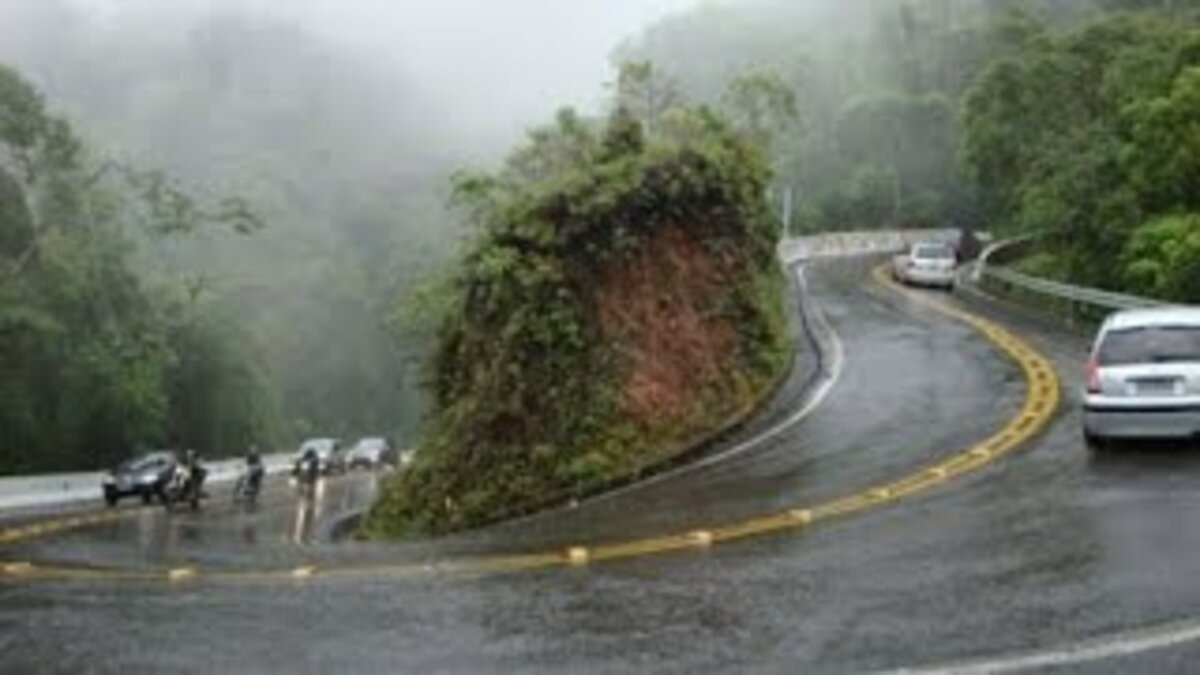


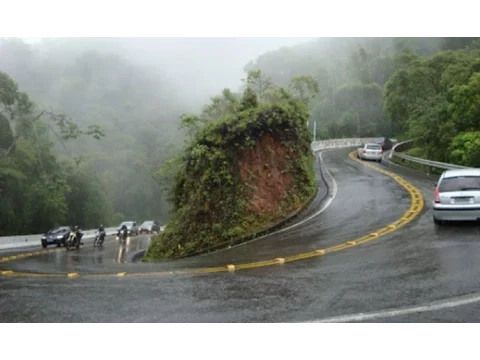
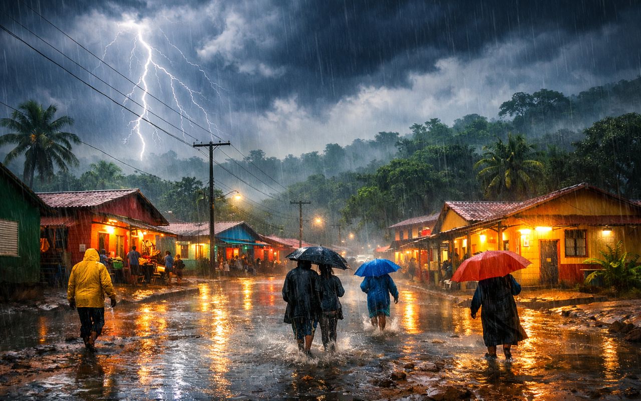
The Descent of the Serra de Ubatuba, Known for Its Acute Curves and Unpredictable Weather, Requires Technique, Preparation, and Extra Attention from Those Adventuring Toward the Paulista Coast
Anyone planning to travel toward the northern coast of São Paulo, especially toward Ubatuba, should prepare well. The descent of the Serra is considered one of the most challenging in the country because it combines tight curves, steep sections, and unpredictable weather conditions. Therefore, the route requires constant attention and full control of the vehicle.
Reports of Tension on the Road
Among the travelers who shared experiences on Tripadvisor, there are reports that highlight how challenging the journey can be.
A user named Smb reported that her children became ill during the descent due to the numerous curves.
-
These are the drivers who may stop paying tolls on highways in a project that promises to reduce costs for those who live from transportation in Brazil.
-
(Video): Italian pilot lands plane on moving train at 120 km/h and achieves unprecedented feat in aviation, even with a narrow runway and without direct visual contact.
-
It seems to have come out of a science fiction movie: A Brazilian city where it rains almost every day, recording over 4,000 mm per year, driven by climatic factors — a direct result of its strategic location in the Amazon.
-
The water crisis that could change everything this year has already begun; it’s not just about the climate, it affects technology, raises product prices, and can halt entire companies without warning.


According to her, there was no shoulder or space to stop and provide assistance. “It was very tense. I do not recommend it and will never take this road again,” she stated.
Another report, from user Gean Panne, describes an even more complicated crossing. He ascended the Serra de Ubatuba via the Oswaldo Cruz Highway amidst a dense fog.
“It was one of the most tense moments of my life. What they say about the elbow curve, it really is elbow curve,” he wrote.
According to him, visibility reached almost zero. “I couldn’t see a hand’s breadth in front of the car. Never again, NEVER again will I go through it,” he added.
The testimonials reflect how frightening the stretch can be for unprepared drivers.

The Right Gear Offers More Control
In vehicles with manual transmission, experts recommend using the same gear for descending that would be used for ascending.
This helps maintain control of the car and avoids overloading the brakes. The technique, known as engine braking, is particularly advised on long, steep hills.
In automatic cars, it is essential to monitor the engine’s RPM. Generally, the system automatically downshifts, but if the RPM is too low, the driver can manually intervene using the gear lever or paddle shifters on the steering wheel.
Basic Care for a Safe Descent
Using engaged gears is the main recommendation as it offers more stability and reduces the need to brake frequently. Additionally, it prevents the brake system from overheating.
Before starting the journey, it is advisable to check the weather conditions and avoid times with heavy fog. With attention and caution, the trip to Ubatuba can be made in a calm and safe manner.
You May Also Like: Discover the Bayburt D915: the road that climbs 1.83 km in the mountain, without safety, with fatal curves and long drops, now rated the most dangerous in the world
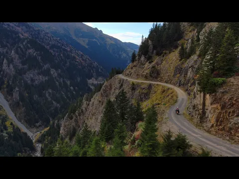
The Bayburt D915 road, in the province of Trabzon, Turkey, has been rated the most dangerous in the world. With a length of 106 kilometers, it cuts through the Soganli mountain at 6,000 feet (1.83 km) high, full of tight curves and lacking safety barriers.
The road connects Bayburt to the coastal city of Of. Despite the risks, many locals prefer this route to alternative options that require more detours and travel time.
Curves Without Margin for Error
Referred to as the “road to hell,” the D915 challenges even experienced drivers. There are 29 tight curves without any lateral protection, requiring maximum concentration. The scenery is stunning, but any distraction can be fatal.
A small mistake can lead the vehicle to fall from heights of up to 275 meters. The road has already recorded many fatalities, reinforcing its global reputation for danger.
The danger does not lie only in the layout. Even during summer, dense fog drastically reduces visibility.
Additionally, there are constant risks of avalanches and landslides, requiring permanent attention from drivers.
Road Built in 1916 with Gravel
The history of the D915 begins in 1916 when Russian soldiers constructed the route using gravel from the mountain itself.
Today, although much of the road has been paved, the central section remains with loose gravel, further complicating drivability.
Narrow Lanes and Daily Traffic on the Most Dangerous Road in the World
In some sections, the road is so narrow that two vehicles cannot pass side by side. Even so, traffic remains heavy, with locals using trucks, cars, and motorcycles every day.
During winter, the road is usually closed. Heavy snowfalls make the slopes slippery and completely compromise visibility, increasing the risk of accidents.
Worldwide Recognition
The D915 was voted the most dangerous road on the planet by the website dangerousroads.org, following a survey of drivers from different countries.
The portal stated, “words and images are not enough to describe how dangerous this road is.”
With that, the D915 surpassed the famous Death Road in Bolivia, which recorded up to 300 deaths per year.


Conheço ela muito bem.
Tem trechos que vc tem que descer de 1a marcha .
Eu adoro esta aventura!
A impressão que tenho, que, apesar de serem poucas curvas, a Serra do Corvo Branco, em SC é mais íngreme. Depois do trecho de precário asfalto, a estrada de terra segue pela beira do precipício, sem qualquer proteção. (Obs: isso, antes das obras, as quais estão em andamento)
Realmente pelo o video é bem estranha mesmo.
Mas ja viram a serra MORRO DO FAMA EM PATY DO ALFERES .
Não perde pra essa não .
Só é menor.