 Português
  Inglês
  Espanhol
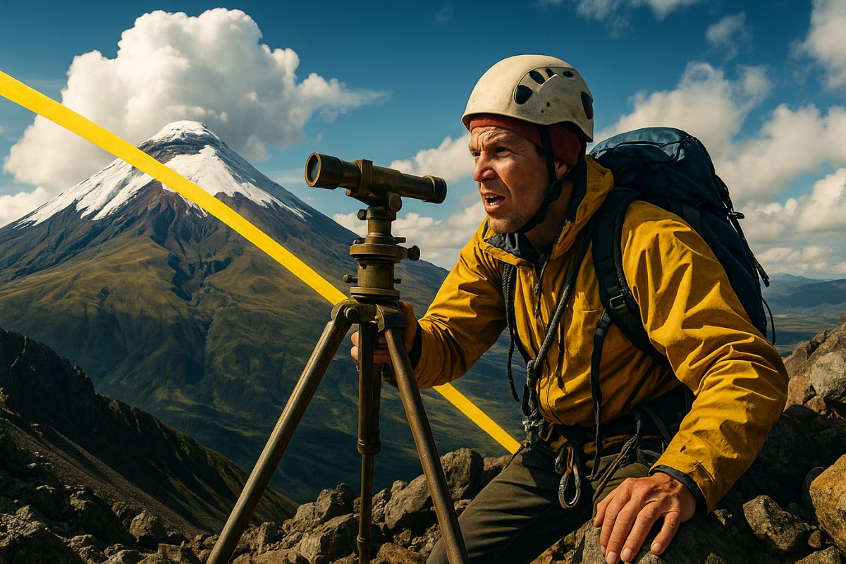
Eighteenth-Century Expedition Risked Lives in the Ecuadorian Mountains to Measure the Earth and Define Where the Largest Circle of the Planet Passes
Few people know, but the creation of the Equator line as we know it today is not the result of a simple geographical assumption, but rather one of the most dangerous and decisive scientific missions in history. Facing jungles, extreme altitudes, and even murders, a French expedition traveled through what is now Ecuador in the eighteenth century to measure the curvature of the Earth and verify a theory by Isaac Newton.
To accurately define where the Equator line passed, the group led by La Condamine had to measure hundreds of kilometers between mountains, calculate stellar angles, and cross one of the most hostile terrains in South America. The result was a measurement with an error of less than 100 meters, even with the limited technology of the time.
It All Started with a Simple Question

In the eighteenth century, there was a fundamental doubt: was the Earth a perfect sphere or did it have deformations? Newton proposed that it was flattened at the poles, but empirical evidence was lacking.
-
With an unusual prize, Japan transforms office chairs into a resistance race on the streets, ISU-1 Grand Prix grows, fills stages, and pays 90 kilograms of rice.

-
House in England with a 7.6-meter shark embedded in the roof attracts attention worldwide and becomes a curious attraction in Oxford.
-
Masterpiece in Spain, under construction since 1882, receives 4.8 million visits in a year and impresses with its gigantism and architecture.
-
Attracting around 250,000 people a year, a lighthouse 200 meters from the sea, on a 60-meter high cliff, on the North Sea coast in Denmark, becomes one of the most impressive examples of how nature can threaten historical buildings.


France then sent a team to Ecuador to resolve the issue, as the Equator line represented the point of greatest diameter of the planet, an ideal location for this verification.
The mission from the French Academy of Sciences departed in 1735 toward Quito, which is almost exactly where the imaginary line crosses South America.
The objective was to measure an arc of meridian, comparing their results with those obtained in French soil. This would allow them to calculate the radius of the Earth at that latitude.
Three Degrees, One War, and Several Tragedies

The scientists chose two points 330 km apart and began the process.
With six-meter metal rods, they manually measured the distance between the points, while simultaneously erecting towers to calculate angles with stars.
The terrain, however, was brutal: deep valleys, incessant rains, storms, and altitudes above 4,600 meters turned the mission into a nightmare.
Even in 1737, the team’s doctor, Jean Seniergues, was murdered after defending a local woman.
The trauma almost caused the expedition to fail.
Subsequently, internal disputes among the scientists divided the group, who began to work separately and in a state of constant tension.
Historical Results and the Origin of Modern Precision
Despite all the setbacks, the final data confirmed Newton’s theory: the radius of the Earth at the Equator was larger than the radius measured in Europe.
This proved that the planet was flattened at the poles.
Using stars as reference, the scientists were able to pinpoint the exact latitude of the Equator line: 0°0’0″.
The point was located near Quito.
After the mission, La Condamine decided to return through the Amazon.
He and two assistants descended the river on a raft, mapping 5,000 km of unexplored territory, collecting data and confirming the position of the Equator in different stretches.
Meanwhile, his colleague Pierre Bouguer returned via the traditional route and published the data first, creating a scientific feud that would last for decades.
The Mistake That Became a Monument
Despite the expedition’s precision, the tourist monument “Mitad del Mundo,” built in Quito in 1936, is in the wrong location.
It was based on old measurements, and today it is known, with the help of satellites, that it is 240 meters south of the real line.
The true point passes through a nearby museum, but most visitors still take pictures at the wrong location.
The Equator line, now calculated based on the WGS 84 model (used by all GPS systems), has a direct origin in this mission from 1736.
It is essential for air routes, satellites, and geographical measurements around the globe.
The Line That Still Moves
Even with all modern technology, the Equator line is not fixed.
The polar movement and the drift of tectonic plates cause it to oscillate a few meters per century.
The ground where La Condamine made the measurements has risen about two meters since then.
Still, the principles used in that expedition—angular measurements, triangulation, and Newtonian physics—remain the foundation of modern geodesy.
The expedition lasted 10 years. Of the 11 original members, three died, one disappeared in the jungle, and another returned mad.
La Condamine spent his entire personal fortune and died poor, but his work was essential to saving billions in future navigation, signaling, and global infrastructure errors.
Have you visited the “Mitad del Mundo” monument or did you know it is in the wrong place? What surprised you most about this story? Comment below!


Seja o primeiro a reagir!