Portuguese
  Spanish
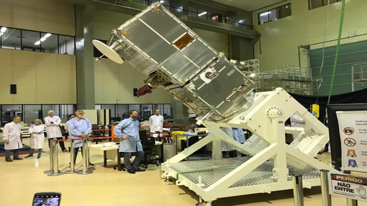
The Fully Brazilian Satellite Amazônia 1, Expected to Launch on February 22, 2021, Will Protect the Amazon Rainforest from Deforestation
The Amazônia 1 satellite, developed in Brazil, will be used to provide more accurate data and monitor especially the Amazon Rainforest for deforestation. It was shipped on Tuesday (12/22) to India, where it will be assembled and launched into space in February 2021. Looking for a job? Recruitment in Rio de Janeiro Demands Job Vacancies for Technicians and Engineers in Industrial Maintenance Sectors
Read Also
- Equipment Manufacturer in São Paulo Is Hiring for Job Openings in Maintenance and Planning Sectors
- HR of Engeman Macaé Closes the Year Calling for Offshore Vacancies
- Recruitment and Selection SBM Offshore in Rio de Janeiro, São Paulo, and Vitória for Internship Vacancies
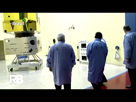
It took 52 special containers to safely transport the satellite’s modules, which weigh 638 kg. The shipment took place on an aircraft that departed from São José dos Campos in São Paulo.
The Amazônia 1 project started eight years ago, developed at the National Institute for Space Research (Inpe) in partnership with the Brazilian Space Agency, being the first Earth observation satellite entirely designed, integrated, tested, and operated by Brazil. The project is coordinated by the Ministry of Science, Technology, and Innovations (MCTI) and cost R$400 million.
-
Half of Brazilians Prefer Lower Taxes with Private Health and Education, While 44% Opt for Higher Taxes for State-Provided Services, Datafolha Survey Reveals

-
Brazil’s Most Expensive Toll Rises to R$ 40.60 on Route from São Paulo to the Coast, Nearly Matching Bus Fare to Santos

-
As Brazil Expands Social Welfare, Survey Reveals 40% Blame Poverty on Laziness, While 58% Cite Lack of Opportunities

-
China Tightens Control on Antimony, Driving Prices from $22,000 to Nearly $40,000 per Ton as U.S. Rushes to Bolster Strategic Reserves


For the President of the Brazilian Space Agency (AEB), Carlos Moura, it is a privilege for Brazil to see its space program consolidating this achievement. “This is largely due to the technological capabilities of the people, scientific development, but also to the logistical effort that continues until it reaches India, and also the administrative effort, which is a victory for all institutions,” he said.
The Brazilian satellite Amazônia 1 will be able to provide data from a specific point in 2 days. This feature is extremely valuable in applications such as deforestation alerts in the Amazon, as it increases the likelihood of capturing useful images amid cloud cover in the region.
About the Brazilian Satellite Amazônia 1
With six kilometers of wires and 14 thousand electrical connections, Amazônia 1 will be the third Brazilian remote sensing satellite in operation, alongside CBERS-4 and CBERS-4A.
Amazônia 1 is a sun-synchronous orbit satellite (polar) that will generate images of the planet every 5 days, thereby having the capacity to provide a significant amount of data from the same point.
To achieve this, it has a wide-angle optical imager (camera with three bands in the visible spectrum VIS and one band near infrared Near Infrared or NIR) capable of observing a strip approximately 850 km wide with 64 meters of resolution.