 Portuguese
  English
  Spanish
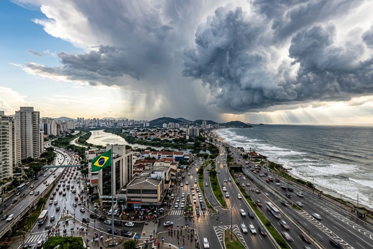
With VCAN at altitude, instability increases in the Central-South and heavy rains raise the risk of storms, especially in the afternoon.
Heavy rains return to affect states in the Central-South after a week marked by stable weather and heat. The change is already being felt with more clouds throughout the day, and the trend is for increased instability starting tomorrow.
The scenario may be accompanied by storms, with storms forming mainly in the afternoon in areas along the southern and southeastern coast. This condition is expected to persist at least until the middle of the week, with overcast skies and episodes of more intense rain.
Weather change interrupts period of heat and stable weather
The change in weather pattern occurs after days of high temperatures and little rain. With the atmosphere undergoing adjustments, the Central-South enters a more unstable phase, favoring more frequent showers and areas of heavy rain.
-
The rapporteur of the critical minerals project said today that Brazil will not create a state-owned mining company, but Lula has already discussed the creation of Terrabras with ministers last Friday, and the United States has already invested 565 million dollars in a Brazilian mining company without waiting for a response from the government.

-
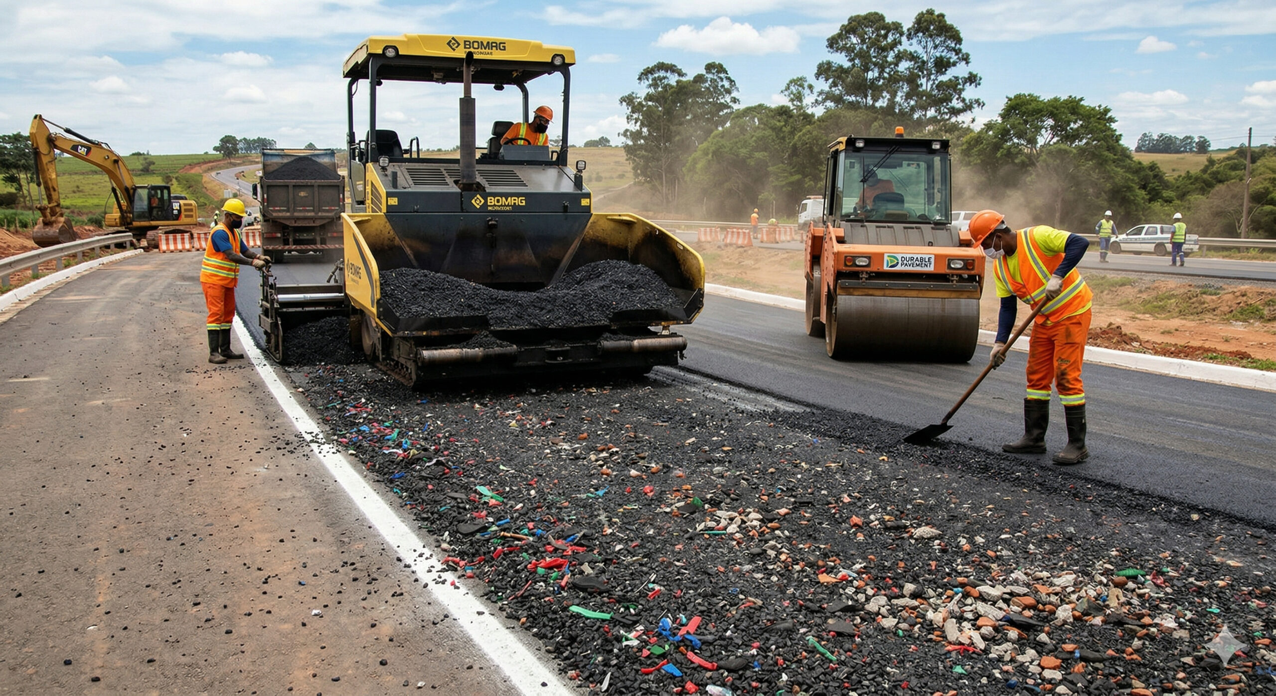
Roads made with recycled plastic, crushed tires, and construction waste are already being applied in several countries, reducing tons of waste in landfills and increasing the durability of the pavement by replacing traditional materials.
-
Drones have become “insects” and spread native seeds to recover inaccessible areas; the Bacias & Florestas program, for 15 years, has planted 3 million trees and restored 15 thousand hectares, despite costs of up to R$ 25 thousand/ha.

-
Alert in the underwater tunnels: the rubber sealing the entrance of the sea in a structure in China is deteriorating from the inside faster than expected.


This type of change usually brings an immediate feeling of alteration, with overcast skies since morning and a higher chance of forming heavy clouds throughout the afternoon.
What is VCAN and how does it influence heavy rains
Instability is associated with a meteorological system called a high-level cyclonic vortex, known as VCAN. It operates at high altitudes, around 10 km above the surface, and alters atmospheric behavior.
VCAN rotates clockwise and tends to induce rainfall formation at its edges, while the center may remain relatively drier.
In practice, this creates a favorable environment for heavy rains in specific bands, with varying intensity depending on the system’s position.
Where the rain is expected to be most intense and which capitals feel the impact
With the system positioned near the southern and southeastern coast, the areas that are expected to feel the most instability include stretches between Santa Catarina and Paraná and a large part of the Southeast. In this corridor, the forecast indicates heavy rains with greater intensity starting tomorrow.
Among the capitals mentioned, are Florianópolis, Curitiba, São Paulo, Rio de Janeiro, and Belo Horizonte. The expectation is for increased cloud cover in the morning and a higher risk of storms during the afternoon.
When storms gain strength and how long the condition is expected to last
The trend is for rain to start in a more organized manner starting tomorrow, with more intense showers forming especially in the afternoon, when daytime heating favors the development of heavier clouds.
This pattern is expected to continue at least until the middle of the week, with indications of maintaining instability until Thursday.
Throughout these days, the alternation between periods of overcast skies and showers keeps the risk of heavy rains at different times of the day, especially in the late afternoon.
How to prepare for days of instability
During periods of marked instability, some simple measures help reduce disruptions in daily life.
Planning travels with extra time, avoiding areas prone to flooding, and keeping track of weather updates throughout the day are actions that make a difference when there is a risk of storms.
For those who depend on outdoor activities, it is best to consider windows of more stable weather in the morning and stay alert in the late afternoon, when the chance of heavy rains tends to increase.
In your city, has this weather change already appeared with overcast skies and more intense showers, or is it still hot and stable?


Seja o primeiro a reagir!