 Portuguese
  English
  Spanish
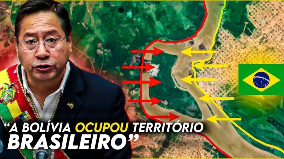
Cartographic Update Reveals Precise Details of the Border Between Brazil and Bolivia.
In the latest survey conducted by the Brazilian Institute of Geography and Statistics (IBGE), an adjustment in the border between Brazil and Bolivia was revealed, impacting an area of approximately 5.9 km². However, this adjustment does not represent a real loss of territory for Brazil, according to experts.
Details of the Cartographic Change in Bolivia and Brazil
According to Jadir Bocato, manager of land regularization and cartography at Agraer and Semadesc, the new measurement conducted on a more precise scale (1 to 100,000) revealed details previously not visible on larger scales.
This includes more accurate curves in the Paraguay River, which appeared straight on less detailed maps.
-
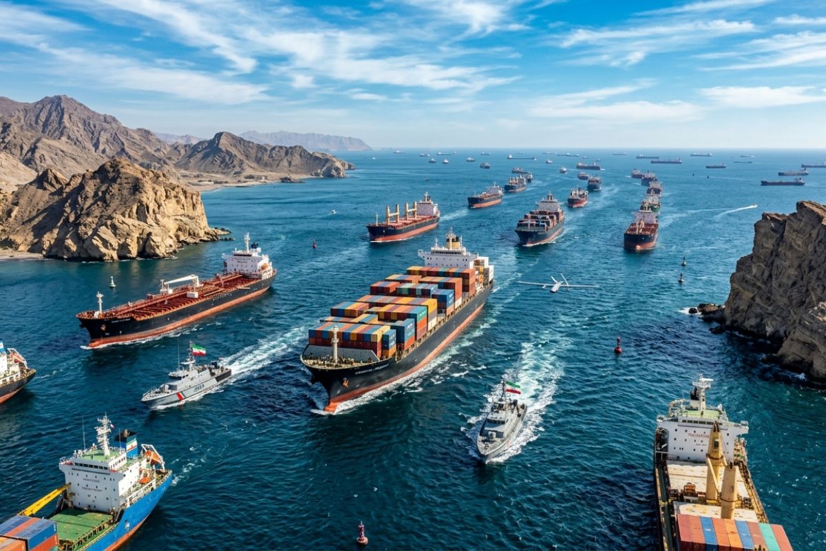
Iran authorizes the passage of ships with essential goods in the Strait of Hormuz, requires coordination and protocols; UN postpones resolution to reopen the oil route, while China, France, and Russia reject the use of force.
-
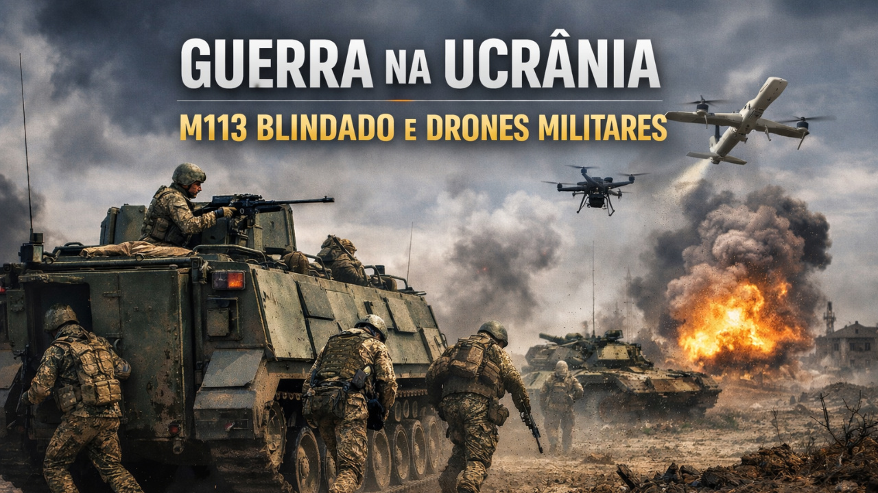
The Ukraine war exposes the strength of the M113 armored vehicle amid modern warfare with military drones.
-
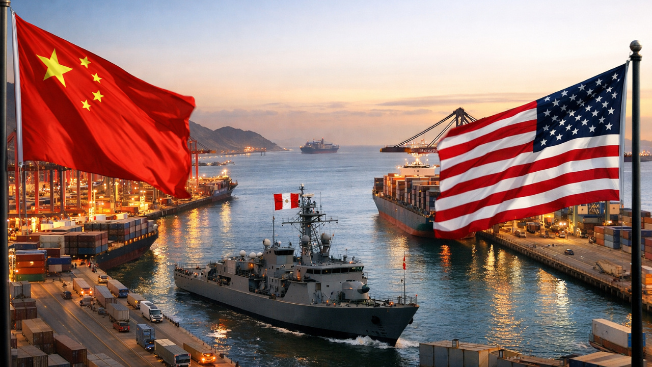
Maritime geopolitics: China and the USA compete for strategic ports in Peru.
-
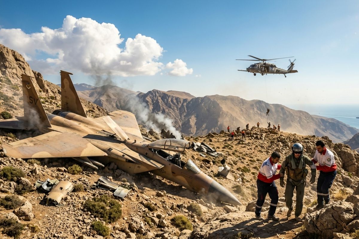
Iran shoots down two US aircraft: F-15 fighter crashes in mountainous area, one crew member is rescued and another is still missing; second crash in the Persian Gulf exposes still active air defense, says US intelligence.

“This is not about losing or gaining territory, but rather a better cartographic representation of what already existed”, Jadir explained.
This update does not affect the physical borders between the two countries, only the precision of mapping.
Elenice Cristaldo Cano, dissemination coordinator at the IBGE in Mato Grosso do Sul, highlighted that, despite the changes in the maps, Brazil’s effective territorial area remains unchanged.
The new mapping methodology based on satellite images allows for a more precise representation of the national territory.
“The borders remain the same. What has evolved is the way we map and understand our territory”, Elenice stated.
Updates on Municipal Boundaries After the Change in Bolivia
In addition to the changes at the border with Bolivia, IBGE also announced adjustments to the municipal boundaries of 174 Brazilian municipalities.
These changes were motivated by new legislation, court decisions, and technical reports issued by the state agencies responsible for the political-administrative division.
According to Roberto Tavares, coordinator of Territorial Structures at IBGE, the state that experienced the most changes was Rio Grande do Sul, followed by Pernambuco and Paraná.
These updates reflect a continuous effort to keep municipal boundaries aligned with current needs and existing legal decisions.
The cartographic updates not only refine the geographic representation of Brazil, but also have significant implications for various sectors.
Sectors such as infrastructure, agriculture, and environmental management depend on accurate maps to plan and execute projects more efficiently.
The improved accuracy of the new maps allows for better management of natural resources and a more precise assessment of environmental impacts.
The new methodology adopted by IBGE not only reflects technological advances but also highlights the importance of cartographic precision in territorial administration.
The ability to visualize details previously imperceptible provides a more complete and detailed understanding of the physical environment, facilitating informed decisions across various public and private sectors.
Continuous Improvement of Geospatial Data
The enhancement of geospatial data is not limited to border adjustments.
IBGE and other relevant agencies continue to invest in advanced technologies to constantly monitor and update Brazil’s cartographic information.
These efforts are essential to maintain the integrity of national borders and ensure a precise representation of Brazilian territory at both national and international levels.
In addition to internal updates, Brazil collaborates internationally to improve mapping and cartography practices.
This cooperation includes data sharing, adherence to global standards, and participation in initiatives aimed at enhancing the accuracy and reliability of maps worldwide.
Challenges and Future Applications
Despite the advancements, the continuous maintenance and updating of maps are ongoing challenges. Environmental changes, such as river courses and urban expansion, require agile and accurate adaptations in maps to reflect current realities.
Furthermore, new technologies such as artificial intelligence and remote sensing promise to revolutionize cartography even further, offering new ways to collect and analyze geospatial data in real time.
The precision of maps not only facilitates urban and rural planning but also plays a crucial role in national security and defense.


Seja o primeiro a reagir!