 Portuguese
  English
  Spanish


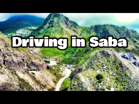
In Saba, Caribbean Island of the Netherlands, Residents Built a 14-Km Road Manually Between 1938 and 1963, Defying Experts
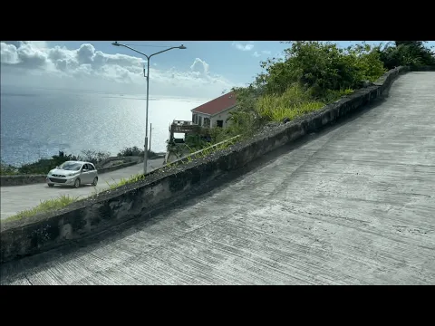
On the small Caribbean island of Saba, a territory belonging to the Netherlands, there is a highway that surprises with its origin. Known as “The Road” and nicknamed “The Road That Could Not Be Built,” it stretches 14 kilometers of concrete, linking several local villages. What makes it extraordinary is the fact that it was built without machines, using only simple tools and the human effort of the residents themselves, between 1938 and 1963.
The Beginning of an Unlikely Dream
For a long time, Saba lived in isolation. People moved along trails and stone steps because engineers believed it was impossible to build a paved road in such rugged and rocky terrain.
But one resident, Josephus Lambert “Lambee” Hassell, self-taught and determined, decided to defy the predictions.
-
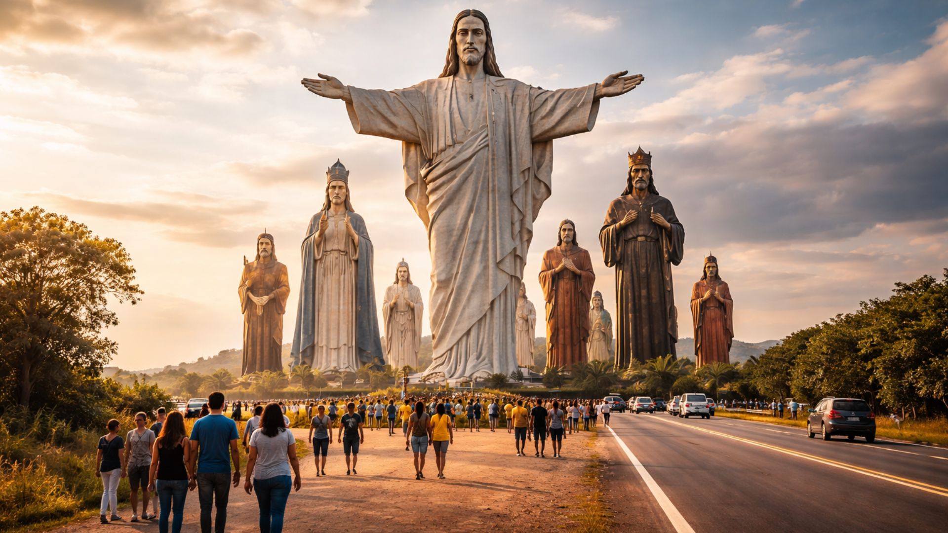
Brazilian city becomes a global destination after attracting tourists who travel up to 10,000 km to visit a sanctuary with 11 giant saints up to 10 meters tall, open 24 hours and located along a highway in SP.
-
After ten days orbiting the Moon, science confirms that the astronauts of the Artemis II mission return with altered bodies.

-
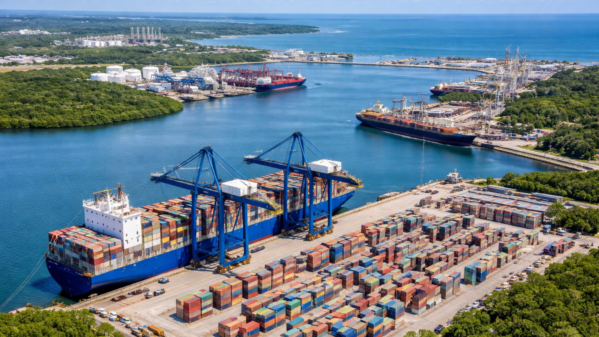
Pernambuco paradise with 59% of preserved area advances with R$ 2 billion in e-methanol, aims for 900 tons/day, grows 38.6% and builds electrified terminal of 400 thousand TEUs.
-
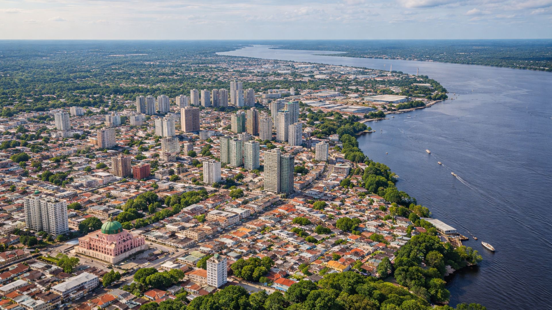
The most ‘isolated’ city in Brazil has over 2.06 million inhabitants, is the 7th largest in the country, has no road connections, hosts a billion-dollar industrial hub, and is located in the heart of the Amazon.
With the help of volunteers, he started the work in 1938. The first section connected Fort Bay to The Bottom, replacing an old path with about 200 irregular steps.
The execution was led by Erroll Hassell and took five years to complete. In 1943, the new road was inaugurated, with a length of 1.15 km and a width of 4 meters, overcoming a height difference of 5 meters.
Stone Upon Stone, The Road Grew
Starting in 1951, the second phase began. This time, the goal was to extend the road to St. John’s and then to Windwardside.
Every meter was manually carved out, removing stone steps and applying concrete on steep slopes. No heavy equipment was used, just basic tools and the collective effort of the population.
In 1958, the third and final phase began, heading towards the village of Hell’s Gate, the farthest from Fort Bay. The project continued under the supervision of Lambee Hassell, who maintained handwritten calculations and practical guidance on the worksite.
By 1963, the road reached the newly built Flat Point airport, concluding a challenge that many experts deemed impossible to achieve.
The Road Is a Conquest Carved in Stone
The completion of the route marked a historical milestone for Saba. The main stretch, between Fort Bay and Flat Point, totaled 10 kilometers, but over time new branches were added.
Among them were accesses to Well’s Bay, to Mount Scenery, to the old Sulfur Mine, and to Cove Bay. Thus, the total length reached approximately 14 kilometers.
Even without complete official records, reports from residents and former workers indicate that the road traverses almost the entire island.
Its tight turns and steep climbs challenge drivers to this day, turning each trip into a mix of adventure and contemplation.
A Legacy of Courage and Unity
More than a transportation route, “The Road” has become a symbol of perseverance. It represents the triumph of collective will against technical disbelief.
In the full 20th century, a group of islanders built with their own hands what engineers claimed was impossible, carving into the mountains of Saba an example of ingenuity and resilience that still moves those who navigate its curves.
With information from Wikipedia.


Nada de **** nesta estrada que justificasse toda está reportagem.