 Portuguese
  English
  Spanish
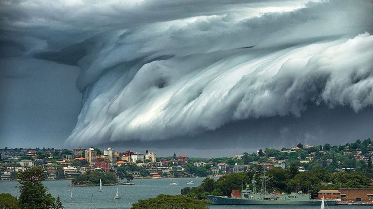
The Tsunami Cloud, Also Called Shelf Cloud, is an Impressive Phenomenon Linked to Storms. Find Out What It Is, How It Forms, and What the Dangers Are.
An immense wave-shaped cloud, known as tsunami cloud, has surprised — and caused some fear — in those witnessing its passage. The phenomenon, officially called a shelf cloud, usually appears before intense storms and can be a sign of strong winds, hail, and even power outages.
But what are these formations, after all? Where do they occur? And why do they have such a strong visual and emotional impact?
The phenomenon has been observed in various regions of Brazil, especially in the South, where cities like Coronel Vivida (PR) report the event several times a year.
-
Half a million liters of fresh water extracted from the sea per day, 300 tons of feed, and 84 fans that renew all the air every 60 seconds keep 16,000 animals alive and even fattening inside the Becrux on its way to Indonesia.

-
Workers were building a hotel near Washington when they found an 18th-century ship buried in the mud of the Potomac River: a hull of almost 15 meters, colonial warehouse, and even old shoes reveal a hidden city beneath Alexandria.

-
Picanha beware: brisket tip is no longer a forgotten cut, enters the radar of Brazilians, attracts attention for its cost-benefit, and becomes a juicy bet for World Cup barbecues.

-
Refugee mother sees schools closing and marries off 16-year-old daughter out of fear of the crisis in Rohingya camps; nearly 500,000 children are left without classes in Bangladesh as aid cuts push families towards child marriage and child labor.


The formation, although it does not represent a risk of tornadoes, demands attention due to the intense winds that accompany it.
What Is a Tsunami Cloud and How Does It Form?
The tsunami cloud is a low, extensive, horizontal formation that projects like a “shelf” in the sky. This type of accessory cloud is linked to the base of a larger cloud, usually a cumulonimbus, and marks the imminent arrival of a storm.
Visually impressive, it can give the sensation that a “wall” is moving towards the city — which explains its nickname.
However, unlike tornadoes, it does not spin on its own axis nor touch the ground. Its frightening appearance, nevertheless, is associated with intense winds and heavy rain.
A shelf cloud arises from the interaction between warm and cold air masses. When cold air rapidly descends from a storm and touches the ground, it spreads and pushes the warm, moist air upwards. This generates rapid condensation and the formation of the tsunami cloud.
This barrier of air moving against the ground is called a gust front. It creates the ideal scenario for the emergence of the phenomenon, usually accompanied by dark skies, violent winds, and turbulent clouds.
Differences Between Shelf Cloud, Roll Cloud, and Wall Cloud
It is common to confuse the tsunami cloud with other curious formations, such as:
Roll cloud: appears as a cylinder in the sky, rotates horizontally, and is not connected to a parent cloud. Although impressive, it is rare and usually harmless.
Wall cloud: is associated with severe storms and can indicate the formation of tornadoes. It is vertical and isolated, unlike the shelf cloud.
While the shelf cloud advances connected to a storm system, roll clouds are isolated and rotate like a tube. Both draw attention, but only the tsunami cloud typically brings winds that require caution.
Where Do Tsunami Clouds Occur?
In Brazil, records are more frequent in the South — especially in Rio Grande do Sul, Santa Catarina, and Paraná. In Coronel Vivida (PR), for example, the phenomenon appears up to three times a year.
Abroad, famous images have been taken in coastal cities like Sydney, Australia, where beachgoers hurriedly left the beach upon seeing the immense cloud approaching.
Those who see a tsunami cloud up close hardly forget it. The beauty of the formation comes with tension, as it precedes storms with destructive potential.
Although they do not form tornadoes, these clouds signal sudden and dangerous winds. Trees may fall, roofs may be damaged, and drivers need to be extra cautious. Therefore, upon noticing its approach, the ideal is to seek safe shelter.
The tsunami cloud is a spectacle of nature that fascinates meteorologists and curious onlookers alike. But, beyond aesthetics, it serves as a clear warning: a storm is coming. Observing is safe — as long as it’s from a distance and with respect for the force that the sky can bring.
With information from the Magnus Mundi website.


-

-

3 people reacted to this.