






 Portuguese
  Spanish


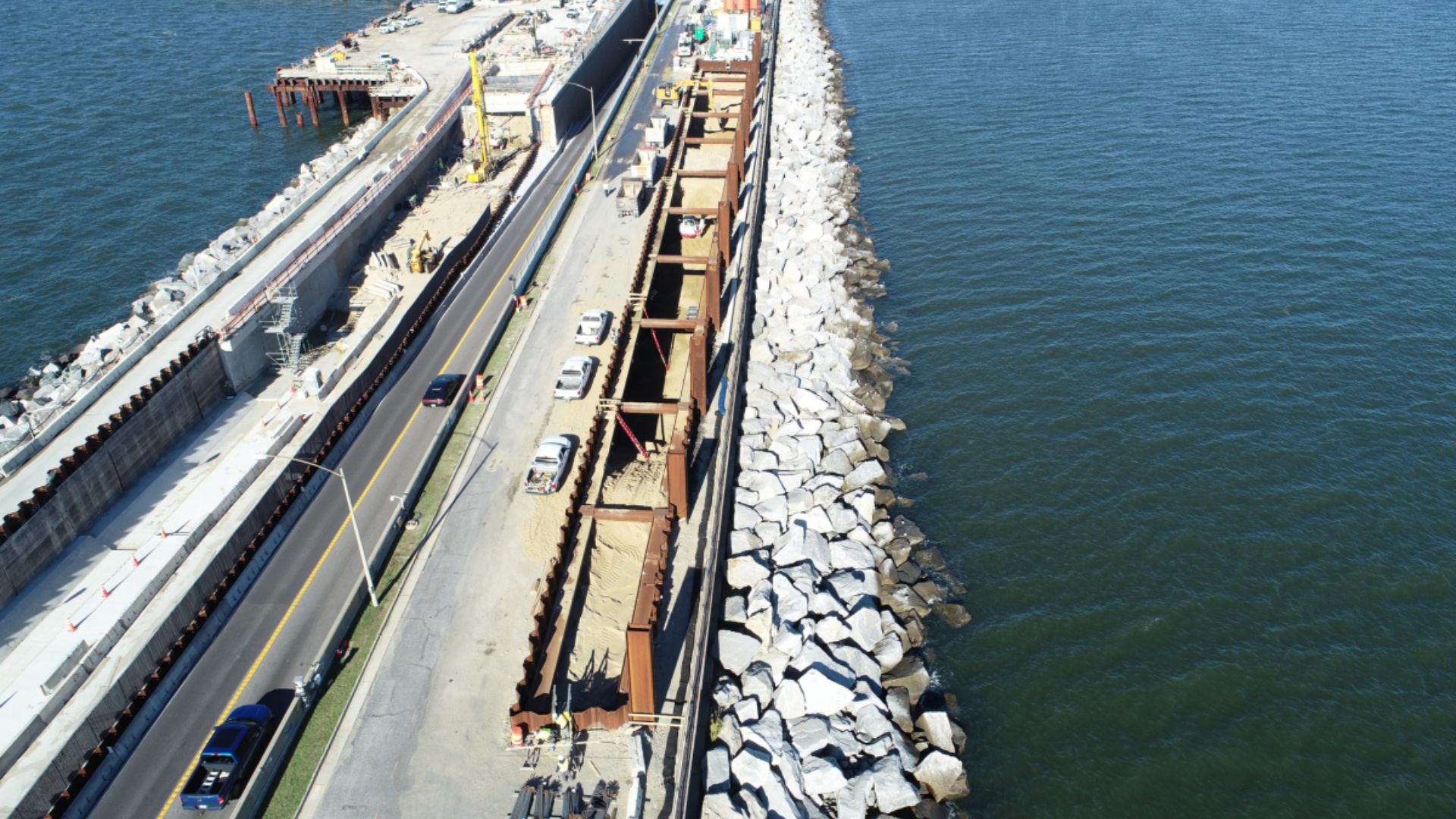


Road Crossing That Alternates Low Overpasses and Underwater Tunnels Beneath Navigation Channels Has Become One of the Most Curious Works in Virginia. Drivers See the Horizon Dominate and Suddenly Enter Artificial Islands.
A road crossing that alternates stretches over the water and underground passages beneath navigation channels is what defines the Chesapeake Bay Bridge–Tunnel (CBBT) in the state of Virginia, United States.
The connection links the Eastern Shore in the Delmarva Peninsula to the Virginia Beach and Hampton Roads area, crossing the mouth of the Chesapeake Bay.
From coast to coast, the complex is about 28 kilometers, but the total route associated with the structure is often described as a “link” of approximately 37 kilometers when land access is also considered, which enhances the feeling of a continuous journey in open water.
-
Workers renovating a playground in northern England uncover 176 World War II bombs buried underground; training artifacts still contained explosives.

-
Brazilian Architect Transforms Waste into Sustainable Homes with Solar Power and Rainwater Systems for 40 Years

-
Security Guard Becomes Doctor at Louisiana Hospital Where He Once Worked, Studied Chemistry Between Shifts

-
Woman Rescued from Luxury Complex in Brazil Worked Without Pay for 55 Years, May Be Entitled to Over $300,000




Why the Road “Disappears” into the Sea
The experience of drivers helps explain why the structure gained international fame.
Instead of a high and monumental bridge, the driver encounters long segments of low deck, almost at water level, in repetitive sequence, interrupted by an unexpected element: the roadway enters artificial islands and from there, “dives” into underwater tunnels.
The logic of the project is not to create a vertical visual landmark, but to solve a practical conflict: to maintain a highway crossing the bay without blocking strategic maritime routes for commercial navigation and vessel traffic.
Low Bridges, Underwater Tunnels, and Four Artificial Islands

The CBBT is classified as a fixed bridge-tunnel system, primarily consisting of low overpass segments (trestles) and two underwater passages.
According to the Encyclopaedia Britannica, the tunnels were positioned in the main navigation channels, and each one is over 1.6 kilometers long.
In engineering terms, this means that instead of building a high enough bridge to allow ships to pass, the solution adopted was to take the roadway below the bed, with entry and exit portals on artificially constructed islands.
These islands are not just an aesthetic detail: they function as transition points between the elevated and submerged segments, as well as housing operational infrastructure.
The district that manages the crossing describes that four islands “cradle” the two underwater tunnels and that each was built “from the bottom of the bay up,” creating over five acres of land (about 2 hectares) and raising the ground approximately 9 meters above the surface.
The same official description provides volumetric figures on an industrial scale: over 1.5 million tons of sand and 300 thousand tons of rock per island, a portrait of the effort necessary to build stable “gateways” in a maritime environment.
The Visual Effect of the Horizon and the Uninterrupted Route
The design of the structure also helps explain the psychological effect of the “road that disappears into the sea.”

In many stretches, the structure is low and relatively uniform, which reduces visual references and allows the horizon line to dominate the field of vision.
The crossing occurs without intersections along the way, which reinforces the sense of continuity.
In institutional materials, the CBBT is presented as a route of 17.6 miles without traffic lights, intersections, or stop signs, an operational choice that is also linked to the nature of the layout and the safety of flow in a long and exposed corridor.
Converted, this reported stretch amounts to approximately 28.3 kilometers.
Before the Ferries and the Opening in 1964
The history of the complex is directly linked to the need to shorten the connection between Virginia’s Atlantic coast and the mainland.
Before the opening, the crossing relied on ferries and ferry services.
The historical page of the venture records that as early as the 1930s, a ferry operation transported travelers between the Eastern Shore and the Norfolk/Virginia Beach area, a reality that affected time and logistics of movement.

The bridge-tunnel was opened in 1964, replacing this ferry model at one of the most sensitive points of the bay, where navigation is central to the economy and regional infrastructure.
Tunnels Beneath Navigation Channels and the Logic of the Project
The choice to combine low bridges and tunnels was not just a technical preference: it responds to local conditions and the heavy use of maritime channels.
Britannica emphasizes that the crossing needed to be “sunk deep beneath” the main channels due to the importance of navigation, which explains the “above-and-below-water” nature of the route.
Instead of a continuous high span, the driver travels long segments over the sea and at two points, disappears for a few minutes in a passage beneath the water surface, resurfacing on the other side of the channel.
Lanes, Expansion, and the New Tunnel Planned

The current operation is the result of phases, expansions, and capacity adjustments.
The CBBT started with a configuration of two lanes, and over time, has received works to widen segments over the water.
General descriptions of the system indicate that it incorporates low overpasses and two tunnels connected by artificial islands; the evolution of the project included the construction of parallel structures in trestle segments to improve flow and safety, while maintaining the core feature of the venture: two submerged passages in navigation channels.
In terms of road arrangement, technical and descriptive references indicate that there are four lanes in the bridge sections and two lanes per tunnel, with the system operating as a continuous link despite the transitions between external and internal environments.
In recent years, the crossing has returned to the news due to expansion projects related to the tunnels.
The management of the venture itself describes the Parallel Thimble Shoal Tunnel Project as the construction of a new two-lane tunnel beneath the Thimble Shoal Channel, connecting system islands, with the proposal to separate traffic directions between the new and the existing tunnel.


