Portuguese
  Spanish


Cold front, maritime circulation, and cold air change the weather in Brazil this weekend, with heavy rain in the South and Southeast, storms in the North, and a contrast between humid coast and dry interior in different regions of the country.
The combination of cold front, maritime circulation, and cold air changes the weather in part of Brazil this weekend, with heavy rain in areas of the South and Southeast, instability on the coast, and a drop in temperature mainly in Rio Grande do Sul.
While the North remains under heat and high humidity, with a risk of storms, the Midwest and the interior of the Northeast remain marked by the predominance of dry weather, low relative humidity, and high temperatures during much of the period.
Between Friday (29) and Saturday (30), the areas of instability regain strength in the South, with moderate to heavy showers in Rio Grande do Sul, Santa Catarina, and Paraná, especially in interior and western sectors.
-
Billionaire says the most valuable skill will help overcome job elimination caused by AI, following Bill Gates’ fears

-
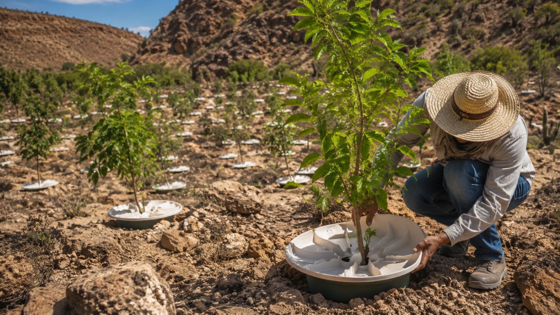
A Dutchman created a ‘box’ that makes trees grow in the desert almost without water and without irrigation: the invention has already brought seedlings to dozens of countries and achieves up to 90% survival where common planting did not exceed 10%.

-
Abandoned warehouse hid a giant collection of rare computers, with over 2,000 artifacts from the 1930s to the 1980s.
-
Scientists warn that melting ice is triggering an alarming chemical transformation in preserved areas, and the first signs are already concerning researchers worldwide.



With the advance of humidity and the action of the cold front, the rain tends to become more intense in the west, northwest, and interior of Rio Grande do Sul, as well as reaching areas of western Santa Catarina and Paraná throughout the day.
According to Climatempo, a cold front and an extratropical cyclone formed on the coast of the Southern Region during the week, between the coast of Rio Grande do Sul and Santa Catarina, reinforcing regional instability.
Classified as weak to moderate intensity, the system had no indication of widespread gales on land, although stronger gusts could occur in coastal areas and offshore, especially in exposed sections of the coast.
During Saturday, instability is expected to spread across the three southern states, with moderate to heavy rain in Santa Catarina, in the south and interior of Paraná, as well as in northern Rio Grande do Sul, the Serra, and the Metropolitan Region of Porto Alegre.
Due to persistent cloudiness and the presence of cold air, temperatures rise little in part of the region, which reinforces the feeling of cold especially in areas of higher altitude and in places with prolonged rain.
On Sunday (31), the rain gradually loses strength, but humidity still supports many clouds and the possibility of light precipitation in coastal and mountainous areas, especially where maritime winds keep the air humid.
Over the ocean, a new cold front advances accompanied by an extratropical system offshore, a scenario that helps to keep the cold air mainly over Rio Grande do Sul, even as instability begins to decrease.
Heavy rain in the South and advance of cold air
Friday marks the clearer return of instabilities to the South, with greater attention to the west, northwest, and interior of Rio Grande do Sul, where the rain may intensify throughout the day.
In these areas, showers are expected to occur with moderate to strong intensity, accompanied by thunderstorms and the risk of isolated storms, especially during periods when humidity encounters greater surface heating.
In Santa Catarina and Paraná, the rain first advances through areas closest to the border with Rio Grande do Sul and then reaches western sectors, keeping the weather unstable in parts of both states.
Despite the presence of instability, temperatures remain more pleasant in much of the region, without intense heat during the afternoon, as cloudiness reduces sunlight in several cities.
Throughout Saturday, the weather remains overcast in different parts of the South, alternating between rain, periods of heavy clouds, and brief clearings, especially in areas where the cold front has greater influence.
The combination of cold air and humidity favors lower maximum temperatures, especially in areas of higher altitude and in places where the rain persists longer, reducing the feeling of warmth during the day.
By Sunday, the scenario begins to change gradually, although it still does not indicate completely stable weather throughout the region, as the circulation of humid winds continues to act between the coast and mountainous areas.
The rain tends to become weaker and more irregular, mainly concentrated on the coast, in the Serra, and in areas under the influence of maritime circulation, while the interior begins to register a greater decrease in instabilities.
Southeast has humid coast and drier interior
In the Southeast, maritime circulation keeps the weather more humid in the eastern strip, mainly between the coast of São Paulo, Rio de Janeiro, and Espírito Santo, where cloudiness is expected to persist.
For Friday, the forecast indicates light rain in these areas, with locally moderate showers between the northern coast of São Paulo and southern Rio de Janeiro, due to the entry of moisture from the ocean.
Saturday is expected to be marked by a more evident contrast between the warm and dry interior and the eastern strip under greater humidity influence, a pattern that favors cloudiness variation throughout the day.
Between the interior of São Paulo, southern Minas Gerais, and southern Rio de Janeiro, instability may gain strength, with moderate to strong showers and the possibility of thunderstorms in isolated spots.
On Sunday, humidity remains concentrated on the coast of São Paulo and Rio de Janeiro, where moderate showers and isolated storms may still occur, especially in areas with greater convergence of maritime winds.
In Minas Gerais, the Zona da Mata and the south of the state continue with more cloudiness, as well as light to moderate rain in specific points, while other areas remain with clearer weather.
According to the National Institute of Meteorology, São Paulo, Rio de Janeiro, and the south of Minas Gerais could experience heavy rain at the beginning of the week, with the instability later moving to other areas of the Southeast.
After this advance, the rainy areas would tend to reach Espírito Santo, the Zona da Mata of Minas Gerais, and the Vale do Rio Doce, keeping the eastern strip of the region under greater influence of humidity.
Central-West maintains heat and low humidity
In the Central-West, dry air continues to prevail in most of the region, especially in Goiás, Mato Grosso, and the Federal District, where stable weather is expected to remain during most of the weekend.
Friday will have predominant sunshine in most cities, but the south of Mato Grosso do Sul may still experience moderate showers and thunderstorms between the afternoon and evening.
On Saturday, heat remains the main regional characteristic, although the moisture flow may cause light and isolated rain in Mato Grosso do Sul, the south of Goiás, and the southeast of Mato Grosso.
Associated with daytime heating, these showers are expected to occur irregularly and briefly, without altering the predominance of dry weather in most of the Central-West.
On Sunday, stable weather remains in most of the region, with low relative humidity in several cities and greater attention to the discomfort caused by dry air during the afternoon.
Even so, isolated showers may occur in the west and north of Mato Grosso do Sul, as well as in parts of Mato Grosso and Goiás, in areas where there is localized moisture entry.
Northeast has rain on the coast and dry weather inland
In the Northeast, rain continues to be more concentrated along the coastal strip, especially between Bahia and Rio Grande do Norte, while much of the interior remains under heat and low humidity.
During Friday, there is a condition for isolated storms on the Potiguar coast, in Salvador, and on the Maranhão coast, with greater cloud presence in areas directly influenced by maritime winds.
On Saturday, maritime circulation maintains frequent rain between Rio Grande do Norte and Alagoas, as well as in the Salvador region, where ocean humidity sustains instabilities at different times of the day.
The Intertropical Convergence Zone also continues to favor strong showers in Maranhão, Piauí, and Ceará, with a risk of isolated storms in areas with a higher concentration of heavy clouds.
For Sunday, the pattern remains, with rain on the northeastern east coast and in areas of Maranhão, Piauí, and Ceará, while the interior of the region continues with heat and little condition for significant precipitation.
In contrast, the agreste and sertão continue under a drought trend, according to Inmet, which also indicated persistent rain on the Bahia coast and more significant accumulations in Maranhão.
North concentrates storms in the extreme of the region
In the North, the heat and high humidity favor heavy showers in Roraima, Amapá, Amazonas, and the north of Pará, areas where the atmosphere remains more favorable for the formation of storms.
Friday has a risk of thunderstorms and wind gusts, especially in the northernmost areas of the region, where the combination of heat, humidity, and heavy clouds increases instability.
On Saturday, the forecast continues to indicate intense rain in Roraima, Amazonas, and Amapá, with more frequent instabilities throughout the day and a greater possibility of significant accumulations in short periods.
Meanwhile, in Tocantins, Acre, and Rondônia, the weather is more stable and muggy, with less cloud cover and more irregular rain, a different scenario from what is observed in the extreme north of the country.
On Sunday, the instability pattern persists in Roraima, Amazonas, Amapá, and north of Pará, with a risk of isolated storms in areas that remain under greater influence of Amazonian humidity.
Meanwhile, Tocantins and Rondônia continue with drier weather, in contrast to the wetter areas of the North, where the forecast indicates a higher frequency of showers and thunderstorms.
The forecast released by Inmet indicated that areas of Amapá, Roraima, Amazonas, and Pará could accumulate high volumes of rain in seven days, while the south of Rondônia and Tocantins would have more stable weather.
Across the country, the weekend combines heavy rain in the South and Southeast, instability in the North, and dry air in the interior, with greater attention to areas subject to storms and temperature drops.