

 Portuguese
  Spanish
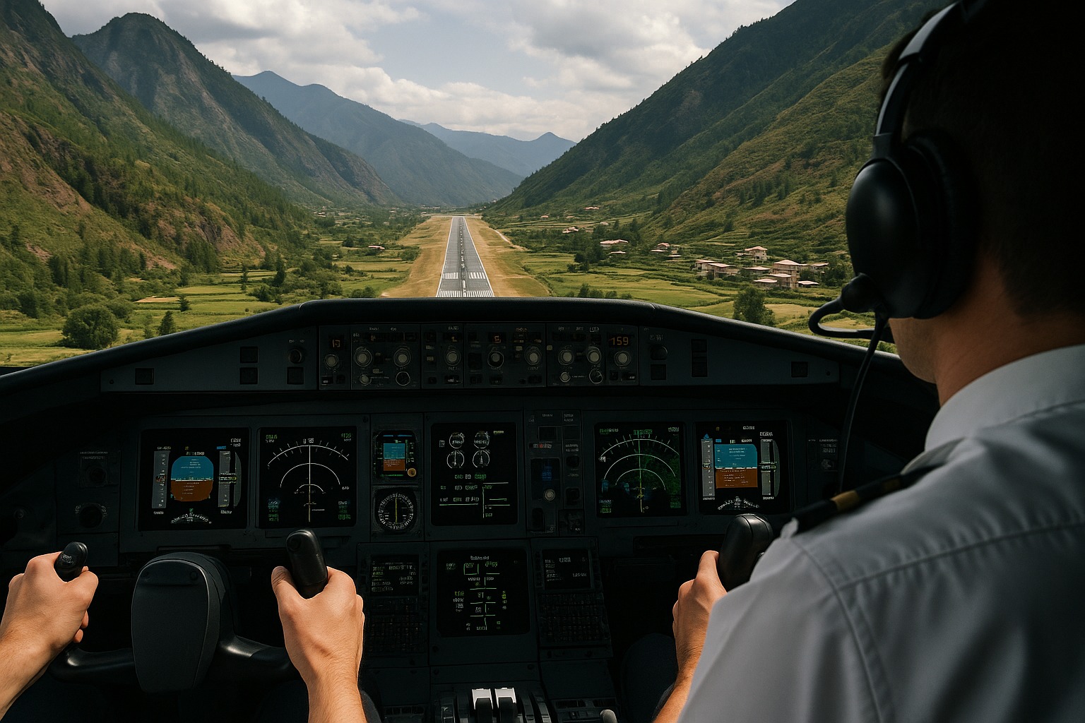
Between Mountains of Up to 5,500 Meters in the Himalayas, the Paro International Airport Challenges Even the Most Experienced Pilots — Only 50 in the World Are Licensed to Land on the Short Runway Without Radars
The Paro International Airport in Bhutan is one of the most feared and fascinating runways in global aviation. Located among the mountains of the Himalayas, the terminal requires extreme skill from those at the controls. Only about 50 pilots worldwide have a license to land there, according to the American CNN network.
A Runway Among Giant Mountains
Just the scenery explains the reason. Paro is at an altitude of 2,250 meters, surrounded by peaks reaching 5,500 meters.
The only runway is 2,265 meters long and is squeezed into a narrow valley, making each landing a millimetric choreography.
-
Brown scar tearing through the blue of the ocean seen from space stretches over 8,000 km in the Atlantic, reaches the route of Northern Brazil, and raises an alert about sargassum on the beaches.

-
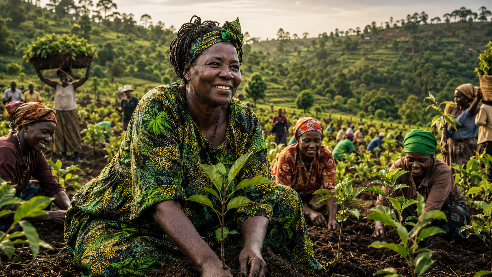
The woman who heard a silent alert in the villages of Kenya and transformed the lack of firewood, water, and food into a movement that began with simple seedlings and grew to over 51 million trees planted.

-
Brazil launches the new national identity in Paraguay, where more than 250,000 Brazilians live, and the document eliminates the need for a passport in 8 South American countries and provides access to 5,000 digital government services.
-
17-year-old balances manual labor on the farm, up to 10 hours of study per day, and gets into Medicine at UFT through Sisu.


Weather conditions also complicate the pilots’ work. Visibility constantly varies, and the wind frequently changes direction.
Because of this, each approach requires precise terrain reading and absolute manual control of the aircraft.
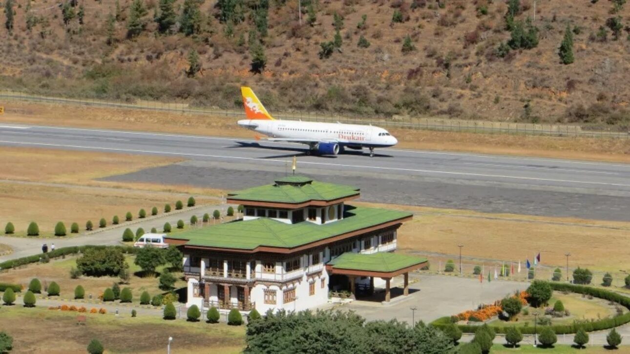
Paro Airport: Without Radars and With Strict Rules
Druk Air — Bhutan’s state airline — announced in June that flights in Paro can only occur between sunrise and sunset.
There are no radars on site, which means that the pilot must rely entirely on their own skill.
The airport is classified as category C by the International Civil Aviation Organization (ICAO).
This means that operations follow specific and restricted rules, requiring special training and proven experience. In Paro, landings are always manual, without the aid of automatic systems.
Knowing the Terrain Is Essential
Familiarity with the landscape is another crucial point. Small calculation errors can cause the aircraft to dangerously approach homes or monasteries on the slopes.
In 2019, YouTuber Sam Chui recorded a landing in Paro and showed the impressive proximity of the mountains and buildings.
Captain Chimi Dorji, who has been flying for Druk Air for 25 years, told CNN that the airport is “difficult, but not dangerous.” According to him, the challenge is technical and requires “local” skills to know every detail of the valley.
Extreme Precision Training
Dorji also acts as an instructor and explains that altitude conditions alter the behavior of the airplane.
“At high altitudes, the air is thinner, so the aircraft needs to fly faster to remain stable,” he stated.
The pilot emphasizes that more important than knowing how to fly is knowing when not to fly. He advises landings to be made preferably in the morning when the air is calmer and more predictable.
Winds That Shape the Flight Routine at Paro Airport
In the afternoon, the winds intensify. Thermal currents known as anabatic and katabatic — ascending and descending — alter stability in the valley.
The heated ground and sharp temperature variations make maneuvers riskier.
Therefore, mornings are reserved for arrivals and afternoons for departures. Between June and August, when storms are more common, the flight schedule needs to be adjusted to avoid additional risks.
Thus, Paro Airport remains a true test of skill and composure — a place where aviation still relies, above all, on human sight and experience.
With information from Nossa.UOL.


-

-

-

-

14 people reacted to this.