Portuguese
  Spanish
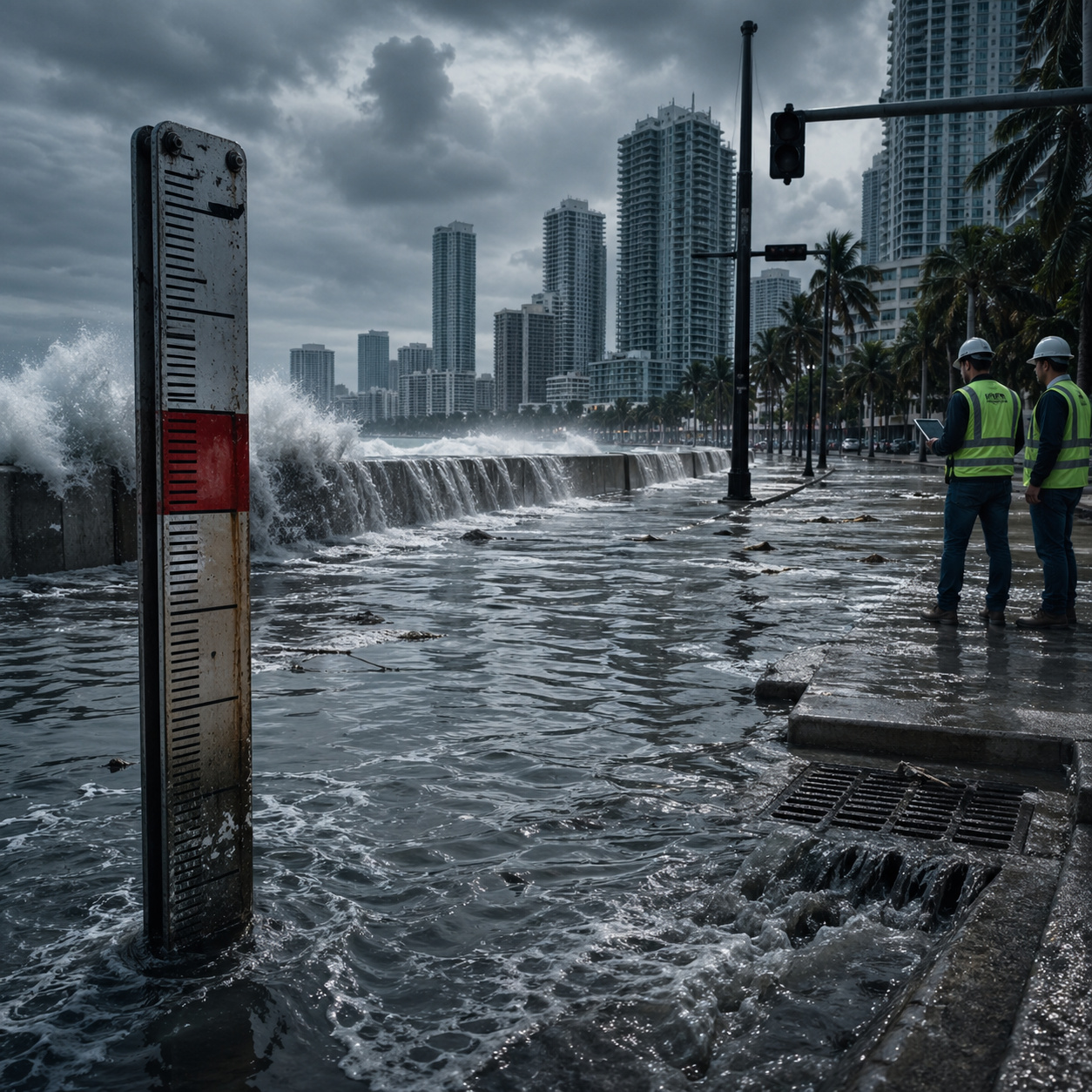
More than 200 engineers warn that coastal cities were designed for a sea level already exceeded, increasing the risk and cost of floods.
In 2026, a study published in the journal Nature on March 4 by Katharina Seeger and Philip S. J. Minderhoud revealed a methodological flaw that could alter the global reading on coastal risk: much of the flood assessments use sea level references based on geoidal models, rather than actual measurements of mean sea level along the coast. According to the authors, this difference makes many coastal areas appear less vulnerable than they actually are in the technical maps used in urban planning, climate adaptation, and flood protection.
The research indicates that 90% of the risk assessments analyzed assumed coastal sea level from models, while more than 99% of the studies evaluated inadequately addressed the relationship between land elevation and sea level. In practice, the authors estimate that, in a hypothetical scenario of 1 meter of relative sea level rise, between 77 million and 132 million more people could be below sea level compared to estimates based on previous methods.
In practice, this means that millions of people are exposed to risks that do not appear on official urban planning maps.
-
China’s Engineered Bamboo: The “Material of the Future” Stronger Than Steel and a Sustainable Wood Alternative

-
Egypt’s “New Nile”: 170 km Artificial River Aims to Turn Desert into Farmland, but Water Supply Concerns Loom
-
Unable to secure a mortgage as a self-employed single mother, she designed her own floating home from a 20-meter boat and now lives “off-grid” with her two children and solar panels on an English canal.
-
Man Transforms Rusty Shipping Container into Luxury Home with Insulated Walls, Large Windows, and Drywall Finish, Surprising Onlookers


Urban systems were designed for an ocean that has already changed
Much of the global coastal infrastructure was designed throughout the 20th century, using historical data on tides, rainfall, and extreme events.
This includes systems such as:
- stormwater drainage
- flood barriers
- underground sewage networks
- drainage channels
These systems were designed to handle scenarios that have already been surpassed.
Sea level rise directly alters the starting point of these systems, reducing their response capacity even without changes in rainfall intensity.
Combination of higher sea level and intense rain increases flood frequency
The problem is not only in the ocean but in the interaction between different factors. In coastal cities, drainage depends on the level difference between urban land and the sea. When sea level rises, this difference decreases, making it harder for water to drain.
At the same time, intense rain events have become more frequent in various regions. The result is that events that were once considered rare are now occurring more frequently, putting pressure on systems that are already operating at their limits.
Megacities in Asia and Latin America are among the most vulnerable
Densely populated cities with rapid growth concentrate the highest risks. Among the examples cited by engineers and technical studies are metropolises such as:
- Bangkok
- Ho Chi Minh
- Mumbai
- Jakarta
These cities have extensive infrastructure built over decades, often without a complete update of design parameters.

The combination of population density, intense urbanization, and aging infrastructure significantly amplifies the impact of changes in sea level.
Adaptation costs can be up to 7 times higher than original planning
One of the most critical points of the study is the cost of adaptation. Retrofitting drainage systems, reinforcing barriers, and updating underground networks within already established cities is much more expensive than designing correctly from the start.
Estimates indicate that:
- interventions can cost between 3 and 7 times more
- construction requires excavation in densely populated areas
- existing networks need to be partially dismantled
The problem shifts from being merely technical to economic, with direct impacts on public budgets.
Underground infrastructure becomes one of the most critical points
A large part of the vulnerability lies below the surface. Sewage networks, stormwater galleries, and drainage systems are designed with specific slopes to ensure water drainage.
With rising sea levels, these slopes are no longer sufficient, creating points of accumulation and water return.

This type of failure can cause flooding even without extreme events, simply due to the system’s inability to drain the received volume.
Historical subsidies and old data contribute to underestimating the risk
Another factor identified by researchers is the use of historical data as a reference. Many urban systems were designed based on data series that do not reflect current conditions.
Moreover, old models did not accurately consider factors such as:
- land subsidence
- accumulated sea level rise
- changes in rainfall patterns
This information lag creates a false sense of security in areas that are already more vulnerable than imagined.
Adaptation requires a complete review of urban planning
In light of this scenario, adaptation cannot be achieved through mere point adjustments. Experts point out that it will be necessary to:
- reassess design parameters
- update risk maps
- redesign drainage systems
- integrate urban planning with updated data
This process involves not only engineering but also political and economic decisions. Adaptation becomes a systemic challenge that requires coordination among different areas.
Continuous urban growth amplifies the challenge in the coming decades
The expansion of coastal cities continues, often in already vulnerable areas. New constructions increase the load on existing systems and amplify the demand for infrastructure.
Without updating design criteria, the risk tends to grow cumulatively. The problem is not only in the past but in how cities continue to be planned.
With millions of people living in underestimated risk areas, urban systems designed for a sea level that has already been surpassed, and increasingly high adaptation costs, the challenge becomes evident.
The infrastructure that supports large cities may be operating outside the parameters for which it was built.
The question that remains is straightforward: will cities be able to adapt in time, or will they continue to face increasingly frequent and costly floods to contain?