Portuguese
  Spanish


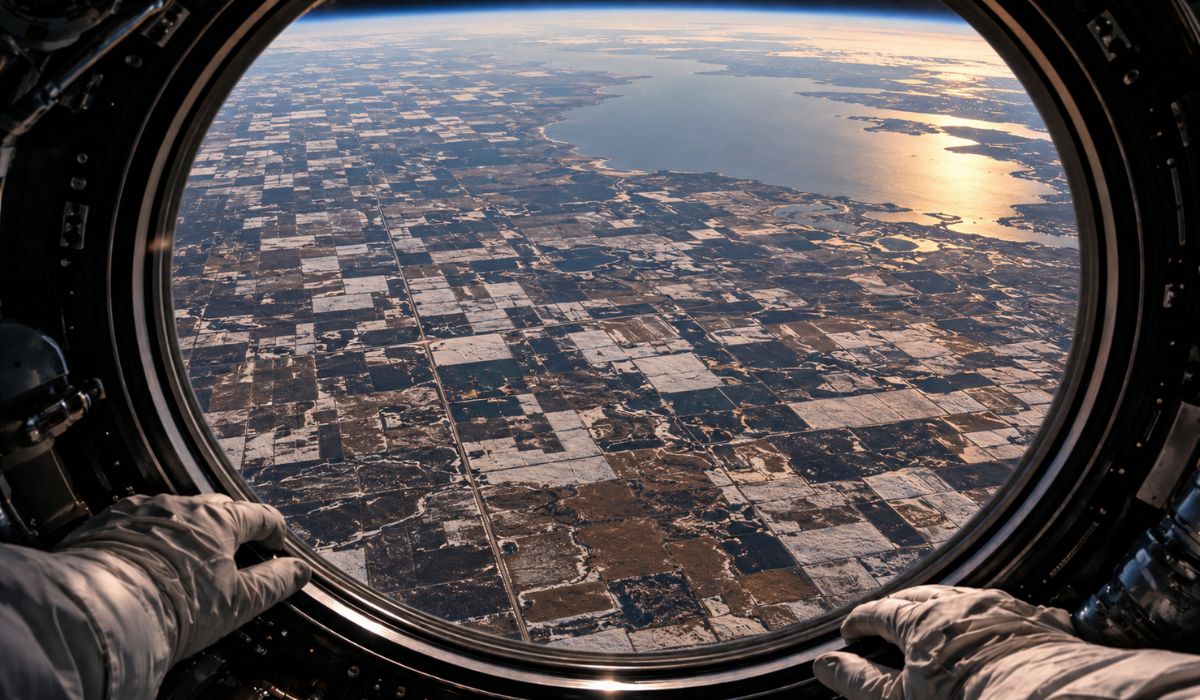

Image taken from the International Space Station shows crops in southern Manitoba on the ancient bed of Lake Agassiz, combining agriculture, ice, fertile sediments, and geometric divisions seen from space.
A photograph taken by an astronaut aboard the International Space Station captured, in April 2026, an agricultural landscape in southern Manitoba, Canada, marked by light and dark rectangles on an almost flat surface.
What appears as a mosaic of crops, roads, and flooded areas lies on the ancient bed of Lake Agassiz, a glacial lake that began to drain about 12,000 years ago and once covered an area larger than all the Great Lakes combined.
The image was published by the Earth Observatory, NASA, on May 19, 2026.
-
Billionaire says the most valuable skill will help overcome job elimination caused by AI, following Bill Gates’ fears

-
A Dutchman created a ‘box’ that makes trees grow in the desert almost without water and without irrigation: the invention has already brought seedlings to dozens of countries and achieves up to 90% survival where common planting did not exceed 10%.

-
Abandoned warehouse hid a giant collection of rare computers, with over 2,000 artifacts from the 1930s to the 1980s.
-
Scientists warn that melting ice is triggering an alarming chemical transformation in preserved areas, and the first signs are already concerning researchers worldwide.



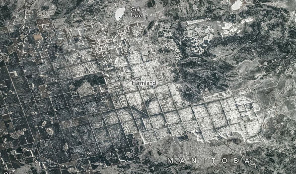
According to the space agency, the photo shows agricultural lands near the southern shore of Lake Winnipeg, where the ancient Lake Agassiz deposited a thick and almost flat layer of silt and clay rich in nutrients, material associated with the formation of productive agricultural areas in Canada.
The record was made in the late afternoon of April 19, 2026.
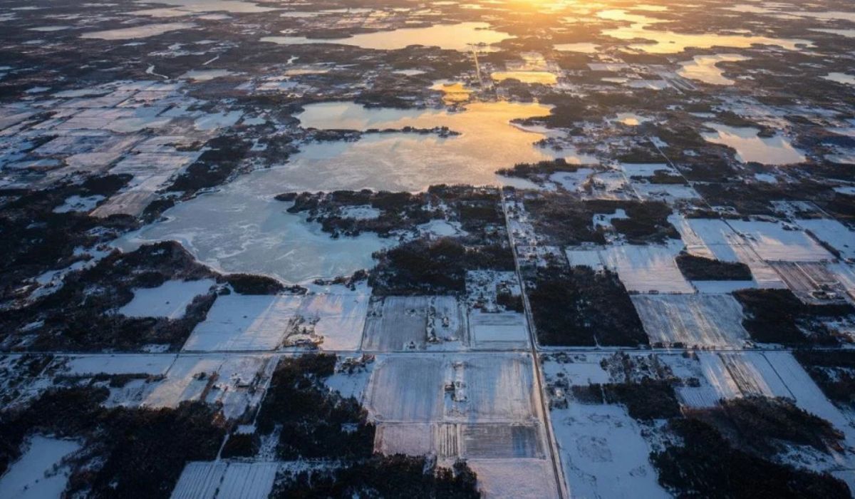
At that moment, snow and ice covered part of the landscape, which helped to highlight the lighter blocks in the image, according to NASA’s technical description.
The whitest areas appear as snow-covered fields or frozen ponds, while dark sections correspond to forests, wetlands, or exposed soil with less uniform coverage.
This difference in tone allowed the observation, in a single image, of the current agricultural layout and the flat surface associated with the ancient lake.
The scene brings together two layers of history observed from space.
On one side, current crops organized in a grid pattern created by 19th-century land surveys; on the other, the legacy of a glacial lake formed at the end of the last ice age.
Lake Agassiz under the crops of Canada
About 15,000 years ago, southeastern Manitoba was under dozens of meters of cold water.
Lake Agassiz formed in front of the retreat of the Laurentide ice sheet, which blocked rivers that could flow towards Hudson Bay.
With drainage blocked by the ice, water accumulated and formed a large body, about 1,100 kilometers long by 300 kilometers wide, according to NASA.
In its extent, the lake occupied areas that today are part of Manitoba, Ontario, Saskatchewan, North Dakota, and Minnesota.
Lake Agassiz also encompassed regions where Lake Manitoba, Lake Winnipeg, and the Lake of the Woods are now located.
Although the ancient glacial lake no longer exists as a single body of water, part of its presence remains indicated in the current geography of the region.
The drainage began approximately 12,000 years ago, when the ice barriers started to give way and the water found new drainage routes.
The ancient lakebed remained as an extensive, relatively flat surface covered by fine sediments.
These sediments help explain the relationship between the vanished lake and current agriculture.
For thousands of years, Lake Agassiz left layers of silt and clay, materials formed by small particles that slowly settled at the bottom of the water.
With the retreat and drainage of the lake, this ancient mud became the base of fertile soils.
Geometric crops seen from space
The geometry seen in the photo was not created by the lake, but by human occupation of the land.
The pattern of rectangles and straight lines comes from the Dominion Land Survey, a surveying system that divided much of western Canada into square mile sections after the Canadian government purchased Rupert’s Land from the Hudson’s Bay Company in 1869.
This division model still influences the design of crops, roads, windbreaks, and drainage channels.
Seen from above, the result forms a regular agricultural pattern, with fields delineated by straight lines.


In the April photograph, the snow reinforced this pattern.
The white and dark blocks appear with greater contrast because each area reacts differently to cold, ice, vegetation cover, and soil moisture.
Open and flat fields tend to retain a more uniform cover of snow.
Already forest areas, wetlands, and exposed sections may appear darker, creating the alternation recorded in the orbital image.
The visual effect described by NASA combines three main elements: the flat background left by the glacial lake, the geometric division of the land made in the 19th century, and the snow accumulated in the late afternoon in an agricultural area of Canada.
Agriculture over the ancient lakebed
The region depicted by NASA is located in an ancient lakebed area.
According to the agency, areas of this type today support some of Canada’s productive agricultural landscapes, due to the presence of fine, nutrient-rich sediments.
Among the crops frequently planted in the region are wheat, barley, oats, and canola, according to the image description by the Earth Observatory.
These crops are common in parts of the Canadian prairies, where flat soils favor large agricultural areas.
The plain also facilitates the organization of properties into large regular blocks.
In an image taken from the International Space Station, this combination of flat terrain and territorial division appears broadly, something more difficult to perceive only at ground level.
The agricultural design seen in the photograph relates to natural processes and human decisions made at different times.
The fertility used today by agriculture originates from sediments deposited when the region was still under the influence of the last glaciation.
The photograph also shows, according to NASA, how agricultural landscapes can preserve marks of ancient geological events.
Even after thousands of years, the shape of the terrain and some of the soil characteristics remain associated with the gradual disappearance of a lake that once covered part of central North America.
Gull Lake and the current landscape
At the top of the image published by NASA, vacation homes and cottages appear grouped around Gull Lake.
The area is described by the space agency as a spot used for boating, fishing, and other water sports.
According to NASA, species such as northern pike, walleye, and yellow perch are common in the lake.
The presence of these residential and recreational areas indicates another form of landscape use: besides the crops, the ancient bed of Lake Agassiz houses communities, smaller lakes, and leisure-related activities.
This detail broadens the territorial reading of the photo without altering the main focus of the image.
The record shows an area where ice marks, water, land division, agriculture, and recreation appear in the same frame.
The International Space Station captured the scene with a Nikon Z9 camera and 560-millimeter lens.
According to NASA, the image was cropped and enhanced to improve contrast, and lens artifacts were removed.
The photograph is part of the collection of Earth images taken by astronauts and maintained by NASA teams.
The program gathers orbital records used to document natural phenomena, landscapes modified by human action, and changes observable from space.