






 Portuguese
  Spanish



Neighborhood was built on an extensive strip of Guanabara Bay, expanded the territory of Rio de Janeiro, and transformed part of the shoreline into an urban park, road corridor, cultural area, sports space, and meeting point between the Center and the South Zone
The Aterro do Flamengo, in Rio de Janeiro, emerged from one of the largest urban transformations carried out on the Carioca shoreline.
Waters of the Guanabara Bay previously occupied the space where there are now avenues, gardens, museums, sports courts, and pedestrian paths.
The place, officially known as Parque Brigadeiro Eduardo Gomes, has about 1.2 million square meters.
-
Man knocks down wall during renovation of century-old house and finds letter sent from Ireland, hidden for almost 100 years, with thanks for a gift and news of a family.

-
Excavating the ruins of a 2,000-year-old city in the Golan Heights, Israel, archaeologists found a small lead projectile with a message engraved in Greek, and the inscription revealed something surprising: psychological warfare, to provoke and intimidate the enemy, was already a common weapon long before the modern era.

-
Retired in Curitiba, a woman decided that the end of her career would be just the beginning of the greatest adventure of her life: she started traveling the world alone and opened her own home to receive tourists from all over, becoming the “mother of the whole world” who trades loneliness for stories from afar.
-
The boy decided to sell hot chocolate on the street because he wanted to buy a car for his mother, added cookies to the menu, managed to earn up to $300 a day, and turned a family necessity into a well-known brand in the USA.


The city inaugurated its most well-known configuration in 1965, creating an extensive connection between areas of the Center and the South Zone.

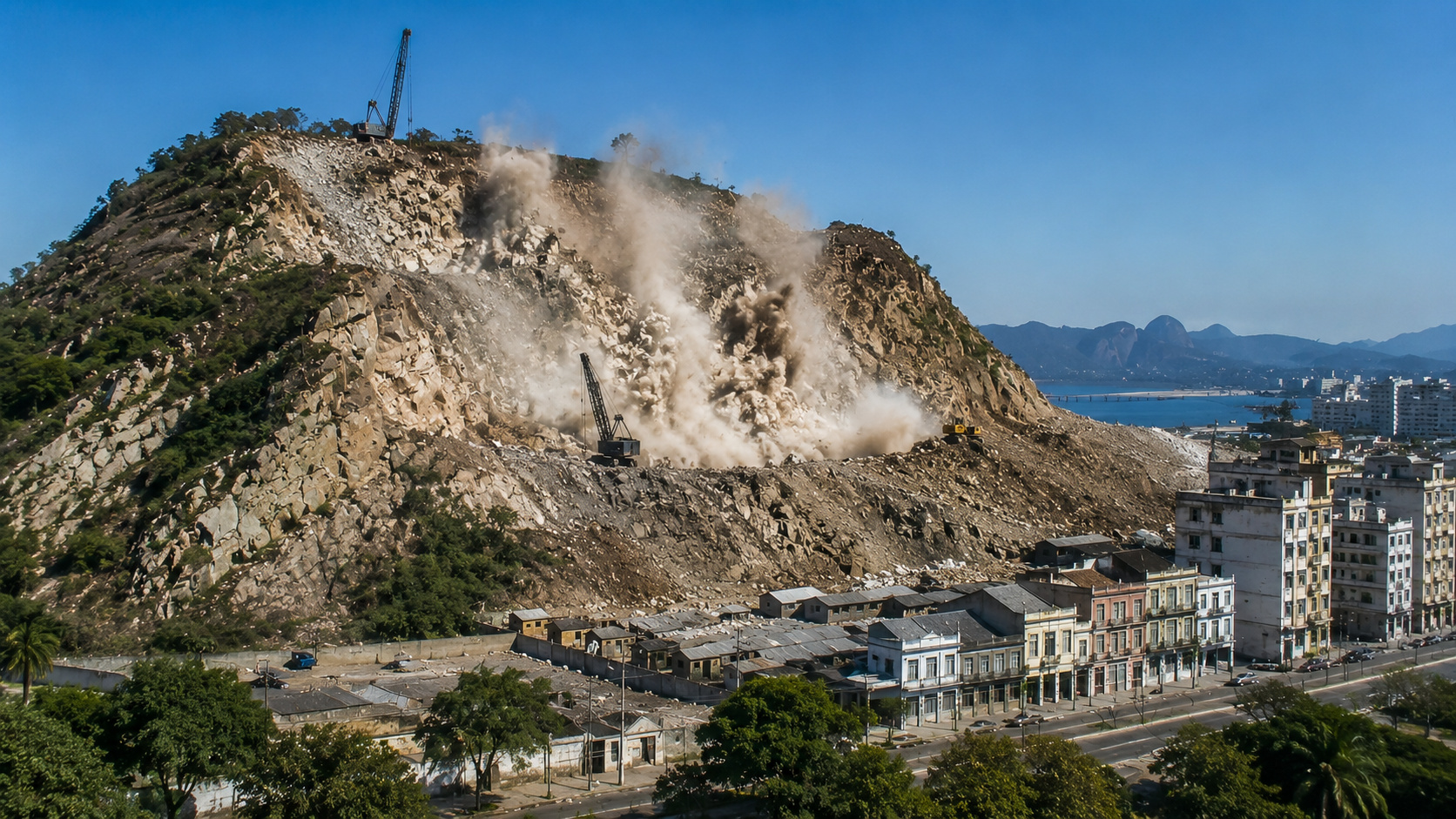
Material removed from a hill helped create Aterro do Flamengo
The origin of the materials used in the formation of the land represents one of the most curious aspects of the project.
A large part of the earth and stones came from the dismantling of Morro de Santo Antônio, located in the central region of Rio de Janeiro.
The authorities began to remove the hill during a period marked by major urban reforms in the city.
Teams transported the materials resulting from the dismantling to the edge of Guanabara Bay.
Part of the old relief of the Center thus began to form a new territorial strip along the sea.
According to the National Institute of Historic and Artistic Heritage, the landfill reached areas in front of Lapa, Glória, and Flamengo.
The intervention expanded the Carioca territory and definitively altered the coastline of that region.


Area of 1.2 million m² changed the Rio coastline
The project aimed to achieve much more than the construction of new avenues.
The planning brought together different urban functions in an extensive public area focused on circulation, culture, and leisure.
The space began to offer:
- gardens and large grassy areas;
- courts, sports fields, and playgrounds;
- bike paths and walking trails;
- museums, monuments, and cultural facilities;
- express lanes for connecting neighborhoods.
The Flamengo Park began to function simultaneously as a park, a road corridor, and a landscape connection.
Its extension connects sections close to Santos Dumont Airport, Glória, Flamengo, and the beginning of Botafogo Beach.
How did landscaping transform the park?
The architect Affonso Eduardo Reidy took on the urban planning, buildings, and park facilities.
Roberto Burle Marx, in turn, developed the landscape design of the complex.
The proposal brought together tropical species, winding gardens, trees, and extensive lawns.
The vegetation created a visual transition between the buildings, express lanes, and Guanabara Bay.
The landscaping also reduced the visual presence of the avenues and opened areas for visitors to stay.
Park brought together culture, sports, and mobility
The urban complex incorporated important cultural facilities.
Among them are the Museum of Modern Art of Rio de Janeiro and the National Monument to the Dead of World War II.
On weekdays, the avenues serve as an important connection between the Center and the South Zone.
During the periods when the lanes are closed, runners, cyclists, families, and practitioners of different sports occupy the space.
This combination allows the park to bring together urban mobility, culture, landscaping, and leisure in the same area.
Aterro do Flamengo became a protected heritage site
The National Institute of Historic and Artistic Heritage later listed the complex.
In 2012, UNESCO included the park in the site Rio de Janeiro: Carioca Landscapes between the Mountain and the Sea.
The protection considers the relationship between the gardens, the monuments, the terrain, and Guanabara Bay.
The Aterro do Flamengo thus became a reference for modern landscape architecture and Brazilian urban planning.
The project transformed material removed from a hill into a new territorial portion of Rio de Janeiro.
Where there was once sea, the city built a 1.2 million square meter park incorporated into the daily life of Rio’s residents.
Do you believe that similar projects could still be carried out in large Brazilian cities?


