Portuguese
  Spanish
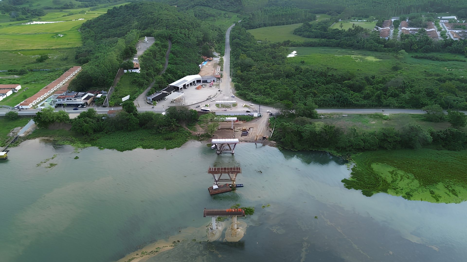
Penedo-Neópolis Bridge, on BR-349, reaches 50% completion, enters the phase of installing 120 80-ton beams, and promises to replace the ferry crossing over the São Francisco River, creating a permanent link between Alagoas and Sergipe for approximately 80,000 residents of the Lower São Francisco.
According to the National Department of Transport Infrastructure, the construction of the bridge over the São Francisco River, which will connect Penedo, in Alagoas, to Neópolis, in Sergipe, on BR-349, reached 50% completion in April 2026 and advanced to the most visible stage of the work: the installation of the superstructure beams. The pillars are already completed both on land and in the section over the river. Five of the 120 beams were installed on the Sergipe side, each measuring 35.39 meters in length, about 2 meters in height, and weighing 80 tons.
“Construction is on a very accelerated schedule. We have already started launching the beams, and the pillars are completed, both on land and in the river. We have a very high expectation to deliver the bridge 100% completed by the end of this year,” said André Paes, superintendent of the DNIT in Alagoas.
Penedo-Neópolis Bridge will be 1,180 meters long over the São Francisco River and will replace the ferry crossing
The structure will be 1,180 meters long, 18 meters wide, with a navigable span of 150 meters and a height of 30 meters in the section over the São Francisco River. The dimensions were defined to allow the passage of vessels that use the river for economic activities, fishing, displacement, and regional transport.
-
On the world’s highest navigable lake, the Uros people have hand-built around 100 floating straw islands, living on them for 3,000 years without concrete or foundations.

-
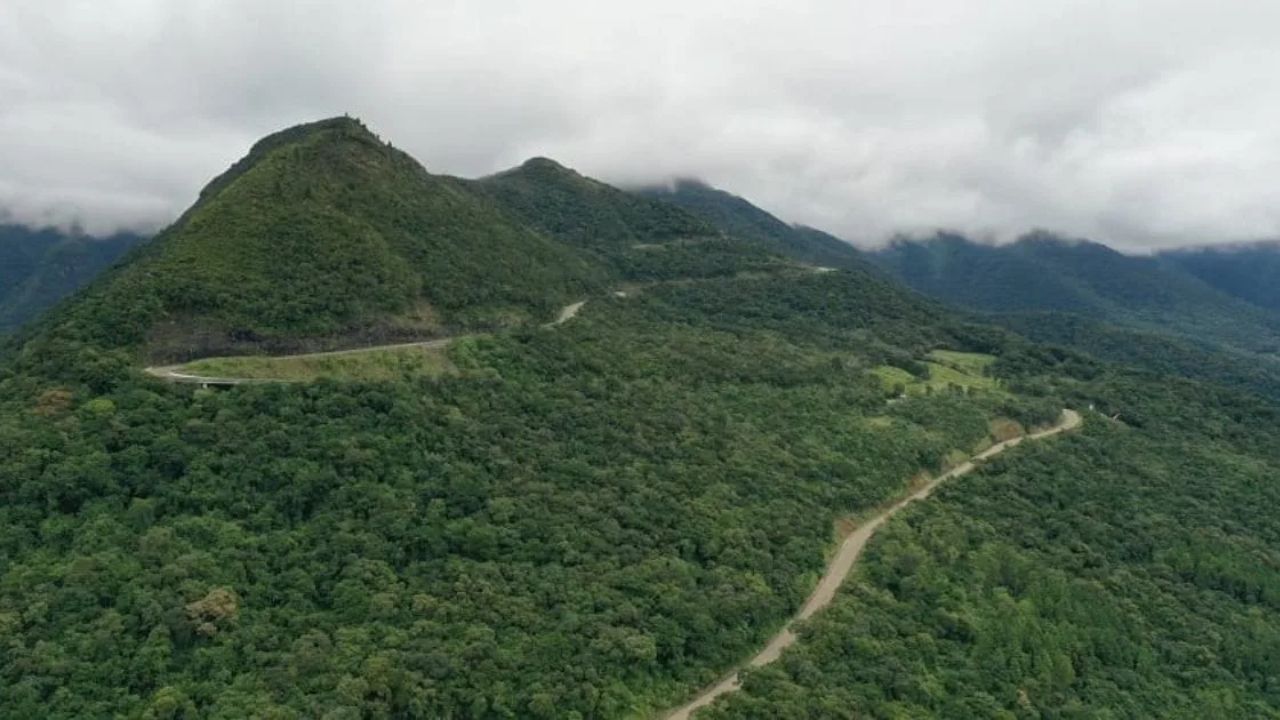
Newly Completed Brazilian Highway in the Serra da Rocinha Becomes a 16.5 km Cycling Challenge and Boost for Local Tourism

-
Innovative Mortar Technique Enhances Porcelain Tile Stability, Reduces Buckling and Detachment Risks, and Provides Durable Finish Under Heavy Use

-
Giant Robots Build Entire Neighborhood of 100 3D-Printed Homes in the U.S., Showcasing Technology’s Impact on Construction Industry


When completed, the bridge will replace the ferry crossing that currently restricts movement between the two banks to limited hours, queues, waiting, and additional costs for water transport. For the local population, the change will not only be logistical but also daily.

The permanent link is expected to serve approximately 80,000 people from the Lower São Francisco who depend on this crossing daily. The bridge will transform a route currently subject to boarding, waiting times, and fares into a direct road connection between Alagoas and Sergipe.
São Francisco River divides Alagoas and Sergipe for over 200 kilometers without a permanent link in this area
The São Francisco River is the only entirely Brazilian river among the country’s major rivers. It originates in Minas Gerais and flows into the Atlantic Ocean at the border between Alagoas and Sergipe, without crossing a border with any neighboring country.
In the Lower São Francisco, the river forms the natural border between Alagoas and Sergipe for over 200 kilometers. Penedo and Neópolis face each other in this section, separated by a water barrier that, until now, depended on a ferry or speedboat to be overcome.
Penedo has 58,650 inhabitants and functions as one of the main commercial and service centers in southern Alagoas. Neópolis, with 16,426 residents, depends on Penedo for a significant part of its daily needs. The bridge transforms two neighboring cities, separated by the river, into a continuous urban and economic link.
Residents expect time savings, cost reduction, and an end to reliance on speedboats or ferries
The crossing between Penedo and Neópolis is currently done by ferry or speedboat, services with defined schedules, limited capacity, additional cost, and dependence on river conditions. For frequent crossers, the impact is felt in their pockets and in the time spent.
Supermarket employee Maicon Douglas summarized what the bridge represents for those who depend on the crossing daily: financial relief and time savings. Retired Luiz Roberto Alcântara, a resident of Neópolis, was even more direct in saying that he goes to Penedo weekly because of the commerce, which he considers cheaper.
“With the bridge, everything will be easier, we will no longer need to spend money on speedboats or ferries. It will be much better,” he stated. For residents, the project means lower travel costs, more predictability, and faster access to commerce, healthcare, services, and education.
Industry, freight, and goods flow are expected to feel the direct impact of the new road connection
The bridge’s impact is not limited to personal travel. For businesses in the region, crossing by ferry increases freight costs, imposes specific schedules, and reduces logistical efficiency between the two banks of the São Francisco.
Businessman Renato Peixoto, director of a textile industry in Neópolis, calculated this effect directly. According to him, the bridge should facilitate the flow of goods, eliminate the dependence on specific crossing times, and remove the cost of the crossing, which increases freight and the final product price.
In a region that depends on commerce, services, tourism, agriculture, small industries, and regional circulation, the bridge changes the logic of transport. What is currently a crossing conditioned by water, fare, and waiting becomes a permanent road connection.
The 120 80-ton beams mark the most visible phase of construction over the São Francisco
The current phase of the work is the most characteristic of large concrete bridges: the installation of the beams that will form the deck over which vehicles will travel. In total, there will be 120 beams, each 35.39 meters long and approximately 80 tons.

These pieces are produced off-site, transported to the construction area, and lifted onto the already completed pillars. The launching of each beam requires specific equipment, precise calculation, wind control, operational stability, and millimeter-accurate positioning.
With five beams installed by mid-April, the pace will need to accelerate for the remaining 115 to be placed by the end of the year. However, progression is not usually linear: the first beams tend to take longer as the team adjusts procedures and equipment. Afterward, the pace tends to pick up.
Before the beams, the invisible work already defined the bridge’s durability for the coming decades
Before the visual phase of the beams, the most difficult structural part had already progressed. Piles were driven into the bed and banks of the São Francisco River, reinforced concrete pillars were erected on land and over water, and crossbeams and pre-slabs were prepared to receive the superstructure.
This stage appears little in public images but determines the bridge’s safety and lifespan. In works of this magnitude, foundations, pillars, and supports are the elements that define resistance to loads, river variations, heavy traffic, and wear over decades.
The bridge was designed to operate as permanent infrastructure between the two states. The part that almost no one sees in photos is precisely what sustains the promise of crossing the São Francisco for 50 or 100 years.
150-meter navigable span designed to maintain navigation on the São Francisco River
The 1,180-meter length is not just a technical number. It represents the width of the obstacle that the São Francisco River imposes at that point and which the bridge will permanently overcome.
The navigable span will be 150 meters long and 30 meters high at its highest point. This configuration was planned to ensure that the bridge does not interrupt river navigation, preserving the passage of fishing vessels, river transport, and local economic activities.
The combination of the span’s height and width considers the history of floods and the profile of vessels using the Lower São Francisco. The bridge connects the banks without closing the river to those who still depend on it as a route for work, fishing, and travel.
Bridge will have two lanes, shoulders, bike path, pedestrian walkway and lighting throughout its entire length
The bridge’s transverse profile was designed for multiple users simultaneously. The structure will have two traffic lanes, each 3.60 meters wide, sufficient for trucks, buses, and light vehicles to circulate in both directions.
In addition to the lanes, the project includes two 2.50-meter shoulders, a 2.30-meter bike path, a 2.30-meter pedestrian walkway, and lighting throughout its entire length. The total width of 18 meters accommodates this set without vehicles, cyclists, and pedestrians competing for the same space.

This design decision recognizes that the bridge will not only be used by cars and trucks. It will also serve cyclists and pedestrians who currently have no way to cross the river without resorting to waterway services. The crossing will no longer be solely a road crossing and will become urban, regional, and multimodal.
BR-349 ceases to be a highway interrupted by the river and becomes a continuous corridor
The Penedo-Neópolis bridge is not an isolated project. It is part of a set of interventions linked to the federalization of BR-349, formalized in September 2025, which consolidated the highway as a strategic corridor between Alagoas and Sergipe.
For decades, the stretch of BR-349 that reached the banks of the São Francisco in Penedo and restarted in Neópolis was, in practice, a highway interrupted by a river. Vehicles that needed to continue their journey depended on a ferry to cross and resume the route on the other side.
The federalization of the 126.9-kilometer stretch in Alagoas raised the highway’s standard to federal requirements, including signage, pavement, and drainage. With the bridge, BR-349 will operate as a continuous connection between the two states, without fluvial interruption and with crossing available at any time.
The next eight months will be decisive in transforming the bridge into a permanent crossing
The pace of the last few months is the most concrete sign in favor of the deadline. The pillars were completed before the beam stage, and the launching of the first pieces shows that the work has entered the phase where the structure begins to appear over the São Francisco.

Infrastructure works in Brazil have a history of delays, and skepticism regarding delivery promises has a real basis. Even so, the physical progress documented by DNIT, the on-site inspections, and the public commitment to delivery by December are the indicators that will now need to be confirmed at the construction site.
The São Francisco River does not wait. And neither do the 80,000 people of the Lower São Francisco who depend on the crossing daily. The question now is whether December 2026 will mark the definitive end of the ferry as a bottleneck between Penedo and Neópolis.