






 Portuguese
  Spanish


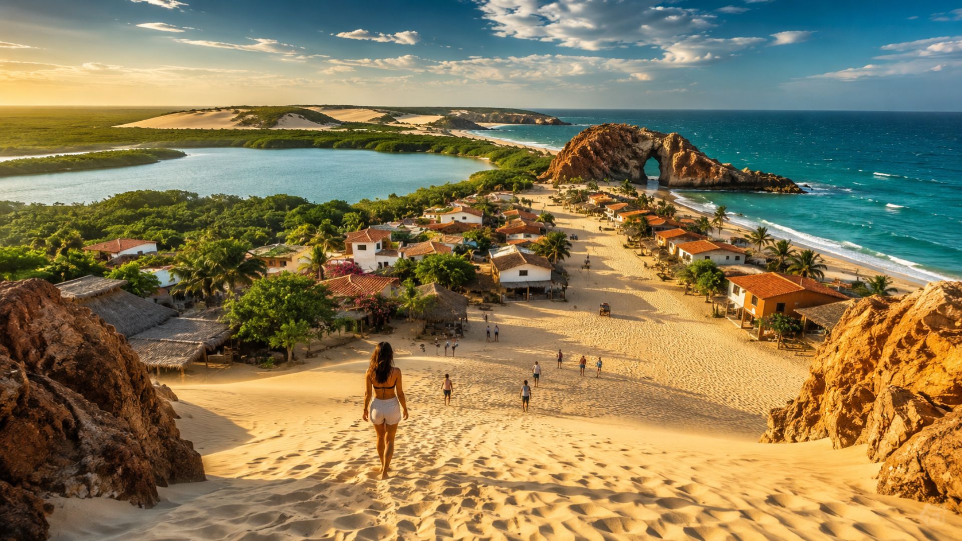

Between dunes, streets covered with sand, and unusual environmental rules, Jericoacoara combines large-scale tourism with measures adopted to preserve one of Ceará’s most well-known landscapes, including vehicle restrictions, specific visitor charges, and planned infrastructure to reduce visual impacts.
On the western coast of Ceará, Jericoacoara features sandy streets, restricted vehicle circulation, and landscapes protected by a national park, while the destination maintains characteristics that set it apart from coastal areas marked by urbanization and conventional traffic.
During 2024, the Jericoacoara National Park recorded more than 1.2 million visits and appeared among the most sought-after conservation units in Brazil, according to a survey released by the municipality with data attributed to the Chico Mendes Institute for Biodiversity Conservation.
This official number corresponds to the accesses recorded in the national park, and not to 1.5 million tourists hosted or received exclusively by the village, a necessary distinction to correctly understand the dimension of the tourist flow observed in the region throughout that year.
-
From the Amazon to a sinking island, satellites with 30 cm resolution captured five environmental crimes hidden where no one patrols and turned suspicion into court evidence.

-
2,100 trucks, 36 hours non-stop, and 2.17 million kg of steel: Miami pours a sea of concrete to build the largest residential foundation in Florida under the 218-meter Bentley tower with car elevators to private garages in the sky.

-
A man bought a friend’s house, was warned of a “secret” in the backyard, and dug almost 1 meter until he hit a metal lid: a fiberglass nuclear fallout shelter sealed since 1961, which he restored as an underground refuge at 22 °C year-round.
-
Spanish owner lost an ancient pine tree during a storm, chose a 500-year-old olive tree and mobilized a crane and platform truck to move the 6-ton tree and transform the mountain chalet with living history and monumental landscaping.


Located in the municipality of Jijoca de Jericoacoara, the village gained international projection after being mentioned by the American newspaper The Washington Post for its natural beauty, recognition that increased the visibility of a historically isolated destination among dunes.
Before the expansion of tourism, Jericoacoara retained characteristics of a fishing community with difficult access and limited infrastructure; nevertheless, the changes that have occurred in recent decades have not eliminated one of its main traits, as the roads remain covered with sand and without conventional paving.
Car restriction preserves the sandy streets
Within the Village of Jericoacoara, the circulation of private cars remains restricted, so visitors need to leave their vehicles in authorized parking at the entrance and use permitted means of transportation to reach inns, restaurants, and residences.
According to the Jijoca de Jericoacoara City Hall, the measure aims to preserve the environment and organize local mobility, although the rule does not completely prevent the circulation of authorized transport and vehicles necessary for the daily functioning of the village’s services.
Inside the park, specific regulations enhance environmental protection, as ICMBio prohibits motor vehicle traffic on fixed or mobile dunes and allows activities such as hiking, canoeing, cycling, and tours conducted by authorized operators.
Underground electrical network reduced visual impact
In 1998, electricity began to reach the village permanently through an underground network that replaced the generators, which until then were responsible for lighting only a few points of the old fishing community.
With the installation below ground, visible poles and wires no longer occupied the landscape of the sandy streets, a solution that expanded the power supply without creating a visible overhead network in a region known precisely for its natural aspect and low urban interference.
Until this transformation, the available infrastructure matched the geographical isolation of Jericoacoara; subsequently, the underground model became one of the village’s most well-known characteristics and came to symbolize the attempt to reconcile modernization, public services, and landscape preservation.
Jericoacoara National Park protects 8,850 hectares
Created in 2002, the Jericoacoara National Park covers 8,850 hectares and includes a maritime strip one kilometer wide parallel to the coast, forming a protected area that surrounds the village and encompasses different coastal environments.
Throughout this territory, dune fields, beaches, mangroves, and temporary lagoons formed during the rainy season compose the landscape, while the conservation unit protects ecosystems, supports scientific research, and allows activities related to environmental education and eco-tourism.
Among the most well-known spots is Pedra Furada, a rocky arch that can be reached by walking depending on tide conditions and local guidance, while Serrote houses the highest point of the park and the area where the lighthouse operates.
Also sought after by visitors, the Sunset Dune offers a view of the coast at the end of the day, while tours through mangroves, beaches, and temporary lagoons expand the options in a region marked by the constant presence of sand, wind, and sea.
Although often associated with Jericoacoara tours, the Lagoa do Paraíso is not next to the village nor usually reached on foot, as it is located about 18 kilometers from Jeri and requires transport by car, buggy, or authorized transfer.
Sustainable Tourism Fee is charged for ten days
To stay in the Village of Jericoacoara, each visitor must pay the Sustainable Tourism Fee, the amount of which is informed by the municipality as R$ 41.50 per person, valid for ten days and renewed at R$ 4.15 for each additional day.
Intended for environmental preservation actions and the maintenance of tourist services, the fee can be paid in advance through official channels or at service points located both at the Jijoca headquarters and at the entrance to the village.
Surpassing 1.2 million visits in 2024, the park highlighted the scale reached by the destination; simultaneously, traffic limitations, tourist fees, and environmental regulations aim to preserve elements that still distinguish Jericoacoara from intensely urbanized coastal areas.
With such a high annual flow between dunes, lagoons, beaches, and sandy streets, what measures should be prioritized for Jericoacoara to preserve its landscape without closing its doors to tourism?


