
 Portuguese
  Spanish
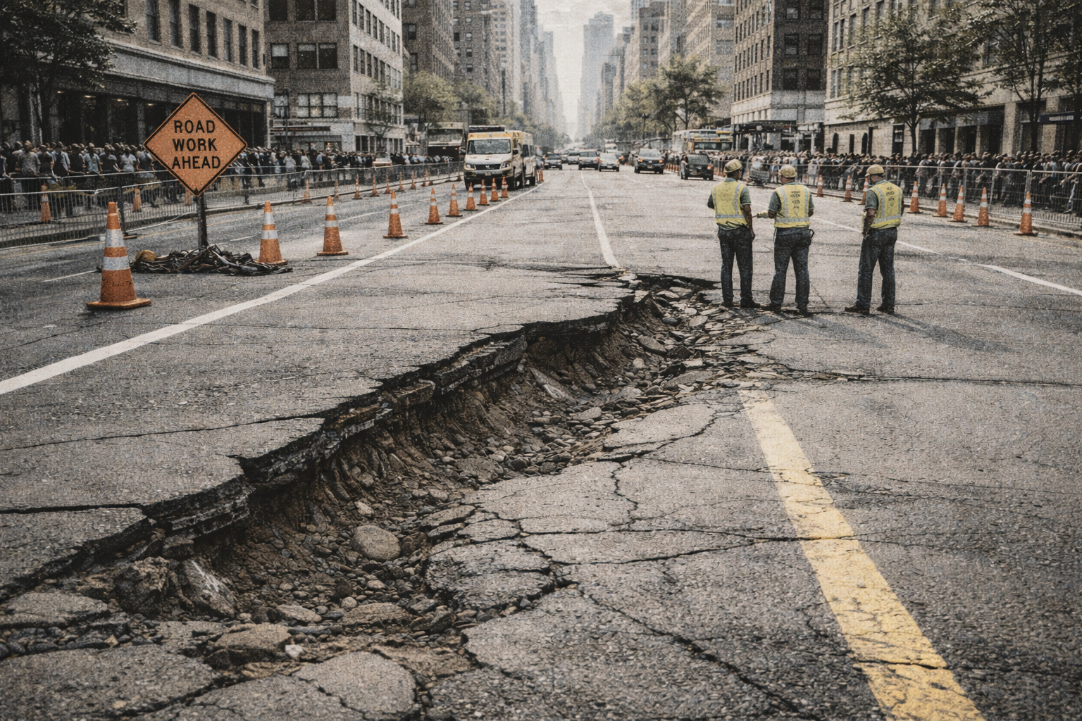
Recent survey shows advancement of ground subsidence in urban areas, exposes structural risks and reinforces need for planning and control
A highly relevant scientific study for urban planning brings a direct warning about the advancement of ground subsidence in cities in the United States.
The journal Science Advances published the research, while specialists from Columbia University and Virginia Tech analyzed data over the past few years.
The researchers explain that the phenomenon represents the gradual sinking of the Earth’s surface, caused by factors such as groundwater extraction, the weight of buildings, and natural terrain characteristics.
-
Scientists warn that melting ice is triggering an alarming chemical transformation in preserved areas, and the first signs are already concerning researchers worldwide.

-
China placed 198 robotic legs under a 7,600-ton school and made the building walk 62 meters in 18 days, rotating the historic structure as if a concrete structure had gained feet to escape demolition.

-
Distributor confirms the premiere of ‘Dark Horse’, Bolsonaro’s film, in 650 cinemas with 99% of copies dubbed.
-
9-year-old boy who could only hold a plank for 6 minutes in physical education class trained alone for 6 months, without needing encouragement from his parents, until he broke the world children’s record with 61 minutes and 5 seconds.


This process, although already known, now appears on a larger scale and directly impacts urban infrastructure.

Technical investigation expands understanding of the phenomenon
The scientists analyzed 28 urban centers in the United States, expanding the understanding of subsidence.
In addition, the teams used recent data and advanced techniques, which increased the accuracy of the results.
According to the researchers, urban expansion in vulnerable areas intensifies the problem and puts pressure on the ground.
Thus, the growth of cities begins to directly influence the advancement of the phenomenon.
Satellite technology allows for precise measurements
The researchers used InSAR (Interferometric Synthetic Aperture Radar) technology to identify the subsidence.
This system measures ground displacements on a millimeter scale over time.
With this, scientists track small variations with high precision and identify areas more susceptible to subsidence.
This approach allows for continuous and detailed mapping of the phenomenon.
“`html
Data reveals large-scale subsidence advancement
The results show that at least two-thirds of the urban areas of 25 analyzed cities exhibit continuous subsidence.
This indicates that the ground gradually loses support and causes progressive lowering.
Furthermore, the phenomenon occurs unevenly and affects different regions within the same city.
This variation requires constant monitoring to prevent structural damage.
Houston records high levels of subsidence
Among the analyzed cases, Houston shows concerning rates.
In some areas, the ground subsidence exceeds 5 millimeters per year, according to the study.
This rate remains continuous and cumulative, which amplifies the impacts over time.
Thus, the effects can intensify and compromise urban structures.
Groundwater extraction is the main cause
Researchers point to excessive groundwater extraction as the main cause of subsidence.
When aquifers are depleted, the ground loses support and begins a compaction process.
Consequently, the land gradually yields under the weight of urban infrastructure.
This process intensifies in areas with high water demand.
Urban expansion increases structural risks
According to researcher Leonard Ohenhen, many cities have grown over naturally vulnerable areas.
This scenario causes the infrastructure to bear pressures above safety limits.
As a result, risks arise in buildings, roads, and bridges, which compromises the stability of these structures.
Thus, the issue requires greater attention from urban authorities.
New York shows widespread subsidence
The city of New York also faces a significant subsidence situation.
Data from NASA, Rutgers University, and the Jet Propulsion Laboratory show that 98% of the urban area experiences some level of sinking.
The average rate reaches 1.6 millimeters per year, although there are regional variations.
“`This behavior reinforces the complexity of the phenomenon in large urban centers.
Areas on landfills show greater subsidence
Regions built on old landfills show rates exceeding 3 millimeters per year.
At the Arthur Ashe Stadium, where the US Open takes place, the subsidence reaches 4.6 millimeters annually.
These grounds compress more easily, which accelerates the subsidence process.
Thus, the type of soil directly influences the intensity of the phenomenon.
Risks include flooding and structural damage
Subsidence increases the risk of flooding and structural failures.
The study indicates that over 29,000 buildings are located in high-risk areas.
This data reinforces the need for preventive actions and adequate urban planning.
Without control, the impacts tend to grow over time.
Solutions include monitoring and policy review
In light of this scenario, researchers advocate for the creation of detailed subsidence maps to guide public policies.
Additionally, they suggest reviewing building codes to reduce structural risks.
They also recommend investments in more efficient drainage systems.
Finally, strict control of groundwater extraction emerges as an essential measure to contain the advance of the problem.
In light of this growing scenario, how can cities balance urban expansion and structural safety without compromising the future of the next generations?


