Portuguese
  Spanish
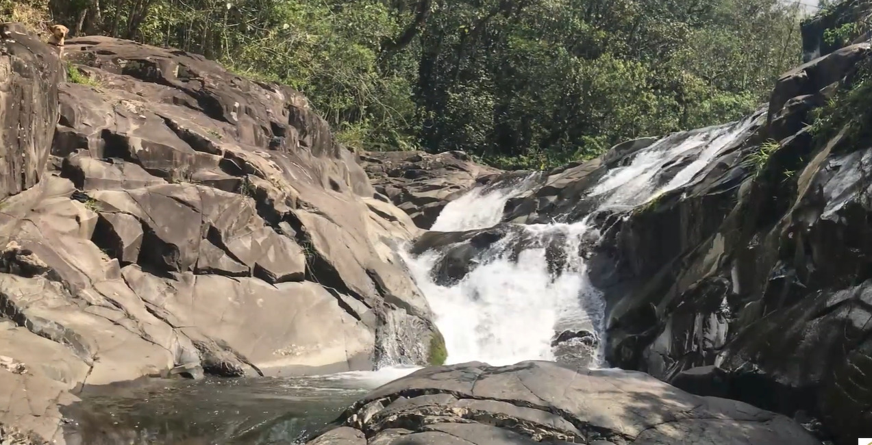
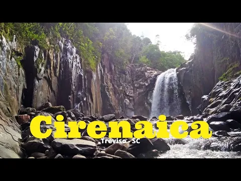
Cachoeira Cirenaica in Treviso (SC) Has a 15-Meter Drop, 4 Km Trail to the Top, and a Natural Pool in an Area Known as Vale Mágico Since 1921
The Cachoeira Cirenaica, located in the Guanabara community in Treviso, in the South of Santa Catarina, has a 15-meter water fall and attracts visitors with its natural pool and a trail of approximately four kilometers that leads to the top.
Origin of Vale Mágico and Formation of the Waterfall
The Cachoeira Cirenaica is situated in an area that became known as Vale Mágico. The nickname was given by Italian immigrants who arrived in the region in 1921 and began to identify the place by its rock formations and natural landscape.
With a 15-meter water drop, the Cachoeira forms a natural pool of crystal-clear waters. The site has become a stopping point for bathers seeking to refresh themselves in a natural environment surrounded by rocks and vegetation.
-
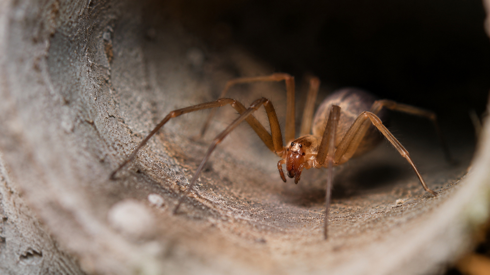
How to Prevent Brown Recluse Spider Bites: Common Hiding Spots and Free Tips to Reduce Risks

-
Natto: The Unusual Japanese Superfood Gaining Popularity on Social Media and Driving Record Exports
-
Brazilian Mayor Goes Undercover as Homeless for 24 Hours to Assess Public Services

-
15-Year-Old Entrepreneur Malu Lira Publishes 20 Children’s Books on Financial Education, Earns $500,000, and Expands Her Project to the Amazon Rainforest


Natural Pool and Landscape
The pool formed by the Cachoeira allows bathing in a natural area surrounded by rock formations. The clear waters and the scenery around create the landscape that marks the location.
The environment is described as an area of great natural beauty, which contributes to the prominence of the Cachoeira among the landscapes present in the municipality of Treviso.
Trail to the Top
A trail leads to the top of the Cachoeira Cirenaica. The route is approximately four kilometers long and has an estimated duration of one hour and 24 minutes to complete.
The path follows natural landscapes and areas covered by vegetation. Along the way, small streams of water accompany part of the trail up to the upper region of the waterfall.
Route and Difficulty Level of the Trail
The trail leading to the top of the Cachoeira is considered moderately difficult. The route features stretches of vegetation and natural landscapes along the way.
Those traversing the route will encounter preserved natural areas and direct contact with the landscape surrounding the Cachoeira, including streams that accompany part of the journey to the final destination, completed in an estimated approximate time.
With information from ND Mais.