

 Portuguese
  Spanish
Interactive tool created by space agency allows forming words with real records of the planet and reveals surprising details invisible to the naked eye
Satellite images have always sparked curiosity by revealing Earth from a unique perspective. However, what many people don’t realize is that these images can go beyond scientific observation and transform into something creative and even personal. This is because NASA has developed an interactive tool that allows you to write any word — including names — using real landscapes captured by satellites.
The information was disclosed by “Olhar Digital,” which highlighted how this technology combines science, creativity, and exploration of the planet in a way accessible to the public. The proposal draws attention precisely by uniting technical data with an engaging visual experience, capable of bringing anyone closer to space observation.
How satellite images work and why they reveal curious shapes
First of all, it’s important to understand that satellite images are visual records of the Earth’s surface captured by sensors installed on spacecraft in orbit. Unlike traditional photographs, these images do not rely solely on visible light. On the contrary, many satellites also capture data in other bands of the electromagnetic spectrum, such as infrared and microwaves.
-
The technology seemed too expensive for many families until a 13-year-old boy used Lego pieces to create a low-cost braille printer.

-
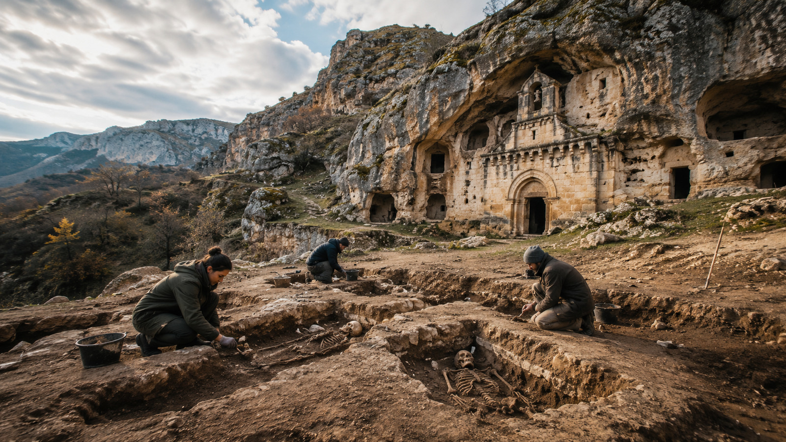
A forgotten society lived isolated in caves for 500 years in Spain, and now the ancient DNA from human remains has revealed smallpox, signs of violence, and a routine marked by animal husbandry.

-
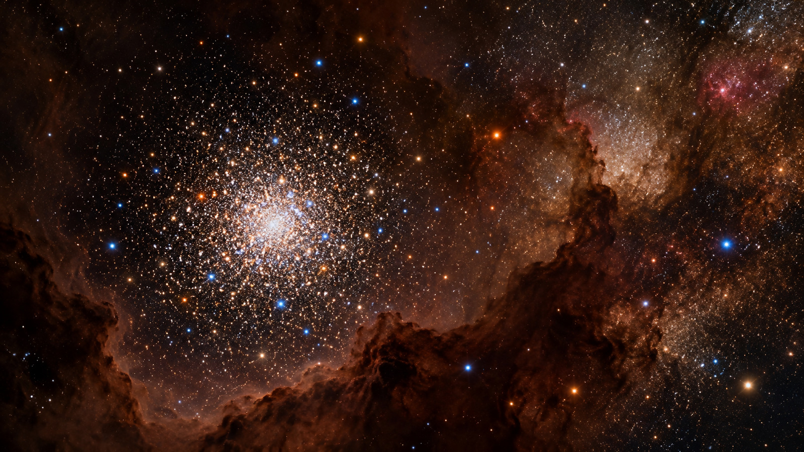
Brazilian study finds chemical signal indicating stars that have consumed a planet: analysis of twin stars reveals an excess of beryllium resistant to 3.5 million °C, detected by an 8.2-meter telescope, and raises doubts about the rarity of systems like the Solar System.

-
Intense cold arrives with winter on Sunday, threatens frost from the South to the Southeast, and could leave Rio Grande do Sul with negative temperatures starting this weekend.


As a result, these technologies allow observing phenomena that would not be perceptible to the naked eye. For example, it is possible to identify variations in vegetation, measure surface temperature, or even analyze soil moisture with high precision. Moreover, these multiple layers of information end up creating unexpected visual patterns — and that’s precisely where natural shapes resembling letters and symbols emerge.
Consequently, NASA took advantage of this phenomenon to create an interactive experience, transforming scientific data into something accessible and fun. Thus, any user can type their name and view letters formed by real landscapes of the planet.
Landsat Program: over 50 years monitoring Earth with precision
For this tool to be possible, NASA uses data from the Landsat program, one of the most important Earth observation projects ever developed. Created in partnership with the United States Geological Survey (USGS), Landsat has been operating since the 1970s, responsible for one of the longest continuous historical records of the planet.
Over these decades, Landsat satellites have captured images in multiple spectral bands, allowing extremely detailed analyses of environmental changes over time. In this way, scientists can track deforestation, monitor water resources, and study urban growth with a high level of precision.
Additionally, governments and organizations use this data to plan public policies and respond to natural disasters. In other words, the images that now serve to create names also play an essential role in preserving the planet and understanding environmental transformations.
Your Name in Landsat: transform your name into real landscapes of the planet
The platform “Your Name In Landsat,” developed by NASA, operates in a simple and highly interactive way. Upon accessing it, the user can type any word and immediately view the result formed by real images of Earth.
Additionally, it is possible to explore each letter individually, getting to know the specific landscapes that gave rise to the displayed shapes. For example, the letter A has five distinct variations: Lake Mjøsa in Innlandet (Norway); Yukon Delta in Alaska (United States); Lake Guakhmaz in Khachmaz (Azerbaijan); Farm Island in Maine (United States); and Hickman in Kentucky (United States).
Another interesting point is that some letters are formed by images from Brazil, which makes the experience even closer to the national reality. Among the examples are:
A piece of the state of Mato Grosso forming the letter F;
The municipality of Fonte Boa in Amazonas forming the letter G;
Luiz Alves district in São Miguel do Araguaia, Goiás, forming the letter N;
Primavera do Leste in Mato Grosso, with irrigation pivots forming the letter Z.
Therefore, besides being a creative tool, the platform also serves as a way to explore different regions of the planet — including Brazil — in a completely innovative way.
So, what word or name would you like to see formed with real images of the planet? Have you ever thought about how yours would look?


Be the first to react!