Portuguese
  Spanish
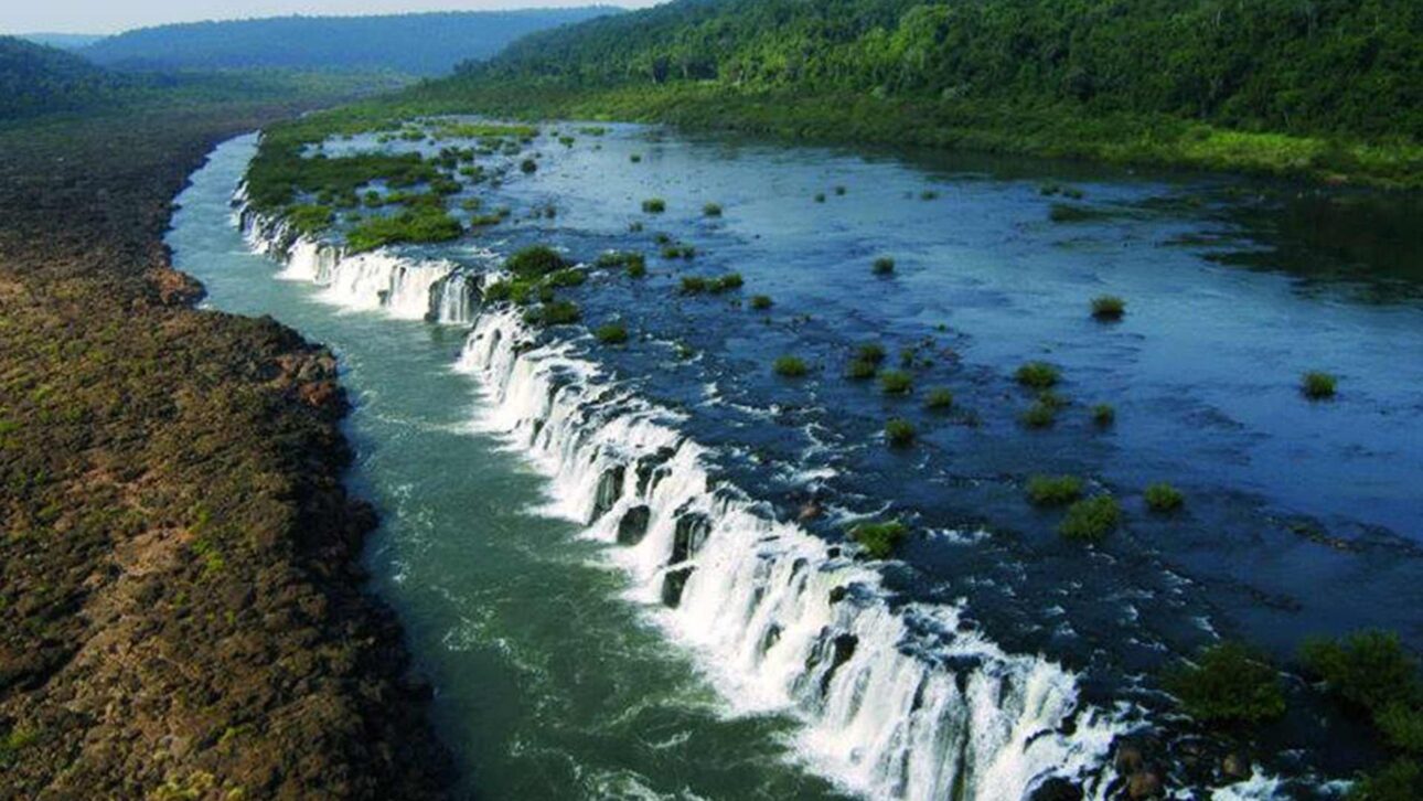
At The Extreme North Of Rio Grande Do Sul, A Natural Formation Impresses With Its Extent And Characteristic Sound. With Controlled Access And Trails Through The Atlantic Forest, The Location Reveals Little-Known Landscapes On The Border With Argentina.
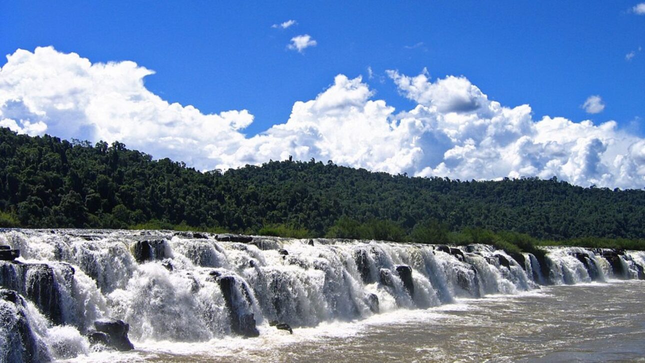
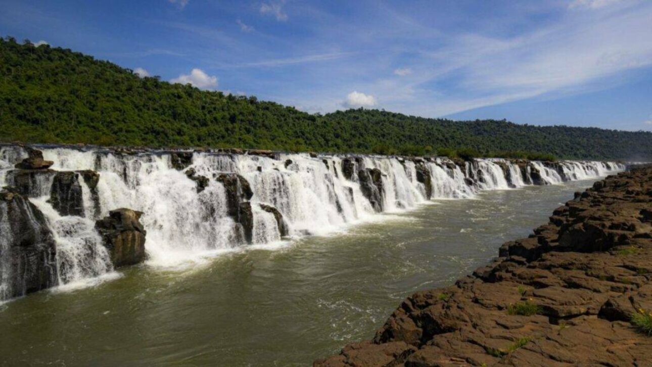
The Salto do Yucumã, located in the Turvo State Park in Derrubadas (RS), is recognized by researchers and environmental agencies as the largest longitudinal waterfall in the world, with about 1.8 km in length and falls that can reach up to 15 meters, depending on the level of the Uruguai River.
The natural formation marks the border between Brazil and Argentina and draws attention for a unique aspect: the best view is from the Brazilian side, where the lower bank allows for observing the succession of basalt steps over which the water descends, according to the park administration.
Controlled Access And Environmental Preservation
Access to the Turvo State Park is via paved road, about 4 km from the center of Derrubadas.
-
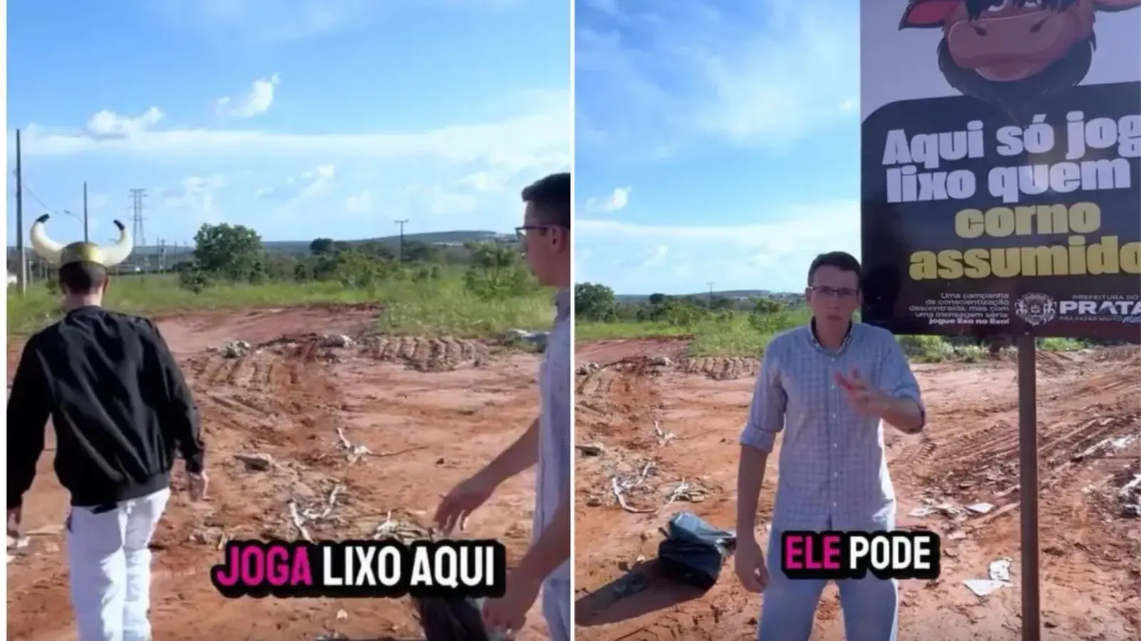
Brazilian Mayor Uses Humorous Sign to Raise Awareness About Littering, Goes Viral on Social Media

-
Award-Winning Japanese Restaurant Reveals It Has Preserved Part of the Same Frying Oil for 66 Years

-
American Youth Transforms from Severe Obesity to U.S. Air Force Enlistment, Losing 90 Kilograms in Two Years
-
11-Year-Old Entrepreneur Sells 60 Homemade Sweets Daily, Mastering Cost Calculation, Social Media Promotion, and Client Negotiation Since Age 7


From the entrance, visitors travel 15 km of dirt road to reach the observation point of the waterfall.
Entry control is considered essential by the Secretary of the Environment of Rio Grande do Sul to reduce the impact on the preserved Atlantic Forest in the region.
In July 2023, the state government signed a 30-year concession contract with the company Três Fronteiras Navegação e Turismo, part of the Macuco Safari Group, responsible for operating tourist services and maintaining the local infrastructure.
Short Trail And Origin Of The Name
At the end of the internal road, a walk of about 500 meters leads to the main viewpoint.
The name “Yucumã” comes from Tupi-Guarani and is translated by specialists in indigenous languages as “Great Roarer,” referring to the constant sound of water compressed in the geological fault of the river.
According to the Department of Biodiversity of Sema-RS, the visibility of the falls varies with the volume of the Uruguai River: during dry periods, the rock formations become more exposed; during flood times, some of them disappear under the water.
Activities And Visitor Modalities
According to information from the park and the concessionaire, visitors can take part in guided trails, bike rides, interpretive safaris, quadricycle excursions, and water activities in controlled areas.
The cycling routes follow the internal path with support vehicles, while water excursions include kayaking, motorboat rides, and floating, always supervised by accredited guides.
The realization of these activities depends on the river and weather conditions, according to the park administration.
Trails: Lagoons And Jaguars
The park offers two official trails open to the public.
The Lagoon Trail, measuring 1.3 km, is classified as of moderate difficulty and crosses flooded areas.
The Jaguar Trail, at 1.5 km, has a higher difficulty level and passes through dense forest areas.
The amount reported in official statements for 2024 is R$ 10 per trip, but the concessionaire recommends checking for any price updates before the visit.
Structure And Functioning
The park entrance houses the Visitor Center, with snack bar, restaurant, and restrooms.
There is also a support area near the waterfall, with basic services and the start of trails.
According to data from the Tourism Secretary of Derrubadas, the park operates from Thursday to Monday, with closure on Tuesdays and Wednesdays for maintenance and environmental management.
The visiting hours may vary according to weather conditions and river levels.
Exclusive View And Geological Formation

Studies by geologists and environmentalists indicate that the Salto do Yucumã forms from a longitudinal fault in the bed of the Uruguai River.
The difference in height between the banks means that, from the Brazilian side, the visitor is positioned below the rocky step, which allows for viewing the entire extent of the falls.
On the Argentine side, the observation occurs above the waterfall, which limits the perspective.
This natural configuration explains why the complete view of the formation is only observable from Brazil, according to researchers affiliated with the Geosciences Institute of UFRGS and park technicians.
Best Time And Conditions For Visiting
The choice of the visiting period directly influences the experience at the site.
According to the park administration, the dry months are the most recommended, as the lower volume of the Uruguai River allows for better visibility of the falls.
During flood periods, the waterfall may become partially obscured.
The monitoring of hydrological conditions is disclosed by the city hall and the Secretary of the Environment and can be consulted before traveling.
Conservation And Biodiversity
The Turvo State Park houses one of the best-preserved areas of Atlantic Forest in Rio Grande do Sul.
According to the state government, the unit is considered an important refuge for endangered species, such as the jaguar and rare birds.
The current concession provides for the expansion of environmental education actions and the maintenance of areas restricted to visitation, aiming to balance tourism and conservation.
The Salto do Yucumã has established itself, according to tourism sector specialists, as one of the main ecotourism spots in Southern Brazil, combining geological relevance, biodiversity, and controlled access.