Portuguese
  Spanish
The SWOT satellite, a partnership between NASA and the French space agency CNES, captured for the first time high-resolution images of a large tsunami seen from space. The recording occurred on July 29, 2025, when an earthquake of magnitude 8.8 in the Kuril-Kamchatka subduction zone in the far east of Russia generated waves that spread across the entire Pacific Ocean. The discovery was published in the journal The Seismic Record in April 2026.
The SWOT passed over the location at the exact moment of the tsunami by coincidence, and what it recorded changed the scientific understanding of how these waves behave. The classical theory of oceanography treated tsunamis as simple waves that travel in a linear and predictable manner. The satellite images showed the opposite: a “braided” and complex pattern of energy that disperses and spreads over hundreds of kilometers, dividing into primary and secondary waves with different speeds.
While DART buoys, pressure sensors installed on the seabed, provide accurate data at isolated points, the SWOT satellite maps a 120-kilometer-wide strip at once. This allowed scientists to see the full geometry of the wave evolving in space and time, something no instrument had been able to achieve before.
What does this change in practice for coastal safety?

The discovery has direct consequences for tsunami forecasting. The mathematical simulators currently used for coastal alerts may be underestimating the variability of energy that reaches the shore.
-
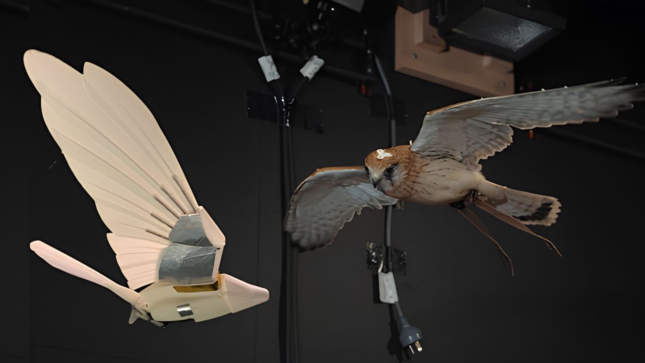
Scientists create robotic bird that uses articulated wings to maintain balance, mimicking hawks and flying with stability where common drones fail.

-
U.S. university performs surgeries with remotely controlled humanoid robots
-
A 12-year-old boy from the municipal network of Canoas won gold in the Brazilian Mathematics Olympiad, earning the school’s first national medal in history and standing out in a competition that brought together more than 18 million students, demonstrating how public education can uncover hidden talents in Brazil.
-
Why did a company that was already earning US$ 1 million decide to completely change its strategy? The answer begins with used bottles, worms, and an unexpected decision.


The dispersion of waves can modulate the force with which the tsunami hits a port or beach in ways that current models cannot predict.
Models that ignore this dispersive behavior have failed to replicate the patterns captured by SWOT.
According to the lead author of the study, Angel Ruiz-Angulo from the University of Iceland, the satellite data serves as “a new pair of glasses” for science.
He emphasized that, although the latency of satellite data is still an obstacle for real-time alerts (complete processing takes 5 to 10 days), the Kamchatka event proves that space altimetry is essential for refining future forecasts.
The data also allowed for the correction of the earthquake model.
Initial estimates indicated a rupture of 300 kilometers along the fault, but the combined analysis of SWOT data and DART buoys showed that the earthquake extended over about 400 kilometers.
The study revealed that the event reactivated portions of the same megafault that ruptured in the historic 1952 earthquake, but in deeper waters, which explains why the 2025 tsunami, although giant, was less destructive.
The SWOT satellite was launched in December 2022 with the primary goal of mapping the topography of the ocean surface and continental waters.
Its radar interferometry technology allows for measuring height variations on the water surface with centimeter precision, covering areas that previous satellites simply could not.
The capture of the Kamchatka tsunami was not planned, but it demonstrated an application that could transform the way humanity monitors natural disasters in the oceans.
For the first time, science saw a tsunami from space with enough resolution to understand what really happens between the earthquake and the wave that reaches the coast.
Comment below: did you know that tsunami warning models can be wrong?